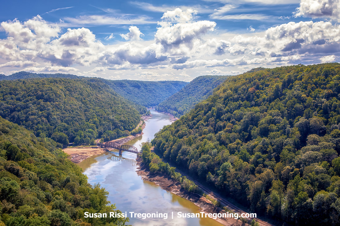
No matter the season, Hawks Nest State Park is renowned for its breathtaking view of the New River Gorge. While this park is not part of the New River Gorge National Park and Preserve, Hawks Nest is adjacent to the National Park. At just 10 miles north of the New River Gorge Bridge near Ansted, West Virginia, its location on the New River and the nearby Gauley River National Recreation Area puts it at the heart of one of the country's most challenging whitewater rafting areas.
0 Comments
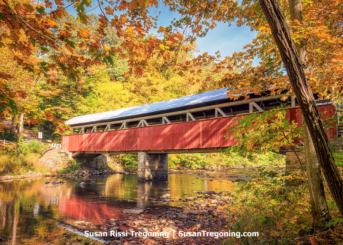
The Laurel Highland region of Pennsylvania is one of the most picturesque regions in the United States. The beauty here is extraordinary, yet it becomes particularly enchanting in Autumn.
The fall foliage starts to unfold in mid-September when the first frost hits the mountains and peaks around mid-October. During this time of year, the landscape is adorned with a spectacular array of autumn colors ranging from yellows and golds to oranges, reds, browns, and even a little residual summer greens. Although the foliage is magnificent, there's also a lot more to admire here. One of my favorite Laurel Highland road trips is the Somerset County Covered Bridge Tour. With ten covered bridges along the way, this drive is approximately 175 miles long, and it begins and ends in the town of Somerset. It sends you down country roads and historic highways while taking you through delightful small towns and past significant historic landmarks. And the scenic views of charming rural landscapes are everywhere you look. It's an easy two days of exploring, making it the perfect starting point for a weekend getaway. 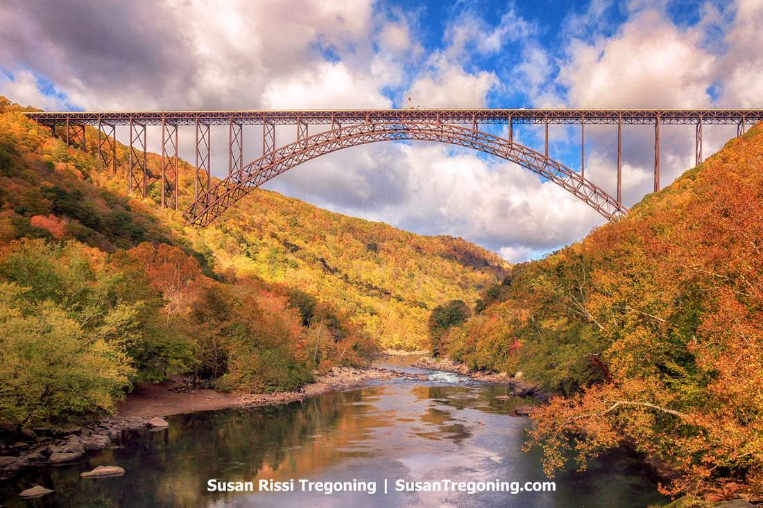
Bridge Day at the New River Gorge National Park and Preserve in Fayetteville, West Virginia, is a festival that encapsulates West Virginia's slogan 'Wild and Wonderful.' This spectacular event occurs annually on the third Saturday in October amidst the scenic Autumn backdrop of the New River Gorge and its iconic Bridge. Not only is it West Virginia's largest one-day festival, but it's the largest extreme sports event in the world. It pays tribute to the world's third-longest single-arch bridge—a marvel of engineering that spans 3,030 feet across the New River Gorge, holding the title of being the longest of its type across the Western Hemisphere.
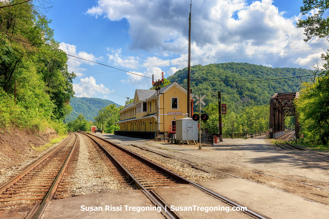
Deep in the heart of Fayette County in southern West Virginia lies an eerie reminder of a bygone era – Thurmond, West Virginia. Today, a ghost town with a population of 5 (in 2020), it was one of the greatest and most infamous railroad towns along the Chesapeake & Ohio Railroad at the turn of the century.
Thurmond stands frozen in time, nestled on the banks of the majestic New River. Its dilapidated buildings and crumbling infrastructure offer visitors a haunting glimpse into its prosperous past from when steam trains traveled the rails and coal was king. At its zenith, Thurmond boasted a bustling population and was home to many businesses that catered to locals and passing travelers. Today, however, only memories wander through the abandoned streets as a reminder of the transient nature of prosperity. Amidst the natural wonders of New River Gorge National Park and Preserve, Thurmond's ghostly presence serves as a poignant testament to the unstoppable march of progress and time's ability to reclaim even the most vibrant communities. 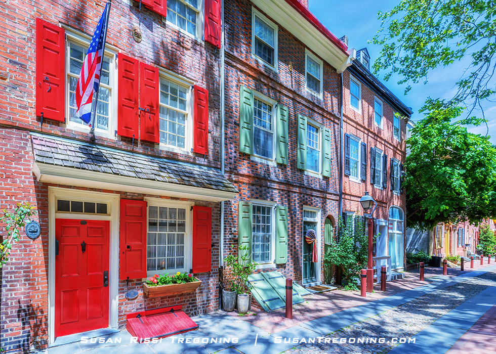
Nestled in the heart of Philadelphia's Old City district, Elfreth's Alley, with its charming cobblestone street, has stood the test of time. The neighborhood features thirty-two houses, half of which were built before the beginning of the American Revolution, while the other half were constructed during the postcolonial and Federal periods. At over 300 years old, Elfreth's Alley holds the distinction of being one of the oldest continuously inhabited residential street in the nation.
Today, Elfreth's Alley is considered one of Philadelphia's top historical sites, second only in popularity to Independence National Historical Park among tourists and history buffs, and it attracts thousands of visitors annually. With its picturesque row houses and rich history, it's no wonder why Elfreth's Alley remains a beloved landmark in the city. 
When the cherry trees bloom, spring in Washington, DC, is magical — transforming into a fairy tale setting of historical monuments framed with delicate pink and white blossoms. It is a place where a soft breeze can send petals floating through the air, almost like a springtime version of snow.
The National Cherry Blossom Festival was started in 1935 to commemorate the 1912 gift of 3,020 cherry trees from Japan to Washington, DC, as an international gesture of friendship. The festival now spans four weeks. While the cherry blossoms are the festival's star feature, it includes a parade, street food, entertainment, and many events throughout the month. The Yoshino cherry trees are the most celebrated cherry trees of the festival, and it is their peak bloom that most visitors wish to experience. Even though there are a dozen cherry tree varieties in Washington, they do not all bloom simultaneously. Still, the blooming season coincides with almost the entire festival. So no matter when you arrive, it's guaranteed you'll see some cherry blossoms. Without traveling to Japan, this is one of few places on Earth where you can experience the Japanese custom of Hanami or watching blossoms. More than 1.5 million visitors travel to our nation's capital annually to celebrate this occasion. 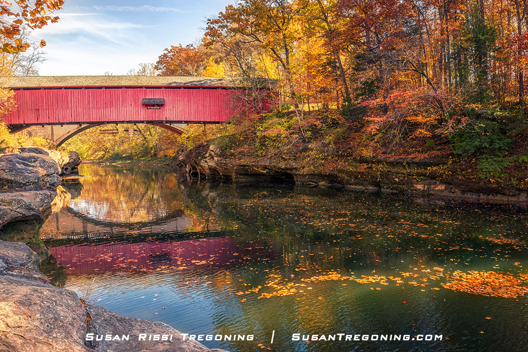
Covered bridges were built on narrow dirt roads as safe passages across scenic winding streams in the 1800s. They remind us of a simpler time when horse and buggy were the mode of transportation between small rural towns. Today, these charming iconic landmarks are located in picturesque settings virtually untouched by the years. They are both appealing and a reminder of their significance as part of our heritage.
Sadly, only a fraction of these wooden bridges remain since maintaining these old beauties takes a concentrated effort. We once had over 10,000 covered bridges scattered throughout the United States, but now only around 750 have survived. Parke County, Indiana, is one such gem of a location, the self-proclaimed "Covered Bridge Capital of America," with 31 covered bridges. They are #1 for having more covered bridges than any other county in the United States. 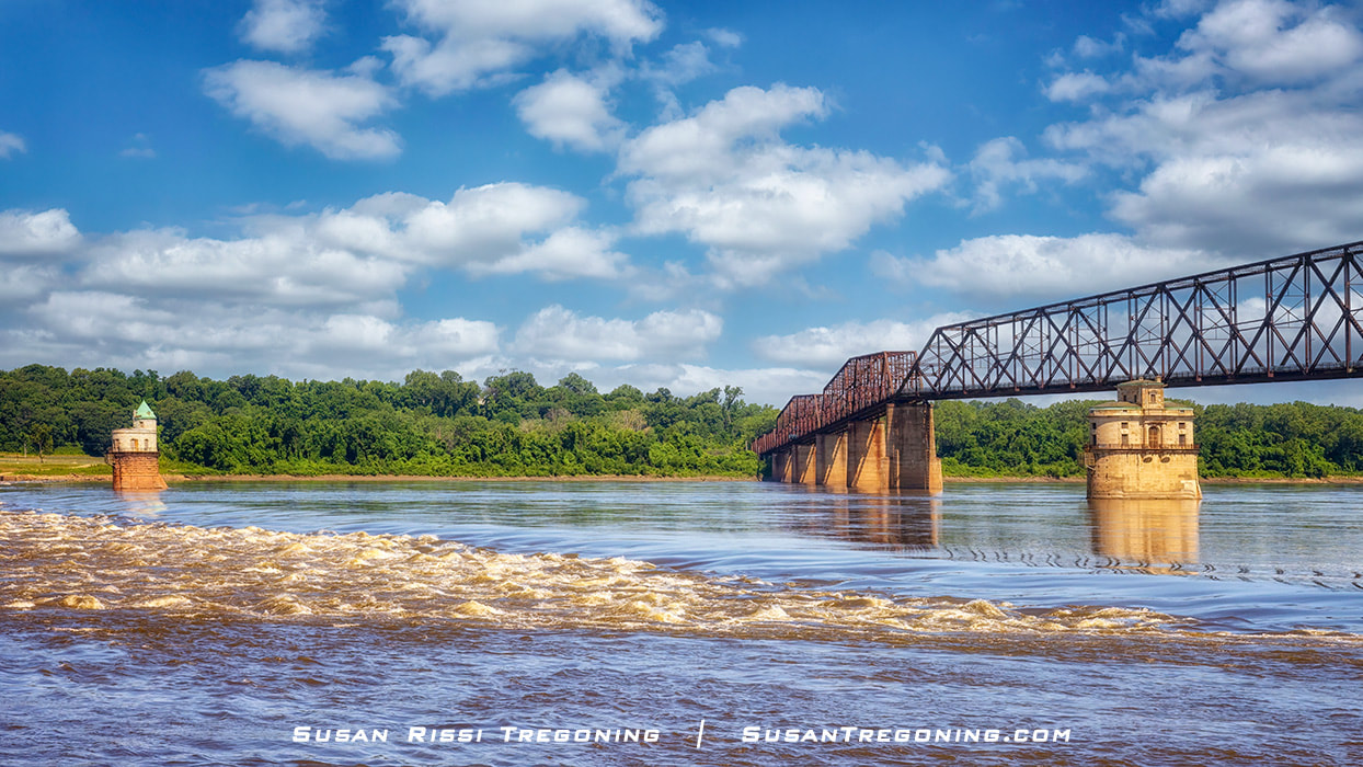
Constructed almost 100 years ago, at the beginning of America's love affair with the automobile, and reinvented as a pedestrian and bicycle bridge, the Old Chain of Rocks Bridge is a MUST VISIT attraction for every Historic Route 66 pilgrimage.
It is a two-mile round trip easy hike or bike across this historic old bridge that soars high above the Mississippi River between Madison, Illinois, and St Louis, Missouri, at one of the river's most scenic locations near its confluence with the Missouri River. Even if you can't go the complete distance, you can drive down the road to the left just before entering the parking lot, where you can admire the Old Chain of Rocks Bridge from the base of the Mississippi River. 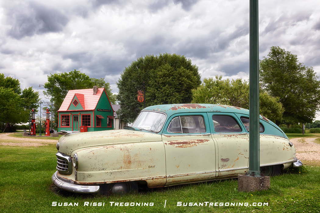
During my Missouri Route 66 planning, I made a note to visit Red Oak II since I wanted to see the cottage-style Phillips 66 service station that had been relocated there and restored from the ghost town of Red Oak, Missouri. That was the extent of my research on this location, and while I knew there were a few other restored buildings on-site, nothing I read prepared me for the magnitude of this Route 66 treasure.
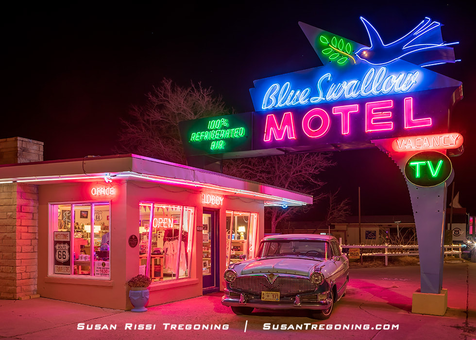
Get your kicks on New Mexico's Route 66 National Scenic Byway!
New Mexico has one of the most varied landscapes in the United States, and Route 66 crosses all of its land regions. Enter New Mexico in the Great Plains at the ghost town of Glenrio, where the landscape is flat and grassy. As you reach Tucumcari, the land begins transitioning to the high desert with broad valleys, deep canyons, sharp cliffs, and flat-topped mesas. It is both harsh and majestic. Nearing the middle of the state, you’ll wind through the mountain pass of Tijeras Canyon as you work your way to Albuquerque in the valley below. Nine Mile Hill brings you up from the valley toward El Malpais, the stark lava landscape near Grants. Approaching the Continental Divide, the lava gives way to breathtaking red-hued cliffs. Those beautiful red cliffs keep getting better and better as you pass through Gallup shortly before exiting the state. 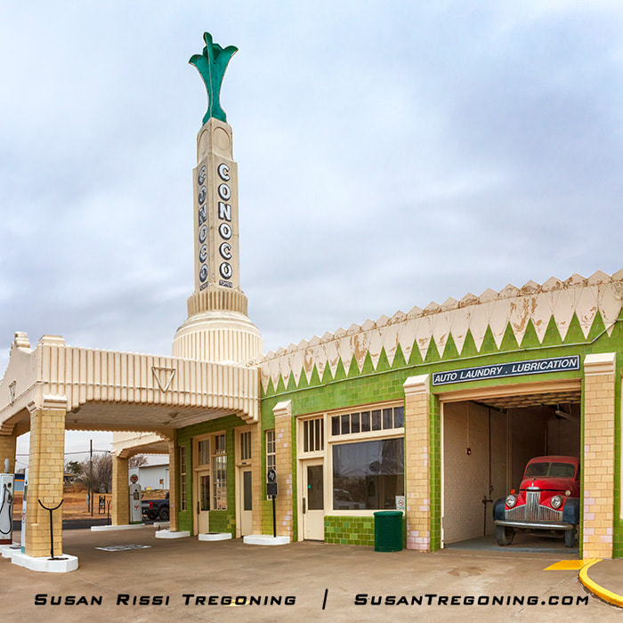
I recently spent a weekend in Texas photographing Historic Route 66. As luck would have it, we had a wind storm the first day I was there. But, after making the long drive, I wasn't about to spend my weekend hunkered down in a motel room like a sane person. So, I was out shooting in it. The 50+ mile an hour wind gusts stirred up the dirt in the more rural areas and made for interesting atmospheric conditions. Even so, we ended up having so much fun, much more than I ever expected.
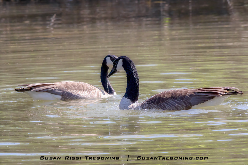
After seeing many posts about the fantastic wildlife encounters at Heron Haven Nature Center, I decided to visit. This small urban wetland sanctuary is located right in the middle of the city of Omaha, Nebraska. At first, I was disappointed that I did not hear the sounds of birds singing since heavy traffic and the sound of children screaming from the ball fields down the road drowned them out. But then I realized the noise that I considered a negative camouflaged the people on the sanctuary trail and is most likely the secret sauce for what makes Heron Haven so great.
They have an excellent photography blind on a pond at the end of a short trail. The day I visited, the nesting Canada Geese entertained me on the island in the center of the pond. A Great Blue Heron flew across my path and perched in a tree at the edge of the pond, grooming himself, while a Great Egret posed atop a bush over the water doing the same. In addition, there were at least a dozen Northern Shovelers swimming about while turtles sunned themselves on a log nearby. That alone was enough for any nature lover to consider the day a success! I might add that this was all happening simultaneously and was not the accumulated sights of many hours of observation. What happened next, I never would have expected in a million years! Of course, it had been going on for a while. But, there were so many more exciting birds to observe; I didn't comprehend the rarity of the moment until it was almost too late. A pair of Canada Geese had swum away from the group. They were performing courtship behavior and eventually mated right in front of the blind! One of America's Newest National Byways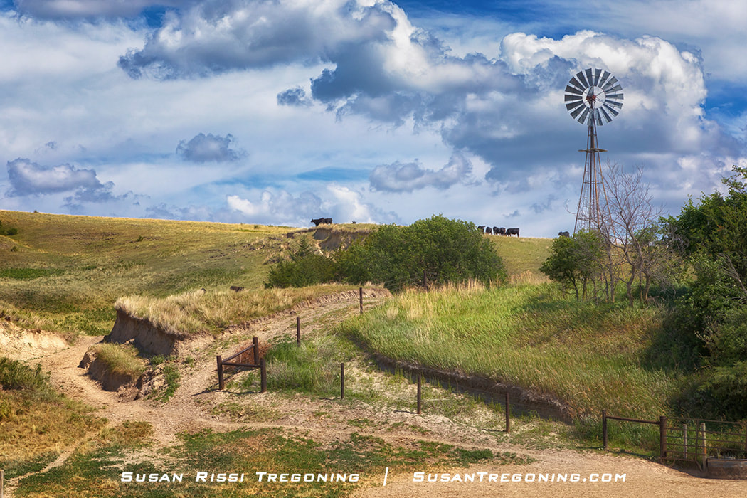
There are very few places left in America that are so pristine that they have been virtually untouched by man. Nebraska Highway 2, AKA Sandhills Journey National Scenic Byway, is one such place. Located in the north-central section of Nebraska, the Sandhills cover a little more than a quarter of the state. This 272-mile long National Byway starts in Grand Island and ends in Alliance, passing through the middle of an area of world-class natural wonders. It’s home to the completely hand-planted Nebraska National Forest, the Loup River, abundant wetlands created by the Ogallala Aquifer, and brilliant night skies. Being in the Central Flyway for migratory birds, it’s teeming with wildlife, and you can’t forget the Spring Migration of the Sandhill Cranes.
The Nebraska Sandhills is a place of wide-open spaces where undulating windswept dunes have been stabilized by a sea of prairie grass that only has a fragile hold on the land, and where cowboy hats and cowboy boots are a way of life and not just a fashion statement. 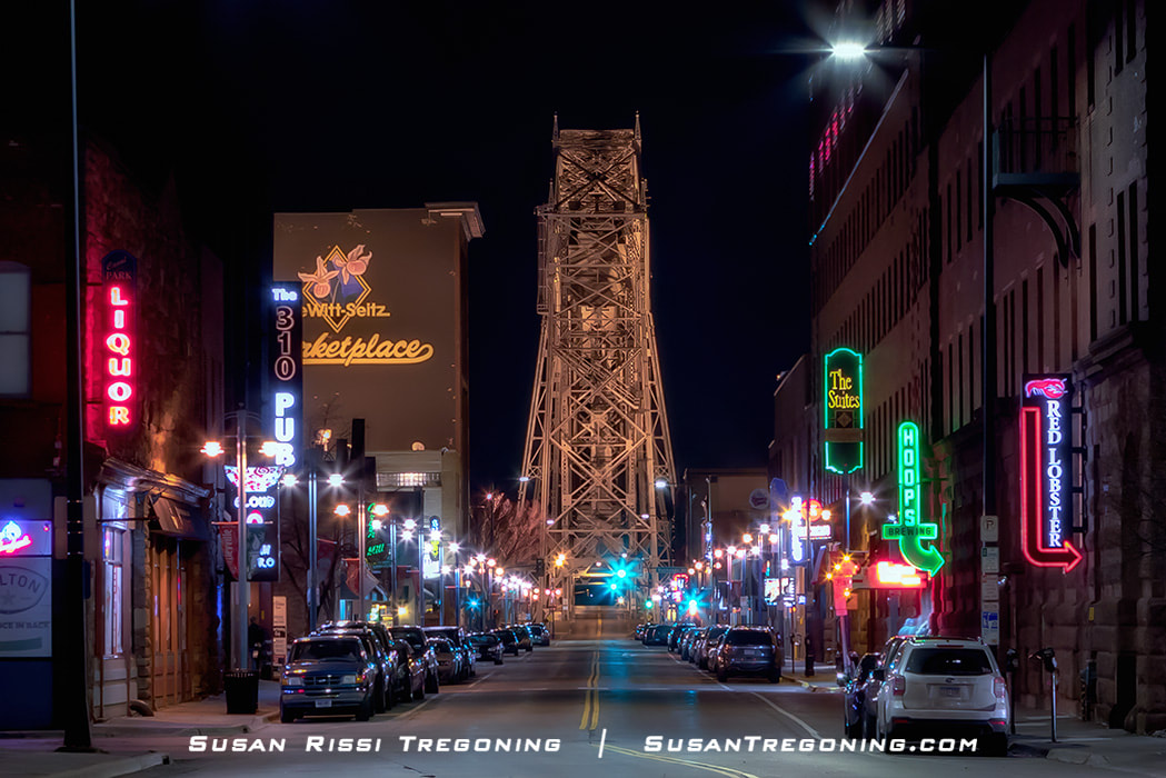
Duluth, Minnesota, is the gateway to the North Shore All-American Scenic Drive, a picturesque journey along Lake Superior up to the Canadian Border with the national "All-American Road" designation. Duluth, when combined with Superior, Wisconsin, is known as Twin Ports, the largest freshwater port in the world! Over 1000 ships enter port here every year. Don't just zoom through the city on the way to the North Shore. Instead, spend a few days in town. Duluth is well worth visiting!
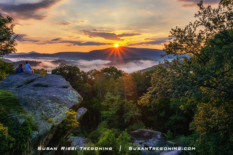
At 468 miles long, the Blue Ridge Parkway is a National Parkway with the designation of All-American Road, the highest classification in the National Scenic Byway system. Starting at Shenandoah National Park in Virginia, the Parkway follows the spine of the Blue Ridge Mountains, winding its way through North Carolina before terminating at the Great Smoky Mountain National Park's Cherokee entrance. At its highest point, the Blue Ridge Parkway reaches 6053 feet in elevation near Mount Pisgah in North Carolina and at its lowest 649 feet along the James River in Virginia. Along the way, you will see spectacular mountain and valley vistas, quiet pastoral scenes, sparkling waterfalls, and colorful flower and foliage displays.
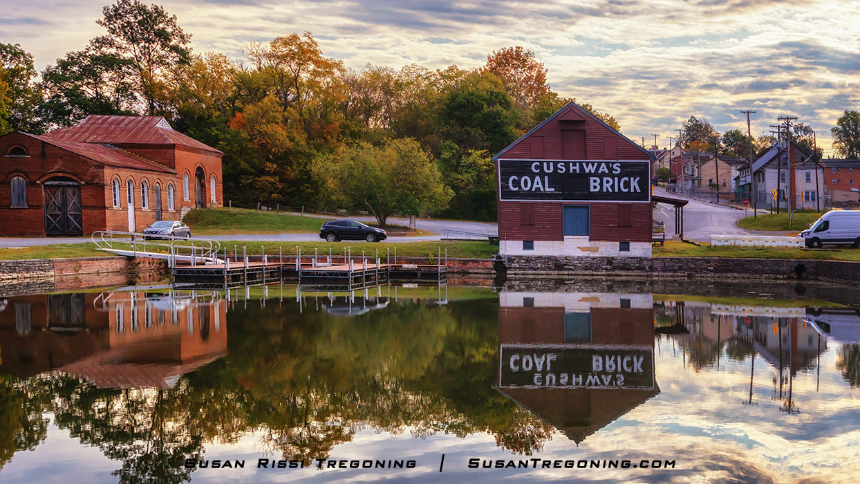
The year 2021 is the 50th Anniversary of the Chesapeake and Ohio Canal National Historical Park becoming part of the National Park System. This park preserves the historic 19th Century transportation canal from Washington D.C. to Cumberland, Maryland. Since 2019, it has been ranked as the 11th most visited United States National Park, with Great Falls being the most visited location along the canal's 184.5 mile-long towpath. Many visitors stop at the Great Falls Tavern but never explore more than the canal's first 14.5 miles.
No road follows along beside the C&O Canal. For that reason, the towpath is most popular with hikers and bikers. However, I decided to stay out of the city and explore some of the lesser-visited C&O Canal highlights. Wanting to see as much as possible and knowing that I didn't have time to see it all, I decided to drive to different locations along the canal, doing a series of short hikes along the way. 
What does the Mississippi Industrial Heritage Museum, a Dentzel antique carousel, and graves of Gypsy royalty have in common?
All three are located in Meridian, Mississippi. This eclectic mix of sites are some of Meridian's more interesting locations dating back to the city's Golden Age. 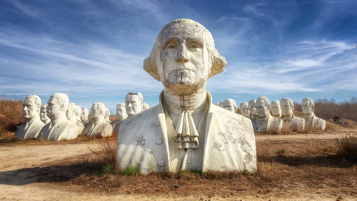
On President’s Day Weekend, I was more than a little excited to get the chance to photograph the Presidents' Heads! These giant busts reside on private property, with only a few opportunities for the public to visit them each year. Exposed to the elements, cracked and crumbling in various stages of deterioration, they are surrounded by heavy equipment in an apocalyptic industrial wasteland where the mold and moss adds character and awesomeness to the entire experience.
Mississippi Gulf Islands National Seashore: Exploring West Ship Island's Fort Massachusetts6/28/2019 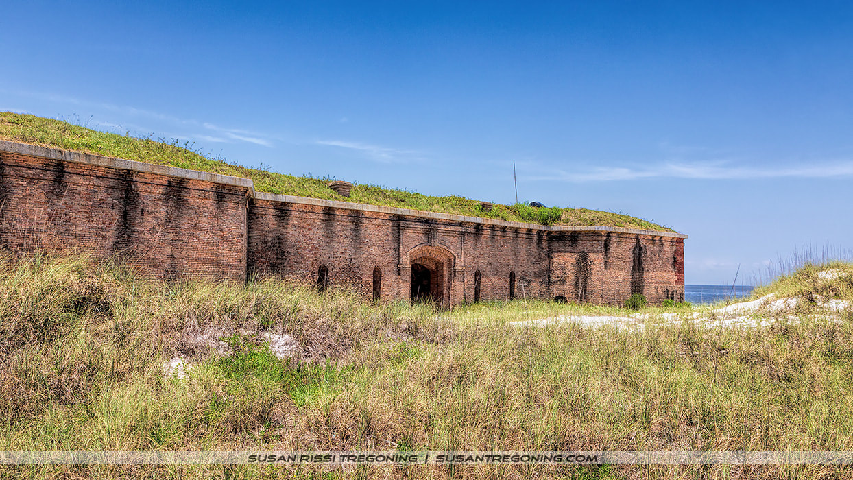
Fort Massachusetts is located on West Ship Island, 12 miles off the Mississippi Gulf Coast; it is part of the Gulf Islands National Seashore. Once known only as Ship Island, Hurricane Camille in 1969 cut the island in half creating East and West Ship Islands. The US Army Corps of Engineers began reconnecting the islands in 2018, so one day it will be one island again.
The barrier islands of the Gulf Islands National Seashore create a buffer between the mainland and the Gulf of Mexico. It is a critical habitat for shorebirds and sea turtles making West Ship Island an excellent location for birding and nature photography. The water around the island is typically crystal clear with visibility as much as 12 to 14 feet deep so the island is also a great destination for swimming and fishing. With something for everyone, it makes for a fun family day trip while also sneaking in a little history at the old fort. 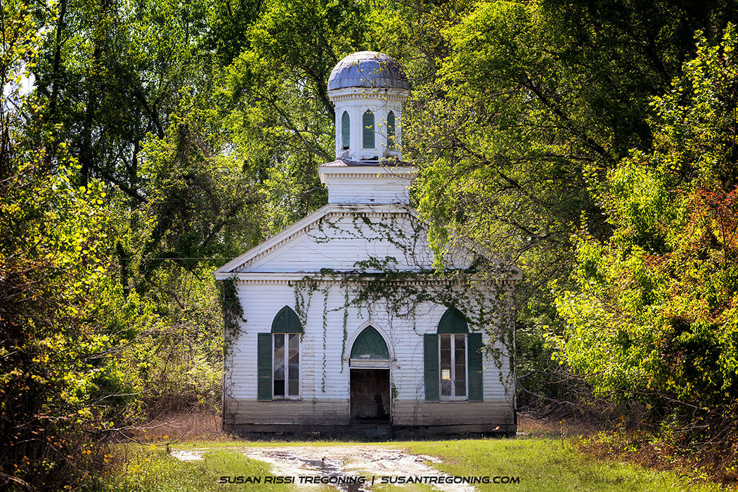
Located just outside of Lorman, Mississippi and a short distance off the Natchez Trace Parkway is the ghost town of Rodney, Mississippi. Not much is left of this early nineteenth-century river settlement that is richly steeped in early American history. It is now all but forgotten and only visited by the most adventuresome travelers.
I first fell in love with an old black and white photograph of the Rodney Baptist Church many years ago placing Rodney Ghost Town high on my bucket list of places to photograph in Mississippi. Let me just say, it didn't disappoint! 
On the Mississippi Gulf Coast, there are two one-mile stretches of beach that make up the largest nesting colony of Least Tern in the United States. This Important Birding Area right along the Gulf of Mexico contains sections of five beaches: Biloxi Beach, Gulfport East, Gulfport West, Long Beach, and Pass Christian; putting the Least Tern within the most populated area for beach-goers along the Mississippi coastline. Situations such as this make biologists suspect that humans and the family pet are the number one reason the Least Tern population is in decline.
I was not aware of this Important Breeding Area until I visited Biloxi several months ago to photograph the birds wintering in the area. Nesting Least Terns quickly became a priority on my birding bucket list. 
Travel back in time with a trip on the 444-mile long Natchez Trace Parkway. This All-American Road travels from Natchez, Mississippi to Nashville, Tennessee and clips the northwestern corner of Alabama along the way.
The Parkway was a long time coming; it officially opened in 2005 after being under construction and planning for 67 years! President Franklin D. Roosevelt signed the Natchez Trace Parkway into law on May 18, 1938, establishing it as a unit of the National Park System, and officially protecting this historically significant highway of the Old Southwest. There are seven segments of the Old Trace that are listed on the National Register of Historic Places. This scenic drive roughly follows and commemorates the historic Old Natchez Trace and is jam-packed with over 10,000 years of history! Along the way, you can hike preserved sections of the Old Trace, read historical markers telling the stories of the people back in the day, see historical buildings, Indian ceremonial, and burial mounds, breathtaking scenic overlooks; there are rivers, lakes, swamps, picnic areas, hiking trails, and campgrounds. It’s not a road you can drive in a day or even a week if you wish to see it all. This is a pleasant, leisurely drive through beautiful country with a maximum speed limit of 50mph. Relax, take your time, and enjoy the drive. 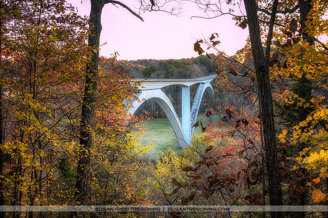
Travel back in time with a trip on the 444 mile long Natchez Trace Parkway. This All-American Road travels from Natchez, Mississippi to Nashville, Tennessee and clips the northwestern corner of Alabama along the way.
The Parkway was a long time coming; it officially opened in 2005 after being under construction and planning for 67 years! President Franklin D. Roosevelt signed the Natchez Trace Parkway into law on May 18, 1938, establishing it as a unit of the National Park System, and officially protecting this historically significant highway of the Old Southwest. There are seven segments of the Old Trace that are listed on the National Register of Historic Places. This scenic drive closely follows and commemorates the historic Old Natchez Trace and is jam-packed with over 10,000 years of history! Along the way, you can hike preserved sections of the Old Trace, read historical markers telling the stories of the people back in the day, see historical buildings, Indian ceremonial, and burial mounds, breathtaking scenic overlooks; there are rivers, lakes, swamps, picnic areas, hiking trails, and campgrounds. It’s not a road you can drive in a day or even a week if you wish to see it all. This is a pleasant, leisurely drive through beautiful country with a maximum speed limit of 50mph. Relax, take your time, and enjoy the drive. 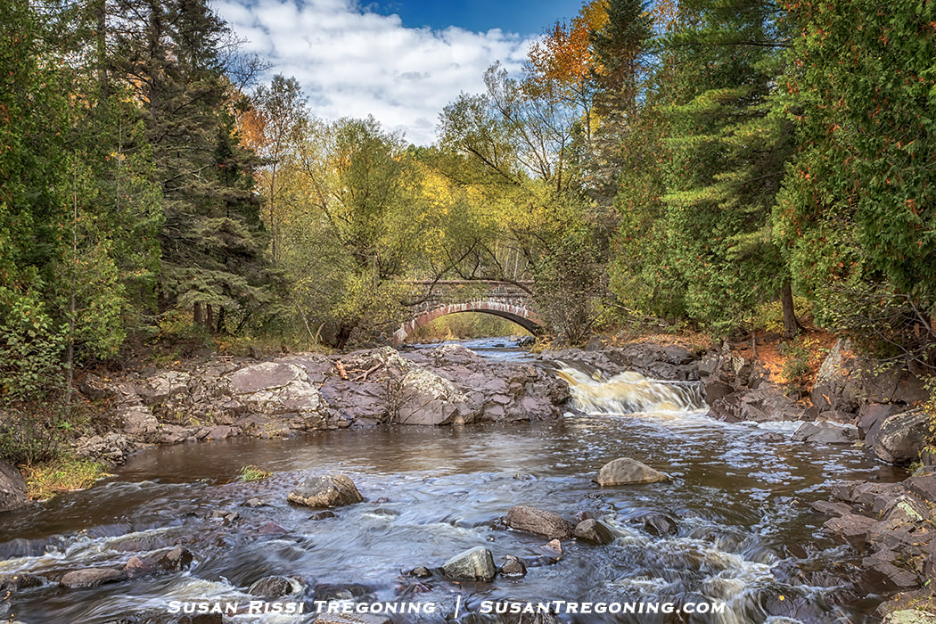
Bridge #1 on Seven Bridges Road as seen from Lester Park.
Seven Bridges Road located in Duluth, Minnesota is one of the more beautiful drives within the city. This 4 mile stretch of road intertwines with Amity Creek, the western branch of the Lester River, as it winds its way through a pine, poplar and birch forest on its way out to Lake Superior. A beautiful stone arch bridge has been constructed at each location were the road intersects the creek. All matching, there are seven bridges to cross along the way.
|
AuthorI am the 8th photographer in 4 generations of my family. Back in 2006, my husband accepted a job traveling, and I jumped at the chance to go with him. Categories
All
Archives
January 2024
|
 RSS Feed