Exploring Iowa’s Loess Hills Will Change How You See the Midwest
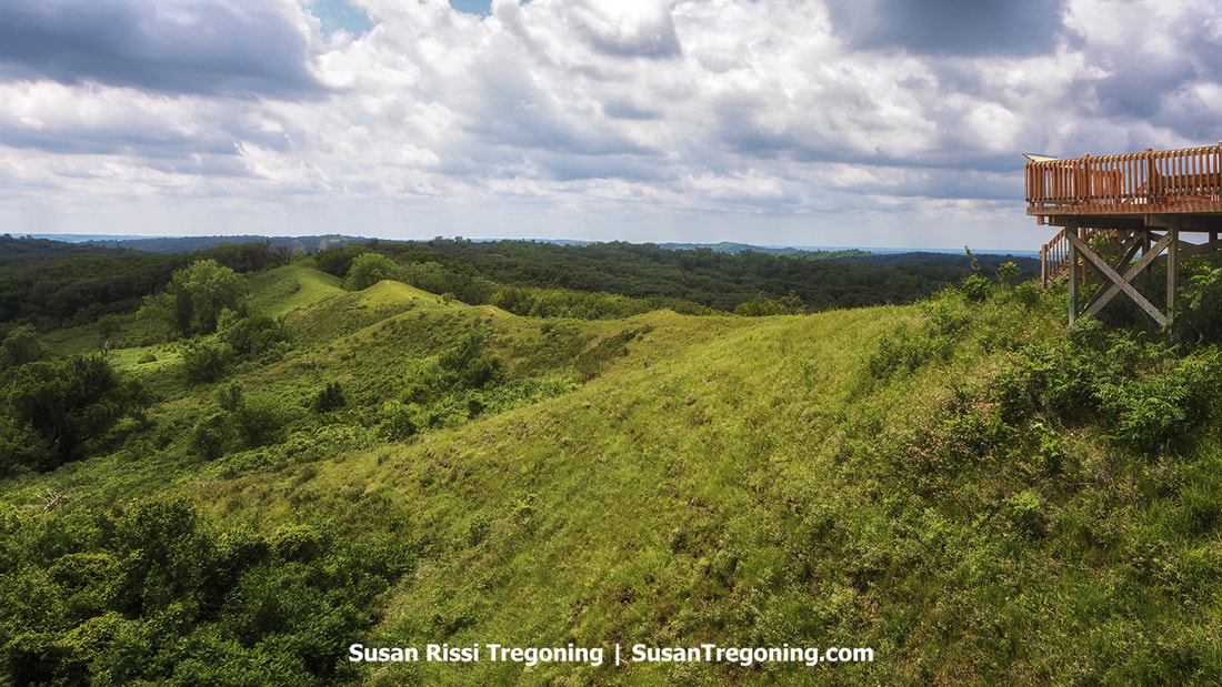

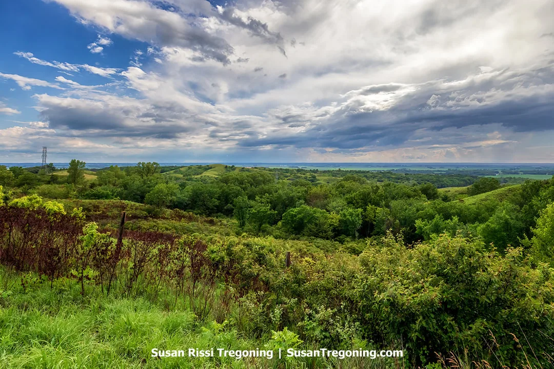
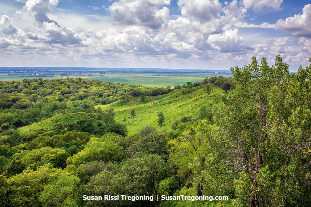
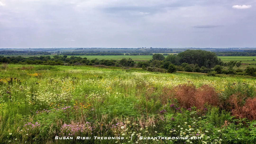
The Spot, a small overlook along the Loess Hills National Scenic Byway, offering a clear view of the region’s steep, wind‑built hills.
Did you know that Iowa is home to a 220-mile stretch of land unlike anywhere else in the world except for China? Running almost the full length of the state’s western border, the Loess Hills National Scenic Byway is a breathtaking mix of large rolling hills, prairie and forest that has been carved into extraordinary shapes by wind and time. The Loess Hills are not only a geological marvel but also a haven for wildlife and outdoor enthusiasts. This region’s dramatic topography offers more than just scenic views, it tells a story of natural wonder and resilience. Join us as we explore what makes this area so unique and how you can experience its beauty firsthand.
The Loess Hills are renowned for their striking beauty and unique ecosystems. Iowa has documented 39 rare plant and animal species inhabiting these hills, including the increasingly scarce plains pocket mouse, the ornate box turtle, the Great Plains skink (a lizard), and the spadefoot toad. The area also provides a habitat for bald eagles and numerous other bird species that either nest in the hills or migrate through each year. Remarkably, the Loess Hills preserve about 75% of Iowa’s remaining native prairies.

At Loess Bluffs National Wildlife Refuge, thousands of Snow Geese remain settled on the water while about twenty birds take flight together. These early lift‑offs often mark the beginning of the swirling mass flight known as a Snow Goose Tornado during the spring migration.
This region is considered an archaeological treasure with much historical significance. There is evidence of human activity dating back over 12,000 years. More than 800 archaeological sites have been identified, including the Mill Creek settlements from around 900 AD, once home to the ancestors of the Mandan tribe, and the Glenwood site, where approximately 80 earth lodges belonging to the Pawnee and Arikara forebears have been found.
The Loess Hills also play an important role in American History, as the scenic byway follows part of the path taken by the Lewis and Clark Expedition in 1804 on their westward journey and again in 1806 on their return. It was a gateway for westbound pioneers traveling along the Mormon, California, and Oregon Trails, and it later served as a starting point for journeys on the Transcontinental Railroad.
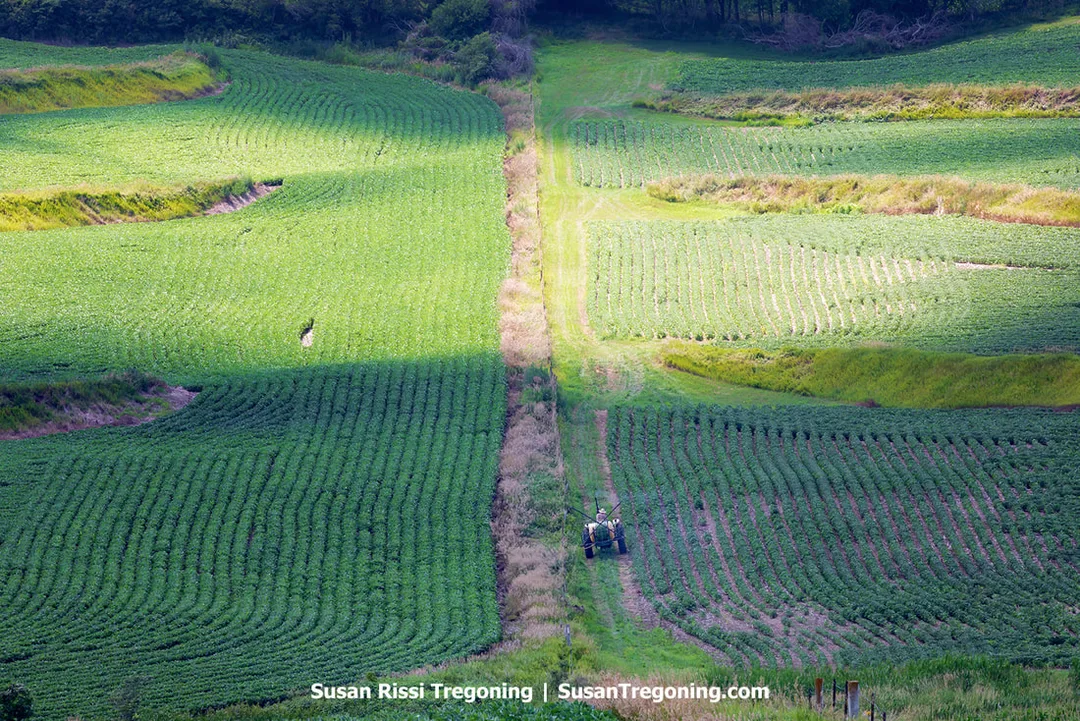
From above, a farmer rides his tractor along the fence line of a hilly Loess Hills field. The steep, wind‑built terrain shapes the path of the equipment and the layout of the farmland, reflecting the region’s distinctive topography.
What is Loess?
Loess (pronounced "luss") is the German word for "loose" or "crumbly," aptly describing the type of soil found in this area. Loess soils are typically found along the borders of expansive river valleys. Composed of densely packed grains of quartz, feldspar, mica, and various other minerals. The soil was created during the ice age when glacial motion ground up the rocks. The resulting soil is gritty, porous, and lightweight, much like dust or silt. Just as the wind shapes sand dunes, the Loess Hills were formed similarly. Although wind-deposited rock dust, or loess, can be found in many locations worldwide — including other parts of the United States, Germany, Argentina, New Zealand, China, and more, there are only two regions where these deposits have accumulated into massive hills that range in height from 60 to 350 feet tall: western Iowa along the Missouri River, and China's Shaanxi Province near the Yellow River.
The Loess Hills in Iowa are relatively young from a geological perspective, having been formed between 14,000 and 30,000 years ago. They cover about 640,000 acres making them 220 miles long and only about 15 miles wide that their widest point. In comparison, China’s Loess Plateau is vast, nearly the size of Texas, and over a million years old, making Iowa’s loess area much smaller and younger in age.
The distinctive landscape of the Loess Hills, marked by steep ridges, is shaped not only by its dramatic topography but also by the unique qualities of its loess soil. Slope inclines here frequently measure between 50 and 75 degrees, a consequence of the soil’s particular engineering characteristics. Made up mostly of coarse silt, loess becomes unstable and loses much of its strength when it absorbs water, often to the point where it cannot support its own weight. In contrast, when the soil is fairly dry, it gains enough temporary cohesion to sustain the striking bluffs and sharp ridges that line the Missouri River valley. These unusual soil traits pose significant challenges for any construction projects, such as roads or buildings.
Loess is also highly susceptible to erosion from flowing water. Its tendency to collapse further exacerbates this issue, resulting in severe soil loss and the formation of deep gullies. This area experiences some of the nation’s most severe erosion rates, averaging approximately 40 tons per acre annually. Consequently, streams in the region carry heavy sediment loads, which require continual clearing of drainage systems and stream beds and create adverse conditions for local aquatic life.
About the Byway
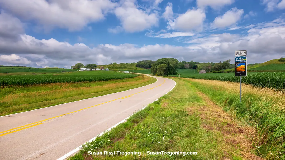
A view from the roadside at the beginning of the Preparation Loop along Iowa’s Loess Hills National Scenic Byway. The scene includes one of the byway’s distinctive signs, set against lush cornfields and the steep, wind‑formed hills that define the region.
The Loess Hills route was officially recognized as an Iowa Byway in 1998 and earned the distinction of National Scenic Byway status in 2000. It has also earned national recognition, being selected by Scenic America as one of the country’s top ten scenic routes.
Spanning seven counties, the byway runs from Akron in Plymouth County at the northern tip down to the Missouri state line in Fremont County in the south. Unlike most other byways, the Loess Hills National Scenic Byway offers a variety of roads to explore, each catering to different levels of adventure.
- The main section of the byway, known as the Byway Spine is a 220-mile-long all paved drive. it skirts the edge of the Loess Hills, allowing you to enjoy views of the hills from afar.
- There is another 185 miles of Excursion Loops, comprised of both paved and gravel roads, which wind deeper into the hills for those seeking to explore. In my opinion, this is where you get the best views, so be sure to explore at least a few, even if you don't have time to drive them all.
- For those wanting a more challenging adventure, I have included a few of the best Unimproved - Level B Roads. These are dirt roads that will not be found in the Byway guidebook. Higher clearance, all wheel drive vehicles are recommended. These stretches offer a genuinely unique Loess Hills experience but are only drive able under perfect conditions. They are 'enter at your own risk' roads. Some are easily managed when dry, but all of them become completely impassable with even a hint of moisture due to the nature of the fine loess soil. Attempting these roads when wet not only puts your journey in jeopardy but also damages them for everyone else, so please avoid them if there have been any recent rains.
Along the Byway Spine of Iowa’s Loess Hills National Scenic Byway, the road bends through cultivated fields while the region’s wind‑built hills form the backdrop. This stretch highlights the contrast between agricultural land and the steep loess terrain.
While the Byway Spine and Excursion Loops are very well marked with signage, attempting to drive it without the maps from the official Loess Hills Scenic Byway Guidebook in hand is difficult. Otherwise the guidebook has not been updated since 2014, and has very few working links and many closed business listed. I have attempted to correct that in this article. Many of the County Roads (CR) now have street names, which are in most cases what Google Maps recognizes, so I have tried to list both whenever possible.
Most likely because this guidebook is obsolete, it is almost impossible to find along the route. I have not found a place to order it online either. That link above is the PDF version of the 2014 Guidebook. I recommend printing out the pages you'll need for your trip or downloading the PDF to an iPad on the off chance you can't get your hands on one before starting your drive. I had Wi-Fi for the majority of the time, but it was spotty, depending on the location, so be sure to save the file and don't just plan to access it online.
If you happen to visit one of the visitor centers, be sure to ask for the guidebook if you don't see it out. The one I visited didn't have it out with the other tourism brochures, but hidden behind the desk.
Driving the Loess Hills Scenic Byway
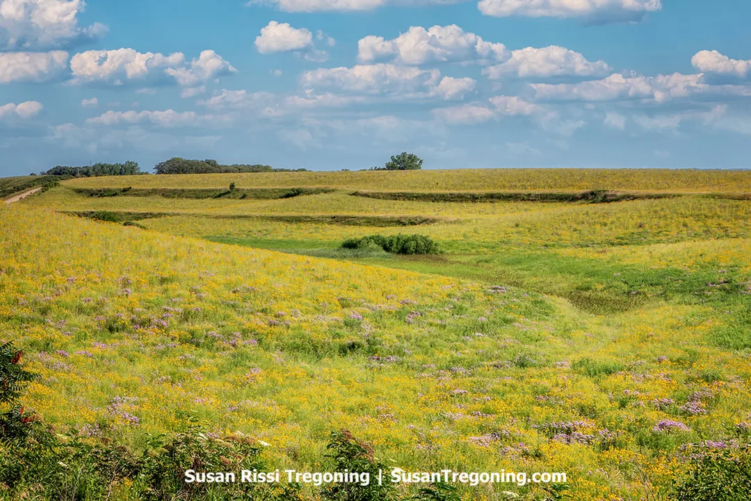
In spring, yellow wildflowers sweep across the rolling terrain of the Loess Hills, emphasizing the steep, wind‑built contours that define this landscape.
I suggest traveling the byway from north to south, as that matches the directions in both the guidebook and what I have provided here. The byway passes through seven counties.
I found the Guidebook directions terribly confusing and far too wordy to follow while driving, if you are like me, you might prefer the more abbreviated directions that I've added in this article.
Plymouth County
Akron, Iowa
Akron is the northern tip of the Loess Hills National Scenic Byway, marking the starting point of this picturesque route as it heads south along Iowa Highway 12. Here, the hills slowly emerge from the level farmland. As you get past Westfield, they will become steeper and more pronounced. Continuing further, travelers will notice the Byway hugging a slim strip of land between the rising bluffs and the Big Sioux River, which forms the border between Iowa and South Dakota.
There is an Information Kiosk on Highway 12 at the Akron City Park on the North Side of Akron. (GPS: 42.8320759,-96.5551262)
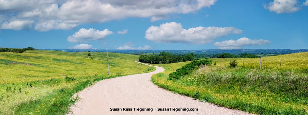
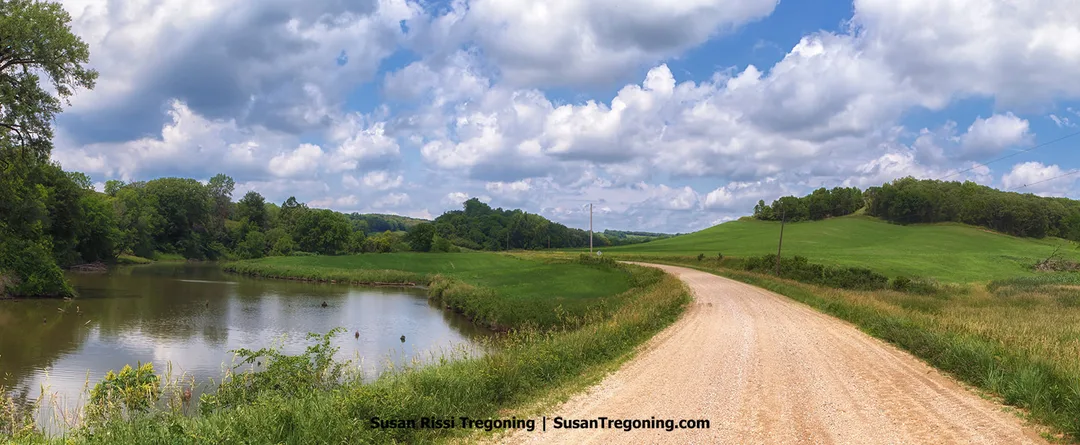
A gravel road follows the contours of the Loess Hills, curving through gently rolling slopes along one of the Scenic Byway Loop Drives. The scene highlights the region’s distinctive wind‑built terrain and rural landscape.
Plymouth County Byway Spine
The byway actually begins on the south side of Akron not far from the Casey's Gas Station (80 South St, Akron) on Highway 12.
Ridge Road Loop
FYI: The directions are incorrect in the Loess Hills National Byway Guidebook. You turn off 12 onto C38 NOT C43, but there is a sign marking the turn so it's easy to find.
From Iowa Highway 12 > Left on C38 > Right onto North Ridge Road - 1 mile > Curve left to stay on North Ridge Road > 3 miles after passing Butcher Road - Right on K18 > 4 miles back to Highway 12
In my opinion, K18 isn't very interesting, I recommend turning around when you get to K18 and backtracking to Butcher Road. Just don't turn on Butcher Road when you first see it or you'll miss some beautiful terraced farmland.
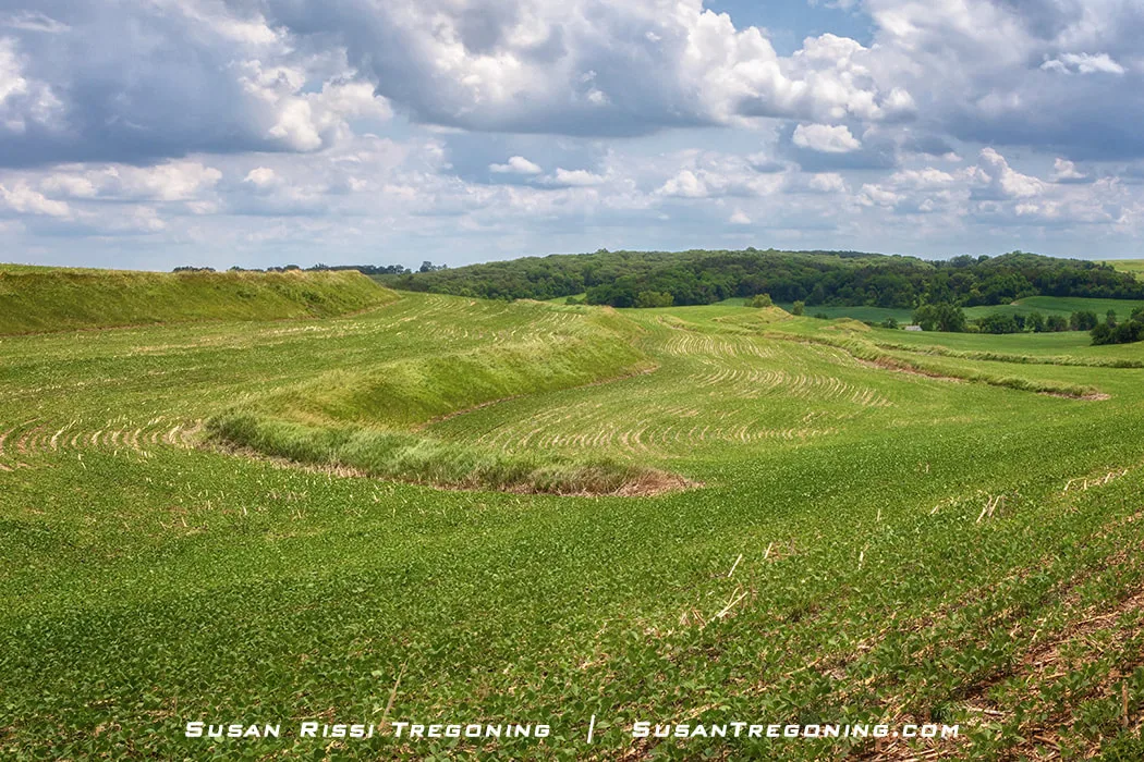
In the Loess Hills, farmers plant mostly corn and soybeans, reserving the steeper slopes for hay and pasture. Terracing, contour farming, grassed waterways, and perennial vegetative strips help reduce erosion, creating distinctive patterns across the rolling landscape.
Butcher Road Connection
Butcher Road is a gravel road that runs through the center of the Ridge Road Loop.
A little more than 5 miles south of Westfield on Iowa Highway 12 > Turn left on Butcher Road.
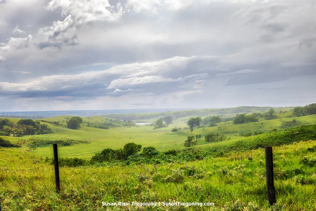
Viewed from Butcher Road, a fast‑moving summer rainstorm passes over Broken Kettle Grassland Preserve. The shifting rain and low clouds soften the contours of the Loess Hills, revealing the broad grassland slopes that define this protected landscape.
Plymouth County Byway Attractions
Broken Kettle Grassland Preserve
The Broken Kettle Grassland Preserve stands as Iowa’s largest stretch of unbroken prairie. Home to a flourishing bison herd now numbering more than 200, the landscape is a patchwork of sweeping grasses, occasional valley trees, and teems with native prairie plants, fascinating insects, and rare wildlife, including the prairie rattlesnake, the bobolink, and the Great Plains toad.
While visitors are invited to experience this remarkable ecosystem, it’s important to know that there are no established hiking or walking paths, nor any visitor facilities. Access may be restricted in certain sections due to bison grazing or ongoing land management.
You can take in views of the preserve from Highway 12, as well as from nearby routes like Butcher Road and County Road 34.
From Butcher Road along the Loess Hills National Scenic Byway, this wide view of Broken Kettle Grassland Preserve highlights the region’s rolling, wave‑like hills formed from deep loess soils. Green grasses and scattered trees cover the slopes, with dense vegetation in the foreground and open grasslands beyond. Layered clouds stretch across the sky, with breaks revealing patches of blue.
Five Ridge Prairie State Preserve
15561 260th St, Westfield
Five Ridge Prairie is spread across 960 acres, this park is one of the largest undeveloped tracts in the Loess Hills. As you explore, you’ll notice a shift in climate — from sunbaked, breezy prairie hilltops to the shaded woodlands below, where the air grows cooler and more humid. Trails vary from gentle walks to rugged, challenging hikes.
FYI: 260th Street is an Unimproved B Road, this dirt road is impassable when wet.
Woodbury County
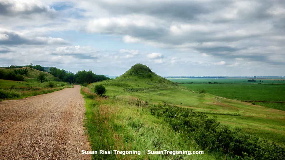
Sugarloaf, a locally named hill on the Stagecoach Trail Loop, rising from flat farmland within the Loess Hills region.
Woodbury County Byway Spine
Enter Woodbury on Hwy 12 near Stone Park Loop > Take I-29 from Exit 151 - 10 miles > Leave interstate at Exit 141 - D38 - 7 miles > SE on D25 > At Smithland - Right on L12.
Stone Park Loop
The Stone Park Loop is the 3 mile paved drive through this 1600-acre park. It's a beautiful wooded park. Be sure to watch for hikers on the road.
Stagecoach Trail Loop
Begins in Smithland > Head west on Hwy 141 > Take K67 - South.
Watch for traces of a stagecoach trail.
Smokey Hollow Loop
Begins in Smithland > Head north on Hwy 31 > At Oto - Left on 290th - 3 miles > Left on Knox Ave > Left - Old Hwy 141
Woodbury County Byway Attractions
Stone State Park
5001 Talbot Road, Sioux City, IA
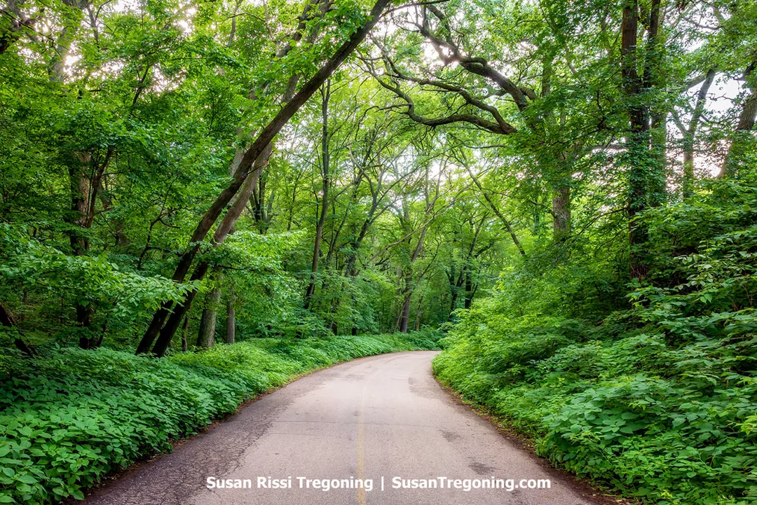
At Stone State Park, a scenic drive curves through dense forest, with trees enclosing the roadway and highlighting the park’s wooded terrain.
Stone State Park sits at Sioux City’s northwest border, tucked into the scenic Loess Hills. Covering 1,069 acres, the park features wooded areas and ridges capped with prairie, providing a sanctuary for local wildlife right next to the city. From the overlooks at Dakota Point and Elk Point, visitors can enjoy views spanning three states.
Dorothy Pecaut Nature Center
4500 Sioux River Rd, Sioux City, IA
In the center of the Loess Hills, the award-winning Dorothy Pecaut Nature Center is dedicated to celebrating this unique landscape. Visitors can explore interactive exhibits, observe live reptiles and fish, stroll through a butterfly garden, and experience a walk-through display that reveals what life is like beneath the prairie.
Sioux City Railroad Museum
3400 Sioux River Road, Sioux City, IA
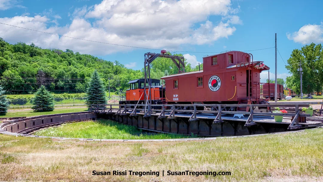
At the Sioux City Railroad Museum, the historic railroad turntable stands as a key feature of the Milwaukee Railroad Shops Historic District. The turntable once rotated locomotives for servicing and remains a central element of the preserved rail complex.
Once home to the Sioux City Engine Terminal and Car Repair Shops of the Chicago, Milwaukee, St. Paul, and Pacific Railway, commonly called the Milwaukee Road, this site has since been transformed into the Sioux City Railroad Museum.
The first railroad arrived in Sioux City in 1868. Eight railroads would eventually serve the city before consolidating into six, making Sioux City, Iowa, the tenth-largest rail center in the United States from the 1920s through the 1930s. Because of this, the Chicago, Milwaukee, St. Paul, and Pacific Railroad (Milwaukee Road) built a repair shop terminal here for their rail network in Iowa and the Dakotas. The shop was completed during the height of World War II. It employed 560 workers, overhauled 35 steam locomotives, and serviced over 70 trains a day. By the mid-1950s, the staff was reduced to 10, and the Roundhouse was scaled back from 30 stalls to six. Finally, with the conversion to diesel engines, the shop was obsolete. The Milwaukee Road filed for bankruptcy in 1977 and then became a farm machinery salvage company in 1981. In 1995, the Siouxland Historical Railroad Association acquired the property and began restoration work converting it into a museum.
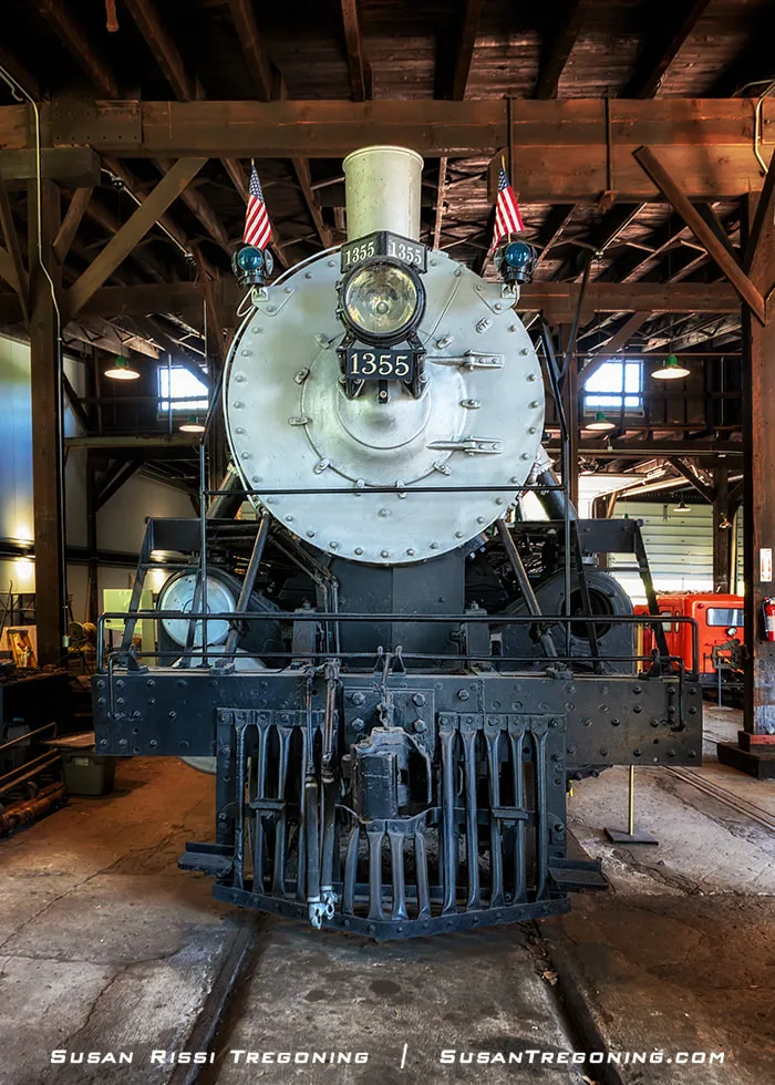
Great Northern Railway Steam Locomotive No. 1355, shown from the front. The view highlights the smokebox, headlight, and number plate that define the locomotive’s appearance.
Recognized as the Milwaukee Railroad Shops Historic District, the location was added to the National Register of Historic Places in 2018. The museum is housed within the former Milwaukee Railroad roundhouse, and features Sioux City’s historic steam locomotive GH 1355 and Tender 1451 (both National Register Landmarks), along with a switch engine and various pieces of rolling stock.
Sergeant Floyd River Museum & Welcome Center
1000 Larsen Park Road, Sioux City, IA
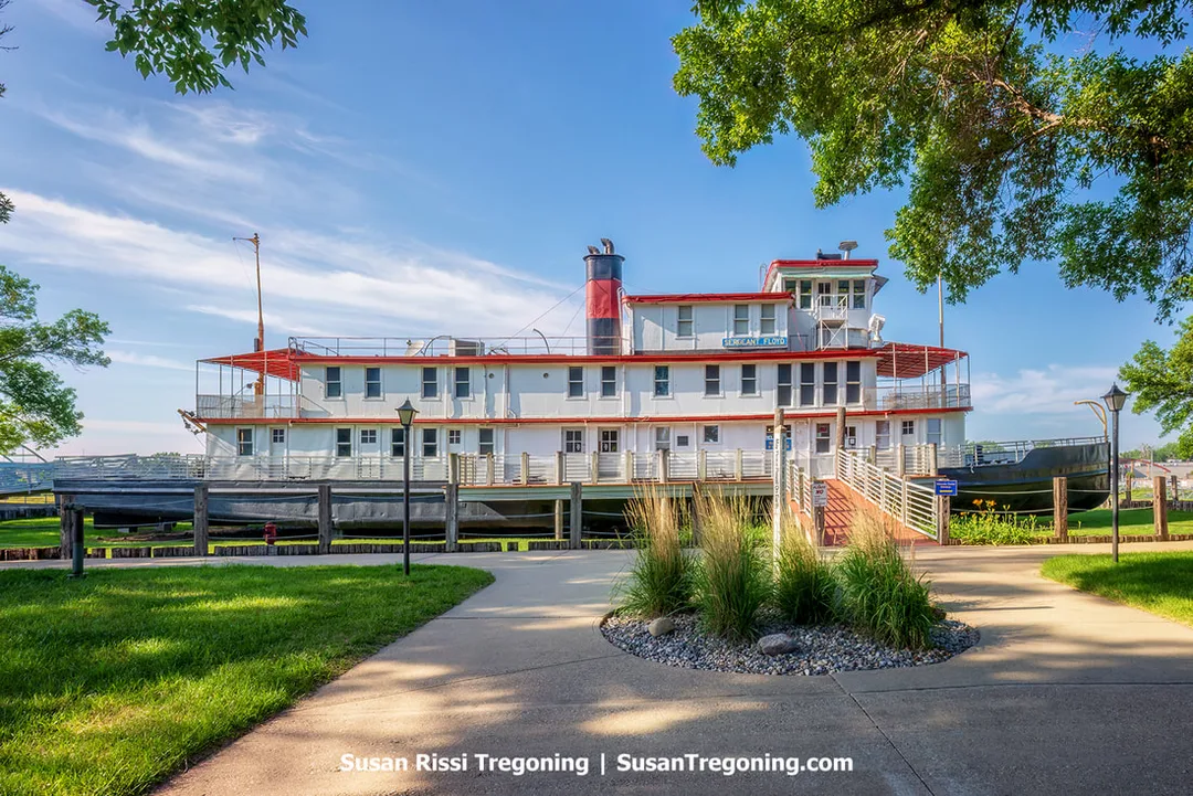
The Sergeant Floyd Survey and Inspection Boat, preserved as a museum and visitor center, represents a rare surviving example of a U.S. Army Corps of Engineers inspection vessel. The site highlights the vessel’s operational history along the Missouri River.
Located beside the Missouri River and bordering a picturesque waterfront trail, the historic M.V. Sergeant Floyd is a distinctive riverboat now resting on dry land. This historic vessel, named after Sergeant Charles Floyd of Kentucky, one of the members of the Lewis and Clark expedition, once served as a survey and inspection boat for the U.S. Army Corps of Engineers before it was retired. Today, it houses the Iowa Welcome Center and a River Museum, where visitors can explore exhibits about the Lewis & Clark Expedition and many other topics.
The Loess Hill National Scenic Byway Guidebook should be available at this Welcome Center.
Lewis & Clark Interpretive Center
900 Larsen Park Road, Sioux City, IA
When the Lewis & Clark Expedition reached the Mandan and Hidatsa villages situated along the Missouri River in 1804, they became the most renowned among many who had come here for trade and learning.
At the Lewis & Clark Interpretive Center, guests can engage with interactive exhibits, realistic animatronic characters, and rotating photo displays that highlight the historic expeditions of Lewis and Clark in 1804 and 1806. Experience captivating presentations, examine hundreds of genuine period artifacts, appreciate outstanding artwork, and converse with expert interpreters who vividly recount the legendary journey of the Corps of Discovery. The Center also highlights other significant explorers and residents who have shaped the history of this extraordinary section of the Missouri River over time. Every gallery within the Center is dedicated to sharing the distinct experiences of these various groups.
Sergeant Floyd Monument
2601 S Lewis Blvd, Sioux City, IA
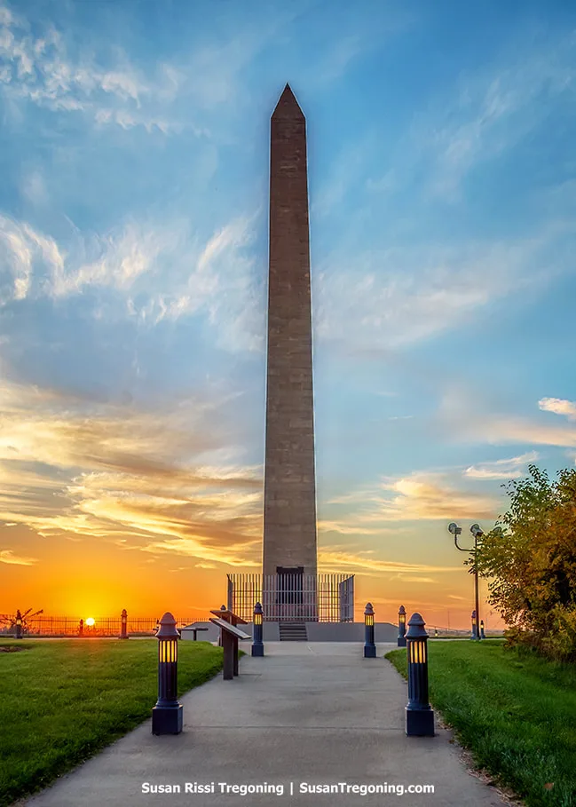
Sergeant Floyd Monument at sunset, with the obelisk in shadow and sunset colors visible in the sky behind it.
Over the course of their two-year journey, the Lewis and Clark Expedition suffered just a single casualty: Sergeant Charles Floyd, Jr. Today, historians think he succumbed to appendicitis.
Originally buried along the riverbank. In 1857, the Missouri River’s erosion partially uncovered Floyd’s burial site. Settlers from the area gathered most of his bones and reburied them elsewhere on the bluff. The grave was relocated once more in 1895. In 1901, a 100-foot Kettle River sandstone obelisk known as the Sergeant Floyd Monument was erected in his honor, and Floyd’s remains were transferred for a third time to rest at the foot of the new monument.
This was the first site in the United States to be designated a National Historic Landmark.
Monona County
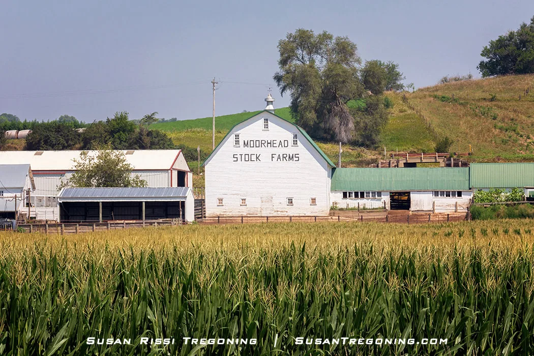
In Moorhead, Iowa, the white Moorhead Stock Farms Barn rises beyond a cornfield filled with gold‑tasseled cornstalks. The field borders the Loess Hills National Scenic Byway, creating a classic agricultural foreground against the regional landscape.
Monona County Byway Spine
Enter Monona County on CR L12 > Left on 133rd St/CR E16 > Right on CR L20 > Near Castana - Right on Hwy 175 - 4.5 miles > Left on Hwy 37 - 1.5 miles > Right on CR L16 - 7.5 miles it becomes CR E54 > Before Moorhead - Right on Hwy 183.
Wilderness Loop
This is a 30 mile paved & gravel loop.
Continue south on L12 (after the byway spine turns off at E16) - 5.5 miles > Left on Nutmeg Ave - about 2 miles > At junction with Oak Ave - continue straight - less than 1 mile > Right on 160th St - About 3 miles > Right on Olive Ave - less than 2 miles > Right on CR L20 > Castana about 2 miles.
Larpenteur Memorial Road Connection
This is a 15 minute paved drive.
Starts as junction of CR L14 & CR L12 > Follow CR L14 - 5.5 miles > At Turin - Left on Hwy 175/37 to rejoin the byway spine east of town OR continue south on CR L14 to the Preparation Loop.
Along this stretch of the Preparation Loop, the Soldier River Cutoff appears beside a gravel road, offering a brief view of the waterway within the Loess Hills setting.
Preparation Loop
The 15-mile long Preparation Loop is a combination of paved and gravel roads.
Head south from Turin for 9 miles on L14 / Larpenteur Memorial Road > Left on E60 - 1.5 miles > Left on Oak Avenue - about .5 miles > Right on 314th Street - 1 mile - Preparation Canyon State Park > at Park Entrance - Left at Y to continue on 314th Street to Byway Spine Hwy 183 about 2 miles away.
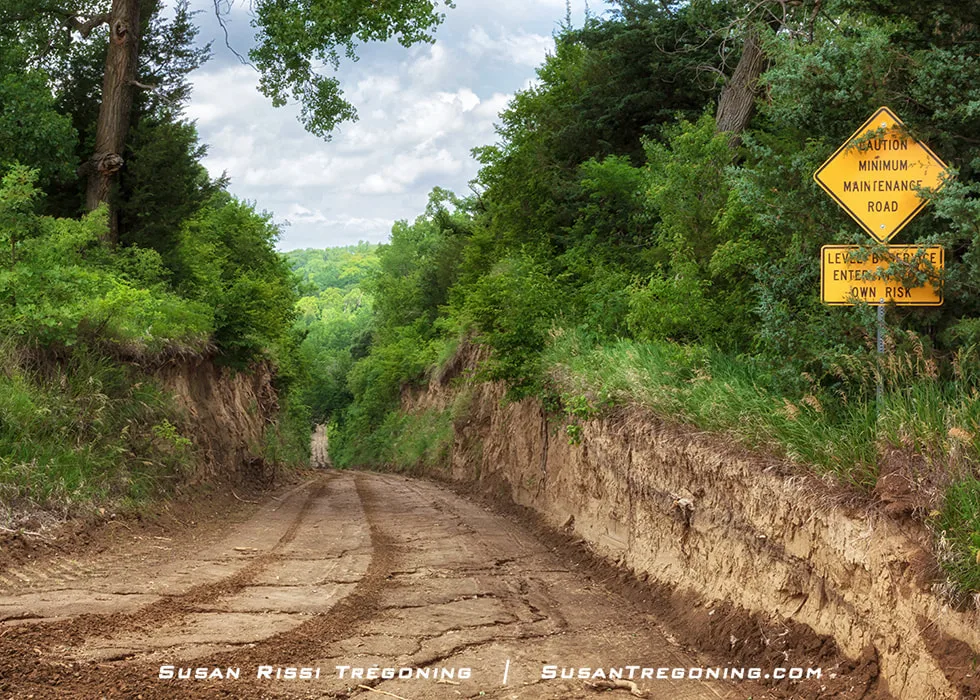
Near Preparation Canyon State Park, the entrance to Sophie’s Hollow begins along a minimum‑maintenance B Road. This unpaved route reflects the rugged character of the Loess Hills and its scenic byway network.
- B Road - Sophie's Hollow - Although Google Maps labels it as Olive Avenue, residents refer to this dirt road as Sophie’s Hollow. The road begins at the intersection of 314th Street and Olive Avenue, near Preparation Canyon State Park. As you follow the route, it plunges steeply into the hollow, flanked by abrupt embankments. Locals, especially those who grew up sledding there, often call this dramatic descent “Suicide Hill.” The road is approximately 1.5 miles long.
Monona County Byway Attractions
Preparation Canyon State Park
Preparation Canyon Rd, Moorhead
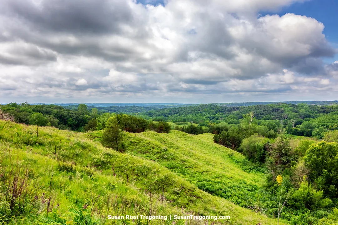
The rippling contours along the slope of a loess hill in Preparation Canyon State Park create a striking scene as the land gradually descends into the wooded areas of the Loess Hills State Forest.
Spanning 344 acres, Preparation Canyon State Park occupies the land that was formerly the town of Preparation.
In 1853, Charles B. Thompson separated from the Mormon wagon train en route to Utah after claiming he had received divine instruction from the "Spirit." Leading a group of 50 to 60 Mormon families, Thompson traveled to Kanesville, now known as Council Bluffs. After much searching, Thompson and a select few men settled on an area known as "Monona," a Native American term meaning "Peaceful Valley." There, they established the community of Preparation, building homes and schools, and launching Monona County’s first newspaper, which Thompson personally managed.
For these settlers, the valley served as their "School of Preparation for the Life Beyond." They soon realized they had chosen one of the most fertile agricultural regions in the new territory. Recognizing its promise, Thompson used his newspaper to publish a message he attributed to a spirit named "Beneemy": "I appoint Charles B. Thompson chief steward of my house to receive, hold, manage, and direct all the treasures of my house to him." Trusting in Thompson’s spiritual authority, his followers surrendered all their property and deeds to him, making him extremely wealthy. He also instructed them to refer to him as "Father Ephraim," a name taken from the scriptures.
By 1856, however, the settlers grew suspicious and demanded the return of their belongings. Thompson, refusing their requests, faced mounting anger from the community. When word reached him that a mob intended to lynch him, he was forewarned by a young follower and evaded capture by hiding in an attic in Onawa. Ultimately, he fled Iowa without reclaiming the deeds. Many of his disillusioned followers left the valley and continued their journey toward Utah.
That same year, the Iowa Supreme Court intervened and divided the land equally among the remaining families. The town of Preparation began to expand, once boasting sixty-seven houses, a post office, a skating rink, and a blacksmith shop. However, by 1900, the town had declined, leaving only a stockyard, which eventually closed in 1946.
In 1934, Martha and Walter Perrin — descendants of some of the original settlers — sold 82 acres of their property to the state of Iowa. Martha Perrin later sold another 157 acres in 1969, including the Perrin family homestead. These parcels included the very valley where the Mormons had once founded Preparation as their refuge and place of spiritual readiness for what lay beyond this life.
Picnic tables, a shelter, and non-modern toilets are provided. To help protect the canyon's natural seclusion and the remaining evidence of its dramatic past, camping is restricted to hike-in camping only at designated sites. Preparation Canyon State Park lies at the very north end of the Loess Hills Pioneer State Forest.
Loess Hills State Forest
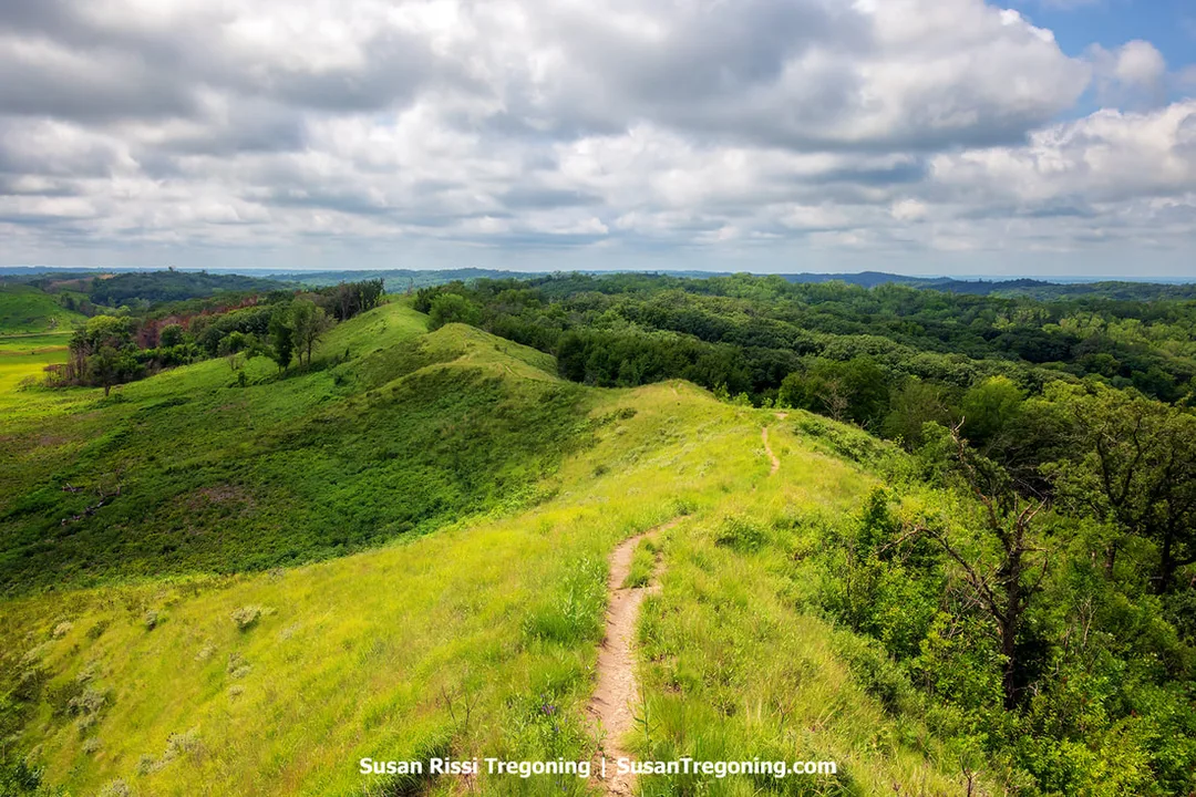
At The Spot in the Loess Hills State Forest, visitors can see deep into the interior of the Loess Hills. A narrow path along the hill’s spine marks the start of an easy 1.2‑mile, lightly trafficked loop trail that follows the contours of the ridge.
Loess Hills State Forest spans 11,484 acres divided among four separate units. As the state’s most recently established public forest, it began to take shape in 1985 through a combination of land donations and acquisitions. The forest is managed with a focus on sustaining natural resources for the long term, while also offering a variety of outdoor recreational activities.
Roughly 1.5 miles west of Preparation Canyon State Park, visitors will find an accessible observation deck that offers some of the finest views into the heart of the Loess Hills.
Here, a stone commemorates Walter Ordway Jr., who named this place “The Spot.” Walter played a key role in creating the Loess Hills Byway program, following in the footsteps of his ancestor, Sergeant John Ordway. Sergeant Ordway was a member of the Lewis and Clark Expedition that passed through these hills in 1804.
Informational displays at this site provide insights into the unique landscape and its significance.
Turin Loess Hills & Sylvan Runkel State Preserves
29631 205th St, Onawa
Located just north of Turin, Sylvian Runkel State Preserve and Turin Loess Hills State Preserve are publicly owned parcels encompass over 3,500 acres. They represent one of the largest sections in the Loess Hills where visitors can experience the original prairie landscape of the hills. Each year, the Western Hills Area Education Agency holds the Loess Hills Prairie Seminar here on the weekend after Memorial Day.
Trailheads for several hiking routes can be found at parking areas on 178th Street and Oak Avenue.
Turin Man Archeological Site
498 IA-175, Turin
In 1955, a skeleton was unearthed in a gravel pit near Turin, Iowa. Initially, specialists believed the remains dated back approximately 10,000 years, possibly belonging to Ice Age-era inhabitants. Continued excavation soon revealed three additional human skeletons nearby. After months spent meticulously reconstructing the bones and conducting scientific analyses, researchers determined that the individuals were most likely members of a family who lived roughly 6,000 years ago. Artifacts and burial arrangements at the site showed striking similarities to ancient burial traditions found throughout the eastern United States. Until August 2011, when a 7,000-year-old settlement was discovered in Des Moines, the Turin skeletons were considered the oldest known human remains in Iowa.
R.T. Reese Homestead & Davis Wetland
22171 Larpenteur Memorial Road, Turin
In 1856, the Reese family established this homestead. Today, it is overseen by the Monona County Conservation Board and serves as a connector between three neighboring public lands. Together with the Turin Loess Hills Nature Preserve, these areas total 713 acres of accessible land. Situated just one mile north of Turin, this location is among the rare spots in Iowa where visitors can easily experience a mix of wetlands, prairies, and woodlands.
The R.T. Reese Cabin sleeps up to eight guests and is available for nightly or weekly rentals. Call 712-433-2400 or you can view cabin details and check availability here.
Ingemann Danish Lutheran Church
32044 County Road E54, Moorhead
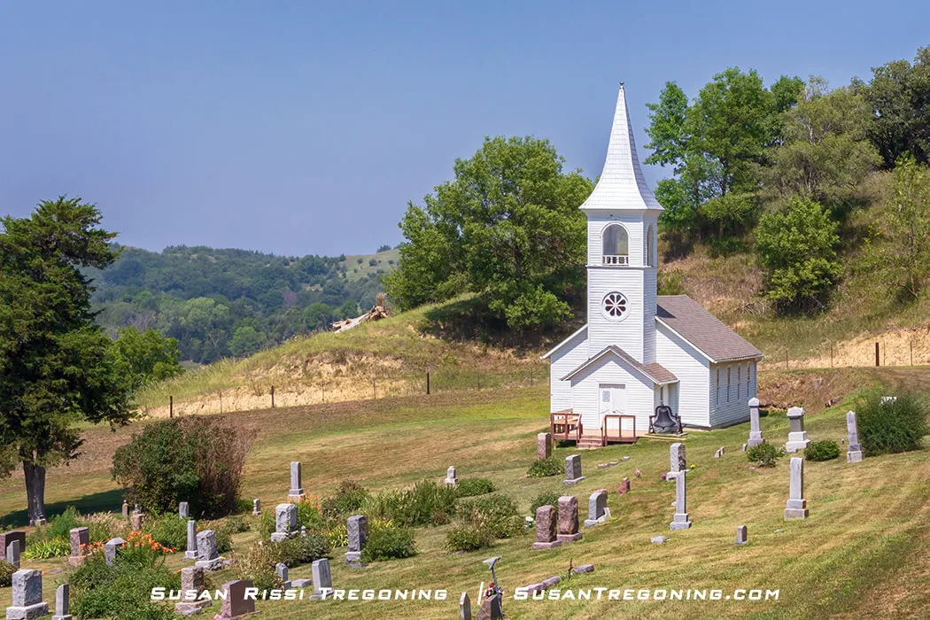
Set within the Loess Hills of Monona County near Moorhead, Iowa, the Ingemann Danish Evangelical Lutheran Church stands with a graveyard on its grounds. The rural setting reflects the region’s long‑standing Danish community and hillside heritage.
Built in 1884, the church showcases the late Victorian style, with its strikingly large steeple, added two decades later in 1904, it mirrors the classic Danish architecture found in rural Denmark.
Following a division within the Danish Lutheran Church in 1894, the Ingemann Church became known as the Lower Danish Church. It played a central role in local life until the early 1900s, when membership declined and it no longer had a resident pastor. The church hosted its final confirmation class and baptism in 1954, though the adjoining cemetery continues to be used today.
In recognition of its importance to the religious history of Danish immigrants, the church was listed on the National Register of Historic Places in 2012.
Lewis and Clark State Park
21914 Park Loop, Onawa
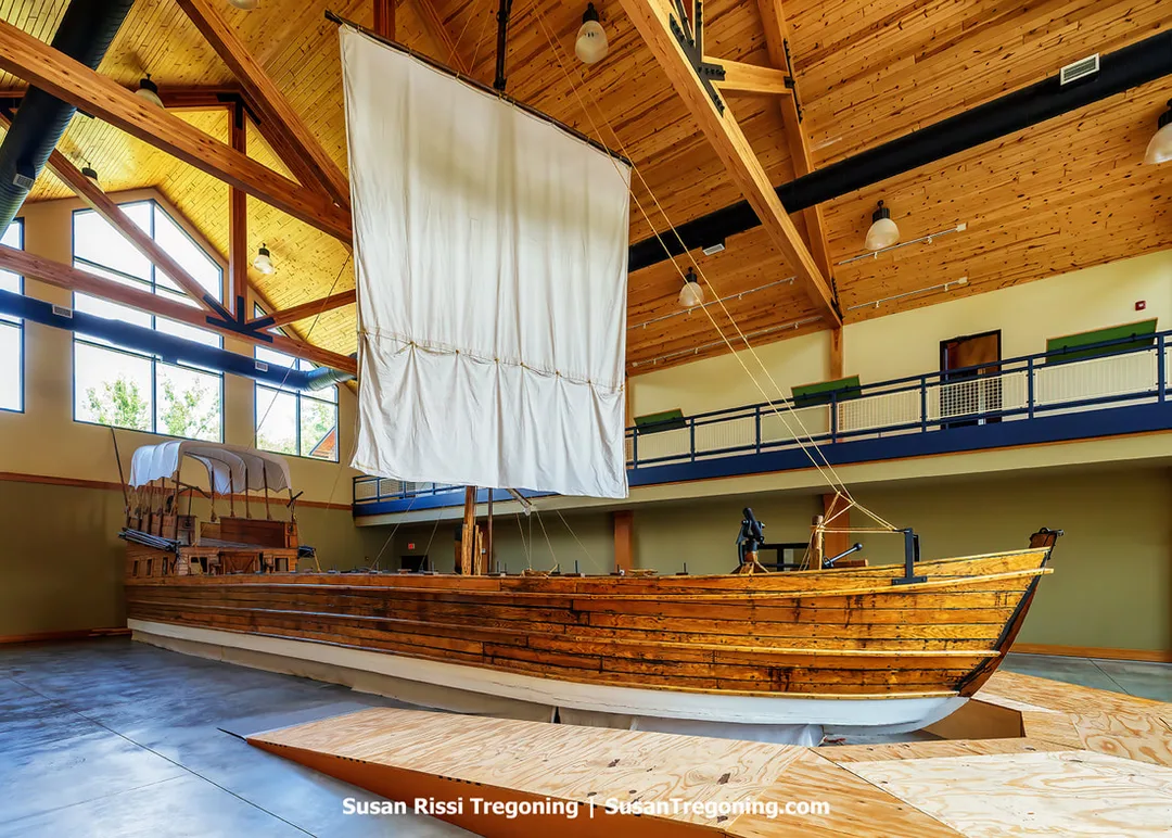
At Lewis and Clark State Park, a full‑scale replica of the expedition’s 55‑foot keelboat illustrates the type of vessel used during the early stages of the Lewis and Clark journey. The reproduction highlights the boat’s long hull and historic river‑travel design.
The park derives its name from Meriwether Lewis, who served as President Thomas Jefferson’s secretary, and Captain William Clark, an officer in the U.S. Army. In 1804, Jefferson tasked them with leading a team of 26 men to explore the vast lands recently acquired from France. Their journey began in St. Louis, taking them up the Missouri River aboard a sturdy keelboat.
On August 10, 1804, Lewis and Clark’s party reached the very location where the park now stands. During their stay, they surveyed the land and documented the local geography, flora, and fauna. Today, visitors can explore the site of this historic encampment. The park’s highlight is a full-sized replica of the expedition’s 55-foot keelboat, which they used to navigate the challenging waters of the Missouri River. They also have a replica of the explorers’ smaller boats, called pirogues.
This is worth seeing. I found this far more impressive than I expected it would be.
For more information: Lewis and Clark State Park.
Harrison County
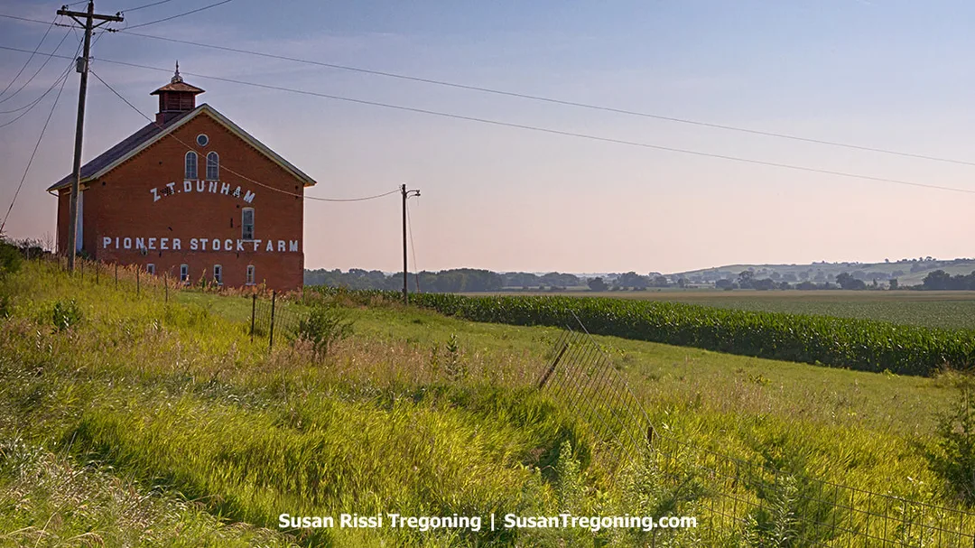
Built in 1870 by the sons of Harrison County’s first settler, the Z.T. Dunham Pioneer Stock Farm Barn stands as one of the region’s early agricultural landmarks. Its construction reflects the farmstead development that shaped the county’s pioneer era.
Harrison County Byway Spine
Enter Harrison County on Hwy 183 > pass through Pisgah > Loess Hills State Forest Visitors Center > 9 miles south of Pisgah take Hwy 127 - 11 miles > Logan - turn right on US 30 > Iowa Welcome Center - . 5 miles past Welcome Center > turn left on CR F58 - 4 mile > at junction of CR L34 - turn right - its about 6 miles to county line.
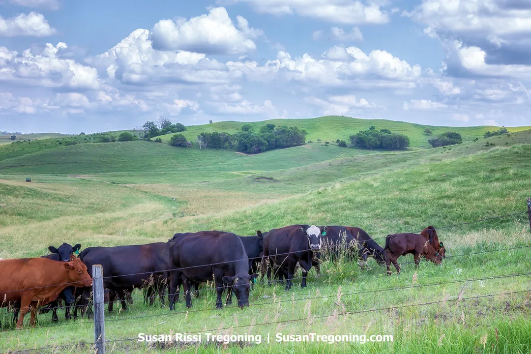
On Murray Hill, the resident cows are known for their enthusiasm when people arrive. They usually hurry across the pasture as soon as they hear a visitor. On a recent visit, they were separated in another part of the field and couldn’t reach the fence, expressing clear frustration at being unable to come closer.
Fountainbleu Loop
This is a 30 minute drive on paved and gravel roads.
From Pisgah - west on CR F20/Easton Trail > About 9 miles to Murray Hill Scenic Overlook > continue 1/2 mile west to CR L14/Larpenteur Memorial Road - approx 3.25 miles > - Left on Eden Ave. - 1.5 miles > Left on 165th Trail - 3.75 miles > Right on Geneva Place > Follow Signs back to Pisgah.
- B Road - Fulton Avenue - Left on Geneva Place instead of Right when following the Fountainbleu Loop directions > Left on 138th > Fulton will be on the left - runs parallel to 138th for a short distance.
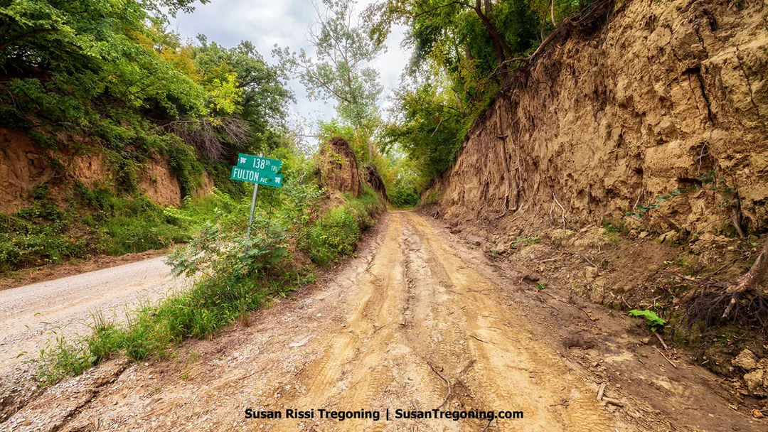
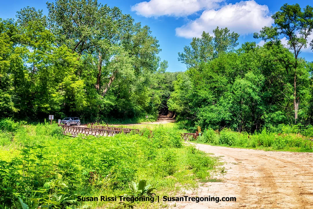
In Harrison County, Iowa, a narrow band of loess soil divides Fulton Avenue and 138th Trail. Fulton Avenue, a B‑level dirt road along the Loess Hills National Scenic Byway near the Fountainbleu Loop, highlights the region’s characteristic wind‑formed terrain and close‑set rural roads.
At 2.4 miles long, this is considered one of the top 8 B Roads in the Loess Hills but it is often in the roughest shape. Sometimes, so impassable that your best option is to leave your vehicle at the intersection and explore on foot which is what I decided to do since a six foot deep gulley is eroding the dirt under the road on one side and another gulley looks to be starting on the other.
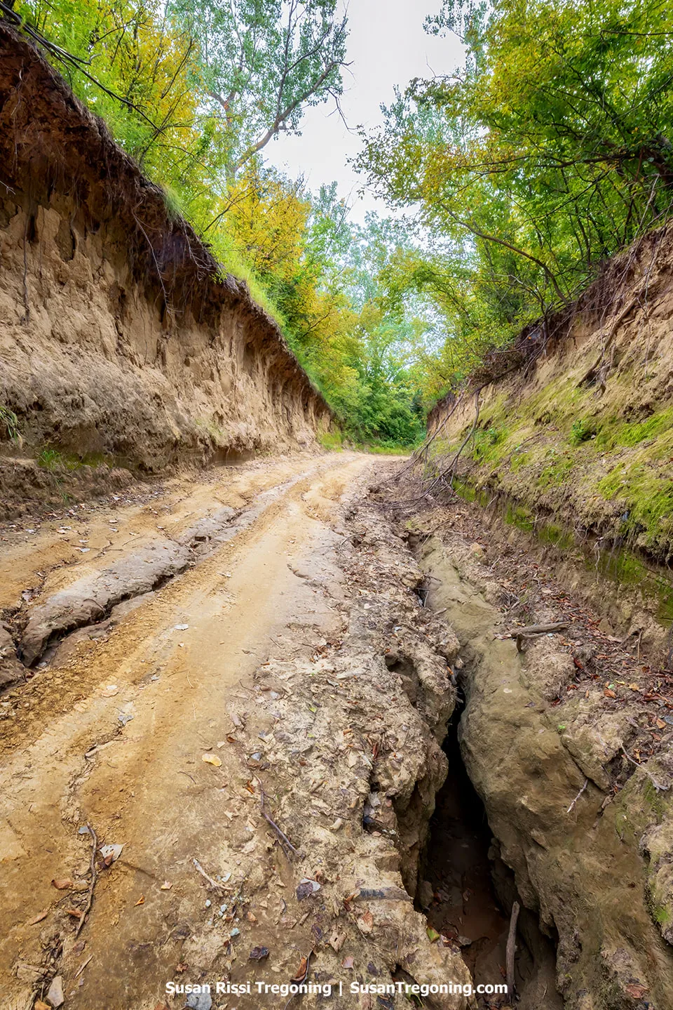
Erosion under Fulton Avenue.
Predominantly composed of coarse silt particles, loess becomes unstable, losing much of its structural integrity when saturated with water, making it particularly vulnerable to water-induced erosion. Its tendency to collapse exacerbates this problem, leading to rapid soil loss and the formation of deep gullies. This region suffers from some of the highest erosion rates in the United States, with losses averaging around 40 tons per acre each year.
Situated in the Little Sioux Unit of the Loess Hills State Forest, at the beginning of this road it runs parallel to 138th Trail, and is separated only by a slender band of loess soil. Within about 100 yards, the route then veers sharply, almost at a right angle. A tree has fallen and is currently blocking the road after the curve so it's not possible to drive this one even if you can get past the gulley but the most interesting section of this road is easily walkable.
Given the present state of this road, I hesitated at first to even share directions to it.
However, then I realized this loess road is actually an ideal B Road for those who want to experience a loess road without needing a four-wheel-drive vehicle to do it. 138th Trail is a nice gravel road and with less than a 100 yard walk, you can be deep in the loess here.
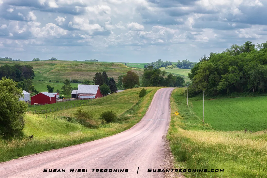
A rural Iowa farm scene along the Orchard Ridge Loop.
Orchard Ridge Loop
This is about a 20 minute drive on paved roads.
From Pisgah - take Easton Trail/CR F20 > turn south on CR L23 - to Magnolia
- B Road - Ideal Avenue Just off Easton Trail/County Road F20 on the Orchard Ridge Loop is a brief, 0.4-mile stretch of B Road that ranks among the top eight B Roads in the area. Ideal Avenue meets another B Road here, forming an unusual three-way junction where all the side embankments come together.
Rain kept me from visiting Ideal Avenue. If you get a chance to drive it, let me know if it's a good as they say.
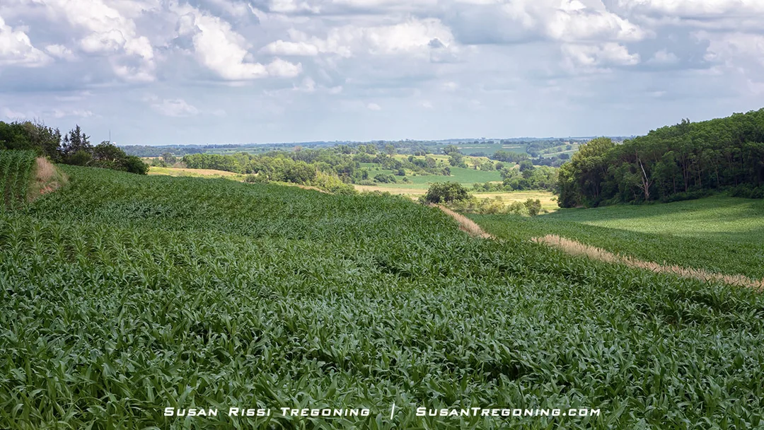
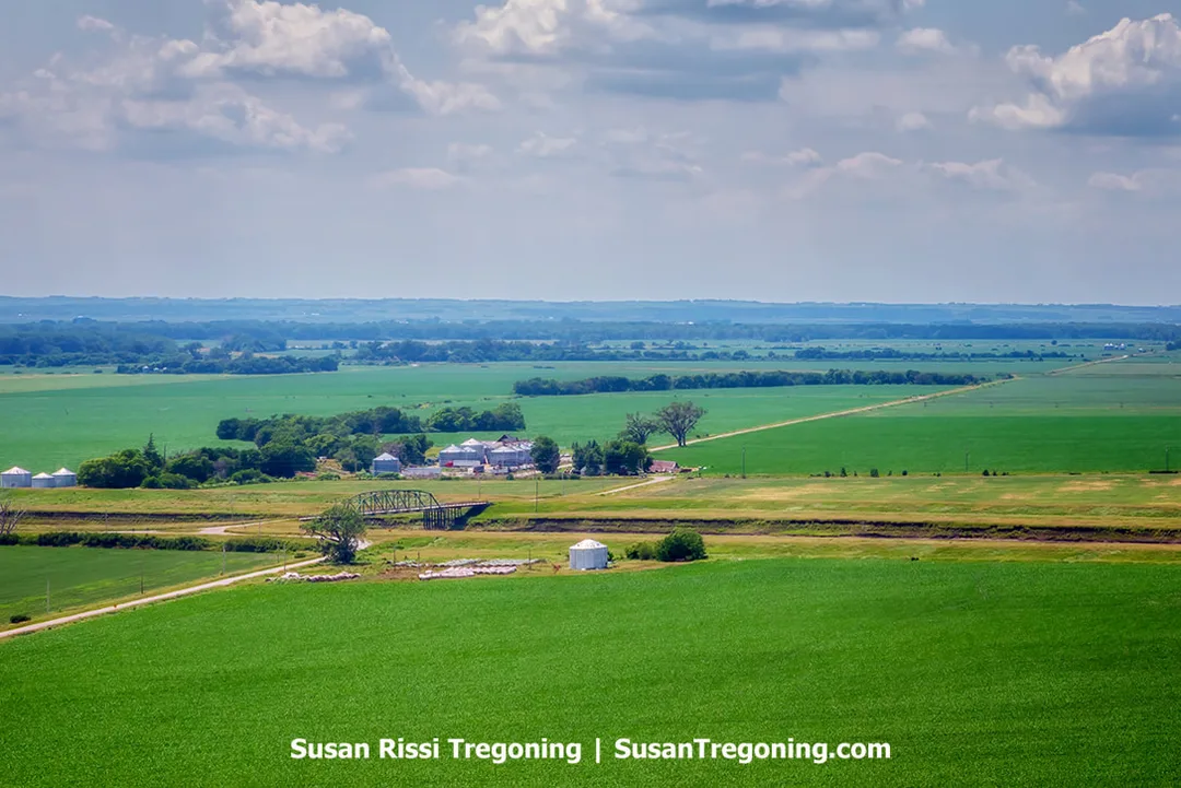
Along the Loess Hills National Scenic Byway, layers of loess vary in depth from 65 feet up to nearly 200 feet, shaping the landscape into undulating hills and wide ridge crests.
Sawmill Hollow Loop
This is about a 20 minute drive on gravel.
Head West from Magnolia on Hwy 127 OR turn left after visiting the Loess Hills Lavender Farm > South on CR L20/Loess Hills Trail (this is an 1850s stage coach route) - about 6 miles > North on CR L23/Laredo Ave. back to Magnolia to Byway Spine.
There is a well marked B Road off CR L20/Loess Hills Trail that will take you to Sawmill Hollow Wildlife Area and Sawmill Hollow Pond. I've never gotten a chance to explore this area.
Harrison County Byway Attractions
Harrison County Historical Village & Iowa Welcome Center - 2931 Monroe Ave, Missouri Valley
Open Monday - Saturday 9-5 & Sunday 12-5
This Iowa Welcome Center is at the intersection of three byways, Loess Hills, Western Skies and the Lincoln Highway, the facility features historic structures, an Iowa-themed gift shop, and the Lincoln Highway and Loess Hills Interpretive Center, an outdoor transportation-themed play area, and public restrooms. They keep the Loess Hills National Byway Guidebook behind the desk. If you are still looking for one, be sure to ask for it here.
Loess Hills State Forest Visitor Center
206 Polk St, Pisgah
The Loess Hills State Forest Visitors Center is connected to the prairie and woodland environments of the Loess Hills and functions as the main office for the 11,000-acre Loess Hills State Forest. Inside, you’ll find exhibits, dioramas, and murals that illustrate how the Loess Hills were formed and what their landscapes look like. There are also maps available for visitors who wish to explore the State Forest, along with art displays inspired by the Loess Hills region.
View from the Murray Hill Overlook.
Murray Hill Scenic Overlook
1634 County Road F20, Little Sioux
The hike up to Murray Hill Scenic Overlook is short but quite steep, offering breathtaking views of the Missouri River Valley once you reach the summit. The trail is a narrow dirt path leading straight up, and it is less than half a mile one way. Along the way, you’ll find several rest spots with benches or picnic tables, as well as interpretive signs that share information about the history and importance of the Loess Hills. Additionally, Murray Hill serves as one end of Brent’s Trail, a newer 13-mile route that winds through the Loess Hills region.
Loess Hills Lavender Farm
2278 Loess Hills Trail, Missouri Valley
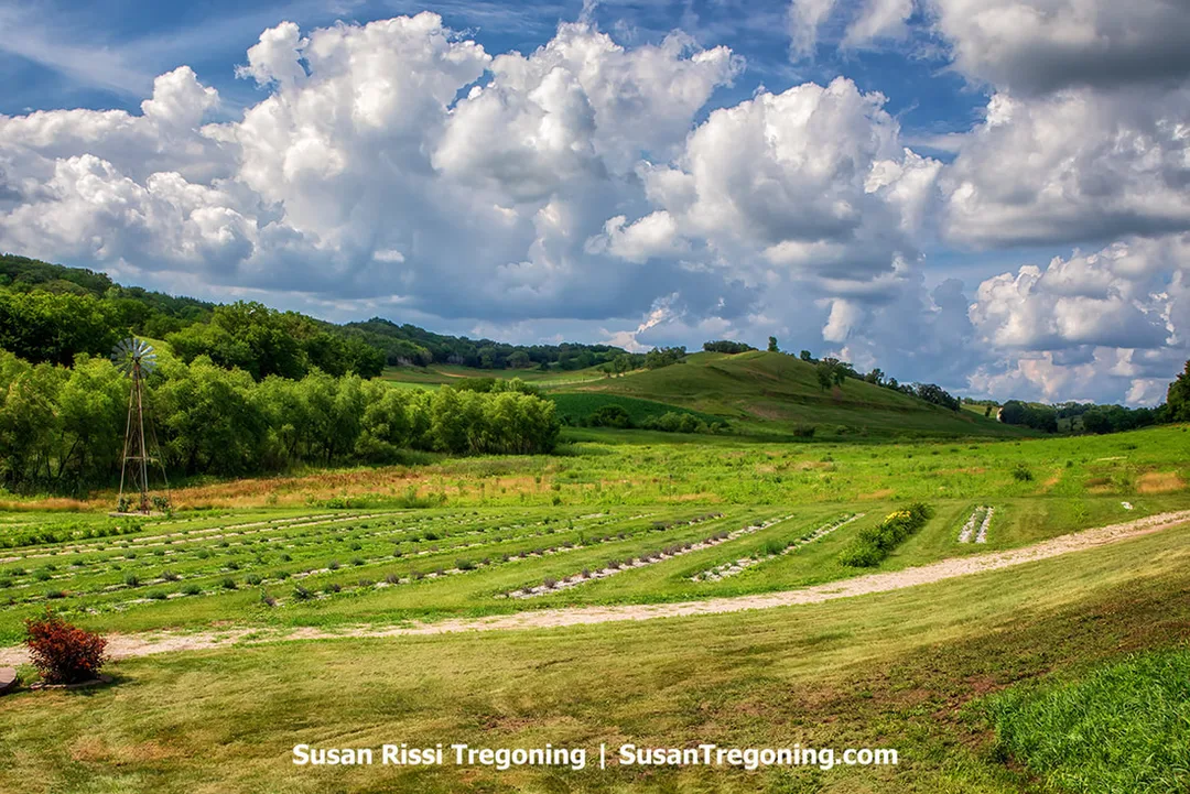
Nestled at the foot of the Loess Hills on the byway spine, the Loess Hills Lavender Farm boasts picturesque surroundings.
Explore the farm by strolling through the fields, picking your own bouquet, and discovering the healing benefits of lavender. Lavender flowers bloom from mid-June to September, with the most vibrant period typically occurring between June 22 and July 15.
Open May to October.
For current hours & additional info, visit Loess Hills Lavender Farm.
DeSoto & Boyer Chute National Wildlife Refuges
1434 316th Ln, Missouri Valley
Every spring and fall, this area becomes a temporary haven for thousands of migrating birds. The visitor center museum, has a fascinating exhibit of artifacts retrieved from the Steamboat Bertrand, which sank at this site in 1865 and was unearthed one hundred years afterward.
For more information: DeSoto and Boyer Chute National Wildlife Refuges.
Pottawattamie County
Looking out from the summit of the Loess Hills, you can see the farmland stretching across the Missouri Valley below.
Pottawattamie Byway Spine
Enter Pottawattamie County on CR L34 as it passes under I-680 - 14 miles > Right on G81/Railroad Hwy - 3.5 miles > Right on US-6 going into Council Bluffs >
Council Bluffs: S. 7th Street/Hwy 192 - one way street heading south toward the South Expressway passing under I-29/I-80 to meet Veteran's Memory Highway- 3 miles > Veteran's Memorial Highway/Hwy 92 & Hwy 275 - turn left - 2 miles >
Leaving Council Bluffs: Right on Harry Langdon Blvd - name changes to Walbash then becomes L35 - 6 miles > leave the county.
Note: I have never been able to stay on the Byway Spine through Council Bluffs, when I get into the city, I normally Google the attractions I wish to visit and then use the address for the Iowa School for the Deaf (3501 Harry Langdon Blvd, Council Bluffs) to pick the Byway Spine back up on the south side of the city. I have split up the directions in case you wish to do the same.
The undulating hills on the Hitchcock Loop.
Hitchcock Loop
Note: This loop is north of Council Bluffs.
This is a 27 mile long loop on paved and gravel roads.
Begins at L34 & I 680 intersection > Head West on I-680 > I-680 Scenic Overlook > North on I-29, immediately exit at Exit 72 - Loveland > In Loveland - Turn Right on CR L20/Old Lincoln Highway thru Honey Creek to Hitchcock Nature Center > Continue south on CR L20 - .75 miles > Turn Left on CR L36/Coldwater Avenue - 8 miles > Return to Byway Spine/CR L34
Pottawattamie County Byway Attractions
Hitchcock Nature Center
27792 Ski Hill Loop, Honey Creek
From atop the 45-foot observation tower at Hitchcock Nature Center where visitors are treated to breathtaking vistas of the Loess Hills and the distant Missouri Valley.
Just five miles north of Crescent is a 1,300-acre nature preserve that offers something for everyone. The Loess Hills Lodge serves as an interpretive center, providing engaging exhibits and family-friendly programs. A 45-foot tall observation tower offers panoramic views of the Loess Hills and is the site of the renowned Hitchcock HawkWatch from September through December. It is recognized as one of North America’s top 25 sites for hawk watching. Nearly 13 miles of hiking trails wind through restored prairies and woodlands, offering breathtaking vistas along the way.
Additional amenities include a half-mile elevated boardwalk that is fully accessible, a campground for tents and RVs, cozy camping cabins, and primitive campsites for those seeking a more secluded outdoor adventure.
While Lewis and Clark did not travel directly through the Hitchcock Nature Center property, the area remains important to their journey, as it lies close to Council Bluffs, where the Lewis and Clark Expedition met with the Otoe people.
Union Pacific Railroad Museum
200 Pearl St., Council Bluffs
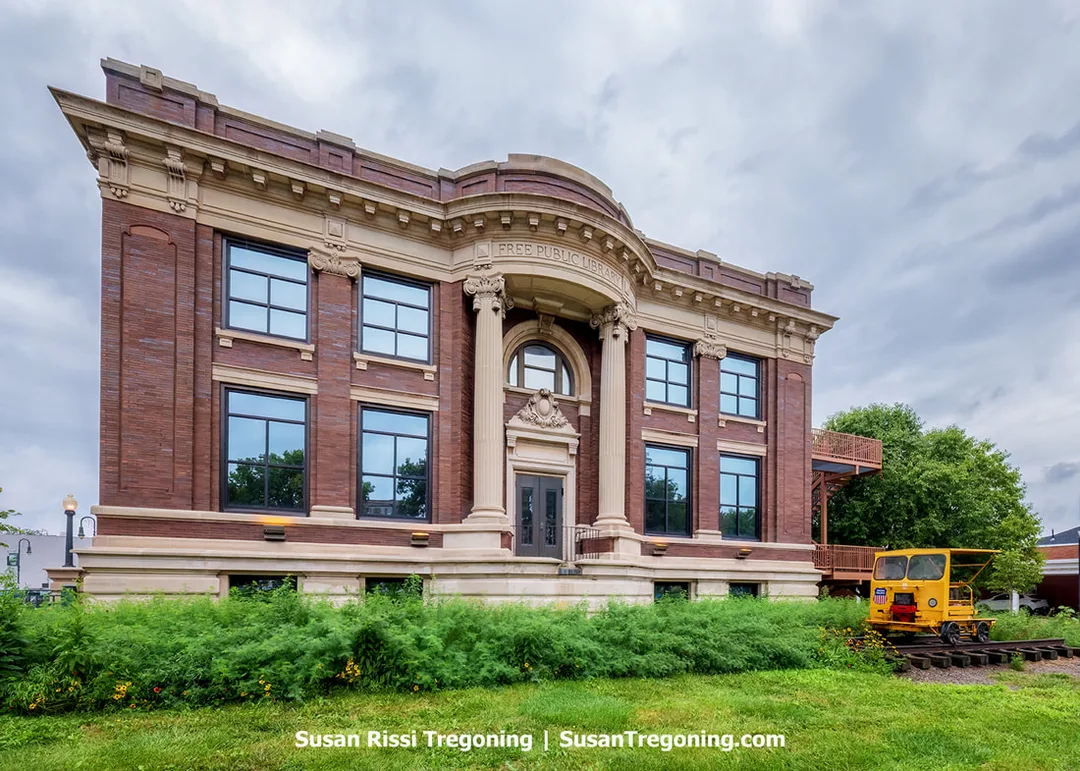
The historic Carnegie Library now houses the Union Pacific Railroad Museum.
Housed in the historic 1902 Carnegie Free Public Library building in downtown Council Bluffs, the Union Pacific Railroad Museum officially opened its doors on May 10, 2003, marking 134 years since the transcontinental railroad was completed.
At the Union Pacific Railroad Museum, visitors can immerse themselves in “Building America,” an interactive exhibit utilizing video-game technology, step back in time to the golden era of passenger rail, and discover the deep connection between Union Pacific’s growth and America’s development.
The museum safeguards one of the nation’s oldest corporate collections, featuring a wealth of artifacts, photographs, and documents that chronicle the story of the transcontinental railroad and the expansion of the American West.
Historic General Dodge & August Beresheim Houses
605 3rd St., Council Bluffs
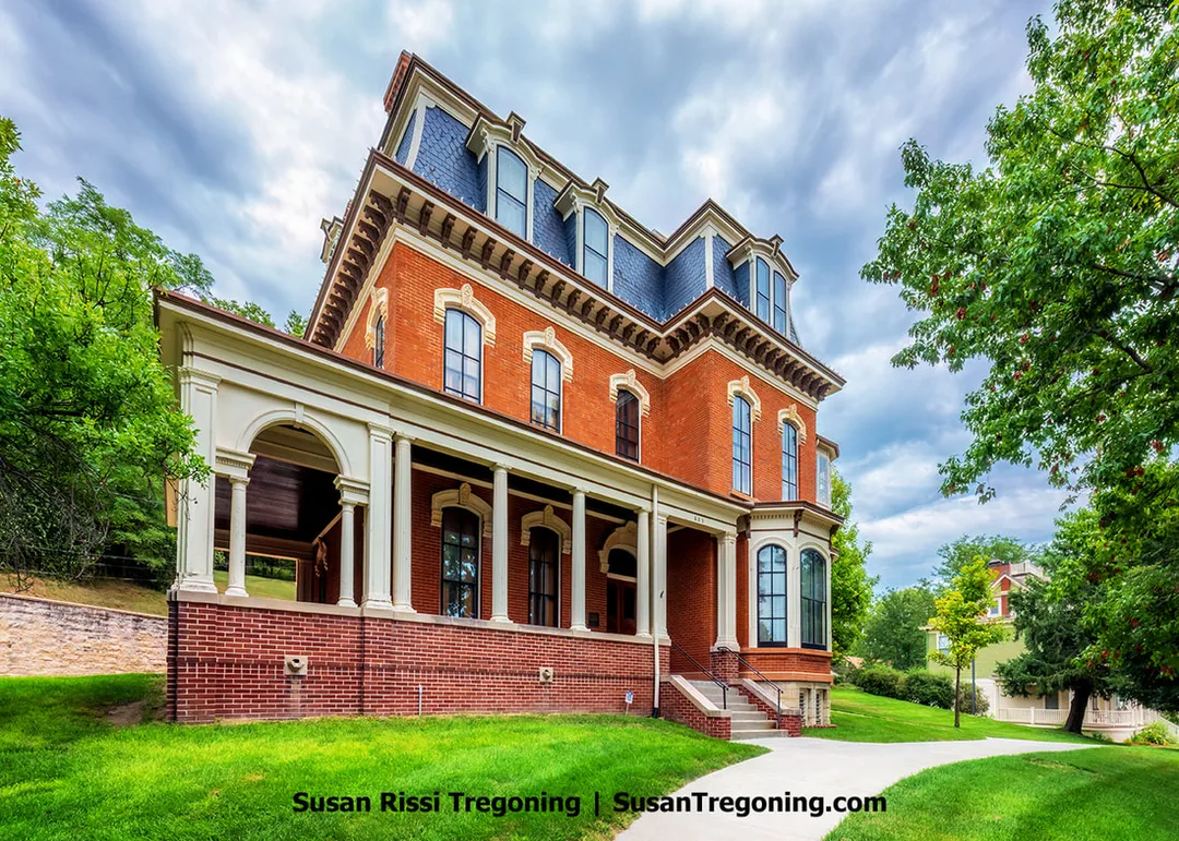
Built in 1869, the Second Empire-style General Dodge House was the home of General Grenville M. Dodge. Today, it is a National Historic Landmark and museum home.
A man of remarkable versatility, General Grenville Mellen Dodge’s career encompassed roles as a merchant, bank founder, and surveyor of the Missouri River Valley for the Transcontinental Railroad. He also served as an Iowa representative in the 40th United States Congress and fought in the Civil War, where he rose to the rank of Major General, the youngest to do so until World War II. Yet, it was through his work in railroad construction that he secured both his legacy and wealth.
As chief engineer for the Union Pacific Railroad, Dodge oversaw the construction of America’s first transcontinental railroad, which was completed in 1869. For the next fifty years, he remained deeply involved in the railroad industry as a builder, director, and financier. He was widely regarded as the most influential railroad lobbyist of his era. His expertise was sought internationally; he consulted on railroad projects in Russia, Cuba, and France. Furthermore, he maintained close relationships with every Republican President from the Civil War through World War I, serving as both friend and advisor.
During his military service, Dodge established the Union Army’s first spy network. He developed lasting friendships with prominent generals like Grant, Sheridan, Sherman, Rawlins, Black, and Logan, all of whom visited him in Council Bluffs after the war. His extensive business ventures led him across North America and Europe, but despite his travels, Council Bluffs remained his permanent home.
His grand 14-room mansion, constructed in 1869 and now recognized as a National Historic Landmark, stands as a testament to his prominence. The three-story residence is celebrated for its architectural elegance, featuring intricate parquet floors, exquisite woodwork crafted from cherry, walnut, and butternut, and several “modern” amenities that were remarkably advanced for its era. Today, it remains an architectural gem of Council Bluffs.

Among all the rooms in the Dodge Home, the Library is the most faithfully preserved.
The Orientation Center for the Dodge House, is the August Beresheim House. Originally constructed in 1899 as a roomy residence for a prosperous Council Bluffs family with strong ties to General Dodge and his enterprises. John Beresheim, father of August, became involved with Pacific National Bank, which consolidated with the Baldwin and Dodge banking office in 1870 to form the Council Bluffs Savings Bank. August devoted his entire career to this bank, ultimately holding the position of president from 1909 until his death in 1916. In 1954, Theda Beresheim, the only child of August and Clara, sold the home. It subsequently served as a nursing facility and later as a dormitory for Iowa Western Community College.
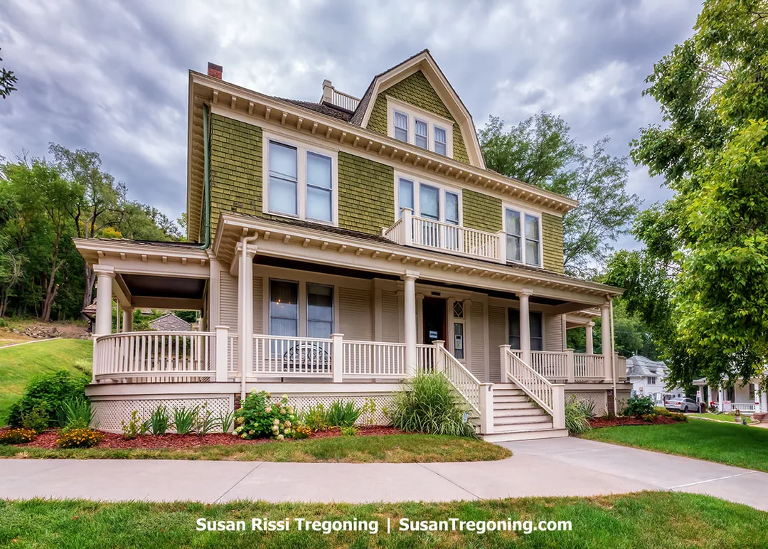
The historic August Beresheim House, located adjacent to the General Grenville M. Dodge Home in Council Bluffs, serves as the Orientation Center for the Dodge House.
RailsWest History Museum
1512 S Main St, Council Bluffs
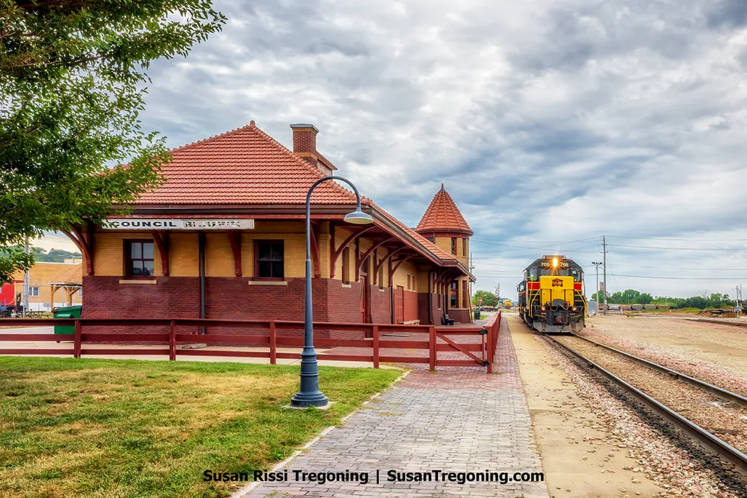
The historic Chicago, Rock Island and Pacific Railroad Passenger Depot, now known as the RailsWest Railroad Museum.
The current Rock Island Depot was built to replace its predecessor, which was destroyed when a boxcar filled with dynamite exploded nearby. The blast, probably triggered by sparks from a passing steam locomotive, left a twelve-foot-deep crater where the original depot had stood. Considered one of the largest explosions in the city’s history, it shattered windows over a mile away in downtown Council Bluffs. The explosion destroyed the depot, fifty railcars, and several surrounding homes. Remarkably, there were no immediate fatalities.
Constructed in 1899 for the Chicago, Rock Island and Pacific Railroad, the Council Bluffs Rock Island Depot is recognized on the National Register of Historic Places. Today, it serves as the home of the RailsWest History Museum, where visitors can explore a variety of railroad artifacts such as dining car silverware, uniforms, ticket stubs, and a recreated telegraph office. Outside, the depot’s former freight area displays an assortment of locomotives and train cars.

Union Pacific No. 814.
The Union Pacific Railroad acquired a total of 45 4-8-4 steam locomotives from the American Locomotive Company, placing three separate orders. Locomotives numbered 800 through 819, including No. 814, comprised the first batch of 20 engines delivered in 1937.
Today, only four Union Pacific 4-8-4s are still in existence: No. 814 in Council Bluffs, No. 833 in Ogden, Utah, and both No. 838 and No. 844, which are housed at the Union Pacific engine facility in Cheyenne, Wyoming.
No. 814 features a 77-inch wheelbase and tips the scales at roughly 890,000 pounds. In 1946, it was converted from burning coal to oil, and its tender was replaced at that time. The distinctive "Elephant Ears" smoke deflectors were added to the front of the locomotive in 1952. The engine was retired from active service in 1956.
Golden Spike Monument
S. 21st St. & 9th Ave., Council Bluffs
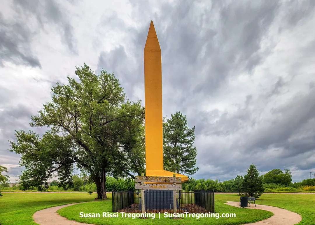
The Golden Spike Monument
A giant gold-painted concrete spike stands not far from the railroad tracks, but there’s not much else to draw your attention, other than the Golden Spike Trailer Park across the street. The locations seem insignificant today, but in 1877, it was a pretty big deal. This is Milepost 0.0, marking the eastern terminus of the Union Pacific Railroad. A transfer station and passenger station once stood here.
For years, Council Bluffs and Omaha have argued over which city has a stronger claim to the Union Pacific legacy. Even though Abraham Lincoln’s legislation names Council Bluffs as the official starting point, Omaha asserts its own claim by hosting the Union Pacific headquarters. It’s an argument that even reached the U.S. Supreme Court in 1875, with both cities presenting their cases.
In 1939, Cecil B. DeMille debuted his film “Union Pacific” in Omaha with a four-day-long celebration. Not wanting to be overlooked during the festivities, Council Bluffs responded by constructing a colossal concrete spike, 100 times larger than the original golden spike that completed the transcontinental railroad in 1869.
The monument, designed by city engineer Jack Boyne, was built under a tight deadline, just ahead of the film’s premiere. It took 14 men, 10 days to make the golden spike. A local business donated 250 yards of white cloth to drape over the spike, and the city unveiled it on the same day the movie premiered.
It is said that the Union Pacific encouraged attendees to dress in 1869 period clothing to honor the year the golden spike was driven for this spike's dedication day, and that the UP sold thousands of period-appropriate dresses and bonnets for the occasion. Men even grew facial hair for authenticity. The local schools even closed for two days so that families could join in the festivities and attend the movie premiere.
The monument, dedicated on April 28, 1939, drew a crowd of over 15,000. DeMille himself attended and addressed the attendees, predicting the spike would stand for at least a century! Hollywood news crews captured footage of the event, which was later featured in newsreels that played before the movie nationwide, giving Council Bluffs a brief moment in the spotlight.
Kanesville Memorial
222 East Broadway, Council Bluffs
Kanesville, located within present-day Council Bluffs, Iowa, emerged as a significant settlement for members of The Church of Jesus Christ of Latter-day Saints who had been forced to leave Nauvoo, Illinois. This community was established to provide support and refuge for the thousands of displaced Saints. Today, the Kanesville Memorial honors the sacrifices made by these early settlers. It also commemorates three notable events: the formation of the Mormon Battalion, the reorganization of the Church’s First Presidency with Brigham Young at its head, and the return and rebaptism of Oliver Cowdery, a key figure in early Church history and principal scribe of the Book of Mormon.
Facing challenges in crossing the Iowa Territory, the Latter-day Saints founded Kanesville as a critical stopping point on their westward journey. The first groups departed Nauvoo in February 1846 and encountered relentless rain, which turned their route into a muddy obstacle course. Upon reaching the Missouri River on June 14, 1846, pioneers set up camps that soon expanded as more Saints arrived. This growing community became known as the Grand Encampment. Recognizing the need for temporary settlements along the migration route, Church leaders set up Winter Quarters on the river’s western bank in what is now Nebraska. At the same time, Kanesville was established on the eastern side of the river in Iowa. Over time, Kanesville flourished with homes, businesses, churches, and even a music hall hosting social events. The settlement remained a vital hub until 1852, when Church leadership called for all remaining Saints to gather in Utah.
Between 1846 and 1852, several pivotal developments took place in Kanesville. In late June 1846, Captain James Allen from the U.S. Army arrived to recruit Latter-day Saint men for the conflict with Mexico. With Brigham Young’s approval, nearly 500 men from Kanesville were enlisted, forming the Mormon Battalion. In December 1847, following extensive deliberation, Brigham Young was formally sustained as President of the Church, with Heber C. Kimball and Willard Richards as his counselors, restoring a unified leadership structure not seen since Joseph Smith’s death. Additionally, Oliver Cowdery, who had been excommunicated in 1838, was welcomed back into the faith through baptism and confirmation in Kanesville.
A replica log tabernacle once stood at this site, but has since been replaced with this memorial garden. Check hours; if you plan to visit, the area is gated and may not always be open to the public, as I discovered during my visit.
Mills County
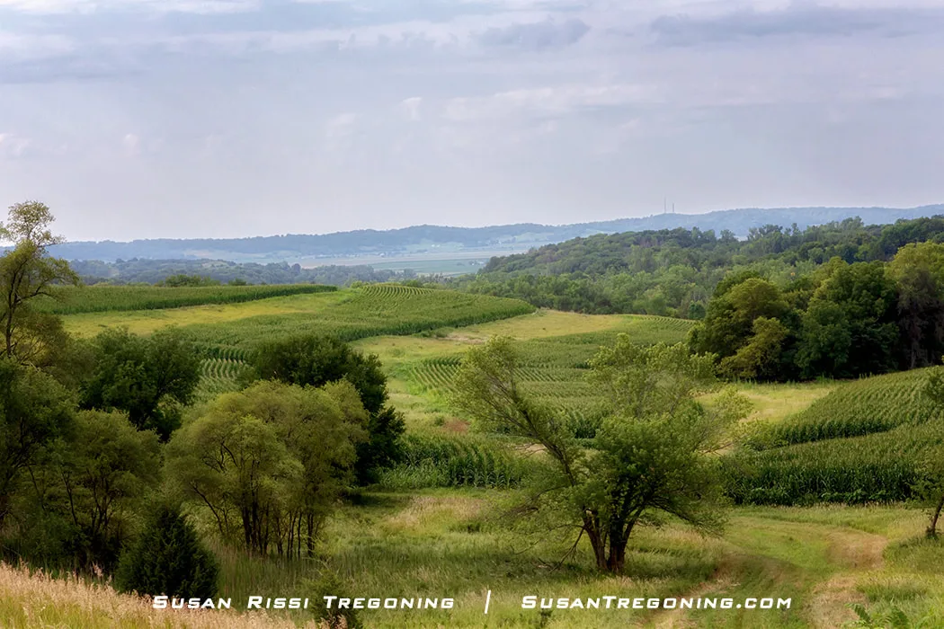
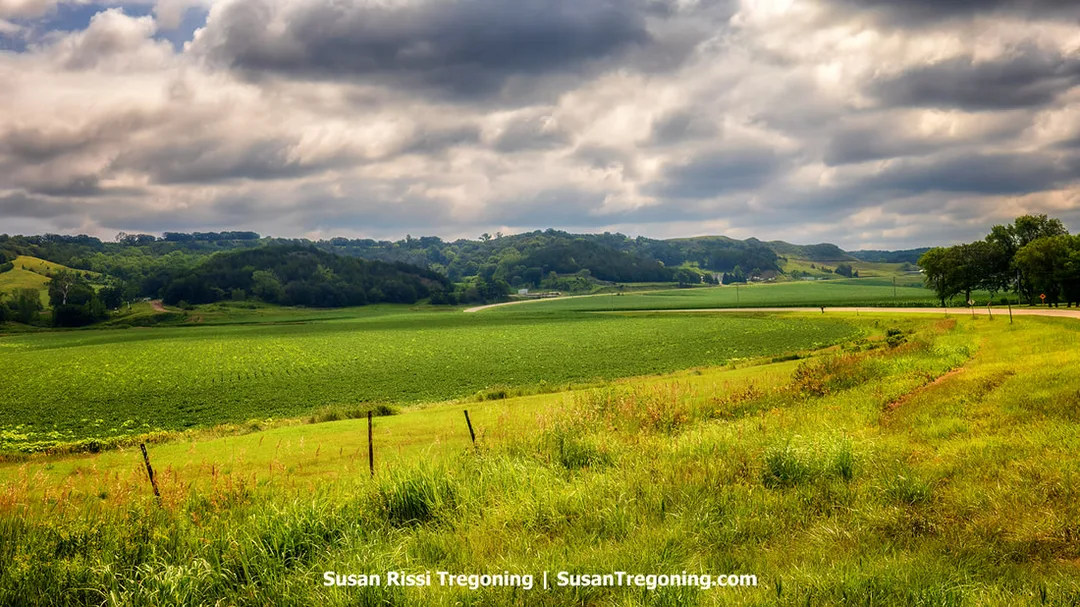
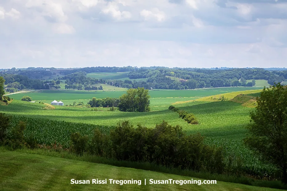
A breathtaking view of the lush green Loess Hills countryside near Glenwood, Iowa.
Mills County Byway Spine
Enter Mills County on CR L35/221st Street > At Glenwood, the Byway Spine becomes Locust Street > East on US 35 - 4 miles > Right on US 275 - 9 miles to Fremont County border.
Pony Creek Loop
This 9 mile loop with both paved and gravel roads starts 5 miles north of downtown Glenwood.
From CR L35/221st Street > Turn Right on Deacon Avenue > Pony Creek Park > US 34 East to rejoin Byway Spine.
Waubonsie Loop
This 12 mile paved and gravel drive starts at the intersection of L45/Levi Road & US 34.
From Glenwood Archeological State Preserve - Head south on L45/Levi Road - 8 miles > Turn Left on Quandt Road - 3 miles > Turn Left to rejoin L45/Rains Road - 1.5 miles > Meet the Byway Spine at US 275 approximately 1 mile north of Tabor, IA.
Driving the Hastie Hollow B Road amidst the Loess landscape is a unique experience.
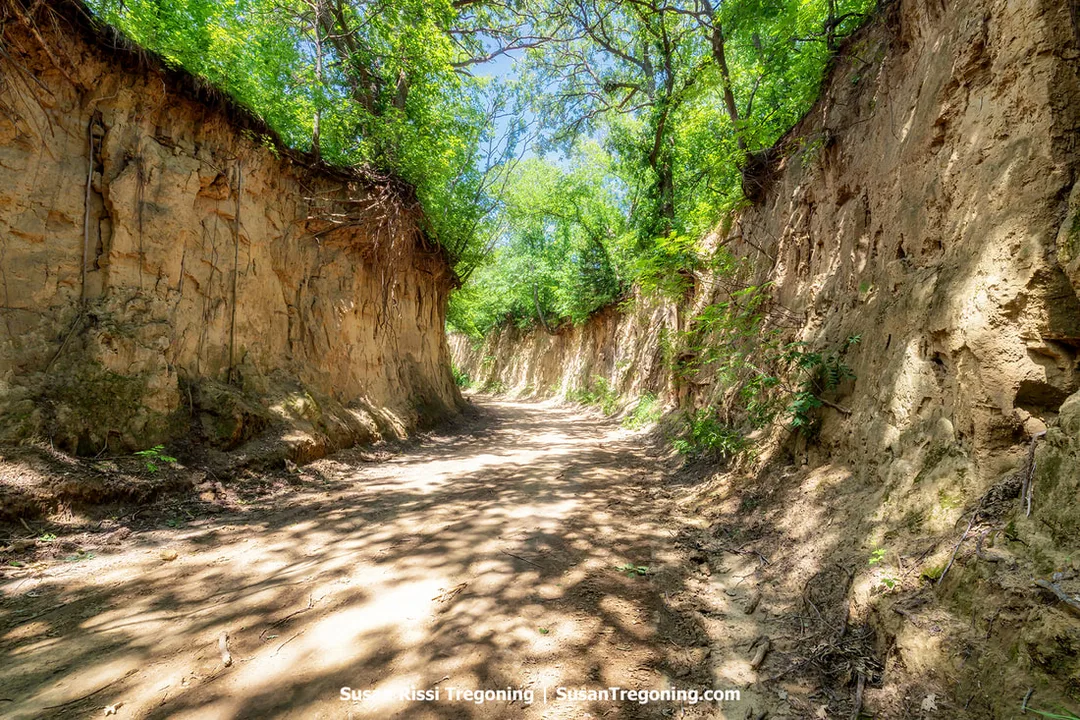
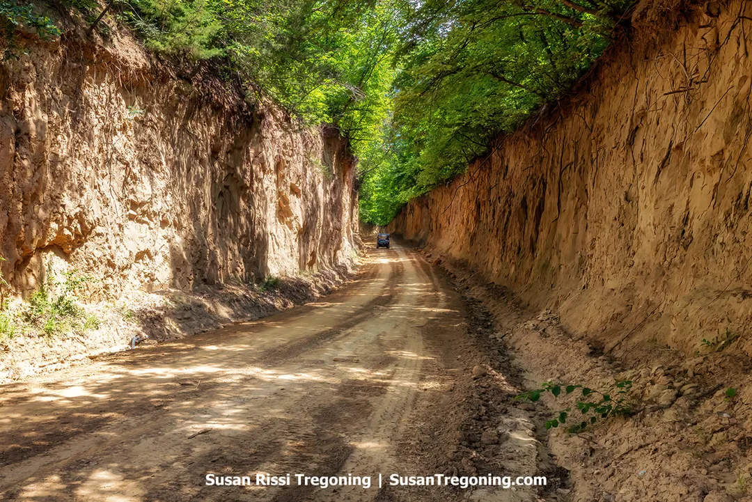
- Hastie Hollow B Road - Hastie Hollow is known on Google Maps as Pathfield Road. This B road is just North of the Waubonsie Church and Cemetery. Hastie Hollow is often regarded as one of the premier B roads for discovering the rustic beauty of the Loess Hills. Stretching a mere 0.7 miles, this rugged trail features towering sidewalls, nearly 20 feet high, carved directly from the loess hills soil. The road twists and turns dramatically as it descends through the hills, forming striking S-curves that eventually guide travelers to a narrow bridge spanning Waubonsie Creek.
The one-lane Waubonsie Creek bridge at the S Curve along Hastie Hollow’s unimproved B Road.
- Lake Hill B Road - From the Waubonsie Church & Cemetery > South on 235th > West on Quigg Ave > South on Raleigh Road.
A side-by-side travels down the Lake Hill B Road.
Lake Hill B Road stretches for a mile and is labeled as Raleigh Road and Ridge Road Hollow on Google Maps. It stands out as one of the top Level B roads in the Loess Hills, thanks to its impressively high and steep sidewalls that are some of the most dramatic cuts in the region. However, drivers should use caution, as a number of sharp bends obscure what lies ahead.
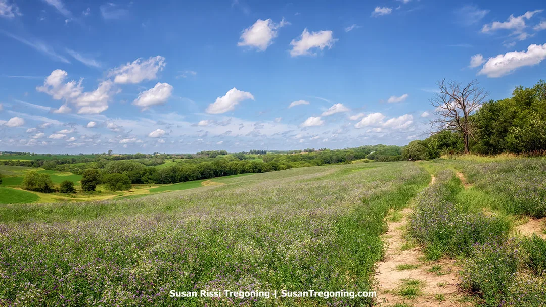
A lush carpet of clover blankets the field above Ridge Road Hollow.
- Lambert Avenue B Road The Bodega Victoriana Winery (60397 Kidd Road, Glenwood) isn’t far from Lambert Avenue B Road, so I used that address to get to the area. If you are coming directly from Lake Hill, you'll find Lambert Avenue before you get to the winery. Go south on Kidd Road, it will intersect with Lambert Avenue > Right on Lambert Avenue
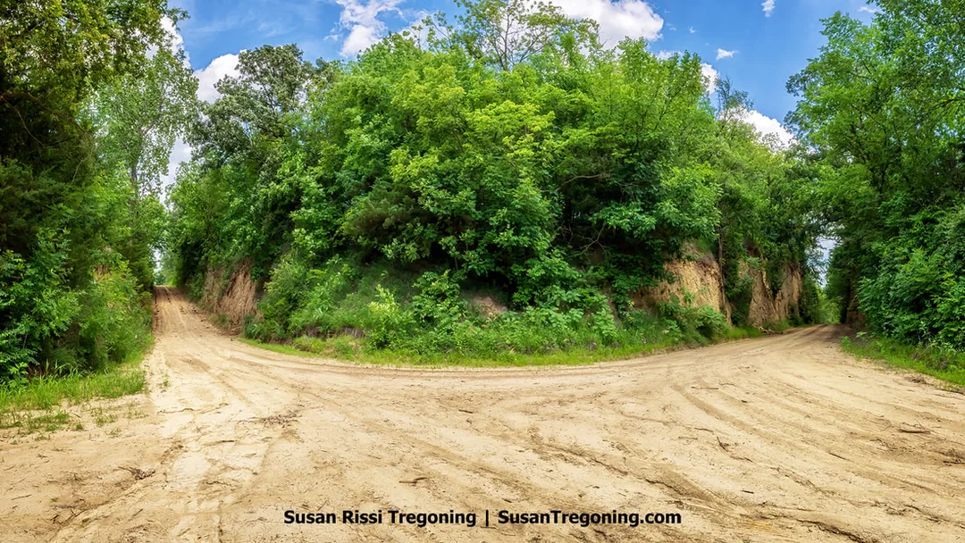
The intersection of Lambert Avenue and 245th Street where the two B Roads meet.
The intersection of Lambert Avenue and 245th Street is where two B Roads meet. It’s this intersection that makes these two unimproved roads unique. The route itself is brief and lacks any S-shaped curves, while the sidewalls remain impressively steep, even though they do not come near the dramatic height of those found on some of the other Mills County B roads.
Lambert Avenue is only about a half mile long. Consider heading north along 245th Street to take in the view of the Loess Hills valley below.
Mills County Attractions
Salem Lutheran Church
50307 Ashton Rd, Glenwood
Situated on Ashton Road, less than two miles east of CR L35/221st Street, Salem Lutheran Church stands within the Plumer Settlement on the first gravel road east of the highway, south of the Mills-Pottawattamie County line. Established in 1867 by German settlers, this modest country church is among the oldest surviving structures in Western Iowa.
The church still hosts one service a year. Every Memorial Day at 10:00 a.m., descendants of the original settlers and their friends come together at the church for a commemorative ceremony. Afterwards, they walk across the road to the Plumer Settlement Cemetery for a short remembrance event.
Pony Creek Conservation Park
56235 Deacon Road, Pacific Junction
The park has an 82-acre lake, fishing, hiking trails, picnicking, and seven campsites.
Pony Creek Park holds the designation of a National Historic Landmark due to its location atop the Davis Oriole Earthlodge, an archaeological site believed to date back nearly a millennium. Despite its significance, there are no visible remains or markers at the site itself; everything lies buried beneath the surface, intentionally unmarked to help preserve the area’s archaeological integrity.
Earthlodges were constructed above ground from wooden frameworks, covered with layers of earth and topped with grasses, resembling rounded, dome-like homes. It was most likely one of several in an ancient village. Archaeologists believe that people lived at this site as early as 900 AD, with occupation possibly continuing until the 1300s.
The Davis Oriole Earthlodge Site is recognized as one of the best-preserved examples of the architectural style used in lodge dwellings found throughout the Great Plains.
For those interested in seeing what an earthlodge looked like, a full-scale reconstruction has been built in nearby Glenwood, just across from the Mills County Museum. The museum also houses artifacts unearthed in the area by a local amateur archaeologist.
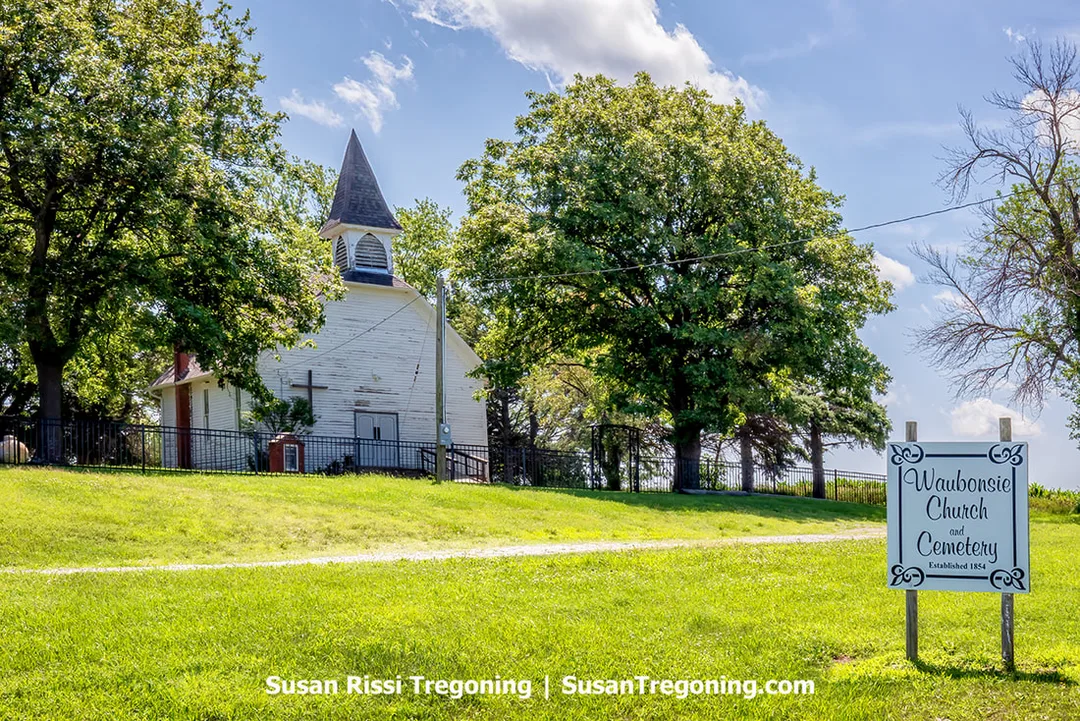
The Waubonsie Chruch and Cemetery.
Waubonsie Church
64975 235th St, Glenwood, IA
The Waubonsie Methodist Church holds the distinction of being the earliest religious institution established in Mills County, Iowa. The original church, constructed in 1854, was destroyed in 1864 after serving as a hospital during a smallpox outbreak in the Civil War era. It is thought that several victims of this epidemic were buried in unmarked graves at this site. The current church building dates back to 1886, having been constructed near the original site. At that time, the area was not yet known as Glenwood; instead, the nearby settlement was referred to as Coonville.
Numerous graves here are unmarked; the oldest identified gravestone dates back to 1857 and is for a ten-year-old boy named Arthur Boyd. Also buried here is Matilda (Hanks) Utterback Anthony, who died in 1863 and was a distant cousin to Abraham Lincoln's mother. Her grave is marked with a modest stone.
The church ceased operations for several years during the early 1970s but was revived in 1975 after receiving support through community donations. Upon reopening, it adopted the new name Waubonsie Bible Church.
Mile Hill Lake
21193 US HWY 34 Glenwood
Covering 39 acres, Mile Hill Park is home to a hardwood forest and includes a 10-acre lake equipped with a boat dock and ramp for fishing. Although there’s a handicapped accessible Scenic Overlook here, the view has become obstructed by tree growth. Informational panels at the site provide details about the Loess Hills Scenic Byway. Visitors can explore several hiking trails throughout the park, which is also open to hunting.
Glenwood Lake Park
100 Lake Drive, Glenwood
East of downtown Glenwood, this park has a pond with waterfowl, a playground, a campground, and the 750-seat, open-air Davies Amphitheater, which has live performances on summer weekends.
Also on the grounds is the Mills County Historical Museum featuring seven Mills County historical buildings and artifacts from the Glenwood Culture, specifically the Nebraska Phase of Native Americans.
Indian Earth Lodge
Glenwood
Just north of Glenwood Lake Park, you'll find a reconstructed earth lodge with a grass roof, similar to those inhabited by local Native Americans between AD 950 and 1300, which offers insight into their lives on the plains. To arrange a tour, visit the Mills County Historical Museum located in Glenwood Lake Park.
Glenwood Archeological State Preserve
59069 Levi Rd, Glenwood
Once called Foothills Park, the Glenwood Archaeological State Preserve spans 906 acres and contains 107 documented archaeological sites. The preserve welcomes visitors for low-impact activities and offers three miles of paved trails perfect for hiking, biking, running, or observing local wildlife. In addition to its rich archaeological heritage, the area includes forests, oak savannah, native and restored prairies, as well as farmland. It is said to be an excellent bird-watching site.
Fremont County
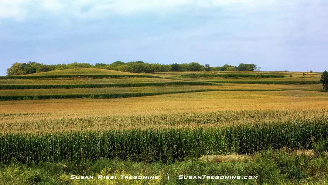
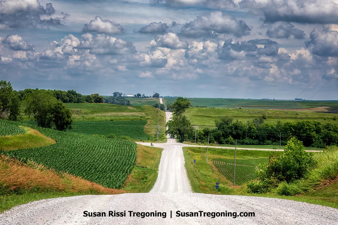
Golden hues spread across the cornfields as tassels appear atop the stalks, painting Iowa’s terraced landscapes that follow the Loess Hills National Scenic Byway.
Fremont County Byway Spine
Enter Fremont County on US275 > Pass through Tabor > Turn Right on CR J18 - about 6 miles > Right on J24 - Enter Thurman > Left on Washington St. - Outside of town road becomes CR L44/Bluff Road - 17 miles > Hamburg - Road becomes E St. > Continue straight onto US 275 > Right on US 275 takes you south to the Iowa/Missouri Border.
Pleasant Overview Loop
This is a 20 mile paved loop. Go east on Spine toward Sidney on CR J34/Knox Rd > US 275 > Left on Main St. - veers to Right onto Indiana St. - Sidney - County Courthouse square > Right on Filmore St./ Hwy 2 - 5 miles > Turn Right on CR L68/330th Ave - 4 miles > Riverton Wildlife Area > In Riverton - Turn Right on K St/CR J46 > At intersection US 275 - 4.5 miles > straight onto Hwy 2 - 2 miles > Waubonsie-Wa-Shaw-Tee State Park > 1 mile past park rejoin Byway Spine on CR L44/ Bluff Rd.
Spring Valley Loop
A 3-mile long gravel loop. CR L44/ Bluff Rd > Left on 222nd St - This is less than .5 miles south of where Pleasant Overview Loop Begins on J34/Knox Rd > Right on 270th Ave . Back to L44/Bluff Rd.
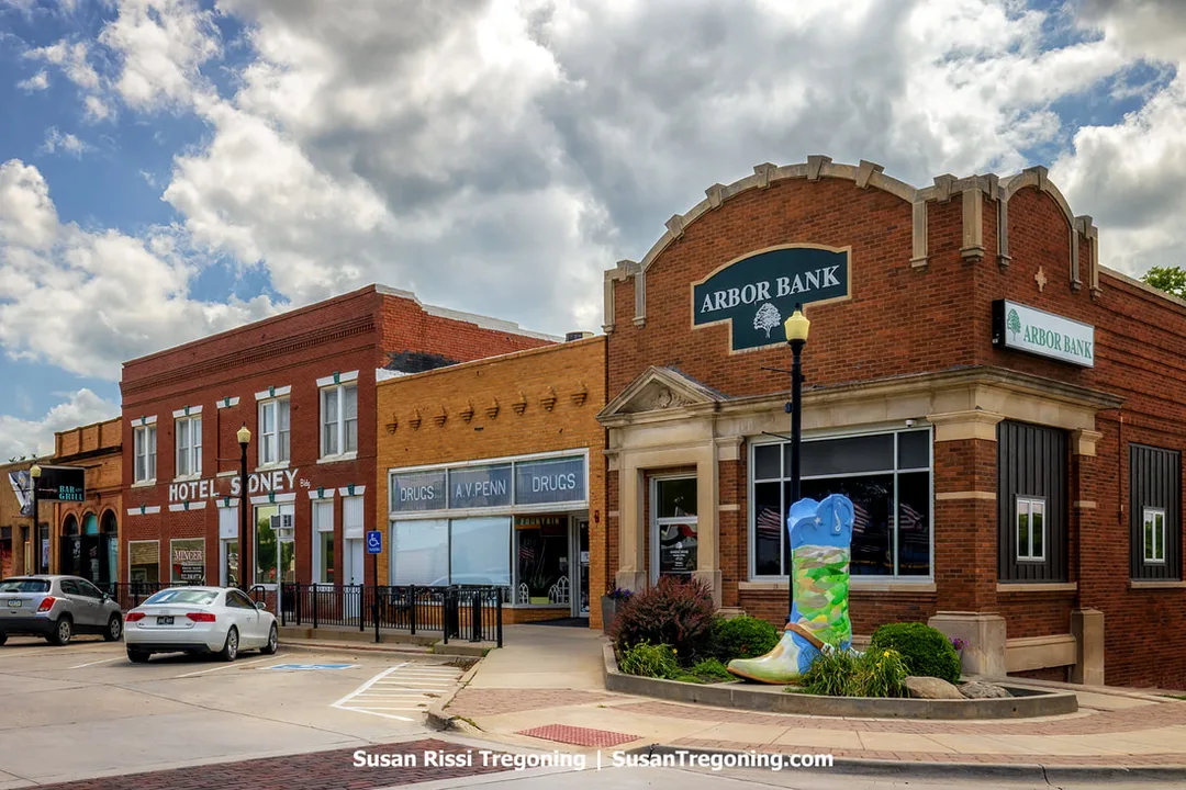
Sidney, Iowa, is nicknamed "Rodeo Town USA." The town's downtown square, adorned with cowboy boots and a variety of decorations celebrating its rodeo heritage, is quite charming.
Fremont County Attractions
Todd House Museum
705 Park St, Tabor
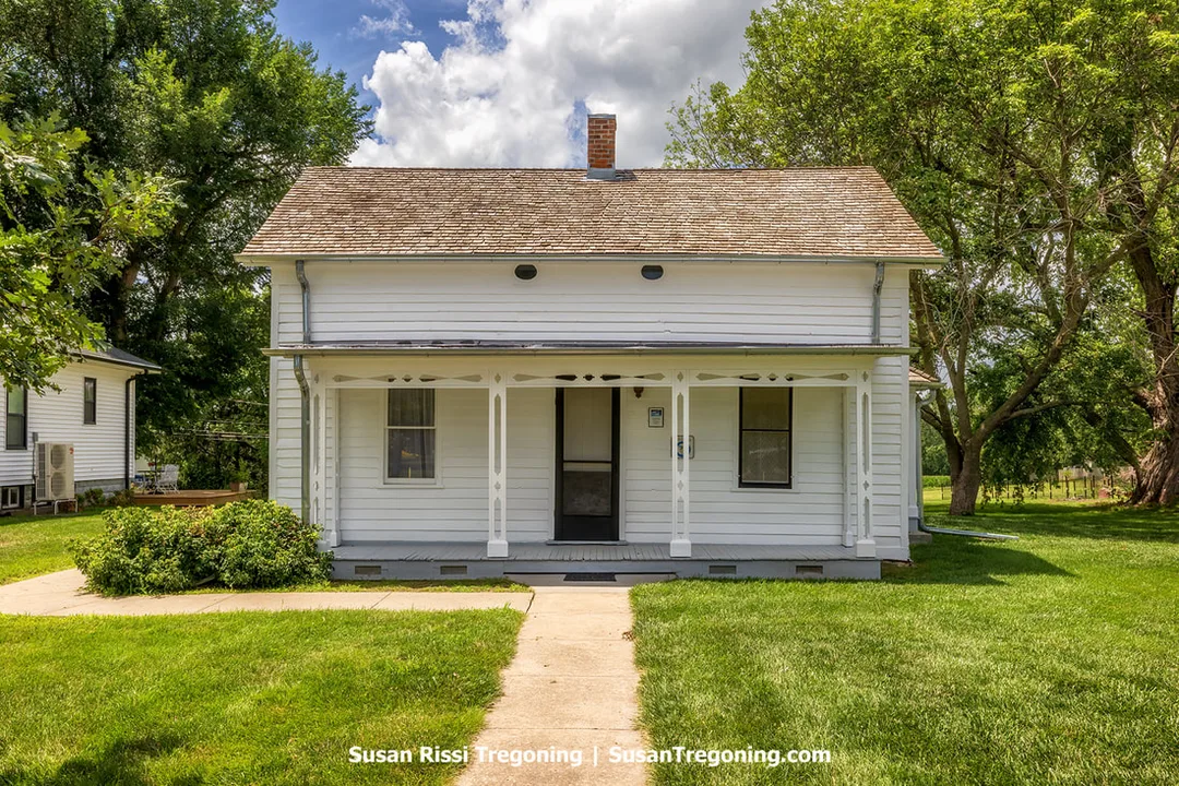
The historic Todd House in Tabor, Iowa, is the most important Underground Railroad site in western Iowa.
In 1852, Reverend John Todd, along with George B. Gaston, Samuel H. Adams, and their families, departed from Oberlin, Ohio, to establish a new settlement in Fremont County. Where they founded the town of Tabor, a Christian community inspired by the progressive values of Oberlin — especially those embodied by Oberlin College, which was known for its commitment to equality and the abolition of slavery. Their vision for Tabor included the creation of a college that would admit students regardless of gender or race, thus upholding the inclusive and socially just traditions they cherished in Oberlin.
Reverend Todd also served as Tabor’s first minister, leading the local Congregational Church.
Tabor emerged as a hub for abolitionist activity and a sanctuary for people escaping slavery. They aided their first recorded escape on July 4, 1854, and such flights continued until 1859. In its heyday, the Todd House played a pivotal role as one of the most significant Underground Railroad stations in western Iowa, and it is one of the few surviving sites associated with the Underground Railroad in the state.
During the violent struggle over whether Kansas would be a free or slave state in the 1850s, Tabor became a crucial refuge for abolitionist fighters. Among them was John Brown, who — along with his sons — frequently sought shelter in the town. They used the Todd House and its barn to conceal a cache of weapons, including 200 Sharps rifles, cannons, and other supplies intended for anti-slavery raids into Kansas and Missouri.
Before launching his infamous raid on the federal armory at Harpers Ferry, John Brown trained his men right on Tabor’s Public Square. Today, this area is known as Tabor City Park and stands near the Todd House as the centerpiece of the Antislavery Historic District.
The Todd House is listed on the National Register of Historic Places along with the Tabor Anti-Slavery Historic District. It is part of the National Underground Railroad Network to Freedom program.
The Tabor Historical Society currently offers guided tours of Todd House; interested visitors can arrange a visit by calling 712-313-0102.
Riverton Wildlife Area
GPS: 40.7162447,-95.5688109 for Handicapped Accessible Wildlife Overlook Platform
Perched high on the Loess Hills ridgeline, the Riverton Wildlife Overlook can be found along the Pleasant Overview Loop of Iowa’s National Scenic Byway. From this vantage point, visitors gaze down into the sweeping valley that makes up the Riverton Wildlife Management Area. During summertime, the slopes beneath the overlook burst into color with wildflowers and teem with birds, butterflies, and countless other insects.
It was here, on July 18, 1804, that Lewis and Clark paused to observe the landscape. In their journal, they described these bluffs as “a ridge of naked hills…running parallel to the river as far as we could see and from three to six miles distance.”
Watch the Spring Migration at Riverton Wildlife Area. As soon as southwest Iowa begins to thaw — typically from late February to mid-March — large flocks of snow geese, ranging from 100,000 to over 300,000 individuals, begin to arrive. Ducks follow a bit later, showing up from early March through April, and then the shorebirds make their appearance, generally from late April into May.
The timing of these migrations can shift considerably based on when spring’s thaw occurs. Shorebird numbers in particular are influenced by the presence of shallow water and mudflats; if spring is unusually dry, they may bypass southwest Iowa altogether.
Birdwatchers tend to prefer spring migration over fall because birds are sporting their vibrant breeding plumage, access to the refuge is permitted on foot, and there are fewer hunters in the area. Spring is also a prime time for observing neotropical migrant songbirds, as males are more vocal during the breeding season, making them easier to locate and identify.
Waubonsie/Wa-Shaw-Tee State Park
2585 Waubonsie Park Road, Hamburg
The Waubonsie State Park is famed for its stunning autumn foliage and scenic vistas, this 1,992-acre park located southwest of Sidney offers a variety of trails suited for hiking, biking, and horseback riding. Visitors can take advantage of shelters and campsites designed for RVs, tents, and equestrians. The park recently grew with the incorporation of Camp Wa-Shaw-Tee, which features rental cabins, a lodge, and a fishing lake.
Southern Loess Hills Interpretive/ Iowa Welcome Center Exit 10 off I-29 - 2083 Crossroads Dr, Percival
The center offers interactive exhibits to teach visitors about the Hills and serves as an information hub for travelers along the Byway and throughout Iowa. It is also a site where you can obtain a copy of the Loess Hills National Scenic Byway Guidebook.
The Loess Hills National Scenic Byway stands as a testament to the natural wonders and cultural heritage of Iowa. Stretching across miles of stunning terrain, it is a destination that appeals to outdoor adventurers, photographers, and families alike. The byway’s unique geology and vibrant communities make it so much more than just a road; it’s an experience that stays with you long after your visit ends. From hiking trails to historic sites, there’s something for everyone to enjoy along this scenic route. Don’t miss your chance to discover the magic of the Loess Hills National Scenic Byway. Start planning your trip today!
Oh, and one last spot if you are visiting for the wildlife...
Although Loess Bluffs National Wildlife Refuge is located just across the state border in Missouri and isn’t featured in the Byway details, it’s still an excellent place to visit, especially during the spring migration.
Check out my other Iowa post...
Not every image makes it into my blog. If you enjoyed the photos in this article, please check out my Iowa Collection for more pictures from the this amazing state, or visit my ImageGallery with over 4000 images of locations around the United States.

“The Spot” along the Loess Hills National Scenic Byway. Walter Ordway Jr., a well-traveled artist, gave this Loess Hills Scenic Overlook its nickname, "The Spot," after returning to Iowa from his global journeys. Following in the footsteps of his ancestor, Sgt. John Ordway, a key member of the Lewis and Clark Corps of Discovery who passed through this area in 1804, Walter played a vital role in establishing the Loess Hills Scenic Byway. His efforts helped earn the byway the distinction of being designated a National Scenic Byway in 2000.
Fine Art Prints are available for order as print only, framed art, canvas art, metal art, acrylic art, and wood art prints in various sizes. Home Decor and Gift Ideas include shower curtains, throw pillows, towels, totes, phone cases, t-shirts, puzzles, blankets and more—Worldwide Shipping with a 30-day money-back guarantee.
More of the USA
- A Travelers Musings (1)
- Alabama (1)
- Hawaii (3)
- Illinois (6)
- Indiana (3)
- Iowa (3)
- Louisiana (1)
- Maryland (1)
- Michigan (2)
- Minnesota (4)
- Mississippi (6)
- Missouri (2)
- Montana (1)
- Nebraska (5)
- New Mexico (1)
- North Carolina (1)
- Pennsylvania (2)
- Route 66 (5)
- South Dakota (1)
- Tennessee (1)
- Texas (1)
- Virginia (2)
- Washington DC (1)
- West Virginia (3)
- Wildlife (6)
- Wisconsin (2)
- Wyoming (4)
