Beyond Yellowstone: A Guide to the Beartooth Highway All-American Road
A panoramic view along the Beartooth Highway frames the glacially sculpted pyramid known historically as the Needle, rising between the granite peaks of the Beartooth Mountains. Identified by the Crow as the Bear’s Tooth, this landmark later gave its name to the surrounding range and the high‑elevation road that crosses it.
Sprawling across the Montana and Wyoming borders between Red Lodge, Montana, and the Northeast Gate to Yellowstone National Park, the Beartooth Highway (US-212), a National Scenic Byway's All-American Road, stands out as one of America's most unique and picturesque scenic drives. It's not just a road but an engineering marvel that winds through the rugged Absaroka and the Beartooth Mountains, offering stunning vistas of high alpine plateaus, glacial lakes, forested valleys, waterfalls, and abundant wildlife. This road offers an unforgettable driving experience, with twists and turns that will leave you breathless.
Spanning over a million acres of wilderness, the Beartooth Highway is the highest-elevation highway in Wyoming (10,947 feet), Montana (10,350 feet), and the Northern Rockies. It's a paradise for adventure enthusiasts, offering a diverse range of recreational activities, from skiing in the summer months of June and July, hiking across vast plateaus, to spotting a diverse range of wildlife such as mountain goats, moose, elk, marmots, mule deer, black bears, grizzly bears, or wolves. You can also fish for trout in nearby streams and lakes or camp at one of the 13 National Forest campgrounds. Even during winter, when the Beartooth Highway is closed, snowmobilers enjoy traversing this route through a captivating winter landscape.
The Beartooth Highway calls for an adventurous soul, challenging your flexibility as you maneuver through its sharp curves and pause at its many scenic viewpoints to admire the wildlife or take a break. So, buckle up; you're about to set off on a trip where every mile promises wonder and awe.
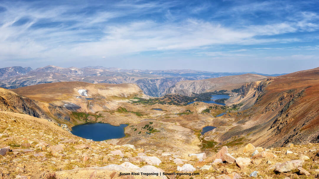
Alpine terrain along the Beartooth Highway, where a small lake sits among exposed rock and open high‑country meadows below distant ridgelines.
The Beartooth Highway is a 68-mile-long seasonal road. Predominantly frozen nine months of the year, the road typically opens on Memorial Day weekend and closes October 15th, but depending on weather conditions it will sometimes open late or close early. Ascending to an elevation of 10,947 feet at Beartooth Pass, it is one of the highest roads in the continental United States. Its high elevation combined with unpredictable weather make it susceptible to late-season snowstorms that tend to be measured in feet rather than inches, making snow and ice removal both time-consuming and challenging.
History of the Beartooth Highway
An alpine lake along the Beartooth Highway, set among rocky terrain, evergreen trees, and distant mountain ridges.
The Native Americans had a significant presence and left an indelible mark on the Beartooth Plateau, their presence was deeply woven into the landscape's history. Specific stretches of the Beartooth Highway trace the footsteps of these ancient peoples, following trails that have woven through this majestic terrain for thousands of years. These timeworn paths, rich with heritage, later guided fur trappers and ambitious prospectors during the gold rush as they journeyed through the rugged Beartooth Mountains in search of gold and silver.
In 1881, General Philip Sheridan led an expedition of 120 men through the Beartooth Mountains, forging a trail to the mining camp at Cooke City. This journey marked the first recorded passage over the mountains, once considered impassable. Merely two years later, in 1883, E.E. Van Dyke refined this pioneering route, marking it in the reverse direction from Cooke City to Red Lodge. The path he charted over the mountain crest is closely followed by the Wyoming segment of the scenic byway today.

Long Lake along the Beartooth Highway All‑American Road, framed by rocky shoreline, evergreen forest, and distant mountain peaks.
It wasn't until 1910 that the pioneering endeavor to forge an automobile route over the majestic Beartooth Mountains began to take root. This visionary idea is attributed to Dr. J.C.F. Siegfreidt, a dedicated physician from Red Lodge. His foresight and dedication to his community's well-being led him to recognize the potential of this road as a lifeline, igniting tourism and recreational opportunities and breathing new life into Red Lodge at a time when its mines were closing.
Driven by his unwavering determination, Dr. Siegfreidt passionately lobbied the Montana State Highway Commission, the National Park Service, and any influential ear he could find. After nearly a decade of relentless advocacy, thanks to the passing of the Federal Highway Act, which ushered in a new era of transportation development with government funds allocated to states for road construction in 1916. His efforts bore fruit in 1919 when the Montana Highway Commission awarded a contract for constructing the first Highway across these rugged mountains. Initially conceived as part of the Black and White Trail, its charted course was designed to span not from Red Lodge but from Bearcreek, ascend Mt Maurice's towering summit, and end in Cooke City. This marks a significant milestone in America's infrastructure history; construction of this road is the first endeavor to receive federal funding and be awarded to a contractor by the Highway Commission.
Red Thatcher, a seasoned resident engineer, was tasked by the Highway Commission to chart a course up the rugged flank of Mt Maurice to the lofty Beartooth Plateau. His ambitious blueprint included 13 serpentine switchbacks. However, after changes to the Federal Highway Bill passed, funding dwindled and finally dried up sometime after 1921. Despite valiant efforts from some tenacious locals to keep the dream alive, by 1924, all work had stopped. The project was ultimately abandoned because federal priorities shifted towards promoting interconnected highways. Once this road reached the windswept summit of the Beartooth Plateau, no further plans were in place—leaving it as an isolated road leading nowhere.
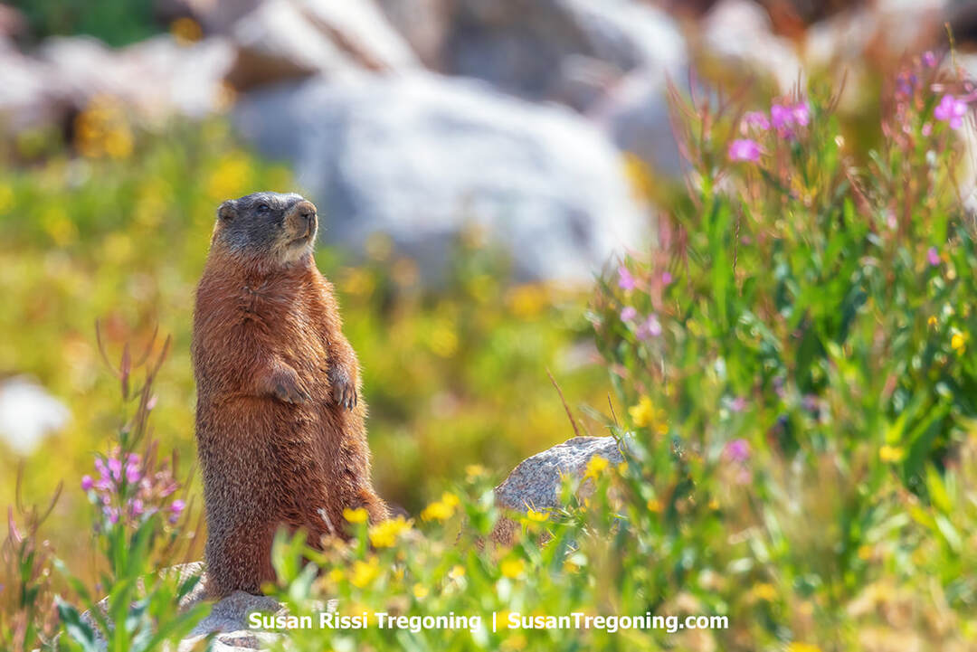
A marmot stands amidst wildflowers beside the Beartooth Highway, perched on a rock within the alpine vegetation.
However, the project was far from over. Throughout much of the 1920s, vigorous lobbying efforts were underway in Congress to construct the road along a new route, distinct from the Black and White Trail. This time, Oscar HP Shelley, the influential publisher and editor of the Carbon County Newspaper, championed the initiative. What set Shelley apart was his extensive network of connections within Congress, which enabled him to galvanize support from the federal government. Moreover, he had backing from Yellowstone Park authorities. At that time, the only route out of Cooke City required miners to navigate the park road to Yellowstone's North Entrance at Gardiner. Yellowstone's primary concern was removing mining trucks laden with ore from their roads; these heavy vehicles caused significant wear and tear and posed a dangerous threat to tourists visiting the park.
In 1931, President Herbert Hoover enacted the National Parks Approach Act, ushering in a transformative era for America's natural wonders. This visionary legislation earmarked three million dollars to forge breathtaking scenic routes into three iconic National Parks: Yosemite, Yellowstone, and Sequoia. The real focus of this initiative was the creation of the Beartooth Highway, as plans for highways to the other two parks had not yet been conceived.
The act imposed specific constraints on this ambitious project, mandating that the road span no more than 60 miles and remain within National Forest boundaries. An innovative funding strategy had to be devised to connect this new segment of road to the existing Federal Aid Highway that had already been started since the Beartooth Highway would be longer than that. Consequently, approximately eight miles were trimmed from the original plan by rerouting the Highway's terminus from Bearcreek to Red Lodge.
A view from above the treetops of Pilot and Index Peaks from the Clay Butte Fire Tower Road as the sun begins its descent behind the mountains.
Since the proposed route meandered through National Forest territory, the Bureau of Public Roads was responsible for its construction. Detailed surveys of this new path began in earnest in 1930, marking the inception of a journey that would forever enhance access to some of America's most treasured landscapes.
Although the Beartooth Highway officially opened its gates on June 14, 1936, adventurous motorists had already begun navigating its rugged terrain as early as 1932, well before its completion. Tales abound of brave drivers conquering the summit of the Beartooth Plateau, and maneuvering their vehicles through boulder-strewn fields where the road remained unfinished. As a soft opening, this allowed the engineers to learn of the road's deficiencies. In its infancy, the road lacked essential safety features such as railings and center striping, leading cautious drivers to veer away from dangerous edges and inadvertently endangering oncoming traffic. The Highway was widened in 1933, and paving on the Montana side was completed between 1934 and 1935. The Wyoming side was fully paved by 1936, just in time for opening.
A view from above the Vista Point Overlook on the Beartooth Highway in Montana, where rugged cliffs and forested slopes rise across the surrounding mountain landscape.
The Montana stretch of this winding route garnered much attention due to its dizzying switchbacks. During construction, workers christened each bend with evocative names like Dead Man's Curve and Mae West Curve—monikers that hinted at both danger and allure.
The road's naming sparked a spirited debate. Throughout the 1930s and the 1940s, it was known as the Red Lodge—Cooke City Highway, but some wanted to shorten that to the Cooke City Highway. Imaginative schoolchildren from Billings proposed enchanting names like Highway to the Clouds and Highway to Heaven. Still, ultimately, Red Lodge—Cooke City Highway prevailed. It wasn't until after World War II that it earned its iconic title, Beartooth Highway.

Above the tree line in the rugged alpine tundra along the Beartooth Highway All‑American Road, where a winding road crosses open high‑country terrain beneath distant mountain ridges.
Upon its grand opening, bolstered by extensive national and international media coverage during its construction, the Beartooth Highway captured immediate acclaim. It quickly became a magnet for vacationers flocking to both Yellowstone Park and Red Lodge. Both destinations eagerly organized bus tours ascending the majestic mountain pass. To this day, a couple of tour companys continue to offer exhilarating journeys along the storied Beartooth Highway, encapsulating a piece of history with every ride.
In 2014, 60 of the 68 miles that make up the Beartooth Highway were added to the National Register of Historic Places as the Red Lodge—Cooke City Approach Road Historic District. The district is named after the two towns the road connects, each serving as a gateway community for the highway.
Driving the Beartooth Highway
Massive boulders lay strewn across the rugged landscape along the Beartooth Highway, set among evergreen trees and distant mountain ridges.
Mile 0 - Bearcreek Bridge
Beartooth Highway has no mile markers because of the difficulties with ice and snow removal. Be sure to reset your trip odometer to zero at the Bearcreek Bridge, located at the Junction of Highway 308 and Highway 212 on the south end of Red Lodge.
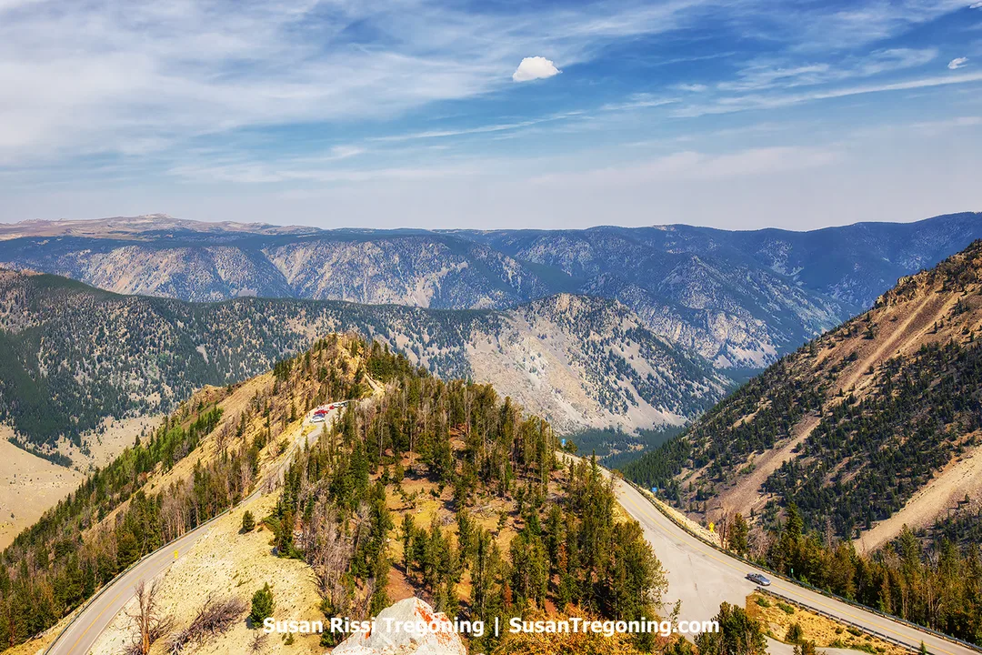
Miles 14-22 - The Rock Creek Switchbacks
Starting at 8000 feet in elevation, you will climb 1500 feet in the next eight miles. This section of the highway is known for its breathtaking views and challenging terrain, making it popular with adventurous drivers and motorcyclists. The climb can be demanding due to the steep grades and sharp turns, so drive carefully and stay alert.
During your ascent, take advantage of pullouts and overlooks where you can safely stop to soak in the scenery and snap some photos.
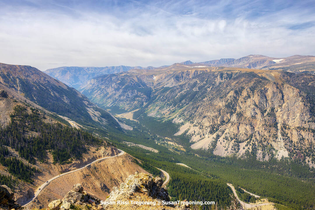
Perched at an elevation of 9,190 feet, the Vista Point Overlook offers a view across Upper Rock Creek Canyon, where steep rocky slopes and forested ridges extend into the distance.
Mile 19.7 - Rock Creek Vista Point Overlook & Rest Area
Following that harrowing experience of navigating those hairpin turns, be sure to stop at the Rock Creek Vista Point Overlook. This area offers pit toilets and a short, wheelchair-accessible trail leading to an incredible viewpoint. Keep an eye out for chipmunks; they are abundant here and often scrounging for food. Even though this location can attract many visitors on pleasant days, it boasts ample room for taking in diverse vistas from various angles. The overlook is at 9,190 feet in elevation, standing almost 3,700 feet above Red Lodge.
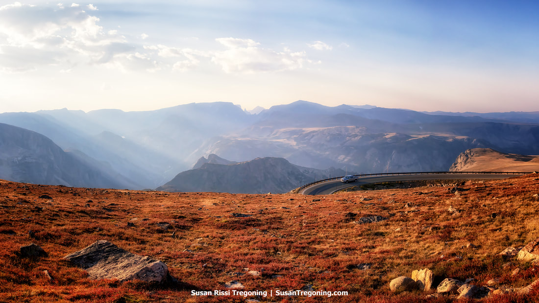
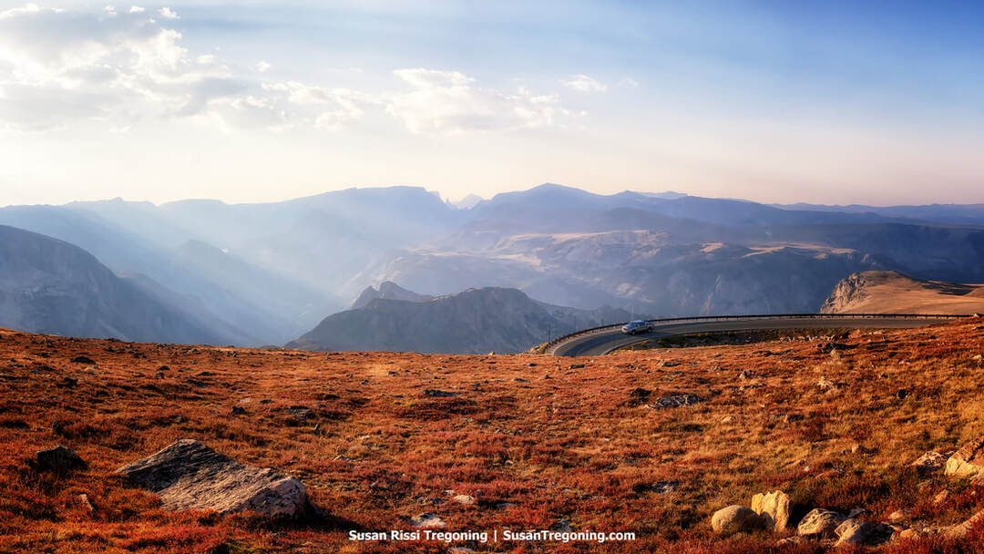
Miles 16-26 - Hellroaring Plateau Views
Gaze to your right across the valley; that plateau is named Hellroaring for good reason, and it's not merely due to the constant wind. The road ascending the valley's slope achieves the same elevation in half the distance, and it's a dirt road without guardrails! It's not for the faint of heart, but it sure provides an exhilarating experience.
Mile 23.9 - The State Line and 45th Parallel
I noticed the Wyoming Welcome sign was absent during my visit, but the Montana Welcome sign is there. It's said to be the highest state Welcome sign in America. Additionally, it marks the 45th Parallel, so you are halfway between the North Pole and the Equator.
The Beartooth Basin Ski Area sits high in the alpine terrain above a valley of rocky slopes, scattered lakes, and distant mountain ridges along the Beartooth Highway.
Mile 27 - Beartooth Basin
Situated at an awe-inspiring altitude of 10,737 feet, Beartooth Basin originated in the mid-1960s under the name The Red Lodge International Ski and Snowboard Camp and is one of North America's oldest alpine ski training sites. This remarkable destination, subject to Mother Nature’s whims, frequently allows skiing on its immaculate slopes until the 4th of July weekend. This location doesn’t need your odometer reading to find; you can spot the ski lift on the hillside as you ascend the highway.
For more information about skiing the Basin, visit Beartooth Basin.
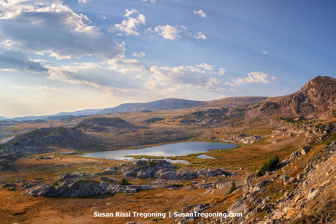
Gardner Lake sits high in the alpine terrain along the Beartooth Highway, surrounded by rocky slopes, open tundra, and distant mountain peaks.
Mile 28.2 - Gardner Lake Pullout
Gardner Lake, at the base of a natural basin, offers a breathtaking view that can be easily admired from a spacious parking area on the south side of the Beartooth Highway.
Look for mountain goats and skiers on the side of the mountain here. The Gardner Lake Headwall, oriented to the northeast, receives minimal sunlight and keeps snow well into summer—making it popular with skiers and snowboarders.
This location marks the northern entry point to the Beartooth Recreation Loop, a nine-mile trail network. Alternatively, you can opt for a direct hike down to Gardner Lake. At 10,550 feet above sea level, the trailhead is among the highest in the Beartooths, so be prepared for some breathlessness during this brief hike. The steep path descends 580 feet within just ¾ of a mile, making for a challenging return ascent. For an optimal experience with fewer mosquitoes, consider hiking in late summer.
The Bear’s Tooth rises among distant mountain ridges along the Beartooth Highway, viewed from a high‑elevation stretch of road crossing open alpine terrain.
Mile 29.6 - The Bear's Tooth
A particularly fascinating view on the Beartooth Highway is a near-perfectly sculpted pyramid that majestically ascends between the imposing granite peaks of the Beartooth Mountain range. This rock pinnacle, once known as "the Needle," was sculpted by glaciers and called the Bear's Tooth by the Crow Indians. Subsequently, it was the name given to the mountain range and the scenic highway that winds through it.
Mile 30.5 - West Summit Overlook
Standing at 10,947 feet, this spot marks the highest point on the Beartooth Highway and offers breathtaking panoramic views. Be sure to drive up to the overlook.
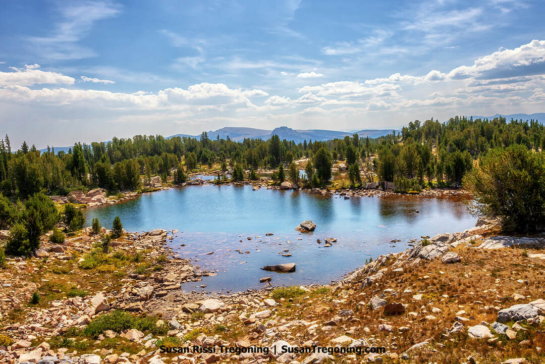
Island Lake rests among forested hills and distant mountain ridges along the Beartooth Highway, with open grassy terrain leading down to the shoreline.
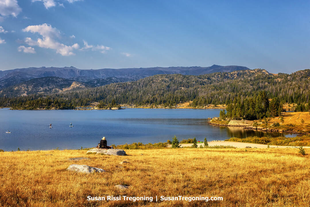
Mile 37.6 - Island Lake
Sitting at 9,518 feet in elevation, Island Lake is a stunning alpine lake nestled just below the tree line. The forest partially encircles the 146-acre lake that reaches depths of up to 100 feet. A popular recreational spot, Island Lake features a US Forest Service campground, a boat ramp and beach area, and a trailhead frequented by hikers and backpackers. It is accessible via a short spur road branching north from US 212. This route accommodates all types of vehicles and leads directly to the campground and boat launch area.
Fishing and boating are favorite activities among visitors to Island Lake. The lake welcomes all kinds of watercraft, including motorboats. A spacious boat launching area provides both a ramp and ample space for hand launching. Despite being open to motorboats, non-motorized use predominates. The lake is home to various fish, with brook trout being the most plentiful. Should you need one, you can purchase a Wyoming state fishing license at the Top of the World Store.
Stargazing is spectacular here due to the thin, clear air and the absence of light pollution. This creates unforgettable night skies that are best enjoyed during the dark phase of the moon. Under a full moon, the sky is remarkably bright at this elevation, casting a unique glow over the lake and the surrounding landscape.
The Top of the World Store sits along the Beartooth Highway, a rustic log outpost offering supplies and fuel amid the surrounding pine forest and mountain landscape.
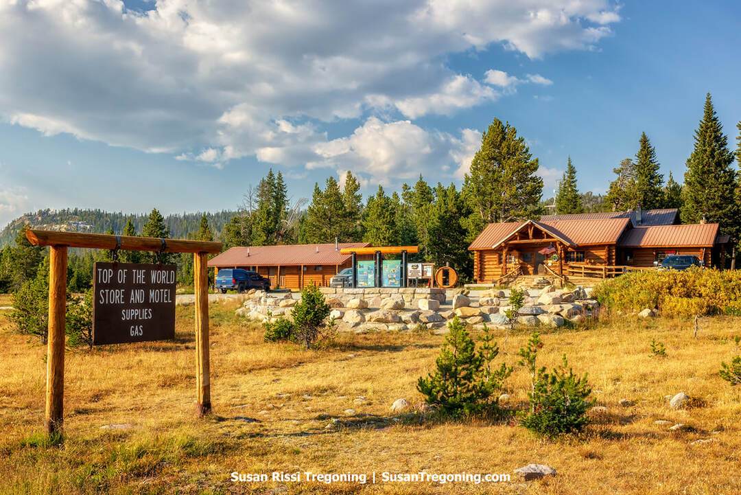
Mile 38.8 - Top of the World Store
The Beartooth Highway was initially constructed as a National Park Approach Road, which meant it was intended to remain largely undeveloped. Perched at 9,396 feet, the Top of the World Store stands alone on this stretch of road and feels like a sanctuary amidst the wilderness. Thirty-eight miles from Red Lodge and twenty-five miles from Cooke City, it’s the sole destination for gasoline, snacks, and souvenirs along the route. Initially established at Beartooth Lake in 1934, before the highway existed, the store was relocated to its current location in 1964.
Next to the store is a quaint four-room motel. It is open year-round and, in winter, only accessible by snowmobile. Due to limited availability, the Top of the World Resort advises making reservations well in advance, but it never hurts to ask.
Visit the Top of the World store to purchase a Wyoming Fishing License.
For more information about lodging options, visit Top of the World Resort.
The store is open Monday through Saturday from 8 a.m. to 7 p.m. and Sunday from 8 a.m. to 6 p.m.
Beartooth Lake lies below the prominent rise of Beartooth Butte, where layered rock formations and forested slopes frame the high‑country landscape.
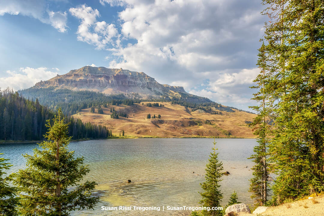
Mile 40.7 - Beartooth Lake & Beartooth Butte
At 10,514 feet in elevation, Beartooth Lake was once a bustling hub. Before the Beartooth Highway was constructed, this was the original location of the Top of the World Store. The area also featured two campgrounds, a lodge, and several commercial and private cabins. Imagine making a 40-mile journey on horseback over rugged miner and hunter trails to reach your summer retreat.
Scientists have identified fifteen different fish species in the Red Talus on Beartooth Butte. This red-hued rock on the Butte's steep face holds fish fossils around 400 million years old—potentially the oldest ever found!
Beartooth Ravine Bridge, Ravine & Falls
Beartooth Ravine features steep rocky slopes and dense evergreen forest, with an elevated roadway tracing the cliffside above the valley.
Completed in 2022, the Beartooth Ravine Bridge, costing $25 million and stretching 420 feet, marked the final reconstruction project on the Beartooth Highway, an extensive effort that began in the 1970s. This three-span structure enables travelers to traverse the Beartooth Ravine while providing a safe underpass for wildlife.
Additionally, it introduced two new scenic pullouts. One pullout on the bridge offers a view of Beartooth Falls to the left, and another pullout, after crossing the bridge, presents views of both Beartooth Ravine and the bridge itself.
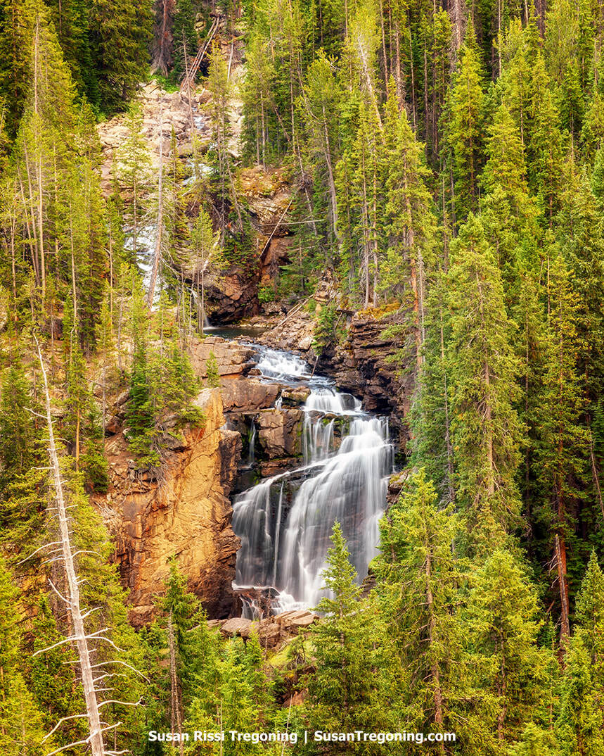
Beartooth Falls descends over layered rock formations within a dense evergreen forest along the Beartooth Highway.
Mile 42.2 - Clay Butte Fire Tower Lookout
A 3-mile gravel road takes you to the historic Clay Butte Fire Lookout Tower. Constructed in 1942 by the Civilian Conservation Corps, this lookout was manned until the 1960s when aircraft became a more effective means of spotting fires. Despite this shift, Clay Butte remained a popular site for visitors due to its scenic views and proximity to the Beartooth Highway. The tower was renovated in 1962 and has been managed by volunteers since 1975. Today, Clay Butte is an educational site offering visitors insight into how fire lookouts operated six decades ago. Travelers along the scenic byway often stop here for information or to enjoy the panoramic views, which include wildlife, botanical areas, remnants of the 1988 Clover-Mist wildfire, and geological features from ancient seas that once submerged the Beartooth Plateau.

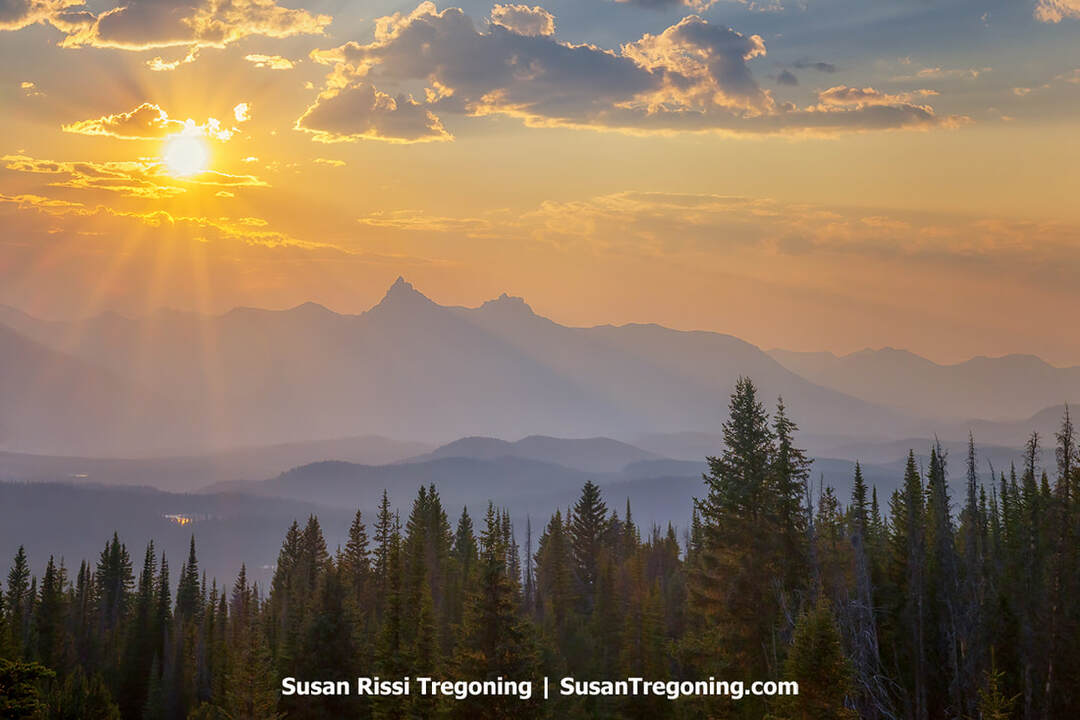
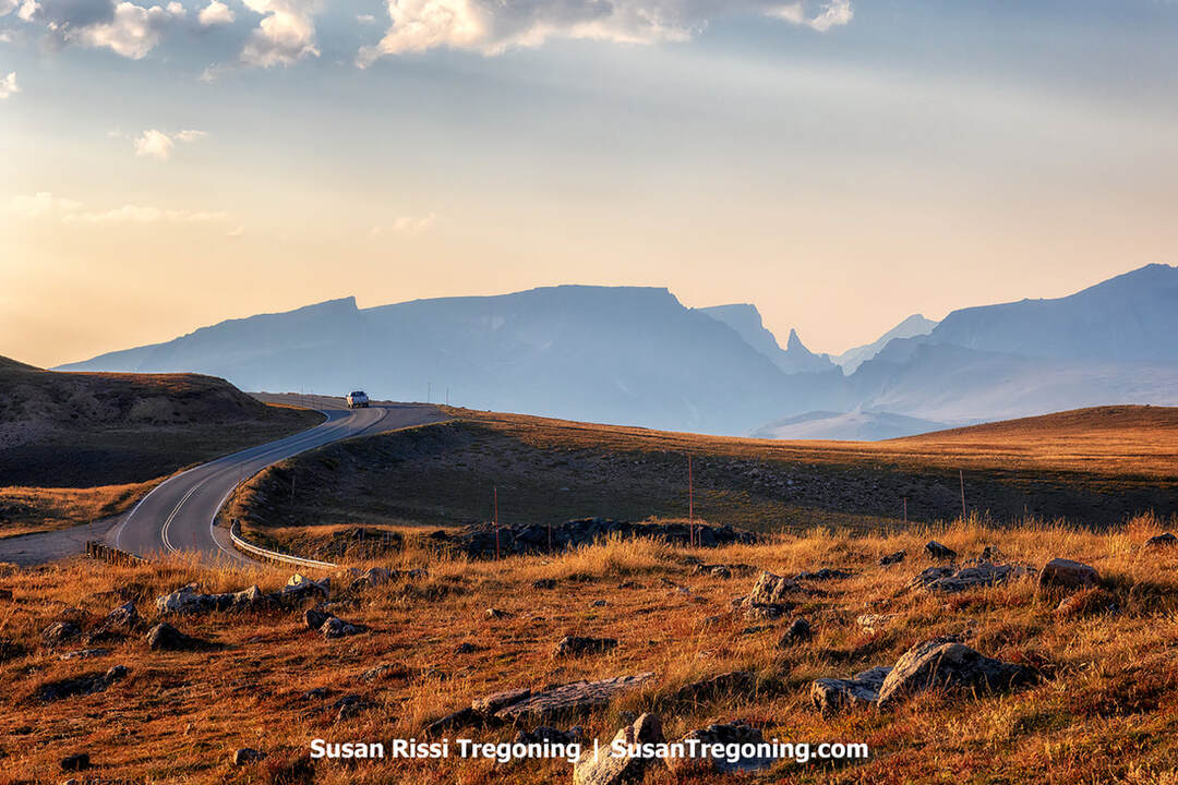
Sunset at the Pilot and Index Peak Overlook, where evergreen‑covered slopes and distant mountain ridges fall away beneath a sky lit by sunbeams streaming through layered clouds.
Mile 43.2 - Pilot & Index Peaks Overlook
The two prominent summits directly before you are Pilot Peak and Index Peak. The sharp, pointed summit to the left is Pilot Peak, while the one to the right is Index Peak. These peaks are quite some distance away in Yellowstone National Park. Many people often confuse Pilot Peak with Bear's Tooth. This picturesque scene ranks in the top ten for most photographed vistas along the Beartooth Highway.
Looking eastward, you can observe the Clark's Fork River Valley and the Wild and Scenic Clark's Fork River.
Clark's Fork Overlook
This scenic pullout provides a breathtaking vista of the Clark's Fork River Valley. In the late summer, vibrant patches of golden aspen trees create a striking contrast against the backdrop of shadowy, mountains in the distance.
Mile 48.6 - Brook Lake Creek Falls
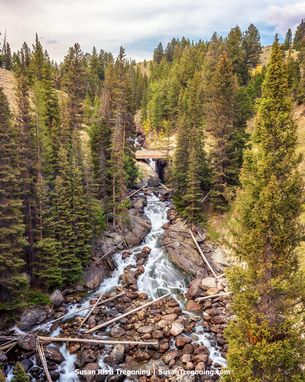
Brook Lake Creek Falls tumbles through a rugged forest landscape along the Beartooth Highway, where clear mountain water rushes over boulders beneath towering pines.
Just a 200-yard walk, this is a must-visit!
At 7,329 feet in elevation, Brook Lake Creek Falls cascades 35 feet down through a narrow gorge carved into Precambrian granite. The pedestrian bridge here was originally part of the Beartooth Highway and is one of five bridges preserved from when it was first built.
The Civilian Conservation Corps meticulously hand-chiseled and assembled the abutments for these bridges abutments during the Great Depression. In 1974, a new steel bridge was constructed downstream.
Mile 49.9 - Chief Joseph Scenic Byway
The road to the left puts you on the Chief Joseph Scenic Byway. When Chief Joseph ends at the T intersection, turn left back to Red Lodge, Montana, or turn right to Cody, Wyoming.
Wyoming 296, the Chief Joseph Scenic Byway, connects Cody to the Beartooth Highway, leading to Yellowstone National Park's Northeast Gate. This picturesque route takes you through the Shoshone National Forest within the Absaroka Mountains and descends into the Clarks Fork Valley. Spanning 47 miles of paved road, it begins at U.S. 120, 17 miles north of Cody, and extends northwest to meet the Beartooth Highway. To the north of this scenic drive are the Beartooth Mountains and Clarks Fork of the Yellowstone River; to its south lie the Absaroka Mountains and North Absaroka Wilderness. The best seasons for traveling this byway are fall and summer; in winter, snow plows maintain accessibility just east of Yellowstone's entrance.
Mile 52.6 - Crazy Creek Falls & Campground
More a cascade than falls, Crazy Creek Falls is quite impressive. They are right up front, so you don't have to travel far to see them. Be careful going up, but a good "shelf" area puts you a little higher on top of the falls if you feel like climbing. If you are here in June, the spring runoff really gets this falls roaring!
The trail continues on for quite some distance but there’s no need to follow it if you only want to see the falls.
Mile 64 - Cooke City & Silver Gate
These quaint little towns exude rustic charm and are cute, cute, cute! Cooke City's year-round population of just 75 and its neighboring village, Silver Gate, offer scenic beauty, outdoor activities, and distinctive small-town allure. These spots are perfect for fueling up and grabbing a bite before venturing into Yellowstone. Nestled between Yellowstone's Northeast Entrance and the majestic Beartooth Mountains, the towns are surrounded by the park and Gallatin National Forest. This provides easy access to mountain trails, trout streams, and winter sports. Despite Cooke City's downtown being only a few blocks long, it boasts excellent dining and lodging options. If you plan to stay overnight, make reservations in advance, as vacancies are rare when passing through. In summer, you can reach Cooke City from the east via the Beartooth Highway; in winter, access is limited to Yellowstone's North Entrance or the Chief Joseph Scenic Byway. Additionally, Cooke City offers fantastic access to Lamar Valley, where grizzlies, black bears, bison, and wolves can be spotted roaming freely.
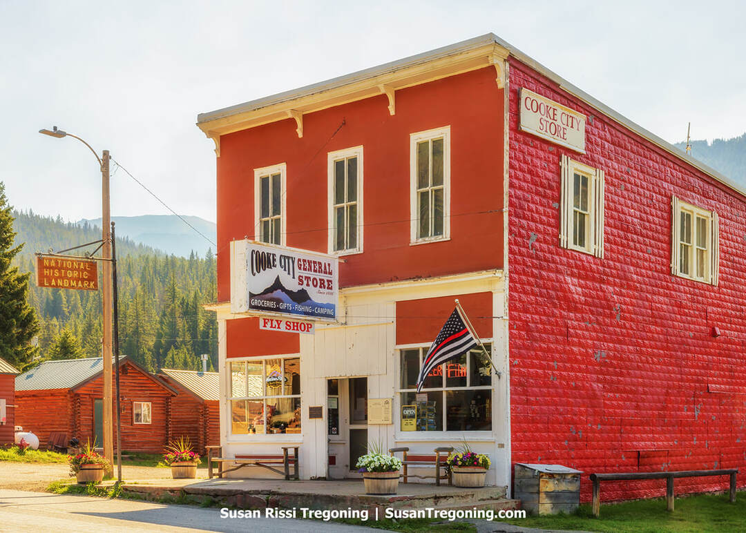
The historic Cooke City General Store, a long‑standing landmark near the northeast entrance to Yellowstone, continues to serve travelers with its classic red façade and mountain‑town setting.
Be sure to stop at the historic Cooke City General Store. It's the only building that remains from when Cooke City was a mining town.
Mile 68.8 - Yellowstone National Park Northeast Gate
Know Before You Go
- Beartooth Highway (US-212) is typically open from the Friday before Memorial Day weekend to October 15. Still, because the weather is unpredictable at the highway’s higher elevations, it’s important to check for road closures before traveling, especially if it is early or late in the season. Use Wyoming Road Information or Montana Department of Transportation for road closure information. You can also call the Red Lodge Chamber of Commerce at 406-446-1718 for current conditions.
- Allow yourself plenty of time. It's at least a two hour non-stop drive from Red Lodge to the Yellowstone Gate. I've never done it in less than 4 to 5 hours, since I can't resist stopping.
- Be prepared for the unexpected. Gas up before leaving town and have water and a few snacks with you. Don't forget a jacket, it's always cold and windy at the top.
- Campgrounds, cabins, and hotels can fill up quickly during the season, so be sure to book your accommodations in advance or have a backup plan.
Be sure to check out my other Beyond Yellowstone blog post!
Beyond Yellowstone: A Guide to the Buffalo Bill Cody Scenic Byway
Not every image makes it into my blog. If you enjoyed the images in this article, please check out my Wyoming Collection and Montana Collection for more images of these states, or visit my Image Gallery with over 4000 images of locations from around the United States.
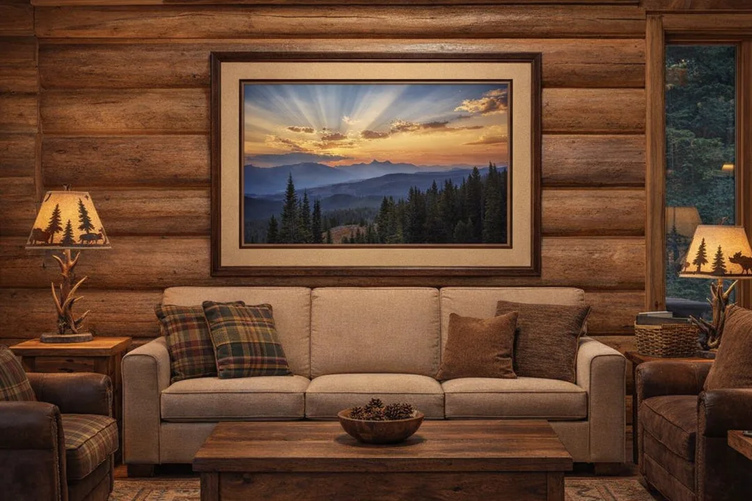
Sunset at Pilot and Index Peak Overlook captures the grandeur of the Beartooth Mountains in glowing evening light. This framed piece, with double matting and a rich wood frame, brings the warmth and serenity of Montana’s alpine wilderness into any cabin or home setting.
Fine Art Prints are available for order as print only, framed art, canvas art, metal art, acrylic art, and wood art prints in various sizes. Home Decor and Gift Ideas include shower curtains, throw pillows, towels, totes, phone cases, t-shirts, puzzles, blankets and more—Worldwide Shipping with a 30-day money-back guarantee.
More of the USA
- A Travelers Musings (1)
- Alabama (1)
- Hawaii (3)
- Illinois (6)
- Indiana (3)
- Iowa (3)
- Louisiana (1)
- Maryland (1)
- Michigan (2)
- Minnesota (4)
- Mississippi (6)
- Missouri (2)
- Montana (1)
- Nebraska (5)
- New Mexico (1)
- North Carolina (1)
- Pennsylvania (2)
- Route 66 (5)
- South Dakota (1)
- Tennessee (1)
- Texas (1)
- Virginia (2)
- Washington DC (1)
- West Virginia (3)
- Wildlife (6)
- Wisconsin (2)
- Wyoming (4)
