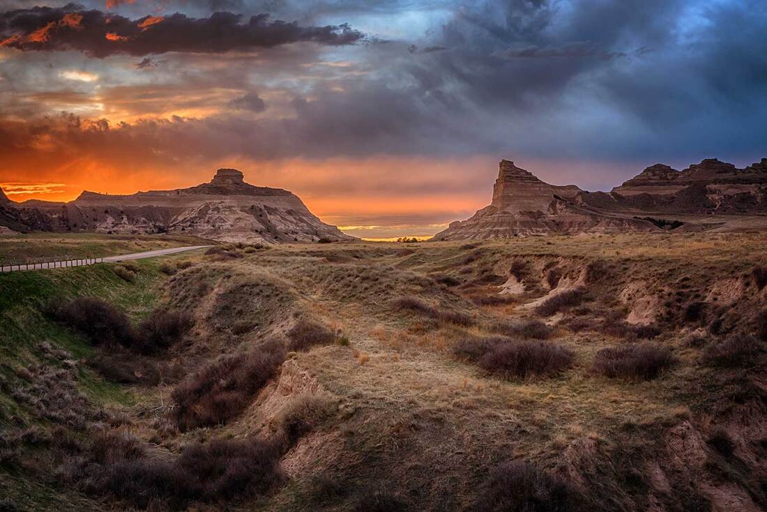
Sunset at Mitchell's Pass - Just stepping a few feet off the road completely changes the perspective. This is what the pioneers fought their way across, not that nice smooth road off to the left.
In the western portion of the state of Nebraska you’ll find Western Trails Scenic and Historic Byway. This is a historic 144 mile route from Ogallala to the Wyoming border that roughly follows the path the pioneers took almost 200 years ago. While there is much to see and do here, I have chosen the amazing geological formations that those brave pioneers saw along the way to be the topic of this post.
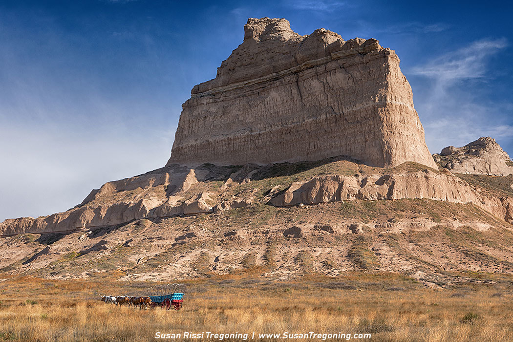
Courthouse and Jail Rock
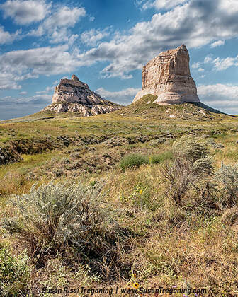 Courthouse and Jail Rocks Courthouse and Jail Rocks
Located in the Platte River valley, just outside of Bridgeport, Nebraska, Courthouse and its smaller neighbor Jail Rock were the first two monumental rock features that the pioneers encountered on their journey west.
This was an important crossroad where two major trunks of the Oregon and California Overland trails merged. Because of its importance, a Pony Express station was located here, as well. Rising 340 feet above the North Platte River Valley, the largest rock formation was called the “Castle” by some, but “Courthouse” by the people that traveled from Missouri since they claimed it resembled the Saint Louis Courthouse. There was never any disagreement about the name Jail Rock for its smaller counterpart since one room jailhouses were common out west at the time. The reasoning was, since you can’t have a jail without a courthouse nearby, the name Courthouse Rock finally stuck.
These monuments are the erosional remnants of an ancient plateau and are composed of Brule clay, Gering sandstone and volcanic ash. They have eroded somewhat since the days of the pioneers but are still impressive formations. They are listed in the National Register of Historic Places and in the Nebraska Natural Areas Register.
Chimney Rock
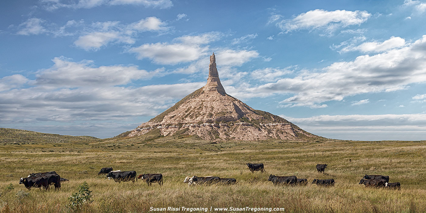
Chimney Rock - A herd of cattle graze in the tall grass prairie at Chimney Rock.
Located about 12 miles to the north-west as the crow flies from Courthouse and Jail Rocks, near what is now the town of Bayard, Nebraska, Chimney Rock is one of the most picturesque landmarks along the Oregon, California and Mormon trails.
Towering 325 feet above the valley, it sits on a conical base and the spire alone is 120 feet tall. Chimney Rock is a natural geologic formation, composed of layers of volcanic ash and Brule clay, it is the remnant of the erosion of the bluffs at the edge of the North Platte River Valley. General Joel Palmer, who led a surveying party in 1845, described it as having the appearance of a haystack with a pole running far above its top.
The name "Chimney Rock” more than likely originated with the early fur traders. It was also called Chimley Rock and Chimney Tower for a time. Earlier on, it was referred to as Elk’s Peak and Elk Brick which were more than likely variations of the Lakota Sioux’s name for it which roughly translated to “elk penis”.
The first recorded mention of "Chimney Rock" was in 1827 by Joshua Pilcher who was a fur trader and the owner of the Missouri Fur Company based out of St. Louis. Pilcher was journeying up the Platte River to the Salt Lake Rendezvous of the Rocky Mountain fur trappers when he spotted Chimney Rock. By the time the pioneer’s followed this path, Chimney Rock was so famous that it was mentioned in most pioneer’s diaries, with some travelers reporting that it was visible from almost 40 miles away. This was an important landmark because it signaled to the pioneers that they had reached the end of the prairies. Their journey going forward would become more difficult; the trail would be more rugged and steep as they approached the Rocky Mountains. Chimney Rock was designated a National Historic Site in 1956.
Robidoux Pass
Robidoux Pass - The backside of Dome Rock, Crown Rock and Sentinel Rock as seen from Robidoux Pass. Once the shorter and easier Mitchell Pass was discovered, Robidoux was no longer used.
Robidoux Pass or Roubadeau Pass is the first of two historic passes through the Wildcat Hills. This trail forced emigrants to swing 30 miles south away from the North Platte River in order to access a natural gap passing through the Wildcat Hills.
The earliest travelers to use this pass were probably fur traders and missionaries between the 1820s and the 1830s. The first transcontinental wagon train to pass through was the Bidwell-Bartleson Expedition in 1841. This expedition was comprised of 80 emigrants bound for Oregon along with the Catholic missionary Father DeSmet. Robidoux saw its heaviest use between 1843 to 1851 during the Oregon Migration and the California Gold Rush. Robidoux almost seems to be forgotten, there are no fancy monuments and none of the historic buildings remain. Along this gravel road, you will find the reconstructed Robidoux Trading Post, a few wagon ruts and several markers that point out the original trail. A couple of pioneer graves can still be seen along the trail, as well. 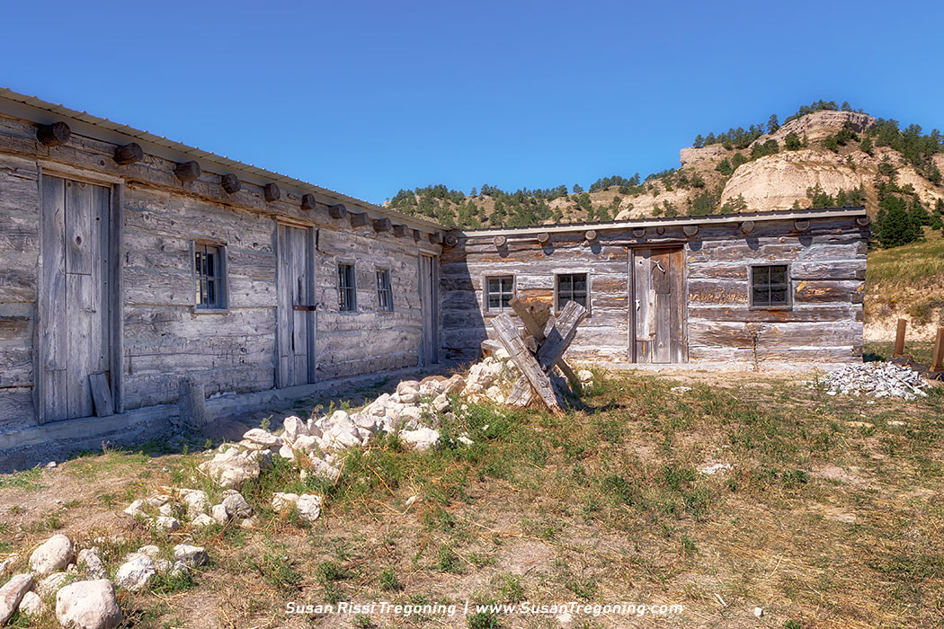
Robidoux Trading Post
While no enduring history of the Robidoux Trading Post exists, this building has been recreated though archaeological research and diary entry’s made by the travelers that passed through the area. This recreated post was built from 100-year old, hand-hewn logs on its original site.
One emigrant described this post as: a log shanty with a blacksmith’s forge on one end and a grog shop on the other.
Other trading posts are known to have existed near the pass at that time, but Robidoux’s is the one most often mentioned in diaries.
Located just east of the trail, this trading post was established in 1851 by a French family named Robidoux who were engaging in free trade with the Plains Indians. The Robidoux Brothers: Joseph, Antoine, Louis, Michael and Isadore visited here and farther west trapping and trading with many tribes as early as 1822. This trading post sometimes referred to as the “winter quarters” followed an earlier trading post and blacksmith shop just north of this location. Robidoux sold a variety of goods and provided blacksmith services for travelers. Research indicates that Antoine, son of Joseph III resided here as the post clerk with his Indian wife and children until 1853. Robidoux Pass is designated as a National Historic Landmark in 1961.
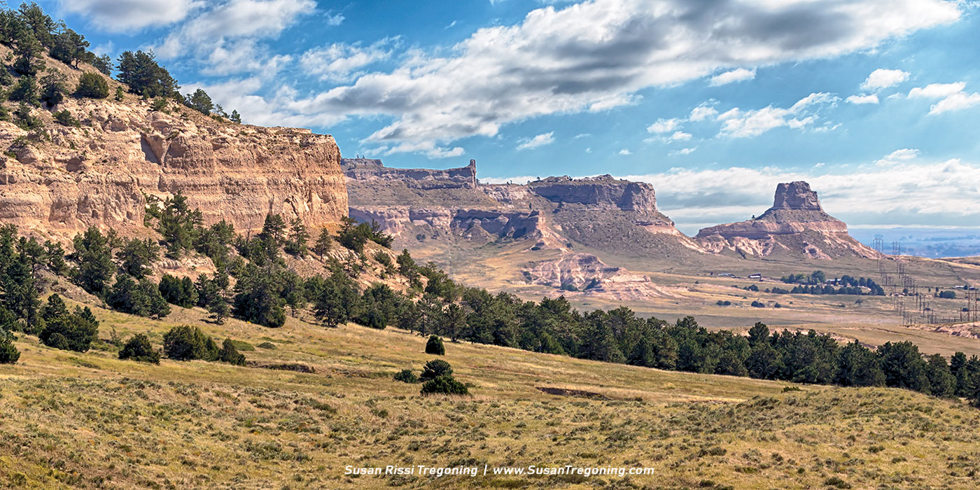
Scotts Bluff
Thanks to the efforts of the US Army, Mitchell Pass, a much shorter route that passes through the center of Scotts Bluff, opened in 1851. It had not been possible to get wagons through this pass until that time. Once this happened, Robidoux Pass was no longer used.
Eagle Rock - Eagle Rock towers over a pioneer wagon as it passes through Mitchell Pass on its way out west.
Scotts Bluff is the second most referenced landmark on the Oregon, Mormon and California trails after Chimney Rock. Rising over 800 feet above the plains at its highest point, Scotts Bluff was a significant milestone for many wagon trains and was gazed upon with a great sense of accomplishment. After two months and 600 miles of travel through “the Great American Desert”, as the semi-arid grasslands of Nebraska were known in the mid-1800s, reaching this point indicated that 1/3 of their journey West was completed. They would now be entering the foothills of the Rocky Mountains.
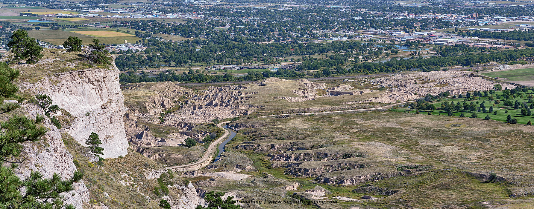
The North Platte River at Scotts Bluff - Looking down from atop Scotts Bluff. Look closely at the flat easy to travel spot of land, you can see wagon ruts here.
Both the Oregon and Mormon Trails paralleled the North Platte River. This river is non-navigable and the pioneers knew it as a much wider and more dangerous river than it is today. Covered wagons passed Scott’s Bluff on both sides of the river but they could not get close for fear of getting caught up in silt, gravel and quicksand. This stretch of Badlands and Scotts Bluff was completely impassable.
Look closely at the image above, on the right side of the above image, you can see wagon ruts. 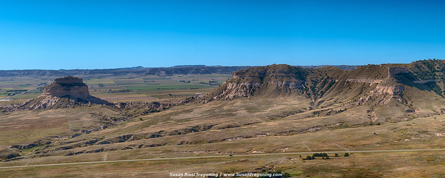
Dome Rock Panorama
Very few pioneers who reached Scotts Bluff ever actually scaled the cliffs to see these amazing aerial views. I think it give an interesting perspective of the difficulties these pioneers faced driving a wagon train through this area.
Part of the Wildcat Hills, Scotts Bluff is an isolated remnant of the ancient high plains. 20 million years ago, the surfaces of the plains surrounding the bluff were the same height as the bluffs. About 5 million years ago, the Platte River and its tributaries began to erode the soil and rock creating these canyons that grew wider and wider. 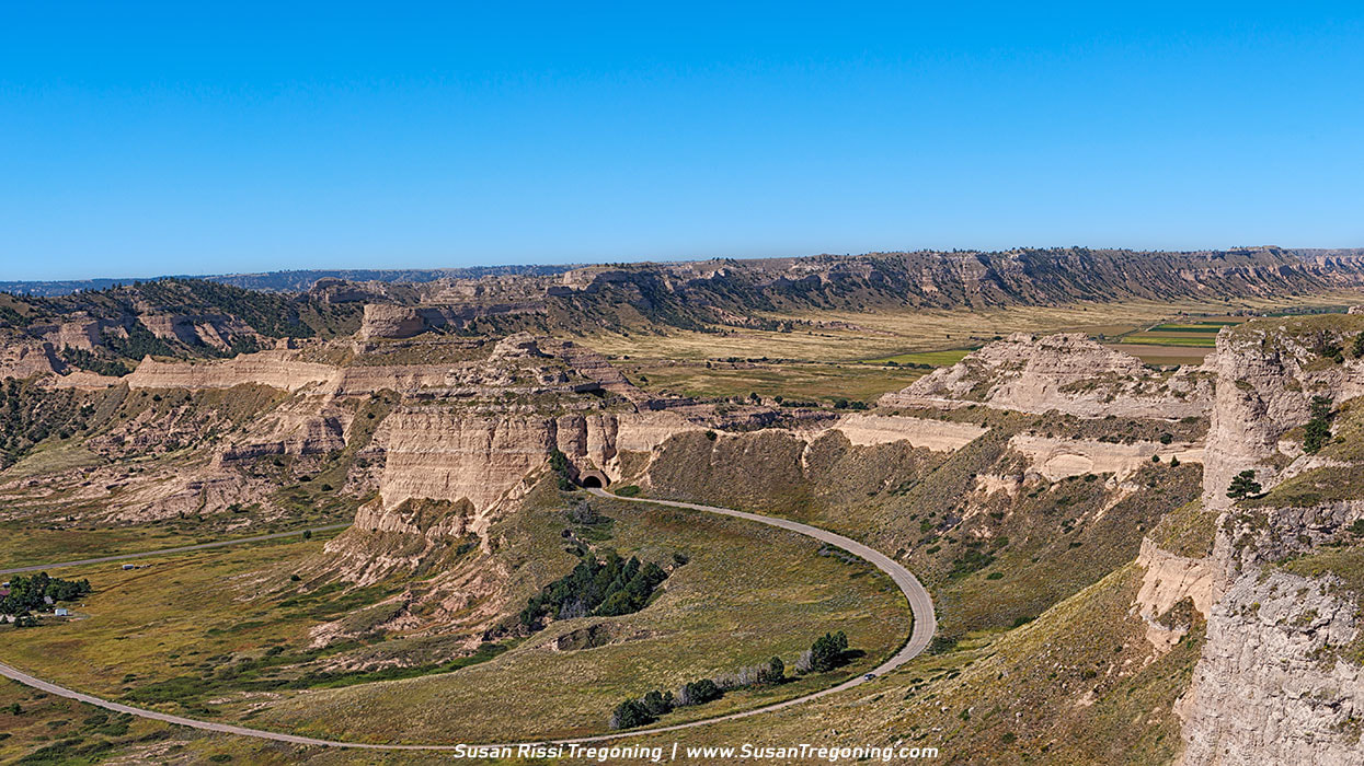
Overlooking Scotts Bluff
From Scott's Bluff, it was a race against time to get across the Rocky Mountains before cold weather set in. The pioneers faced even more hardships on the way. Wagons began to break down. Food supplies diminished. Cattle and horses gave out. Many emigrants died along the way.
To view more of my Nebraska images, visit the Nebraska Collection.
See an image you like? You can purchase Susan's work in The Art Gallery.
All images in the her collection are available as wall art, fine art prints, on home decor, gift items and apparel. 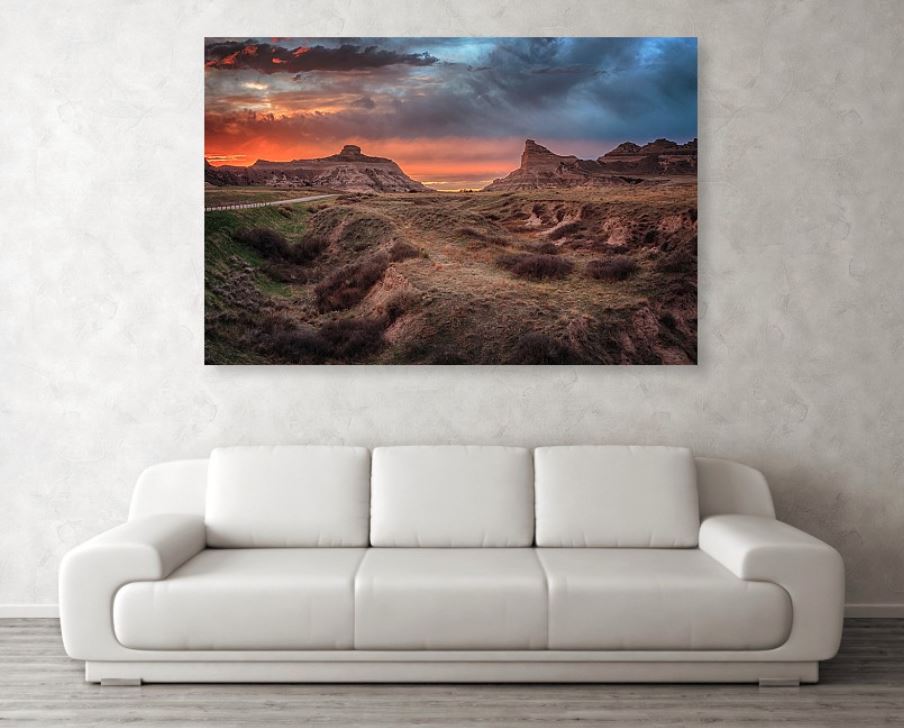
'Sunset at Scotts Bluff" on Metal Art
Bring your artwork to life with the stylish lines and added depth of a metal print. Your image gets printed directly onto a sheet of 1/16" thick aluminum. The aluminum sheet is offset from the wall by a 3/4" thick wooden frame which is attached to the back. The high gloss of the aluminum sheet complements the rich colors of any image to produce stunning results. 
0 Comments
Your comment will be posted after it is approved.
Leave a Reply. |
AuthorI am the 8th photographer in 4 generations of my family. Back in 2006, my husband accepted a job traveling, and I jumped at the chance to go with him. Categories
All
Archives
June 2024
|

 RSS Feed