Explore Indiana's Historic Pathways National Scenic Byway: A Southern Indiana Road Trip


A quiet morning view of the multi‑arched concrete bridge reflected in the still river, with a second bridge and water tower rising in the distance.
Few American roads pack as much history per mile as Indiana's Historic Pathways National Scenic Byway through southern Indiana. This 250-mile drive shadows the ancient Buffalo Trace from the Ohio River toward the Mississippi, threading stories of Indigenous heritage, Revolutionary War clashes, steamboat glory, and audacious Civil War raids. Traveling US 50 and US 150, you'll cross rolling hills, farms, covered bridges, and state forests, with national historic sites, museums, mansions, and memorials along the way. Read on for the must-see stops, how to navigate the twin routes, and tips to make the most of this history-rich drive.
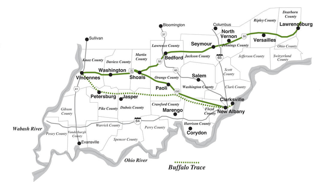
The Northern Spur travels US 50, crossing the state from Lawrenceburg on the Ohio border to Vincennes near Illinois. While it's a major coast-to-coast federal highway stretching from Maryland to California, in Indiana, it follows the former bed of the Ohio and Mississippi Railroad, which later became the B & O and is now CSX, except for portions of Lawrence County. As with the railroad before it, US 50 was the first, and remains the most important east–west overland artery in southern Indiana.
The Southern Spur follows US 150 and overlays segments of the Buffalo Trace, roughly following the Vincennes–New Albany stagecoach route, which was established when this part of the country was still known as the Indiana Territory. This route has gone by many names over time, including Vincennes Trace, Clarksville Trace, Harrison Road, and Kentucky Road. It's one of the Midwest's earliest roads!
Along the byway, you will find multiple covered bridges, notably the Medora Covered Bridge, recognized as the longest historic covered bridge in the nation. History and architecture/design enthusiasts can visit the Howard Steamboat Museum, Hillforest Victorian House Museum, Veraestau Historic Site, and the Culbertson Mansion State Historic Site.
For an immersive retreat, stay at one of French Lick's landmark hotels, the French Lick Resort & Casino or the West Baden Springs Hotel. Sweet-tooth travelers can tour Schimpff's Confectionery in Jeffersonville, a 130-year-old candy shop and museum renowned for its classic treats. Families will find plenty to do as well, from rides on the French Lick Scenic Railway and encounters with giraffes and elephants at Wilstem Wildlife Park to fossil hunting at Falls of the Ohio State Park.
Craving excitement? There are state and national forests, winding rivers, hidden caves, wildlife refuges, the Lawrenceburg Speedway, plus skiing destinations like Paoli Peaks and Perfect North Slopes. Indiana has an outstanding cave network, which includes Indiana Caverns, the state's longest, and Marengo Cave, a US National Landmark, among others.
What is the Buffalo Trace?
Historically, many maps of Indiana once showed a diagonal line across the southern part of the state labeled "Old Buffalo Trace" or "Vincennes Trace."
By the time French and British settlers reached what is now southern Indiana, a vast bison migration had already etched a permanent corridor across the region. Herds numbering in the thousands moved seasonally from the tallgrass prairie of present-day Illinois, waded the Wabash River at the shallow crossing where Vincennes now stands, traversed Indiana, and then forded the Ohio River at the Falls of the Ohio to spend the winter in Kentucky. The weight and repetition of these animals' travels pressed a track so firm that Native Americans followed it for centuries. The French later used the same route and established a trading post at Vincennes in the early 1700s.
Called the Buffalo Trace or the Vincennes Trace, this was more than just a path; it was a vital migration route that shaped Indiana's history, often more enduring than modern pavement. Reported to be 12 to 20 feet wide and, in places, worn 12 feet deep into solid rock, it served as the primary east–west corridor for both wildlife and early travelers, making it a key part of Indiana's migration and settlement history.
Some highlights from Buffalo Trace's history include:
- In 1786, George Rogers Clark, then a colonel in the American Revolutionary War, led 1,000 men over the Buffalo Trace to Fort Sackville at Vincennes.
- It became the first western mail route, with two carriers walking the 130 miles each week.
- The Vincennes Treaty of 1804, this Native American treaty line was drawn along its length.
- In 1807, authorities captured a British spy on the trail, suspected of working with Native allies before the Battle of Tippecanoe.
- In 1812, the trace's strategic value led to mounted "rangers" patrolling it to shield travelers from attacks and wild animals.
- In 1819, one of several roadside taverns recorded more than 5,000 travelers heading toward Missouri.
- By 1820, the first stagecoach service began running the full stretch from New Albany to Vincennes.
Today, the Buffalo Trace has faded from prominence, but its historical importance remains. Most modern maps omit it, yet segments of its course still exist, illustrating how vital this migration route was to Indiana's past and how it shaped the region's transportation development.
Traveling the Historic Pathways
We will start in Vincennes, Indiana's oldest city and the former capital of the Indiana Territory. Today, it features the Indiana Military Museum, George Rogers Clark National Historical Park, Vincennes State Historic Sites, and Grouseland, the home of William Henry Harrison, the first governor of the Indiana Territory and our ninth US president.
From here, you can pick whichever Spur you wish to tackle first; when you reach the Eastern side of the state, take Indiana’s Ohio River National Scenic Byway to link up with the other Spur for the return leg. If time allows, I highly recommend stopping in the other towns shown in bold on the map as well. Especially, Corydon, Indiana's first state capital, and Marengo, home of the Marengo Cave, a National Natural Landmark.
Please note: many historic sites shut down from January 1 to April 1. I drove much of the byway during that time, so several spots on my list were closed. The cold also kept me from my usual hikes, which means I don’t have photos of the lovely rolling hills that start in the middle of southern Indiana and stretch to the eastern border. I hope to return and remedy that someday.
Knox County
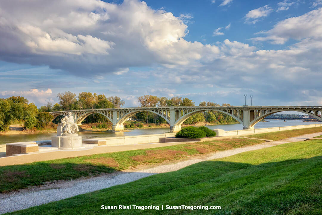
At the George Rogers Clark National Historical Park in Vincennes, the beautiful grounds on the Wabash riverfront, where a statue of Francis Vigo stands, with the historic Lincoln Memorial Bridge in the background.
Born in Italy, Francis Vigo served in the Spanish military before becoming a fur trader. He supported the American cause in the Revolutionary War and later helped establish Vincennes University. In 1934, the George Rogers Clark National Historical Park placed a John Angel sculpture of Vigo along the Wabash River waterfront to honor his important service during the American Revolution.
During the war, Vigo volunteered to act as a spy for George Rogers Clark. Dispatched to Vincennes to assess the situation at the British-occupied Fort Sackville, he was seized by Indigenous warriors and handed over to Lt. Gov. Henry Hamilton. Although Spain’s neutrality technically protected him, Hamilton distrusted his aims and released him on parole, requiring that he check in at the fort daily. Ironically, this arrangement allowed Vigo to study the garrison’s strength and defenses.
Soon afterward, the local Canadiens, who generally admired Hamilton, were urged by Father Gibault to insist on Vigo’s freedom, threatening to cut off the fort’s supplies. Hamilton agreed to release Vigo if he pledged “not to do any act during the war injurious to the British interests.” Vigo accepted, with the understanding that these restrictions only applied during his return trip to St. Louis. A man of his word, Vigo traveled down the Wabash, Ohio, and Mississippi Rivers directly to St. Louis, before proceeding to Kaskaskia to brief Clark on British preparations. That intelligence enabled Clark to take Fort Sackville in 1779. Vigo settled in Vincennes in 1783 and opened a fur trade business. He died there in 1836.
Vincennes
Vincennes, Indiana’s earliest established city, was the first seat of government for the Indiana Territory from 1800 to 1813 and continues to serve as an important center for the state’s history.
Set along the Wabash River, the community began in 1732 when French fur trader François-Marie Bissot, Sieur de Vincennes, founded a trading post named after him. The outpost linked French Louisiana with Canada, and after the French and Indian War, it passed to British control as Fort Sackville.
In 1779, Colonel George Rogers Clark, backed by Francis Vigo and local French inhabitants, seized Fort Sackville from the British. It was the most decisive frontier victory of the American Revolution, and it helped secure the Northwest Territory for the United States.
When the vast Indiana Territory was organized, encompassing present-day Indiana, Illinois, Wisconsin, and parts of Michigan and Minnesota, Vincennes became its political hub. William Henry Harrison, later the ninth U.S. president, served as the first territorial governor from his home, Grouseland, in Vincennes. He established Jefferson Academy in 1801, which, by 1806, was renamed Vincennes University, becoming the territory’s first institution of higher education.
Vincennes is recognized as Indiana's longest-serving territorial capital, serving from 1800 until 1813, when the seat of government moved to Corydon. It remains the state's oldest continuously inhabited town and ranks among the oldest communities west of the Appalachian Mountains.
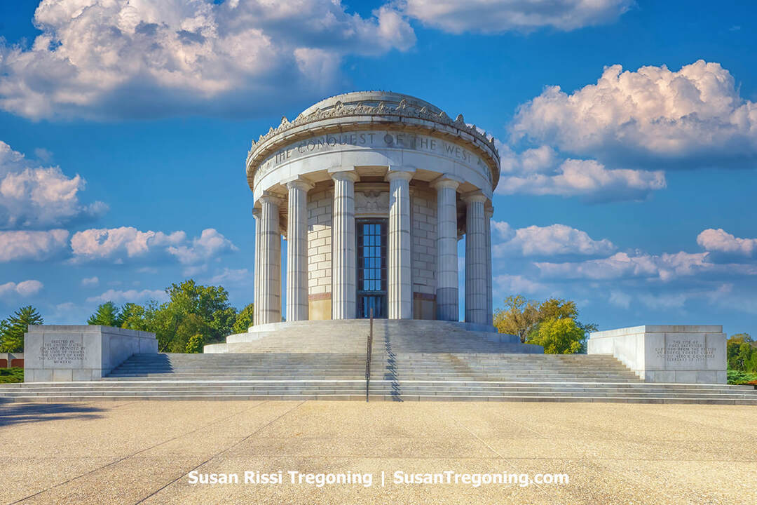
The George Rogers Clark National Historical Park Memorial is a round granite structure encircled by sixteen fluted Greek Doric columns and topped by a shallow glass-paneled saucer dome. Visitors must ascend thirty granite steps to enter.
George Rogers Clark National Historical Park
401 South Second Street, Vincennes
Located right on the Wabash River, the George Rogers Clark National Historical Park holds the distinction of being the largest national monument outside of Washington, DC. Authorized by President Calvin Coolidge and formally dedicated in 1936 by President Franklin D. Roosevelt, the classical memorial occupies what is thought to have been the location of Fort Sackville.
On February 25, 1779, Lieutenant Colonel George Rogers Clark, elder brother of William Clark of Lewis and Clark fame, seized Fort Sackville and captured British Lt. Governor Henry Hamilton during the Illinois Campaign of 1778–1779. Clark’s mid-winter trek from Kaskaskia on the Mississippi River and the hard-won triumph that followed is remembered as the most remarkable achievement of the American Revolution and considered by many to be the action that won the war.
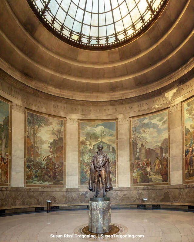
Inside the rotunda at George Rogers Clark National Historical Park, a statue of George Rogers Clark stands beneath the central skylight, surrounded by murals depicting the Revolutionary War campaign.
This victory represents the high point of General Clark’s career. Dispatched by Virginia to safeguard its interests in the Old Northwest, he launched a campaign that included establishing Louisville, Kentucky, and taking several British outposts in the lower Ohio and Mississippi valleys. Although his forces had taken Fort Sackville earlier, news that Hamilton had reclaimed it spurred Clark to undertake a grueling wintertime return march to retake the fort. His success helped the newly formed United States assert control over the territory that would become Ohio, Illinois, Indiana, Michigan, and Wisconsin, as recognized in the 1783 Treaty of Paris.
Take the time to watch the movie at the Park's Visitor Center; it tells the story of Clark's taking of Fort Sackville and is extremely well done.

The Basilica of St. Francis Xavier anchors the Old Cathedral Complex in Vincennes, Indiana, its brick façade and steeple rising above the landscaped grounds.
Old Cathedral Complex
205 Church Street, Vincennes
Locals still call it the Old Cathedral, but the Basilica of St. Francis Xavier stands with quiet grandeur beside the George Rogers Clark National Historical Park, a Greek Revival sentinel completed in 1826 on sacred ground where faith first took root in Indiana.
Long before its limestone facade rose, a rough-hewn log chapel stood here around 1732, and around it Indiana’s first Catholic parish began to grow. Jesuit missionaries formally organized the parish in 1734 on land granted by the French crown; its registers begin in 1749, tracing generations at the very edge of the frontier.
In 1834, Pope Gregory XVI created the Diocese of Vincennes, elevating St. Francis Xavier to cathedral status, a role it held until 1898. The honors didn’t stop there: on March 14, 1970, Pope Paul VI recognized its historic weight by naming it a minor basilica.
This was a place where clergy were shaped and sent. From 1834 to 1898, two of its priests rose to the episcopacy, Benedict Joseph Flaget of Bardstown and Célestin de la Hailandière of Vincennes, while others served as vicars general and seminary rectors. Between 1837 and 1882, seventy-five priests were ordained here, including Michael E. Shawe, the first priest ever ordained in Indiana. In 1847, the cathedral hosted Indiana’s first episcopal consecration, that of Bishop John Stephen Bazin.
Beneath the basilica, the crypt holds the remains of Vincennes’s first four bishops, Simon Bruté, Célestin de la Hailandière, John Stephen Bazin, and Jacques Maurice de St. Palais, while the neighboring cemetery shelters more than 4,000 of the city’s early residents, a silent testament to a community built in faith and endurance.
In 1976, the basilica’s story was etched into the National Register of Historic Places, securing its place not just in Indiana’s past, but in the nation’s.
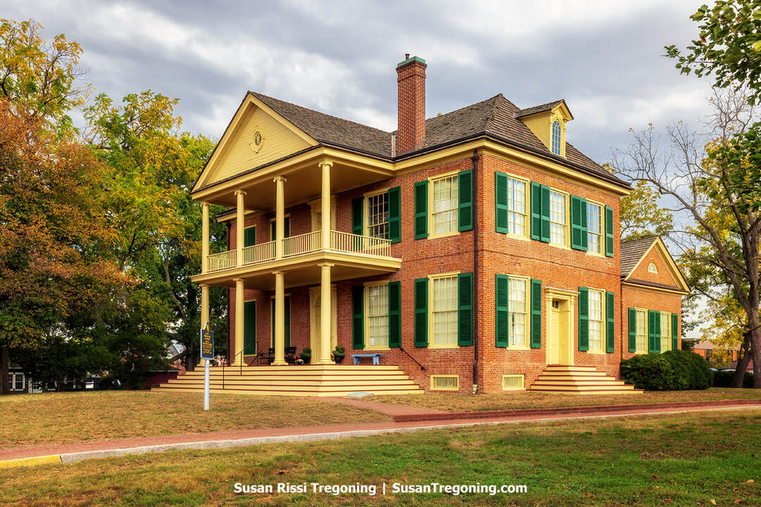
The historic residence known as Grouseland—built for William Henry Harrison during his tenure as governor of the Indiana Territory, features a distinctive brick façade and elegant columned portico.
Grouseland
3 West Scott Street, Vincennes
Before Harrison became the 9th President of the United States, he served 12 years as governor of the Indiana Territory, based in Vincennes, the territory's capital. Arriving in 1801, he purchased 300 acres just beyond the town limits and, anticipating reelection, set out to construct this imposing home. His land is where Vincennes University, Indiana's first school of higher education, stands today.
Between 1802 and 1804, builders erected a red-brick Federal-style mansion, an arresting contrast to the surrounding log structures. Harrison called the estate Grouseland, after the plentiful grouse on the property that he said he favored. With 26 rooms and a price tag of roughly $20,000, it was among the territory’s earliest brick buildings and quickly became a focal point for both social gatherings and government business.
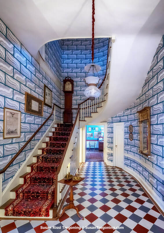
Inside Grouseland, the sweeping staircase and landing‑level grandfather clock create a striking focal point in the historic entry hall.
Harrison was named governor by President John Adams in 1800 at age 27. He governed a thinly populated region centered around Vincennes, a community of about 700 Americans and French. From there, officials managed a jurisdiction larger than that overseen from any city outside Washington, D.C., as had also been true when Vincennes was the capital of the Northwest Territory.
At Grouseland, Harrison entertained legislators and visiting dignitaries and conferred with Native leaders, including Little Turtle and Buckongahelas. Between 1803 and 1809, he concluded eleven treaties that dispossessed Native peoples of lands covering the southern third of present-day Indiana and much of Illinois; five of those agreements, including the 1805 Treaty of Grouseland, were signed in the mansion’s main-floor council chamber.
William Henry Harrison, his wife Anna Tuthill (Symmes) Harrison, and their family lived at Grouseland until 1812. At least three of their ten children, among them John Scott Harrison, were born there.
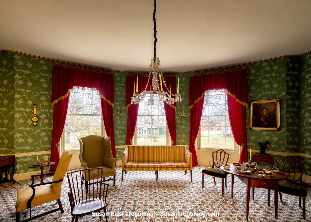
The formal parlor at Grouseland reflects William Henry Harrison’s period style, with its ornate wallpaper, upholstered seating, and table set for tea beneath a crystal chandelier.
His son, John Scott Harrison became a politician who represented Ohio in the U.S. House of Representatives and was the father of the 23rd US president, Benjamin Harrison. He is the only person to have been both the son and the father of a U.S. president.
Today, Grouseland, also known as the William Henry Harrison Mansion and Museum, is recognized as a National Historic Landmark for its Federal-style architecture and historical significance. It was designated a National Historic Landmark in 1960 and added to the National Register of Historic Places in 1966.
Grouseland tours are available upon request, just ring the front doorbell to gain entry to the home. For further details, see the website linked above.
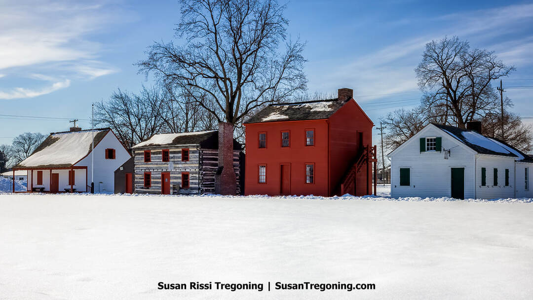
A snowy scene at the Vincennes State Historic Sites showcases the red Old Indiana Territorial Capitol alongside early territorial‑era structures.
Vincennes State Historic Sites
1 West Harrison Street, Vincennes
The tours start at the on-site log-cabin visitor center. History buffs should not skip this; it’s one of the best tours I’ve taken in ages.
Old Indiana Territorial Capitol
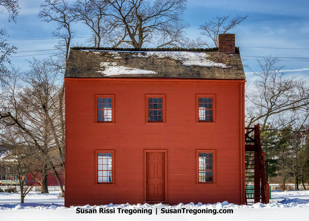
The “Red House,” Indiana’s early Territorial Capitol in Vincennes, appears here in winter, its simple wooden construction and bold red paint contrasting with the surrounding snow.
The Indiana Territorial Capitol, in Vincennes, is widely regarded as the Midwest's oldest significant government structure. Erected in 1805 as a tailor's shop, the modest two-story building features timber framing secured with wooden pegs. From 1805 to 1813, it was among three structures leased for legislative use, and in 1811, following the Battle of Tippecanoe, it hosted the territorial legislature's session. The seat of government was relocated to Corydon in 1813, and when Indiana achieved statehood in 1816, Corydon became the first state capital.
Known as the "Red House," the building was relocated to its current location in 1949, added to the National Register of Historic Places in 1973, and now sits within the Vincennes Historic District.
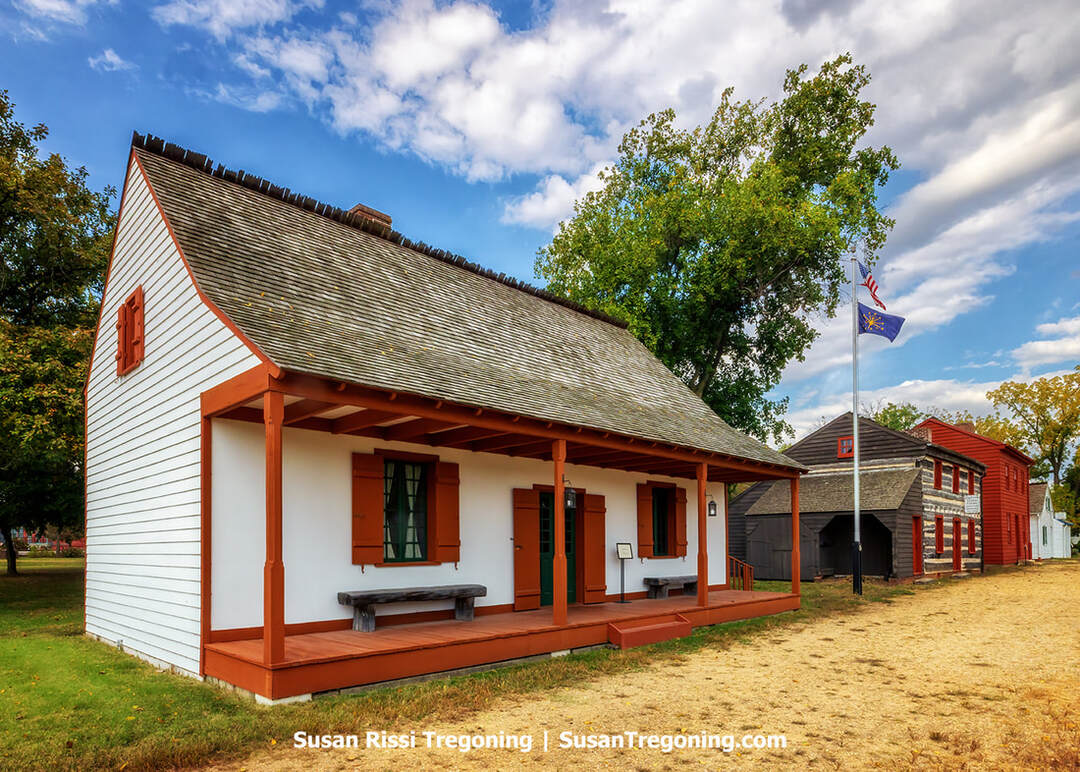
At the Vincennes State Historic Sites, Jefferson Academy’s white façade and deep orange detailing reflect the simplicity of early territorial‑era architecture.
Jefferson Academy
Before it took the name Vincennes University in 1806, the Jefferson Academy stood as Indiana's earliest institution of higher learning and one of the nation's oldest. Established in 1801 by Territorial Governor William Henry Harrison, the school operated from a single room in the church rectory, where Catholic clergy taught courses such as Latin, French, geometry, and geography.
The academy's headmaster was the village priest, Father Jean François Rivet, who was formerly a Latin professor at the Royal College of Limoges in France.
Notably, Harrison and Thomas Jefferson are the only two U.S. presidents known to have founded colleges. Through its brief but formative life, the Jefferson Academy exemplified the beginnings of public education in the Indiana Territory before evolving into Vincennes University.
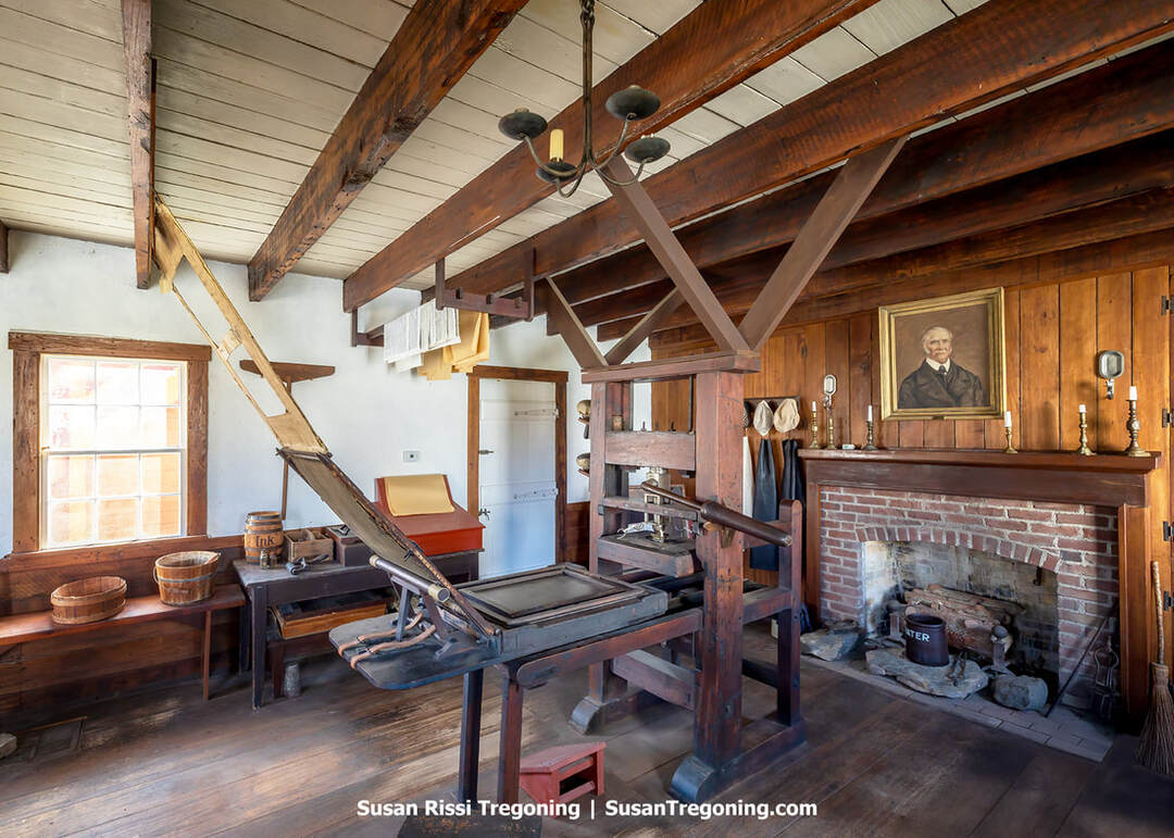
Inside the Elihu Stout Print Shop at the Vincennes State Historic Sites, an authentic Adam Ramage printing press anchors the historic workspace.
Elihu Stout Print Shop
In 1804, Governor William Henry Harrison recruited Elihu Stout to Vincennes to print the statutes passed by the Indiana Territory's legislature. Before that, Stout had worked in Lexington as a journeyman at the Kentucky Gazette. That July, he launched the Indiana Gazette, Indiana's first newspaper, which continued publishing for 41 years. Stout's operation symbolizes how communication fueled westward expansion; as Americans moved west, reliable news and legal information were essential to the formation of new states.
The Elihu Stout Print Shop standing in today's Vincennes is a reconstruction of his original workplace. Still, the wooden press on display is an authentic Adam Ramage model, the same kind Stout used. Disaster struck in 1806 when his first shop and press were lost to a fire, yet he quickly secured resources to resume publication, and by July 1807, the paper was again being printed and delivered to subscribers.
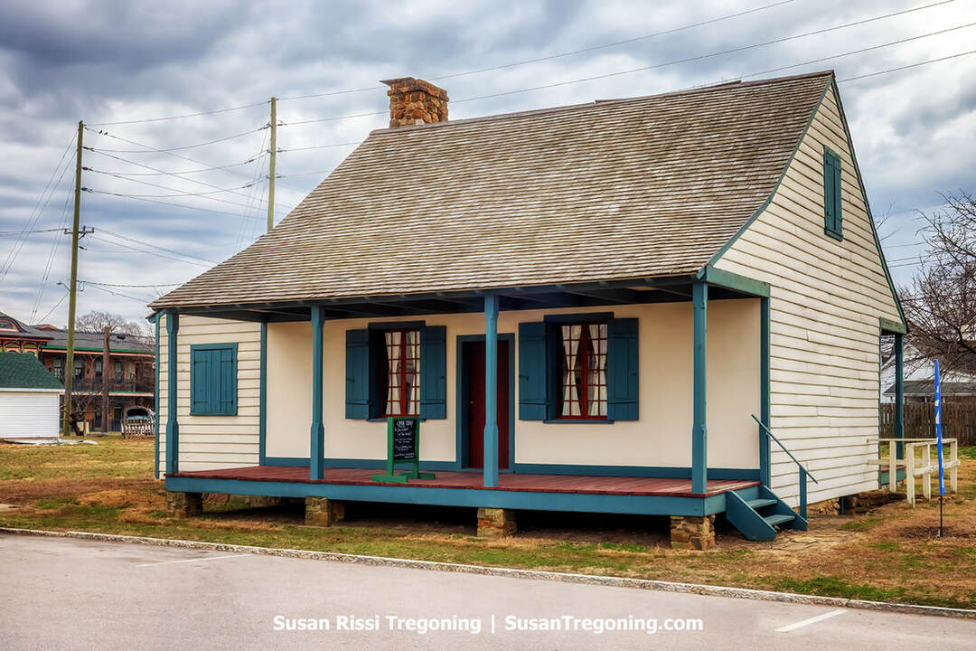
The Old French House, an authentic French Creole residence and the last surviving post‑on‑sill dwelling in Indiana.
Old French House
509 North 1st Street, Vincennes
Known as the Old French House, this authentic French Creole residence went up sometime between 1806 and 1809. It belonged to Michel Brouillet, a Vincennes native born in 1774, who spent most of his life in the fur trade. During the War of 1812, Brouillet served as a scout and courier on the route between Vincennes and Fort Harrison near present-day Terre Haute, Indiana.
Architecturally, the house typifies French building traditions common across the Mississippi Valley in the 1700s and early 1800s. Whereas American log cabins rely on stacked horizontal logs, this Creole method sets vertical cedar posts into a horizontal sill. The spaces between were packed with bousillage, a mud-and-straw infill also spelled bousiage.
It is the last surviving French Creole post-on-sill dwelling in Indiana, a rare link to the region's early French settlers. The Vincennes State Historic Sites operates it, and the home is included in the Territorial Capitol tour.
Indiana Military Museum
715 South 6th St., Vincennes
As a boy, Jim R. Osborne got his start in military collecting when a neighbor passed along a stash of German war trophies. By the late 1960s, he had moved on to acquiring military vehicles as well. Encouraged by friends, he established the Indiana Military Museum in 1982 and opened its doors to visitors two years later. His collection is quite impressive.
For more Vincennes and Knox County travel information, see Visit Vincennes.
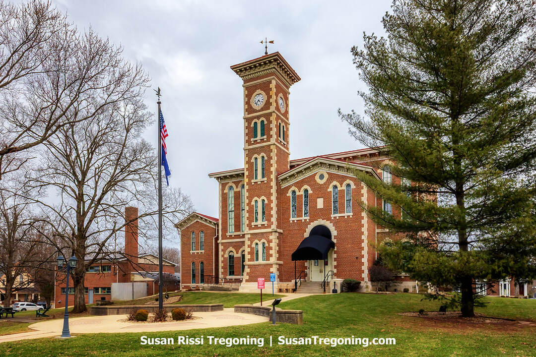
Daviess County
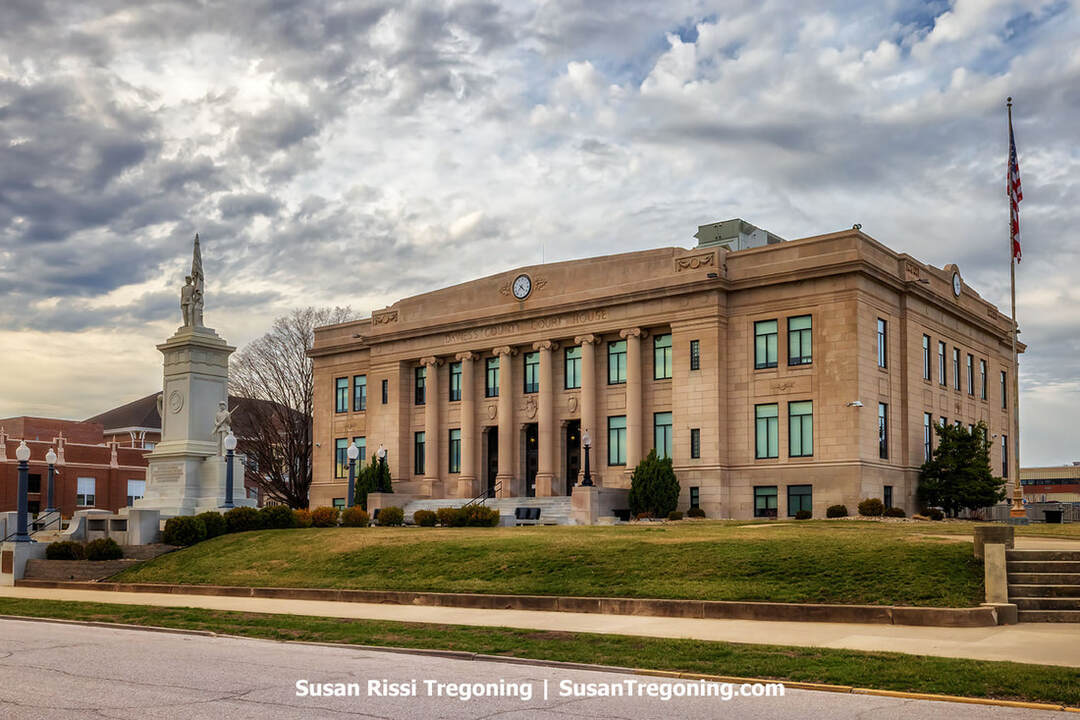
Designed by Sutton & Routt of Vincennes and dedicated in 1929, the Daviess County Courthouse in Washington, Indiana, exemplifies the Classical Revival style with its brick construction and Bedford limestone detailing. The south pavilion features six freestanding Ionic columns whose phoenix‑themed capitals symbolize the courthouse’s rebirth after the 1927 fire. A notable 1900 American Civil War memorial on the southwest lawn survived that blaze, while a second fire in 1985 severely damaged the original second‑floor courtroom, prompting later restoration.
Washington
Formed on February 2, 1818, out of Knox County, Daviess County, Indiana, traces its story from Indigenous roots to its present-day role as a regional agricultural and industrial center. Its name honors Major Joseph Hamilton Daveiss, the Kentucky U.S. District Attorney who died at the Battle of Tippecanoe in 1811.
Daviess County’s development drew early strength from the Wabash and Erie Canal and the timber and coal industries. The county also played a part in the Underground Railroad, where local households sheltered and supplied freedom seekers heading toward Canada. The railroad soon defined the region’s economy: a line reached Washington in 1857, and by 1889, the town served as a major depot and repair hub for the Ohio and Mississippi Railroad. The Baltimore and Ohio Railroad assumed control in 1893 and, at its height, employed more than 1,000 people. Today, only the depot survives as a reminder of that era.
Beginning in the 1860s, Amish families from Allen County, Indiana, and Stark County, Ohio, settled in Daviess County. The community has grown into the state’s fourth-largest Amish population, and visitors will find multiple Amish restaurants in the area.
Washington’s role as a regional marketplace, especially in agriculture and railroading, is reflected in the Washington Commercial Historic District, notable for its architecture. The Daviess County Museum, housed in Washington’s former Masonic Lodge (built in 1869), preserves over two centuries of local history.
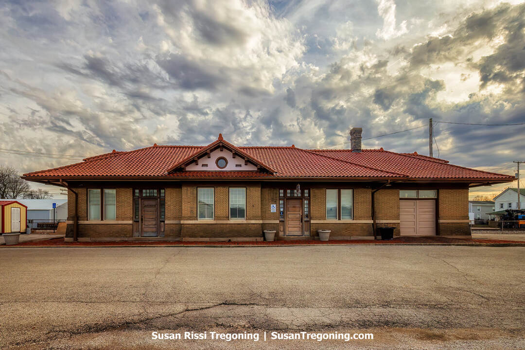
The restored 1906 B&O Southwestern Railroad Depot in Washington, Indiana—an iconic Mission Revival rail hub with deep industrial and presidential history.
Completed in 1906, the Baltimore & Ohio (B&O) Southwestern Railroad Depot in Washington, Indiana, was designed in the Mission Revival style and quickly became central to the town’s industrial growth. As a major regional rail hub, it supported manufacturing, locomotive overhauls, and caboose construction, helping shape the local economy. Now a contributing property within the Washington Commercial Historic District, the depot was restored in 1990. President Dwight D. Eisenhower’s funeral train paused here on April 1, 1969, an event later commemorated by an Indiana Historical Bureau marker installed in 1992. The depot’s history also reflects broader regional rail changes, including the removal of connections linking the New York Central/Conrail lines to the B&O between 1981 and 1985.
For more travel information, see Visit Daviess County.
Martin County
Shoals
Founded in 1844 as Memphis, the community later adopted the name Shoals, inspired by the shallow stretches of the East Fork White River. It grew into a key river settlement in Martin County and was named the county seat in 1871. Its expansion took off after 1857, when the Ohio and Mississippi Railroad, later folded into the B&O, was completed through town, creating a St. Louis–Cincinnati link. To mark the connection, a ceremonial golden spike was driven in Shoals.
By the end of the nineteenth century, local enterprises included sawmills, a planing mill, leather production, pottery works, and flour mills. In the early twentieth century, Shoals gained recognition for producing buttons made from mother-of-pearl mussel shells harvested from the White River. Midcentury development shifted toward mining: beginning in the 1950s, the National Gypsum Mine opened and ultimately reached a depth of 515 feet, then the deepest gypsum mine in the nation. Notable historic elements include the courthouse, in continuous use since Shoals became the county seat, and relics of the rail era, such as a former pump station.
On the night of September 17, 1861, while a portion of the 19th Illinois Volunteer Infantry Regiment was traveling through Martin County on the Ohio & Mississippi Railroad, tragedy struck at Beaver Creek near Willow Valley: the bridge failed as a locomotive crossed it. The wreck occurred near Willow Valley, about three and a half miles east of Shoals. That stretch of track was abandoned in 1900 and is now Deep Cut Lake Road. The most credible evidence places the bridge crossing south of the US Gypsum Plant, close to the “Deep Cut.”
Jug Rock
Right on 50 where it intersects with Albright Lane, Shoals
On 50, there's a pull-off just large enough for one car and a small sign pointing to the path down to the rock. I didn't go down in the winter; it was easy to see through the barren trees.
Jug Rock is a striking 60 foot tall sandstone “table” formation in the valley of the East Fork of the White River. Geologists regard it with special interest because it is the largest free-standing table rock, found anywhere east of the Mississippi River. The formation belongs to the Mansfield Formation, deposited during the Pennsylvanian period, roughly 325–286 million years ago. Over time, erosion exploited natural fractures, cutting Jug Rock away from an adjacent cliff. Facing it across the way stands a related feature known as House Rock.
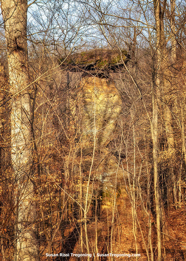
Jug Rock Shoals in Indiana, where a massive stone formation stands quietly within a dense forest of bare winter trees.
As a tribute to Jug Rock, Shoals High School’s athletic teams go by the name Jug Rox, and their mascot is the Roxer Boxer.
Martin County Museum
220 Capital Avenue, Shoals
Once the seat of county government, the 1876 Martin County Courthouse in Shoals now serves as the Martin County Museum, its central tower rising above the historic grounds.
Housed in the 1876 courthouse, the Martin County Museum showcases striking turn-of-the-century design and preserves a rich trove of the county’s history. It is open from May to November.
A new courthouse rose in 1876 after a fire that same year destroyed its predecessor in West Shoals. Designed by architect William George and built on the very site of the lost building, the two-story structure combines Greek Revival and Italianate influences. Local sandstone forms its foundation, with red brick above (now painted), and a central cupola and arched second-story windows give it a distinctive profile.
From 1876 until 2002, this courthouse functioned as Martin County’s seat of government. Recognized for its architectural and historical significance, it is listed on the National Register of Historic Places and stands as a symbol of the county’s resilience.
When a new courthouse was erected in 2002–2003, the 1876 building found a second life as the Martin County Historical Society & Museum. Today, it houses archival records, a preserved courtroom, and a range of exhibits documenting the area’s past.
Martin State Forest
14040 Williams Road, Shoals
Martin State Forest began in 1932 with an initial acquisition of 1,205 acres. A fire tower and a small picnic spot were added soon after. In 1933, the Civilian Conservation Corps built several shelters. Three fishing ponds, each about 3 to 4 acres in size, were built in 1957. By the mid-1960s, a primitive campground with 26 sites had been developed.
Through later purchases and land swaps with the U.S. Forest Service, the property expanded to 7,863 acres. Much of what was obtained consisted of eroded, abandoned farmland or heavily logged woods. After years of focused stewardship, planting thousands of trees, spending countless hours suppressing wildfires, and conducting selective improvement harvests across hundreds of acres, the landscape has been restored into a thriving, vigorous forest.
For more travel information for Martin County, see Visit Martin County.
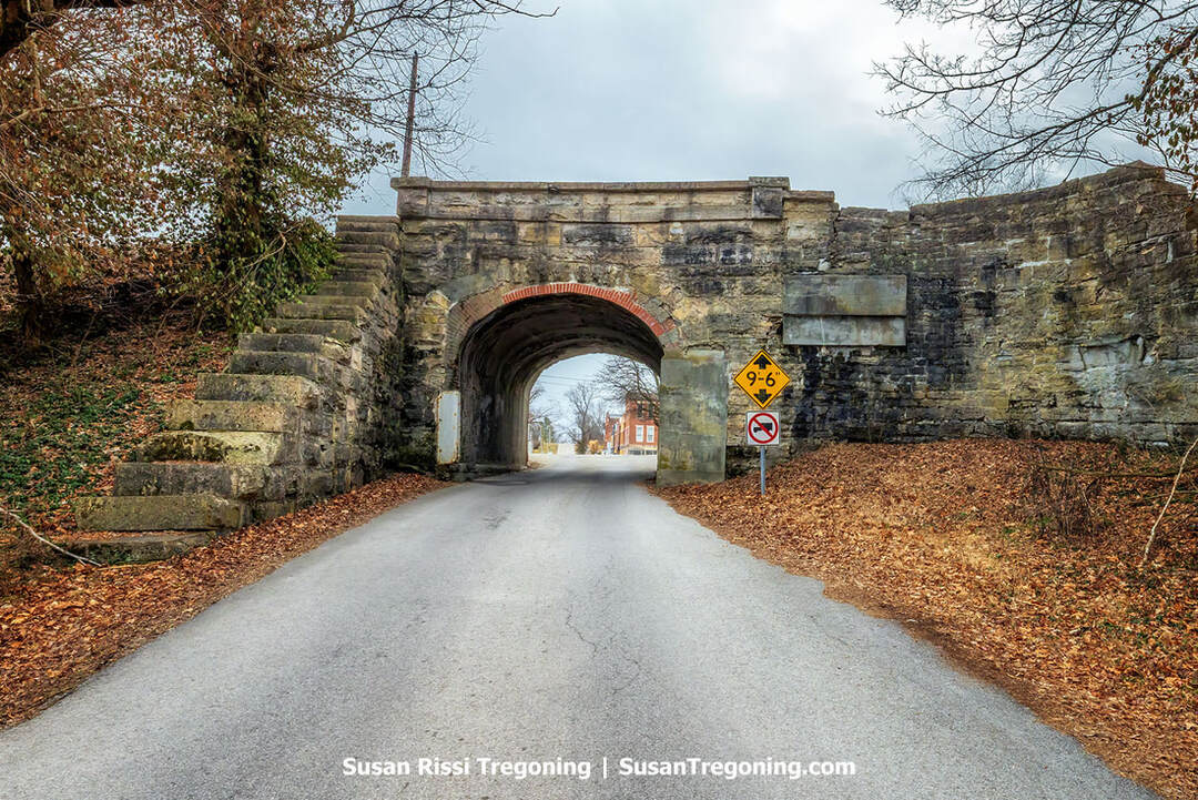
The North Spur
A note about the covered bridges: On Google Maps, all eight of the covered bridges are easy to find by name, so if you have your phone handy, you shouldn't have any problems locating any of them. One exception is Otter Creek Covered Bridge, which is listed as “Holton Covered Bridge,” reflecting the name of the town where it’s found.
Along the Byway, you will come across several J.J. Daniels' Covered Bridges. Joseph "J.J." Daniels is regarded as Indiana’s most prolific covered-bridge builder. He may have produced as many as 60 bridges, with documentation confirming 53 of them; 15 of his bridges survive today, eight in Parke County, three along the Historic Pathways Byway and the remainder scattered throughout the state. If you are interested in learning more about JJ Daniels, see my article, A Guide to Parke County, Indiana: The Covered Bridge Capital of America. I have written a segment about his background at the beginning of that post.
Lawrence County
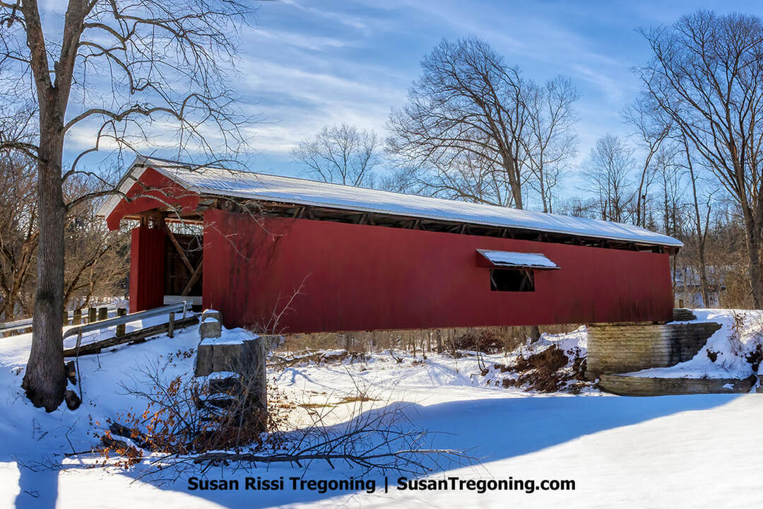
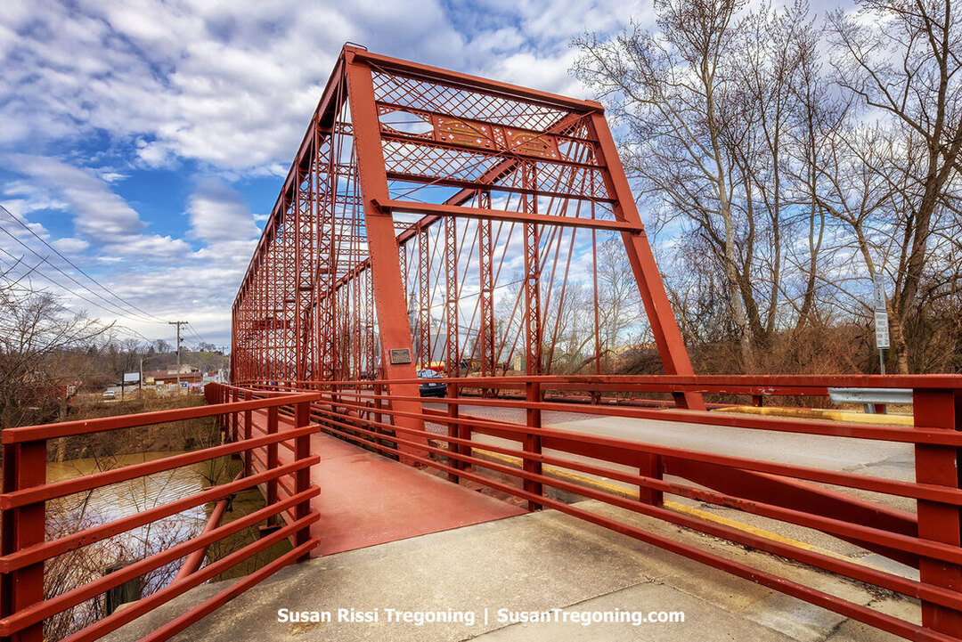
On a frigid, snow‑blanketed day, the Williams Covered Bridge stretches across the partly iced East Fork of the White River in Lawrence County.
Williams Covered Bridge
Huron and Williams Road, Williams | GPS: 38.7968364,-86.6676916
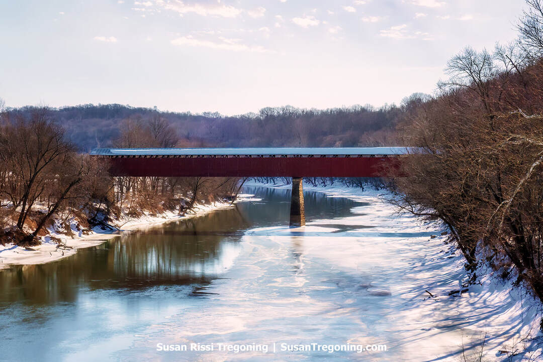
Built in 1884, the Williams Covered Bridge is a two-span wooden structure measuring 373 feet. It once carried the Huron and Williams Road over the East Fork of the White River in the community of Williams, and is located about seven miles from Huron.
The bridge uses a Howe truss and was erected by Joseph “J.J.” Daniels. Although Daniels favored the Burr Arch truss, he sometimes employed the Howe design.
The Williams Covered Bridge joined the National Register of Historic Places in 1981. At that time, it was Indiana’s longest covered bridge still open to vehicles, but it was closed to traffic in 2010. At 434 feet, the Medora Covered Bridge remains the state's longest.
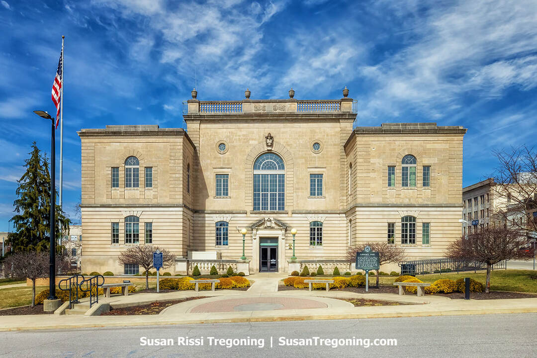
The Lawrence County Courthouse in Bedford, completed in 1930 to plans by architect Walter Scholer, stands as a three‑story Neoclassical landmark built of locally quarried limestone. It is the county’s sixth courthouse and contributes to the Bedford Courthouse Square Historic District on the National Register of Historic Places.
Bedford
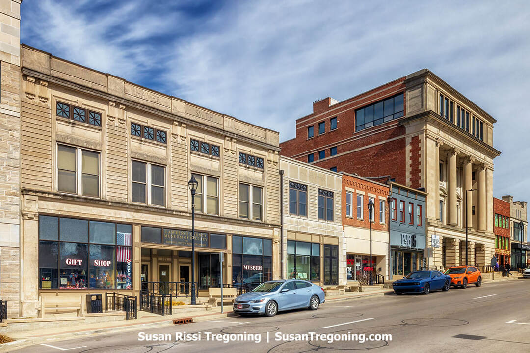
Bedford proudly calls itself the "Limestone Capital of the World". Its Oolitic limestone has been quarried since the 19th century, valued for its strength, uniformity, and ease of carving.
Bedford stone helped build American icons, including the Empire State Building, the Pentagon, Biltmore Estate, and Rockefeller Center. Remarkably, Bedford limestone supplied the stone for 35 of the nation’s 50 state capitol buildings and for nearly all of Indiana’s 92 county courthouses, as well as countless other courthouses and college campuses throughout the US. You can see that legacy in downtown facades, historic monuments, and during the annual Limestone Heritage Festival held in June.
The Bedford Limestone Walking Tour is a great way to see the town.
Bluespring Caverns
1459 Bluespring Caverns Road, Bedford
Bluespring Caverns features the nation’s longest underground river, tours last about one hour, and may be suspended when water levels are high.
Descend 100 feet to a constant 53°F and travel more than a mile by guide-operated, custom boats through the subterranean waterway. Along the way, you’ll spot native rarities like Northern blind cavefish and blind crayfish. At the same time, guides describe the ongoing geologic forces shaping vast chambers beneath southern Indiana’s rolling hills.
Greenhill Cemetery
1202 18th Street, Bedford
Greenhill Cemetery’s headstones are an excellent example of early limestone carving. The link above takes you to a self-guided walking tour of the cemetery that I found on Facebook. I do not recommend using the link on the Greenhill Cemetery website; it has been hijacked and may contain viruses.
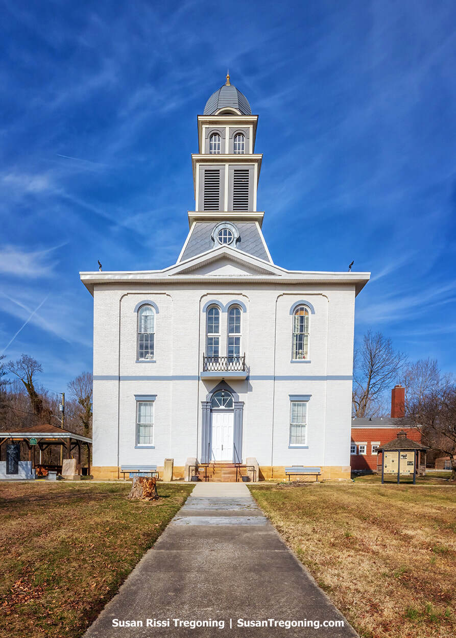
The Hamer‑Smith Building in Bedford, commissioned by James Frank Hamer—grandson of mill owner Hugh Hamer of Spring Mill fame—has housed an evolving mix of businesses since its early years as the Hamer & Day furniture and undertaking establishment. Over the decades it served medical and dental offices, dry‑goods shops, a glove manufacturer, the Bedford Fruit Store, and the New Home Hotel before becoming best known as the longtime home of the Buck Lemon Furniture Company, which operated here from the 1930s until 1998. Acquired in 2000 by the Lawrence County Historical and Genealogical Society, the building underwent extensive restoration between 2001 and 2005 to become the Lawrence County Museum of History, earning a Historic Preservation Award for its rehabilitation.
Lawrence County Museum of History
929 15th Street, Bedford
The Lawrence County Museum of History anchors the community’s efforts to protect and share its past. At its heart are a 2,400-square-foot exhibition space and the Edward L. Hutton Research Library, which preserves extensive genealogical and historical materials reaching back to 1818.
The museum’s displays are arranged around key local stories. Visitors will find tributes to Lawrence County’s own NASA astronauts, Virgil I. “Gus” Grissom, Kenneth D. Bowersox, and Charles D. Walker, alongside finely crafted carvings by area artisans that reflect the county’s internationally renowned limestone trade. Military history is represented from the American Revolution through the Korean War with uniforms, medals, and flags. A highlight is a large 1934 model of the Spring Mill State Park gristmill and its village. Quirkier treasures include “dressed fleas,” a 19th-century grand piano, period apparel, and a fluoroscope (X-ray device) once used to fit shoes.
In the Edward L. Hutton Research Library, floor-to-ceiling shelves hold family folders, microfilmed local newspapers dating to the 1830s, and school yearbooks. The Gift Shop helps sustain the museum by offering limestone-themed keepsakes, books by local authors, and reproductions of vintage photographs.
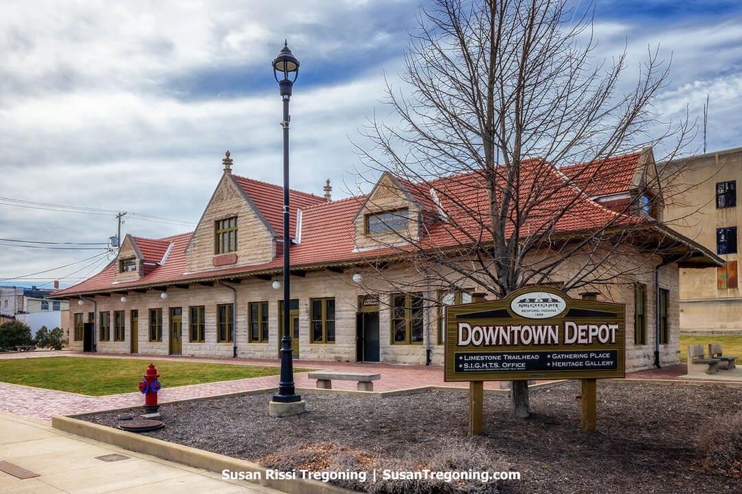
Once a proud limestone showpiece for the Southern Indiana Railroad and later the Milwaukee Road, Bedford’s 1899–1900 Milwaukee Railroad Depot was rescued from deterioration, moved downtown in 2016, and reopened in 2017 as a community gathering place and trailhead.
The depot handled traffic for the Chicago, Milwaukee, St. Paul and Pacific Railroad until 1921, when the Milwaukee Road assumed control of the line, making it the only line east of Chicago owned by a western railroad. Its elaborate facade doubled as a showcase for Bedford's claim as the Limestone Capital of the World. The last passenger train departed on July 15, 1950. The building then sat idle for many years and suffered heavy deterioration.
This single-story landmark is defined by limestone walls, a red clay tile roof, and finely carved ornamentation, mirroring the areas stonecraft tradition. It remains a prominent emblem of Bedford's railroad and limestone legacy.
Rescue came through the Stellar Communities Program. In 2016, the 135-ton structure was hauled by truck from its site near 10th and J Streets to a new location at 14th and J Streets in downtown Bedford. Reopened in 2017, the Downtown Milwaukee Depot now operates as a community event venue and as the trailhead for the Limestone Trail System.
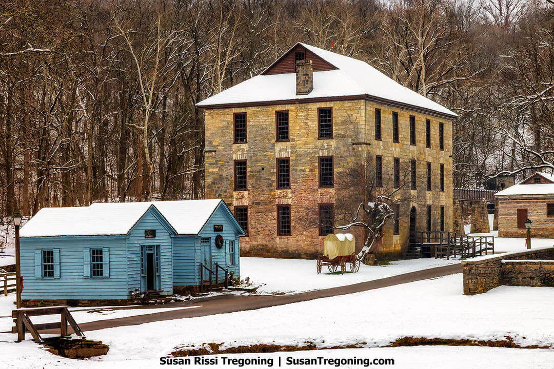
The 1817 three‑story limestone grist mill rises above the snowy pioneer village at Spring Mill State Park, its massive stone walls dominating the winter landscape.
Spring Mill State Park
3333 IN-60 E, Mitchell
Near Mitchell, a frontier settlement took shape in 1814 around cave-fed springs that flowed year-round without freezing. Those springs powered an integrated industrial site, saw and woolen works, a distillery, and, most notably, a limestone gristmill completed in 1817, which made the community a lively trading center. A tavern stood nearby, and a post office began service in 1832.
Samuel Jackson founded the village, but in 1831, Hugh and Thomas Hamer acquired it, expanded its commercial reach, and served as postmasters. Even so, when rail lines reached Mitchell in the 1850s, steam-driven plants outcompeted water power, and the once-busy village slipped into decline, becoming nearly a ghost town by the late 1800s.
In the late 1920s, Lehigh Portland Cement Company deeded the property to Indiana. The Civilian Conservation Corps rehabilitated the mill and several other structures, and the site opened to the public as Spring Mill State Park in 1930. Today, the 1,358-acre park blends early Hoosier industry and striking karst landscapes with a touch of Space Age history, and it offers dining, lodging, and campsites.
The Upper Residence at Spring Mill State Park, once lodging for the Bullitt Brothers during their visits from Louisville and later the home of mill owner Hugh Hamer, stands quietly in the snow within the pioneer village.
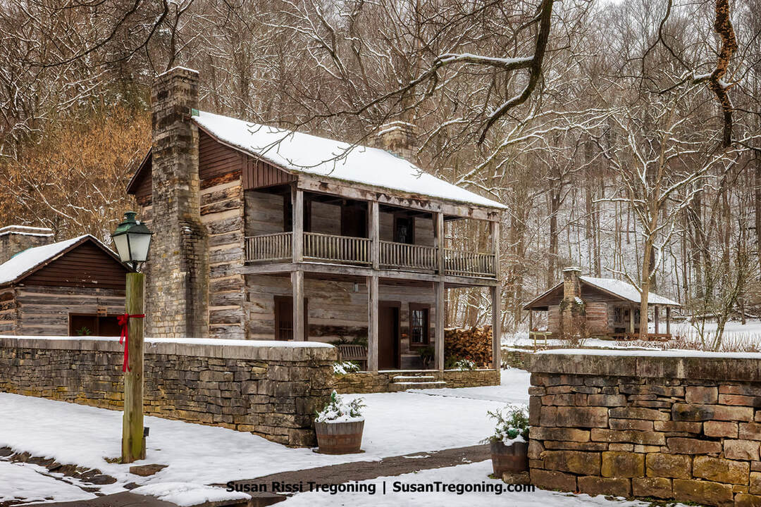
The reconstructed Pioneer Village presents about 20 historic buildings, among them the still-operating 1817 stone gristmill that grinds corn, a tavern, a combined nursery and schoolroom, and the Hamer residences, interpreting daily life around 1863. Open all year, the village features seasonal interpreters who demonstrate mid-19th-century skills such as blacksmithing and weaving, as practiced in 1863.
The park also houses the Gus Grissom Memorial, honoring Mitchell native and Mercury Seven astronaut Virgil “Gus” Grissom, with exhibits that include the Gemini 3 capsule “Molly Brown,” his spacesuit, and personal artifacts.
The park’s cave system includes Donaldson, Bronson, and the Twin Caves. In summer, visitors can take a guided boat ride of roughly 500 feet through Twin Caves to view dramatic rock formations and possibly glimpse the endangered blind cavefish.
Perched above Spring Mill Lake, a Nature Center offers live animal displays, such as snakes and turtles, bird-viewing windows, and interactive areas for children.
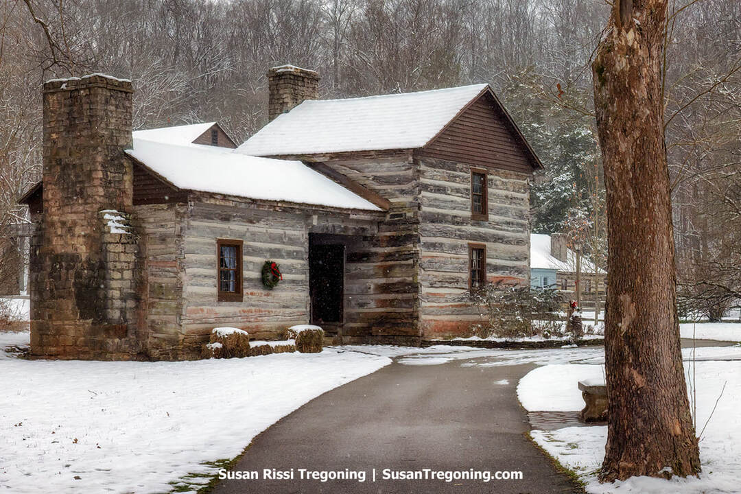
At the entrance to Spring Mill’s Pioneer Village, the Weaver Cabin—built around 1816 for George and Elizabeth Sheeks—sits quietly in the snow, marked for the season with a Christmas wreath. The oldest known dwelling in Lawrence County, it later became known for the loom George crafted as Elizabeth’s wedding gift.
Their daughter, also named Elizabeth, married Daniel Bass; together they became the parents of the famed outlaw Sam Bass, who, along with his gang, is responsible for the largest train robbery ever committed in the United States.
Jackson County
Vallonia
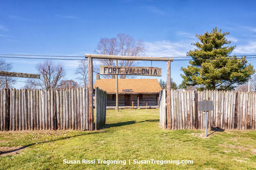
Rebuilt to honor the early frontier fort, the replica Fort Vallonia greets visitors with its wooden palisade and garrison headquarters cabin beyond the gate.
Fort Vallonia
2382 S Main St., Vallonia
Once Fort Vallonia, the town began as a French outpost in the late 1700s and later served as a frontier stronghold in the 1800s. The original settlement stood between the Muscatatuck River and the east fork of the White River. Around 1810, conflict flared between settlers and Native Americans. In response, Governor General William Henry Harrison ordered the construction of a fort and additional defenses, a large stockade, a garrison, blockhouses, and a protected spring safeguarding roughly ninety local families. During the War of 1812, two companies of Indiana Rangers were posted there.
In 1968, the Lions Club began building a replica of the historic fort. The museum was dedicated in 1972, and the fort's gateposts were installed. In 1991, the Garrison House was added at the center of the grounds.
Today, Vallonia celebrates Fort Vallonia Days on the third weekend of October.
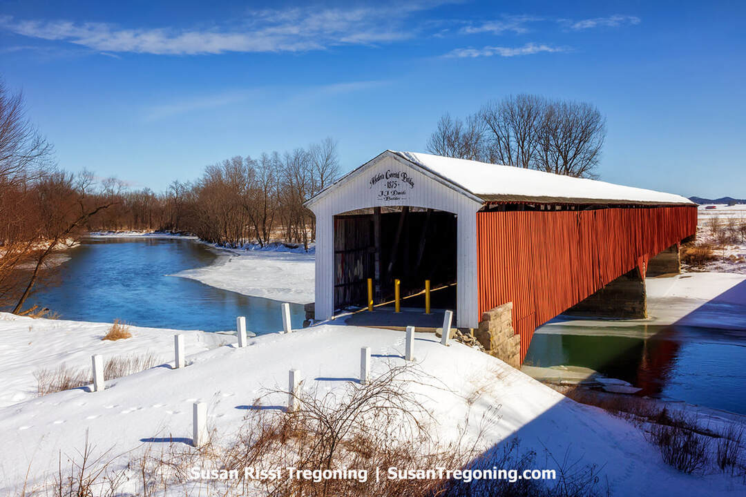
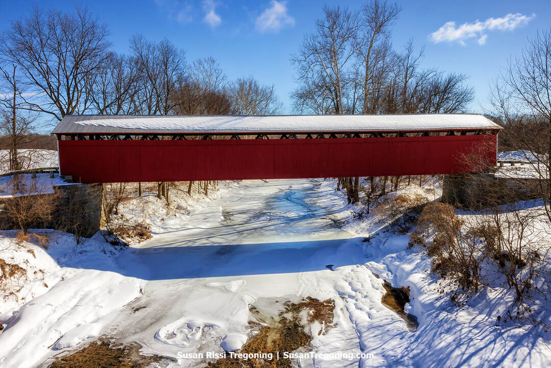
The historic Medora Covered Bridge, the longest historic covered bridge in the United States, stretches across the East Fork White River in a quiet winter landscape.
Medora Covered Bridge
IN-235, Vallonia | Between Vallonia and Medora
Measuring 431 feet, 10 inches, the Medora Covered Bridge spans the East Fork of the White River about a mile east of Medora, running alongside State Road 235. It is recognized as the longest historic covered bridge remaining in the United States. Its 19th-century truss remains intact, repaired where needed but never structurally altered.
J. J. Daniels built the bridge in 1875 for $18,142, completing the work in nine months. The covering was added to shield the truss from weather, replacing an earlier ferry crossing at the site.
An unverified account suggests the bridge once had a central wooden railing to separate two-way traffic; as vehicles became wider, the railing was removed, and the span was used in one direction. The bridge carried US 50 until 1935, when the highway shifted four miles north. Threatened with demolition in 1968 as a modern bridge was planned, it was spared by Governor Whitcomb's order in 1971; the new bridge opened in 1973, and the covered bridge was closed to vehicles. It was listed on the National Register of Historic Places in 2007 and underwent rehabilitation in 2011.
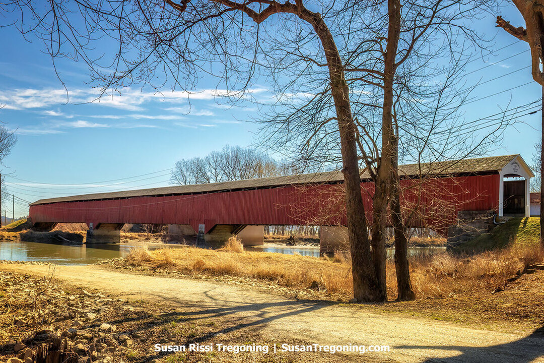
The triple‑span Medora Covered Bridge, a J.J. Daniels landmark from 1875, reaches across the East Fork White River amid a peaceful winter scene.
Just 4.5 miles off U.S. Highway 50 and close to Fort Vallonia, the oldest settlement in Jackson County, Starve Hollow was established in 1938 and features a 145-acre lake along with fishing, camping, hiking, swimming, and other recreation.
Jackson-Washington State Forest/Skyline Drive
1278 East State Road 250, Brownstown
Just two miles off US Highway 50, this more-than-7,000-acre tract in Jackson County lies within Southern Indiana's knobs region. Skyline Drive, at 908 feet, is one of Jackson County's highest elevations, with its many high-elevation overlooks offering sweeping panoramas. It's absolutely gorgeous in the autumn.
The loop is closed annually from the first measurable snowfall until April 1.
Visitors can enjoy hiking, biking, camping, fishing, and horseback riding. Don't miss the impressive vistas from the fire tower.
Seymour
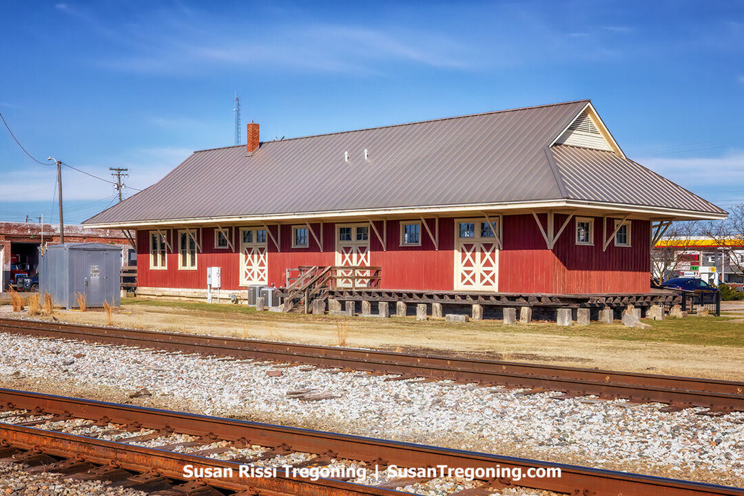
The historic Southern Indiana Railroad Freighthouse, the last surviving depot in Seymour, stands as the sole remnant of a town that once had three railroad stations.
Seymour, Indiana, grew up around the railroad. In its busiest years, three depots served the town, each feeding the steady flow of freight and passengers that shaped the community. Today, only one remains, the Southern Indiana Railroad Freighthouse, a 1901 structure that once handled the town’s freight traffic and now serves as the Jackson County Visitor Center. Its long wooden frame and wide eaves still feel rooted in the era when the rails ruled everything. But the tracks beside the Freighthouse hold a darker story too, one that made Seymour famous far beyond Indiana.
In 1866, the Reno Gang, a group of local brothers already known for trouble, pulled off something no one had dared before: the first robbery of a moving train in the United States. Just outside Seymour, they boarded an Ohio & Mississippi Railroad train under the cover of darkness, subdued the guard, and tossed bags of cash and gold off the moving cars. The heist shocked the nation and inspired generations of outlaws.
Their crime spree didn’t last. By 1868, the Pinkerton detectives were closing in, and the brothers were captured and taken to the Floyd County Jail in New Albany. But public anger had reached a breaking point. In the early hours of December 11, 1868, a vigilante group stormed the jail, dragged Frank, William, and Simeon Reno from their cells, and hanged them inside the building. Their brother John, imprisoned elsewhere, escaped the same fate.
The three hanged brothers were brought back to Jackson County and buried together in Seymour’s City Cemetery, where their graves remain today and have become a local tourist stop.
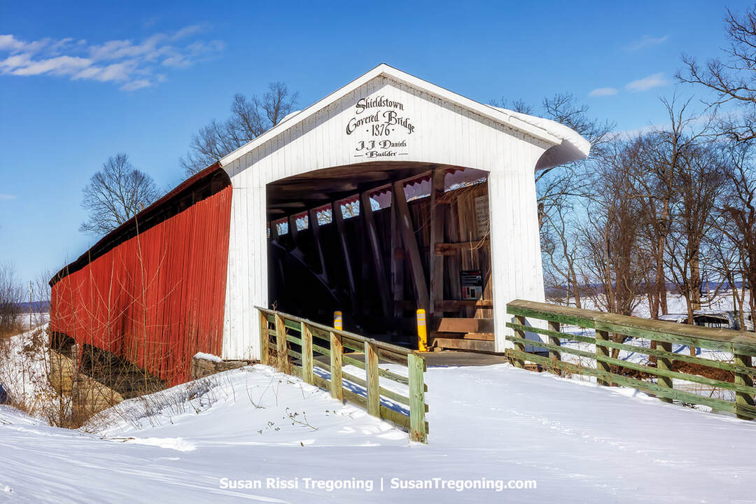
The historic Shieldstown Covered Bridge—completed in 1876 by master builder J.J. Daniels—spans the winter scene with its red walls and white‑trimmed portal.
Shieldstown Covered Bridge
1917 East CR 200N, Seymour
Completed in 1876, the Shieldstown Covered Bridge stretches over the East Fork of the White River and was once known as the Shields’ Mill Covered Bridge. This wooden, two-span crossing measures 365 feet 6 inches and rests on a cut-limestone center pier with stone abutments. Noted builder JJ Daniels erected it for $13,600, employing a Burr-arch truss strengthened by multiple king posts and using minimal metal hardware. The bridge took its name from the nearby family-operated mill in the village of Shields and served as a vital route for farmers transporting crops to be milled.
Closed to motor traffic in 1970, it was listed on the National Register of Historic Places in 2016 and underwent a 2019 restoration that cost over $1 million.

Snowflakes swirl as a sandhill crane launches from a cornfield in the Ewing Bottoms.
Created in 1966, Muscatatuck National Wildlife Refuge near Seymour spans 7,724 acres, including the 78-acre Restle Unit, and serves as a key refueling stop for migrating waterfowl. More than 280 bird species have been recorded there, earning it recognition as a bird area of continental significance.
The refuge is among Indiana’s premier winter viewing sites for Sandhill Cranes. Migration activity starts in October, but local numbers typically peak in December and January, with a few birds staying around through February. By day, cranes usually feed in surrounding farm fields rather than on refuge lands; at about 15–45 minutes after sunset, they fly back to the refuge’s protected wetlands to roost.
To minimize disturbance, the main roosting marshes are closed to visitors. Good viewing is often from refuge edges or designated open trails. Within the refuge, Endicott Marsh is a known gathering spot, and the west side, where Sandy Branch enters Moss Lake, also offers excellent crane habitat.
U.S. Highway 31 forms the refuge’s western border. Reliable places to look include the bean and corn fields immediately west of Highway 31, south of the Seymour Westside Walmart, and along Farmington Road. Large flocks also use the Ewing Bottoms along the White River north and west of Brownstown, especially on W County Road 100N and N County Road 150W. The old B&O Train Depot at 115 N Front St and the West Spring Street intersection sits at the town’s edge and helps pinpoint the Ewing Bottoms area. West Spring Street becomes County Road 100N as you exit the city limits.
I visited twice. I found a sizable flock in the Ewing Bottoms on the first trip. On the second trip, I found a sizable sedge of cranes feeding in the fields on 235 between Medora and the Medora Covered Bridge.

Two sandhill cranes glide across the sky near Medora.
Jennings County
Scipio Covered Bridge
North CR 575W, Scipio
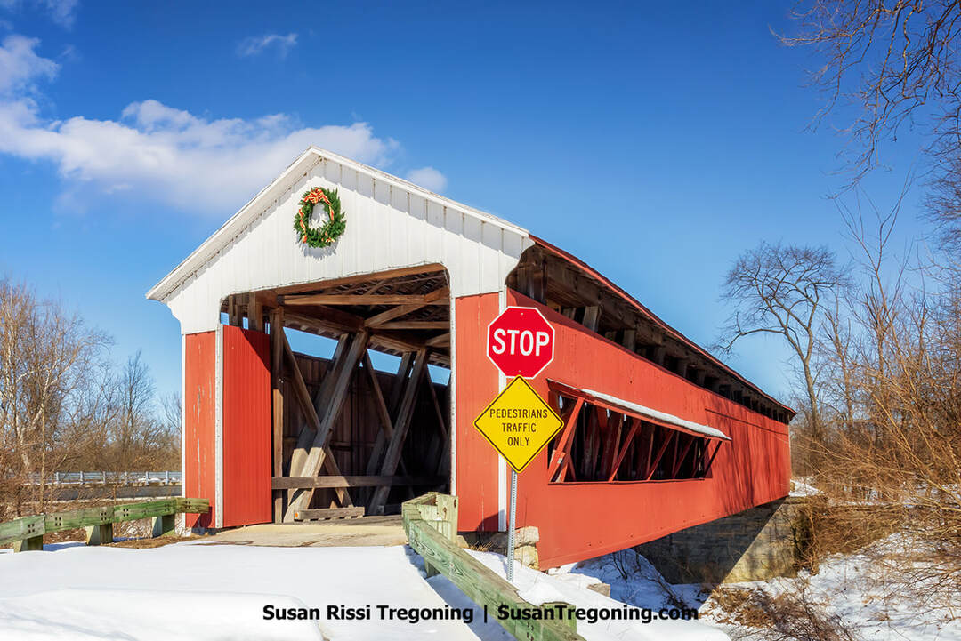
The historic Scipio Covered Bridge stretches across a snowy landscape, its festive white portal and red siding creating a striking winter view.
On the north edge of Scipio in Jennings County, Indiana, the Scipio Covered Bridge spans Sand Creek at 148 feet, a single-span Howe truss bridge. Built in 1886 by the Smith Bridge Company of Toledo, Ohio, it was restored in 1984. A new bypass bridge opened in 2015; at that time, the covered bridge was refurbished and closed to automobile traffic. The original construction cost was just $600, while the later rehabilitation totaled $540,000. Although engineered to accommodate trains, it never carried rail traffic. The bridge was listed on the National Register of Historic Places in 2022.
Scipio Covered Bridge shown spanning across the frozen Sand Creek on a snowy winter day.
The all‑red James Covered Bridge rises above the snowy creek banks, a striking landmark in the quiet winter countryside.
James Covered Bridge
West CR 650S, Commiskey
The James Covered Bridge, a Howe truss structure spanning Graham Creek in Jennings County, Indiana, is named after Thomas S. James, who owned the nearby mill and land. Locals often call it the Kissing Bridge because the interior timbers bear the carved names of several of James’s children alongside those they courted.
In 1887, the county commissioners ordered a bridge to be built at James Ford in Lovett Township. Soon after, Robert Carson attempted to have the crossing relocated to Carson Ford, about a mile upstream, but his legal challenge was filed too late and was thrown out.
Plans called for a 130-foot bridge with a 122-foot main span, designed as a covered Howe truss incorporating wrought-iron tie rods and cast-iron angle blocks. Following the dismissal of the lawsuit, the Barron & Hole Company commenced work, first setting one-foot-thick abutments of native limestone, then raising the superstructure using lumber supplied by the nearby James Saw Mill. The entire build took roughly five to six weeks.
James Covered Bridge was added to the National Register of Historic Places in 2022.
North Vernon & Vernon

Snow falls over the diamond crossing in North Vernon, Indiana, softening the lines of the intersecting tracks and the old rail office beyond.
Platted in 1854 under the original name Tripton, North Vernon, Indiana, developed into a pivotal rail junction where historic lines converged, earning it the nickname “The Gem of the Midwest.” Today, it’s recognized for a well-preserved historic core and deep roots in Indiana’s early rail era. The community includes the North Vernon Downtown, State Street, and Walnut Street Historic Districts, each listed on the National Register of Historic Places.
North Vernon is adjacent to Vernon, one of Indiana’s oldest communities.
The historic Jennings County Courthouse in Vernon, Indiana, standing prominently on the town square.
Vernon was founded in November 1815 by John Vawter, who chose the name to honor George Washington’s Mount Vernon. The town became the Jennings County seat in 1817. Fewer than 300 people live there, making it not only Indiana’s smallest county seat but also one of the smallest in the nation.
The entire town is listed on the National Register of Historic Places, with a streetscape dominated by pre-1900 buildings in the Federal, Greek Revival, and Italianate styles. Remarkably, Vernon still operates under a special charter issued by the Indiana General Assembly on January 22, 1851, rather than the state’s uniform municipal code, making it the last Hoosier town governed by a pre-constitutional charter.
Vernon’s historic stone arch railroad bridge stands over the road below, its graceful masonry arch highlighted against the bare winter landscape.
Vernon’s past is rich with notable moments and “firsts.” In 1863, during Morgan’s Raid, Confederate General John Hunt Morgan advanced as far north as Vernon before being repulsed. The town introduced the first elevated railroad and underpass west of the Alleghenies (1837), Indiana’s first all-women jury trial (1921), the state’s first public playground, and one of its early desegregated schools. Three original log cabins from the founding era still stand and are occupied, underscoring their living link to the 19th century.
Celebrated for its Civil War connections, innovations in education and infrastructure, and exceptionally well-preserved architecture, Vernon endures as a tangible piece of early Indiana history. Nearby lies Muscatatuck County Park, once designated as Indiana’s fourth state park.
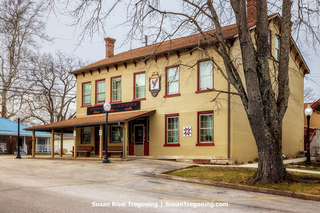
The historic North American House, home of the Jennings County Historical Society in Vernon, Indiana.
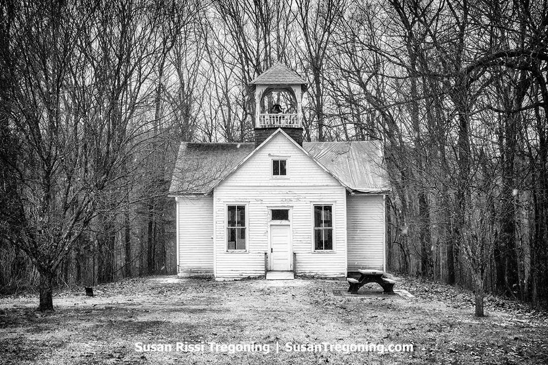
The restored Walnut Grove one‑room schoolhouse at Muscatatuck Park in North Vernon.
Now called Muscatatuck County Park, previously Vinegar Mills State Park and later Muscatatuck State Park, the area opened in 1921 as Indiana’s fourth state park. The park safeguards buildings and artifacts from that era and earlier. Besides the schoolhouse, you'll find the 1850 William Read Home, once the home of the Vinegar Mill's owner and later the Muscatatuck State Park Inn; it functions today as the park’s visitor center. In the Vinegar Mill area, guests can view traces of one of Indiana’s earliest stone-cutting works, along with a newer shelter modeled after it. Upstream, an 1850 dam stands near one of two WPA/CCC-built shelter houses.
Downtown North Vernon & Historic Park Theater
25 Madison Avenue, North Vernon
Around the turn of the century, North Vernon ranked as the sixth-largest rail hub, with over a hundred trains coming and going each day. Today, the Historic Park Theater, originally a 1916 cinema, hosts films, live performances, and festivals.
Ripley County
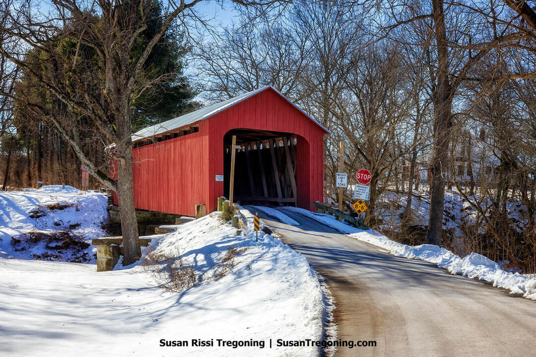
The Otter Creek Covered Bridge rests quietly in the snow, a preserved 1884 Howe‑truss landmark just outside Holton, Indiana.
Otter Creek Covered Bridge
896 N County Road 850W, Holton
Google Maps labels the structure as the Holton Covered Bridge and says it crosses the Muscatatuck River. Yet, its official name is the Otter Creek Covered Bridge, and it is recorded as spanning Otter Creek. I haven't taken the time to research that, but just be aware of the name discrepancy if you are searching for more information about this bridge.
Completed in 1884 by builder Thomas Hardman with inspector Phillip Ensminger overseeing the work. The bridge measures 112 feet in length and features a Howe truss. Historically, it linked rural parts of northwestern Ripley County with the village of Holton via an old diagonal road that ran southeast from the bridge. Vehicular access ended in 1996.
Listed on the National Register of Historic Places in 2019, the bridge lost part of its roof to a straight-line windstorm only months later. Repairs were made quickly, and it reopened to pedestrian use.
Versailles
Settlement began around 1781; the town was platted in 1819 and incorporated in 1845. Its name pays tribute to France's Palace of Versailles. In 1863, during the Civil War, Morgan's Raiders captured and plundered the community, stripping the county treasury. The town later prospered thanks to philanthropist James "Uncle Jim" Tyson, co-founder of Walgreens, who funded major civic works, including the library, the school, and the Tyson Temple.
Tyson Temple United Methodist Church
324 West Tyson Street, Versailles
Well before you arrive at the Tyson Methodist Temple in Versailles, its slender, lace-like cast-aluminum steeple is visible from afar, climbing 100 feet into the air. Beneath that spire, the 1937 Art Deco building offers sleek, modern lines that stand apart from the town’s prevailing nineteenth-century styles. It ranks among the most distinctive sacred sites in Indiana and is listed on the National Register of Historic Places.
The church was commissioned by James Henry Tyson, a Versailles-born, devoted Methodist and co-founder of Walgreens, as a tribute to his mother, an original member of the local United Methodist congregation. Tyson’s journeys through Europe and the Middle East shaped the building’s progressive aesthetic. The entrance, with its monumental columns and temple form, reveals a clear Egyptian inspiration.
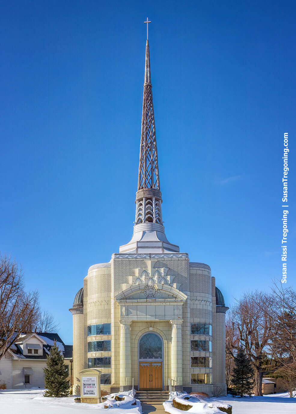
Glazed terracotta brick, glass tile, and a 100‑foot cast‑aluminum steeple define the Art Deco Tyson Methodist Temple, shown here on a snowy day in Versailles, Indiana.
Except for the furniture, no wood was used; the structure relies on concrete, steel, glazed terra-cotta brick, and glass tile. The congregation remains United Methodist, but the building is called a temple because “hammers were not heard” during its erection, echoing the tradition of Israel’s Holy Temple.
Inside, worshipers sit beneath a blue, vaulted canopy, lit by reflected light, suggesting a flawless daytime sky. Gilded constellations and a gleaming North Star, rendered in gold and silver leaf, mirror the exact heavens on the night of Tyson’s mother’s passing.
Versailles State Park
1387 US-50, Versailles
Versailles State Park, set amid the scenic, undulating landscape of southeastern Indiana, is the state's second-largest park. During the Civil War, Morgan's Raiders moved through what is now the park, and for a short time, the town of Versailles fell under Confederate control. Fossils found throughout the area reveal that a prehistoric sea once blanketed this region.
The Busching Covered Bridge sits just across from the park office, right before the entrance into Versailles State Park.

Approached by a curving road and framed by a snowy field, the 1885 Busching Covered Bridge sits peacefully within Versailles State Park.
Busching Covered Bridge
1387 US-50, Versailles
Probably named for the nearby Ernst Busching family, the Busching Covered Bridge was built in 1885 under the direction of Thomas A. Hardman of Brookville, Indiana. A noted local contractor, Hardman later became known for reconstructing numerous spans in Dearborn and Ripley counties that were wrecked during John Hunt Morgan's Confederate raid. He built four of Ripley County's seven historic covered bridges; only two survive today, the Otter Creek Bridge and the Busching Bridge, and of those, only the Busching Bridge still carries vehicles.
The original contract set the price at $20.80 per linear foot with a completion date of October 20, 1885. Given its dimensions, about 15.5 feet in width, 16.5 feet in height, and 176 feet in length, the total should have approached $3,500, yet records show Hardman received only about $2,200. Its timbers were hewn from the grounds of the Versailles Baptist property. The structure features red, vertically laid siding at the midpoint on both sides. These awning-topped windows invite travelers to pause and take in views of Laughery Creek and the surrounding landscape.
Structurally, the bridge is a modified Howe truss, a form that marked the transition toward metal in bridge engineering. The Howe system, devised by William H. Howe (born in 1803), a former millwright who patented the design in 1840, combines wooden compression members with iron or steel tension rods. At the Busching Bridge, the X-shaped wooden braces (in compression) and the metal tie rods (in tension) are sized differently, a deliberate variation that reveals the design's refinement. The span rests on stone abutments with stone wing walls.
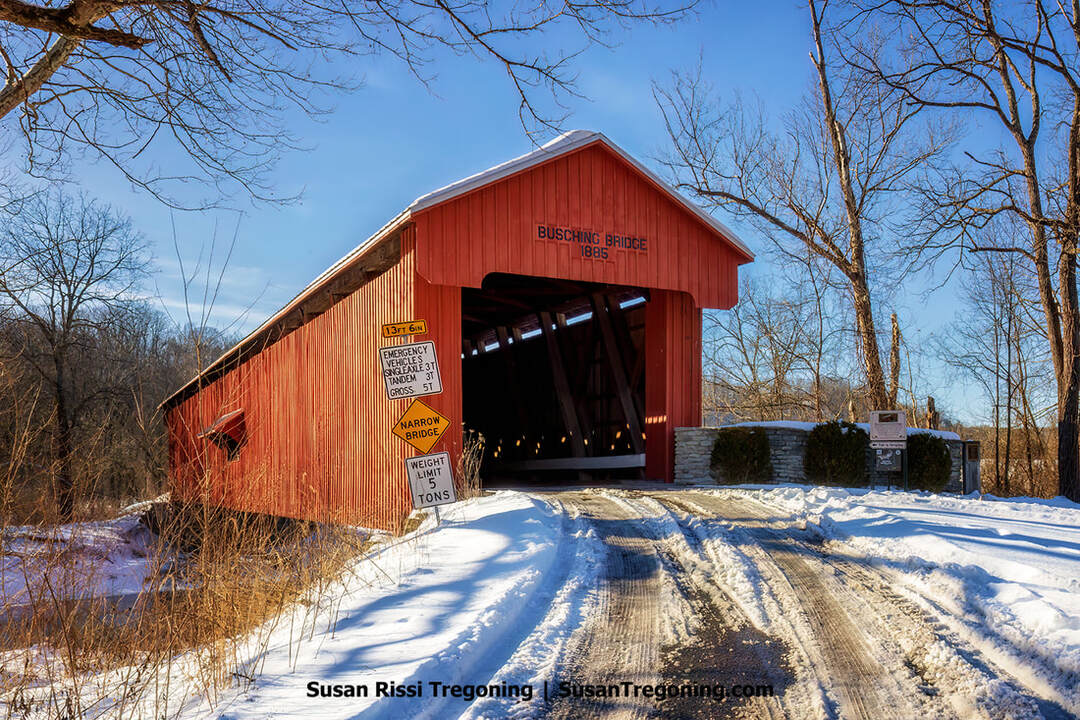
Approached by a snowy road and surrounded by quiet woods, the 1885 Busching Covered Bridge remains a striking landmark within Versailles State Park.
Milan ’54 Basketball Museum
201 West Carr Street, Milan
The Milan '54 Basketball Museum chronicles the 1954 Indiana state title game and the real-life story that inspired the 1986 film Hoosiers. That year, Milan High School upset Muncie Central to claim the state championship, a landmark achievement because Milan was the smallest community in the country ever to capture a state crown at the time.
In addition to local artifacts, the museum houses the Hoosiers Collection, the largest known assemblage of props and uniforms from the movie. Visitors can see jerseys worn by beloved Hickory Huskers such as Jimmy Chitwood, Buddy, and Strap, as well as Myra Fleener's three-quarter-length "Betty Rose" vintage coat, which she wore during her confrontation with Coach Norman Dale. The collection spans more than 100 pieces, including numerous opponent uniforms from Cedar Knobs, Birdseye, Oolitic, South Bend Central, Decatur, and Terre Haute, as well as jerseys, shorts, Chuck Taylor shoes, warm-ups, pullovers, cheer outfits, and more. These authenticated items are treasured components of Indiana's basketball heritage.
Visit Ripley County Tourism for more area travel information.
Jefferson County
Big Oaks National Wildlife Refuge
1661 West Niblo Road, Madison (28 miles south of Versailles on US Highway 421)
Covering 50,000 acres near Madison, Big Oaks National Wildlife Refuge is the largest refuge in Indiana. Established on the former Jefferson Proving Ground, a World War II munitions testing site, the refuge lies north of the historic firing line. It encircles a 1,000-acre tract managed by the Indiana Air National Guard. The former test-fire zone remains closed to the public because cleanup would be prohibitively expensive.
Owing to the site's past use by the U.S. Army for depleted uranium ordnance testing, all visitors must annually watch a safety video and sign an Acknowledgement of Danger before entry. If you decide to visit, allow about an hour for the safety video and paperwork.
Public access is confined to 4,000 acres in the refuge's northeast, around Old Timbers Lake. The area supports more than 200 bird species and 46 mammal species. Listed on the National Register of Historic Places are Collins 'Ford Bridge (a two-span stone arch), Marble Creek Bridge (a single-span stone arch), Oakdale School (a one-room schoolhouse also known as Building 401), and Old Timbers, the 1932 lodge of Alexander Thompson of the Champion Paper Company in Hamilton, Ohio.
Visit Madison for more Jefferson County travel information.
Dearborn County
Street-level color photo on 4th Street, Aurora, Indiana, showing the steeples of First Presbyterian and St. Mary’s above a residential block under dramatic midday clouds.
Aurora
Along the Ohio River, Aurora, dubbed the City of Spires for its many historic church steeples, began as a river settlement in the early 19th century and became an incorporated town in 1845. Its fortunes rose with the river: situated between Cincinnati and Louisville, Aurora grew into a key shipping point.
Nearby, in 1781, Chief Joseph Brant defeated part of George Rogers Clark’s force in the Revolutionary War engagement known as Lochry’s Defeat. Many of the first arrivals to the area began in the 1790s and were Revolutionary War veterans seeking prospects on the frontier. The town site was laid out in 1819 by the Aurora Association for Internal Improvements. It was named “Aurora,” after the Roman goddess of dawn, pointedly suggesting the place “comes before the Rising Sun.” Rising Sun just happened to be a competing community downstream at the time.
The historic George Street iron truss bridge in Aurora, Indiana.
Aurora first prospered as a river port, then surged again after the railroad reached town in 1859. By the late 19th and early 20th centuries, it supported a range of industries: the Crescent Brewing Company (established 1873) shipped its beer as far as Australia, and the Aurora Casket Company began operations in 1890. The Aurora Ferry served the river crossing for more than 160 years, ceasing after the I-275 bridge to Kentucky opened in 1978.
Today, the city is noted for its remarkably intact 19th-century streetscape. A 25-block historic district is listed on the National Register of Historic Places, highlighted by Hillforest Mansion, Veraestau, and a 1914 Craftsman-style railroad depot.
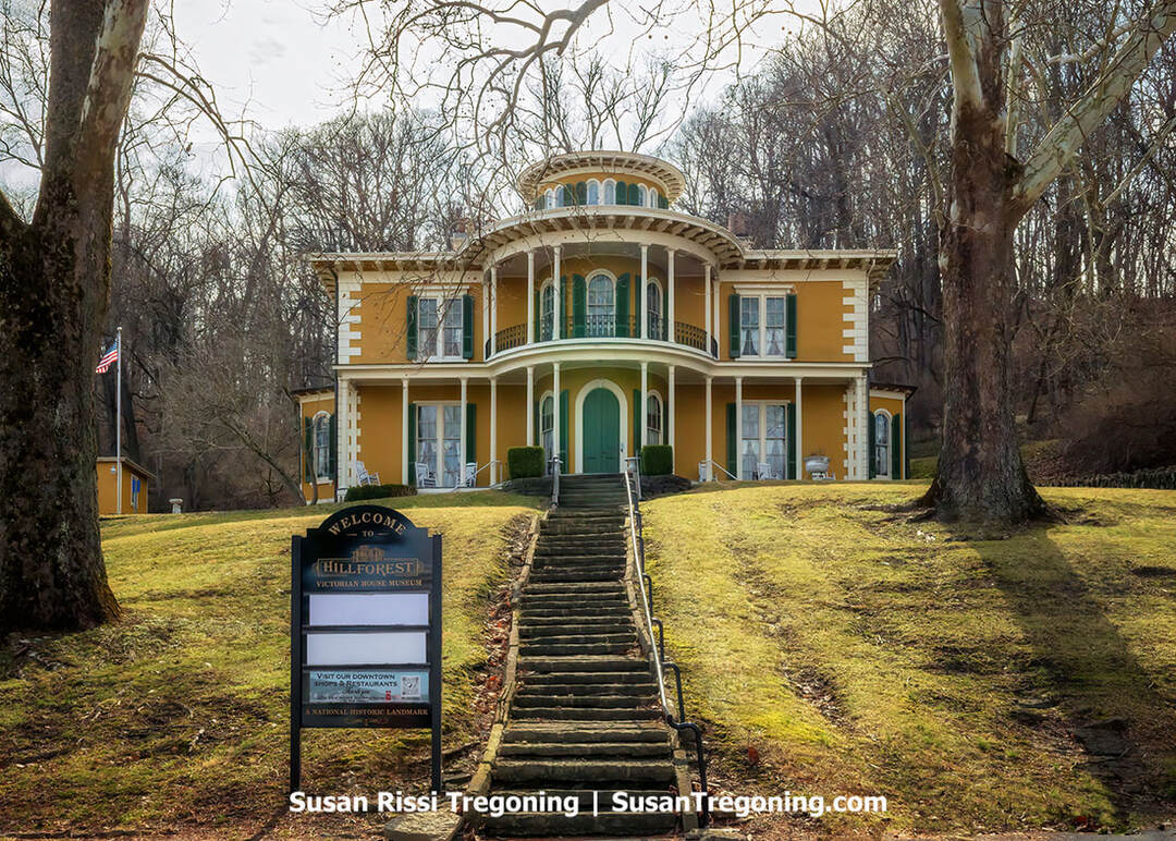
The Hillforest Victorian House Museum is a yellow Italianate mansion overlooking the hilltop entrance in Aurora, Indiana.
Hillforest Victorian House Museum
213 Fifth Street, Aurora
Perched on a bluff above the Ohio River in Aurora, Indiana, the Hillforest Victorian House Museum, originally the Thomas Gaff House, is an Italian Renaissance villa completed in 1855. It is famed for its distinctive Steamboat Gothic character, a direct nod to the original owners ties to shipping and industry.
The residence was commissioned by Thomas Gaff, a prosperous Scottish-born entrepreneur involved in distilling, brewing, and steamships. He engaged the noted architect Isaiah Rogers to plan the estate (though some accounts credit Francis Costigan), and construction took place from 1853 to 1855. Its riverboat-inspired details include tiered verandas suggestive of decks, a circular rooftop belvedere akin to a pilothouse, and a dramatic flying staircase in the entry hall.
Rogers, who established his reputation in Boston and New York designing hotels, courthouses, and other major structures before moving to the Midwest, was one of the nation's leading hotel architects. His notable works include Boston's Tremont House (the first hotel with indoor plumbing), the Astor House in New York City, and Richmond's Exchange Hotel. He also created Cincinnati's Burnett House, once the Midwest's largest and most refined hotel, and New York's Astor Opera House (1847).
The Gaff family lived at Hillforest until 1891 and retained ownership until 1926. In 1926, local furniture manufacturer William Stark acquired the property. From the late 1940s through the mid-1950s, it functioned as a clubhouse for the local Veterans of Foreign Wars post. Concerned about potential demolition, community members organized the Hillforest Historical Foundation in late 1955 to buy and rehabilitate the mansion.
Hillforest has been open to the public as a historic house museum since 1956. It was listed on the National Register of Historic Places in 1971 and designated a National Historic Landmark in 1992. Open seasonally from April through December, visitors can take guided tours led by docents in period attire, view original furnishings from the Gaff family, and enjoy Victorian-themed programs such as afternoon teas.
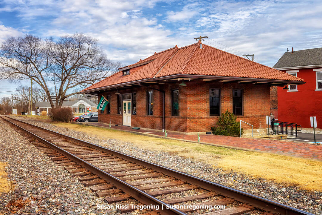
The historic Aurora Train Depot in Aurora, Indiana, now serves as the Aurora Local History Library.
Veraestau House Museum
4696 Veraestau Lane, Aurora
Tours by appointment only. Veraestau is now a wedding venue and houses Indiana Landmarks' Southeast Field Office.
On a bluff above the Ohio River, Veraestau embodies a broad span of Indiana's architectural past and showcases the preservation efforts of two generations-spanning families: the Holman/Hamiltons and the O'Brien/Gibsons. Its name fuses the Latin words for spring, summer, and autumn, pointedly omitting winter.
Pioneer Jesse Holman erected the original house in 1810. He later served on the Indiana Supreme Court. His son, William, and son-in-law, Allen Hamilton, took part in the 1850–1851 convention that drafted Indiana's constitution. Allen Hamilton enlarged the residence in 1838, and his daughter, Margaret Vance Hamilton, undertook another expansion in 1913.
Allen's granddaughters grew up at Veraestau: Edith Hamilton, the celebrated author whose Mythology: Timeless Tales of Gods and Heroes first appeared in 1942 and has been frequently reissued, and Alice Hamilton, a trailblazer in industrial medicine and the first woman appointed to the Harvard medical faculty.
In 1933, industrialist and early preservation advocate Cornelius O'Brien acquired the property, added to it again in 1936, and planted thousands of trees. His daughter, Mary O'Brien Gibson, secured Veraestau's listing on the National Register of Historic Places in 1973. The Cornelius and Anna Cook O'Brien Foundation later gifted the 116-acre estate to Indiana Landmarks in 2004.
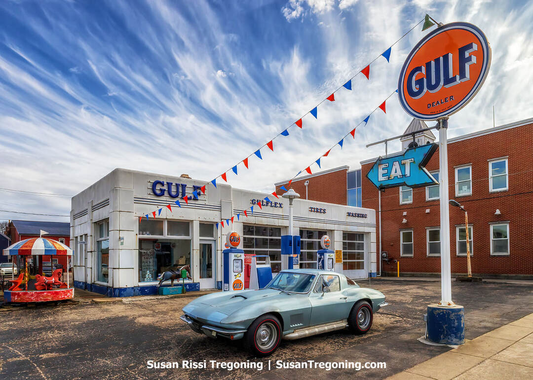
A restored 1940s Gulf station and Corvette Stingray capturing small‑town Americana in Aurora, Indiana.
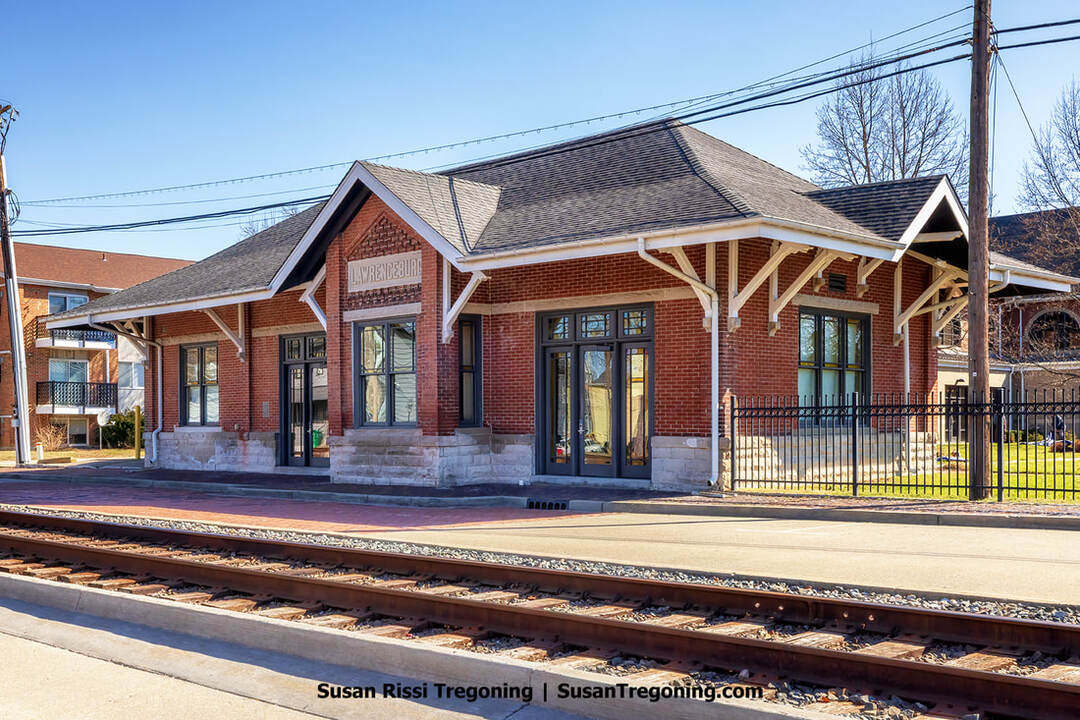
Lawrenceburg
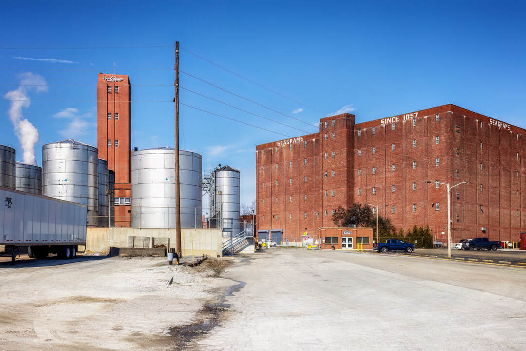
Historic Ross & Squibb Distillery complex with brick warehouses and metal storage tanks in Lawrenceburg, Indiana.
A charming historic Ohio River town not far from Cincinnati, Lawrenceburg, Indiana, traces its roots to 1802, when Samuel C. Vance established the community and named it after his wife’s maiden name, Lawrence. Named the seat of Dearborn County, it stood within the first county created in the Indiana Territory in 1803 by Territorial Governor William Henry Harrison. River trade powered a 19th-century boom, further accelerated by the opening of the Whitewater Canal in 1839, which linked area farmers to markets as far as New Orleans.
Branded “Whiskey City, U.S.A.” for its long-standing distilling tradition, Lawrenceburg remains home to the MGP Indiana plant (formerly Seagram’s), which is the historic 174-year-old Ross & Squibb Distillery. Repeated flood disasters prompted the Lawrenceburg Conservancy District to construct a large protective levee from 1940 to 1943. Enduring landmarks include the Vance-Tousey House (1818), Hamline Chapel (1847), and the Greek Revival Dearborn County Courthouse (1871). Today, a refreshed downtown, the Hollywood Casino, and a picturesque riverfront showcase a city that balances its industrial past with a growing tourism scene.
Two other byways intersect with Historic Pathways in Lawrenceburg, the Whitewater Canal National Scenic Byway, and Indiana's Ohio River National Scenic Byway.
The Lawrenceburg B&O Train Depot.
Perfect North Slopes
19074 Perfect Lane, Lawrenceburg
A winter-season mountain resort offering skiing, snowboarding, and snow tubing. It features five chairlifts and six carpet lifts serving 22 runs and two terrain parks, providing varied terrain for all ability levels.
The historic Guilford Covered Bridge sits in a park in Guilford, Indiana.
Guilford Covered Bridge Park
4785 Main Street, Guilford
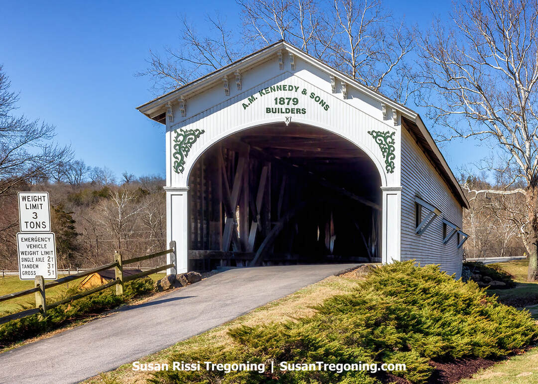
In Guilford, Indiana, the county’s last surviving covered bridge stands as the centerpiece of Guilford Covered Bridge Park, set where Indiana State Road 1 meets York Ridge. This 104-foot, white-painted timber span was constructed in 1879 by Archibald M. Kennedy & Sons. It first crossed the East Fork of Tanners Creek on York Ridge Road and, when finished, showcased a Burr arch truss with a Belgian wood-block roadway — one of only three such surfaces in Indiana. As Guilford’s industry expanded in the early 20th century, especially with nearby coal mining, extra structural supports were added to carry heavier traffic.
Supplanted by a modern crossing in 1960, the historic bridge was spared demolition and relocated to a nearby park. After an arson attack in 1993, it underwent restoration, completed by 1997 with the involvement of L.L. Brown Co. and Amos Schwartz Co. Today, the bridge sits along IN-1 in Guilford and remains open to vehicles as a signature feature of Guilford Covered Bridge Park.
Visit Southeast Indiana for more Dearborn County travel information.
South Spur
Orange County
Rise of the Lost River Nature Preserve
N Co Rd 500 W, Orleans, IN | GPS: 38.6312541,-86.5571661
Indiana’s second-largest spring, the Orangeville Rise, is part of the Lost River system, one of the largest underground stream networks in the United States. Named a National Natural Landmark in 1972 and set aside as a state nature preserve in 1975, it occupies just over three acres within the town of Orangeville. It is open to visitors at all hours. The primary viewing pull-off is located along the preserve’s northeast edge.
Here, the “lost” river reappears after coursing for miles through limestone karst tunnels. While the preserve itself is small, it sits within a broader 187-acre area notable for striking geology, including swallow holes, sinkholes, and additional caves. The spring’s flow swings dramatically with the weather: following heavy rain, increased discharge can be seen in under a day, while drought reduces the output substantially.
French Lick / West Baden
Set along the age-old Buffalo Trace, where a shimmering salt lick lured migrating herds across southern Indiana, the French Lick area first drew Native American hunters who knew it as a rich, reliable hunting ground. In time, French traders and settlers made their mark here, and the place became known as French Lick, a nod to those early European pioneers.
In 1826, Indiana authorized salt mining there. But the brine proved too weak to sustain a major operation, and the land soon went up for sale. In 1832, Thomas Bowles and his brother, Dr. William A. Bowles, secured 1,500 acres near the mineral springs.

Holiday light projections and a glowing Christmas tree transform the French Lick Springs Hotel and Spa in French Lick, Indiana, into a festive centerpiece.
French Lick Springs Hotel & Casino
8670 West IN-56, French Lick
Around 1845, Dr. Bowles raised a modest, wood-framed inn and christened it the French Lick Springs Hotel, a summer-only retreat that drew a steady stream of visitors.
In 1846, with Dr. Bowles leaving to serve in the Mexican–American War, he leased the property to Dr. John A. Lane, a physician and patent medicine entrepreneur. After Bowles returned in the early 1850s, he resumed management. At the same time, Lane acquired 770 acres from Bowles, located just a mile north, home to another mineral spring. There, Lane built the West Baden Springs Hotel, sparking a spirited rivalry that would captivate visitors for decades.
By the 1860s, Dr. Samuel Ryan was leasing and operating the French Lick property for Bowles and, after Bowles died in 1873, for his heirs. The hotel's largest mineral spring was called 'Pluto's Well,' evoking the Roman god of the underworld and giving the waters an air of mystery and reputed healing power, attracting visitors seeking health benefits.
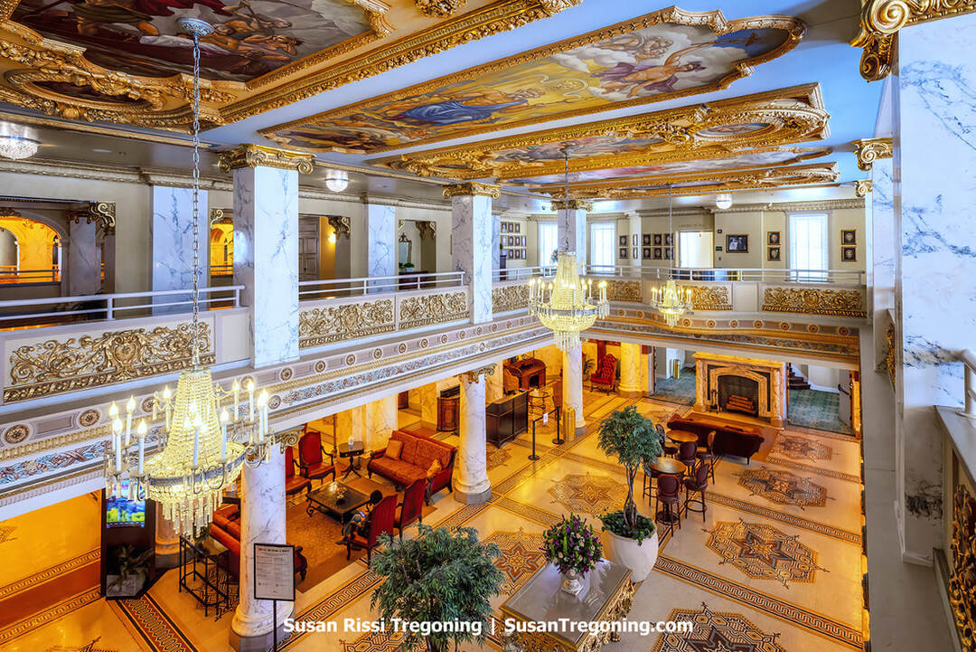
Opulent classical architecture with ornate ceilings and richly furnished seating areas at the French Lick Springs Hotel and Spa in French Lick, Indiana.
Legal wrangling over the Bowles estate eventually led to a sheriff's sale in the early 1880s, transferring the hotel and springs to Hiram Wells and James Andrews. They invested in the property throughout the 1890s, transforming it into a fashionable health resort. By 1887, Wells bought out Andrews, then quickly sold the hotel to a Louisville investment group for $122,000 in cash and $100,000 in French Lick Springs Company stock, retaining a quarter interest until 1891. The new owners unfurled two new wings and, with the Monon Railroad delivering guests beginning in 1887, transformed French Lick into a year-round destination.
Disaster struck in 1897 when the main hotel burned to the ground, but it rose again, larger, grander, and more confident. The mineral waters, bottled and bathed in, were touted as tonics for more than fifty ailments, from gout and rheumatism to alcoholism, and visitors flocked to test their promise.
In 1901, the property passed to a powerhouse investment group led by Thomas Taggart, the former mayor of Indianapolis. His partners included William McDoel, president of the Monon Railroad; Terre Haute brewer Crawford Fairbanks; and limestone magnate Livingston T. Dickson. They reimagined the hotel, replacing its Late Victorian sensibility with an Italian Renaissance Revival grandeur: unified rooflines, harmonious proportions, and walls of warm buff brick that glowed in the Indiana sun.
By about 1905, Taggart had bought out his partners and took sole command. Under his direction, French Lick evolved into a glittering, first-class resort drawing the well-heeled and the well-known. Taggart modernized relentlessly, stringing electric lights, installing a fresh-water system, launching a trolley to town, and persuading the Monon to lay a spur directly to the hotel and run daily service to Chicago. At the height of its golden era, some 150 to 200 guests checked in each day, and the resort delivered more than $2 million in annual profits for Taggart. When he died in 1929, his son, Thomas Douglas Taggart, inherited an estate comprising nearly 4,000 acres and buildings valued at approximately $2 million.
French Lick was also a major employer of African American workers, many of whom were from Kentucky. In the early 1900s, the hotel fielded a Negro Leagues baseball team, the French Lick Plutos, and, through the 1940s, the area welcomed professional baseball clubs for spring training. By the 1920s and 1930s, French Lick was synonymous with recreation, especially golf, even as the region built a whispered reputation for illicit gambling.
Though the Great Depression dimmed its fortunes, the resort endured. It pivoted from a health spa identity to a recreation-and-convention hub anchored by championship golf. In 1946, Thomas D. Taggart sold the hotel to New York investors. Pluto Water became a separate enterprise in 1948. In 1954, Sheraton purchased the property, renamed it the French Lick–Sheraton Hotel, and invested millions in upgrades. Still, the glow faded, and business waned.
In 1979, the hotel was acquired by the Cox Hotel Corporation of New York, which restored its original name. After several more ownership changes, the Cook Group of Bloomington, Indiana, acquired the property in 2005, setting the stage for a sweeping revival.
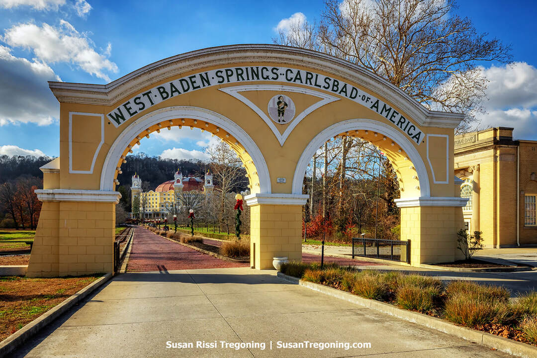
The double arched gateway to the historic West Baden Springs Hotel and Spa.
West Baden Springs Hotel
8538 W Baden Ave, West Baden
The West Baden Springs Hotel has a storied past. After the original hotel was destroyed by fire, this replacement was erected in 1901–02. Lee W. Sinclair, an Indiana banker, had a bold vision to build an enormous domed hotel. Dismissed as unworkable by many architects, the innovative design, featuring a massive, free-span dome, one of the largest in the world at the time, made the hotel an architectural marvel and a symbol of American ingenuity, drawing visitors from across the country.
Sinclair's new resort was a spectacle even before guests tried the famed mineral springs. The hotel itself offered a music room, a theater, and even a stock exchange. Beyond the main building, visitors found a wealth of attractions: an independent opera house; an immense, double-decked, covered bicycle track oval, a third of a mile around, with a full-sized baseball diamond set in its center; a vast "natatorium" encircled by three stories of bath facilities; a small Catholic chapel resembling a cathedral on the hill west of the hotel; golf links, bridle paths, and nature trails; and a trolley stop at the entrance with service to French Lick, just a mile away.
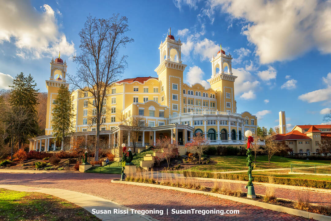
The historic West Baden Springs Hotel and Spa in West Baden, Indiana, is decorated for Christmas.
The resort loomed large in American social life. While the mineral waters and recreation drew crowds, the area's gambling, especially in the 1920s, added to its magnetism.
After Sinclair died in 1916, his daughter and son-in-law assumed control. The hotel briefly served as an Army hospital in 1918–19.
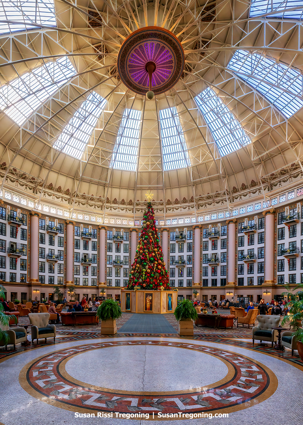
The West Baden Springs Hotel atrium is decorated for the holidays beneath its domed glass ceiling.
In 1922, ownership passed to Ed Ballard, a hometown boy who had made a fortune in casinos and the circus business. He had relocated the Hagenbeck–Wallace Circus to the West Baden area in 1915. He occasionally used the hotel's "Big Dome" like a circus big top, even staging shows there to entertain soldiers during the hospital period. Under Ballard, the hotel prospered until the Great Depression, though, like many northern resorts, it began to lose patrons to newly accessible destinations such as Florida as automobile travel expanded.
Ballard, by foresight or luck, sold off his circus mere days before the 1929 stock market crash, but he kept the hotel and tried to maintain it for his hometown's sake. By spring 1932, the struggle proved too much, and it was closed. Reluctant to sell to the disreputable gambling interests that showed the most interest, Ballard searched for a buyer with a religious or educational mission. In 1934, although not a Catholic himself, he donated the property to the Society of Jesus for a seminary.
Over the next 30 years, the Jesuits modified the exuberant interiors, toning down the hotel's earlier flamboyance. After the seminary relocated to Chicago in 1964, the Jesuits placed the property on the market. It was purchased in 1966 by the Northwood Institute, a private business management college that used it as its campus until 1983.
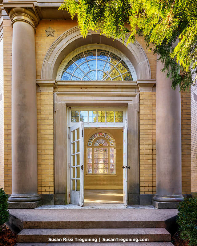
Entrance to the Hygeia Spring, first designated as Spring No. 1, at the West Baden Springs Hotel in West Baden, Indiana.
After years of ownership changes, this historic landmark was finally restored and reopened as a hotel in 2007.
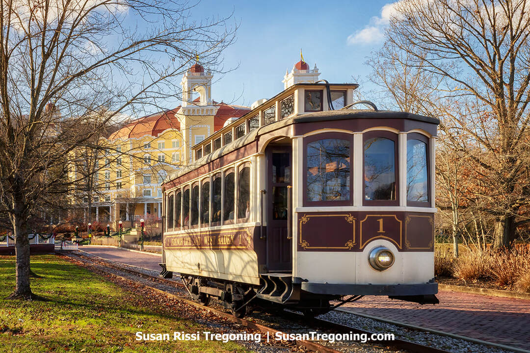
The French Lick – West Baden Trolley pulls out of the West Baden Spring Resort on its way to the French Lick Springs Resort in French Lick, Indiana.
The electric trolley service linking French Lick and West Baden debuted in 1903. At a time when guests still pulled up in horse-drawn carriages, the new rail link made moving between the two hotels far simpler.
A ride cost a nickel, and the car ran "ping-pong" style because it couldn't turn around. After reaching French Lick, the conductor had to reposition the overhead power line to the back before the trolley could return to the West Baden depot. Service ran every 30 minutes throughout the day, and it pulled right up to the steps of the West Baden Springs Hotel. In 1911, a small 10-by-10-foot station was added to shield passengers from rain and sun.
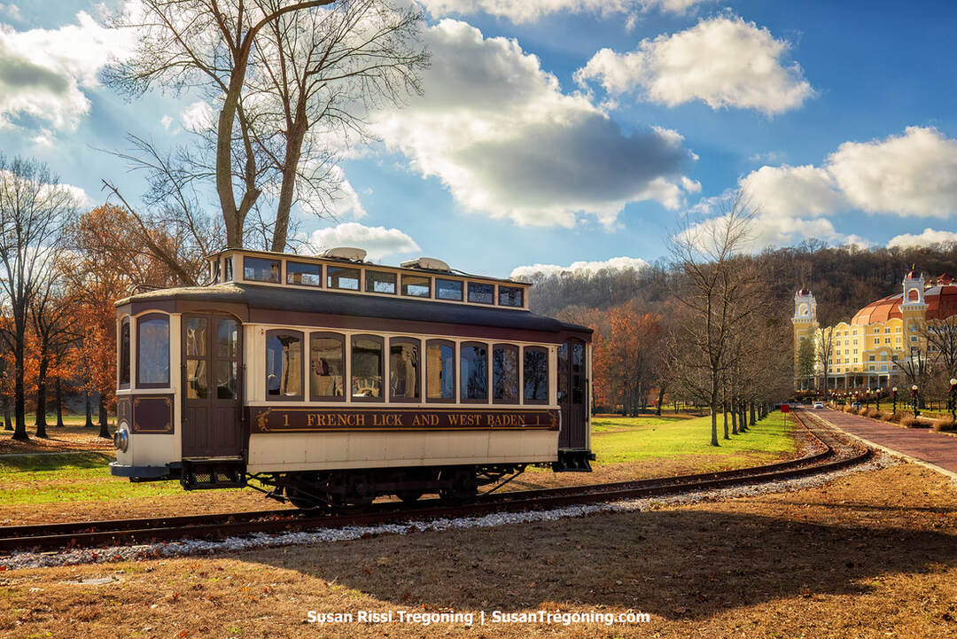
A vintage French Lick and West Baden Railway car passes through the grounds near the historic West Baden Springs Hotel.
Between the hotels, the line paused in the towns of French Lick and West Baden Springs, covering nearly two miles of track. In those days, both towns were bustling destinations in their own right, not just extensions of the grand hotels.
The line made its final trip on July 10, 1919, when the automobile took over.
A century later, the trolley has returned: the track was laid anew, and while the car isn't original, it's been carefully restored to match the one from a hundred years ago. Best of all, you can keep your nickels; rides are free.
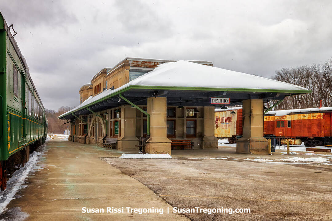
The historic French Lick depot with railcars lined along the snowy winter platform.
French Lick Scenic Railway
8594 West IN - 56, French Lick
The 1907 French Lick Passenger Depot served both the Southern Railway and the Monon Railroad, ferrying affluent travelers to the French Lick Springs and West Baden Springs hotels. Before paved roads and cars, most visitors arrived on horseback, and the hotels operated only when conditions permitted. Rail service reached the Springs Valley in 1887, marking a crucial turning point for the resort's rise as a celebrated destination, with both properties staying open year-round for the first time in 1888.
During the resorts' heyday, roughly 1890 to 1930, as many as nine scheduled passenger trains arrived daily. With 150–200 riders per train, well over a thousand guests could arrive in a single day. Expanding the hotels' reach to major cities across the Midwest and the East Coast, the Southern Railway joined the route in 1907, increasing passenger options to both towns.
Some of the most affluent visitors arrived by private rail cars and on company trains. The railroad also brought the circus to its winter quarters, delivered horses to the hotel stables, and handled a variety of freight. Spurs ran straight to the front entrances of both the West Baden Springs and French Lick Springs Hotels for maximum ease.
In the early years of the railroad, each property maintained its own station on the front lawn, so guests disembarked almost at the doorstep. It was common to see porters handling enormous trunks, as visitors often stayed for weeks to savor the resort experience. In a nod to the French Lick Springs Hotel's famous red devil mascot, the Monon launched the Red Devil Express, a nonstop run to Chicago catering to the hotel's growing national clientele. In 1948, round-trip tickets cost $12.10 in coach and $18.80 in first class.
Today, the French Lick Scenic Railway offers a mix of excursions. The Scenic Train Ride winds through Hoosier National Forest, highlights several landmarks, and traverses Burton Tunnel, Indiana's second-longest railroad tunnel. For guests 21 and older, Tasting Trains pair bourbon, wine, or tequila with curated bites as the scenery glides by. Families can also book seasonal trips, with The Polar Express drawing the biggest crowds each holiday season.
Today, the reborn French Lick Resort Casino complex unites the French Lick Springs Hotel, its adjacent casino, and the storied West Baden Springs Hotel. A $382 million restoration polished the French Lick Hotel's historic bones. It modernized its 443 guest rooms, while the 2006 grand reopening unveiled a vibrant destination with restaurants, boutique shops, a spa, and a conference center. Guests enjoy swimming pools, three championship golf courses, a bowling alley, a fitness center, horseback riding from on-site stables, and more than thirty miles of wooded trails.
In their heyday, French Lick and West Baden were the Disney World of their era, drawing America's elite to revel and perform. It was a favored retreat for celebrities and public figures. Famous guests included: John Barrymore, Howard Hughes, Lana Turner, Bob Hope, Bing Crosby, Hoagy Carmichael, Duke Ellington, Irving Berlin, and Louis Armstrong; presidents Franklin D. Roosevelt, Harry S. Truman, Richard Nixon, and Ronald Reagan; and storied families like the Vanderbilts. People like "Diamond Jim" Brady, General John J. Pershing, the Studebaker family, Chicago's Mayor "Big Bill" Thompson, New York Governor, humorist George Ade, and vaudeville star Eva Tanguay. Paul Dresser composed "On the Banks of the Wabash" during a stay and premiered it there. Boxing greats John L. Sullivan and Thomas J. Sharkey were regulars. Al Capone, notoriously, visited year after year in the 1920s with his bodyguards. The legend endures, part spa-town myth, part railroad romance, and wholly American in its reinvention.
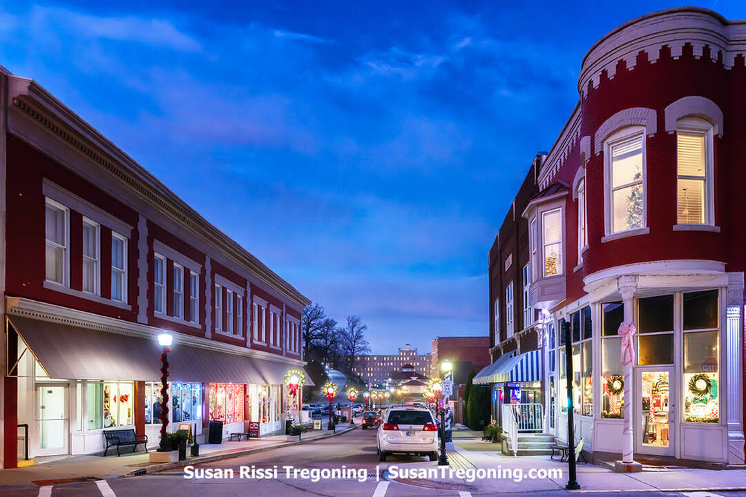
Downtown French Lick decorated for Christmas at dusk, with historic storefronts glowing under holiday lights.
French Lick West Baden Museum
469 South Maple St, French Lick
Opening in 2007 to mark French Lick’s 150th anniversary, the museum presents the rich stories of the French Lick and West Baden communities, keeping the area’s history alive with dynamic exhibits, interactive experiences, and firsthand storytelling.
Paoli
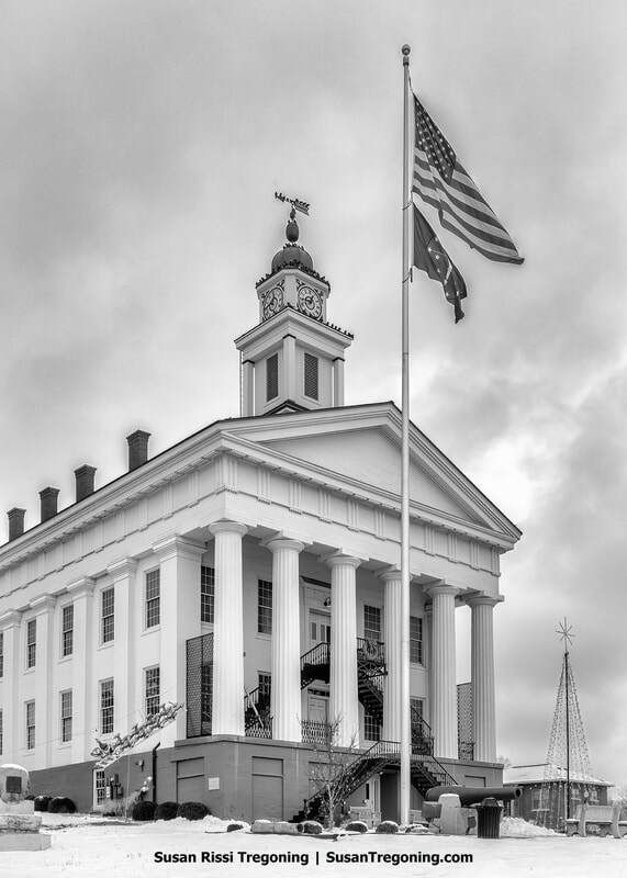
Snow blankets the grounds around the historic Orange County courthouse, accented by seasonal decorations and the American flag.
Founded in 1816, Paoli, Indiana, took its name from Pasquale Paoli Ashe, the Corsican patriot’s namesake and the son of North Carolina governor Samuel Ashe. The community grew along Lick Creek and became an early center of farming and industry, with sawmills, tanneries, and whetstone production driving its economy. A strong Quaker presence shaped the town’s identity and supported Underground Railroad efforts to help enslaved people escape to freedom.
Paoli’s courthouse, a Greek Revival structure completed in 1850 and still in regular use, anchors the town square and is among the oldest continuously operating courthouses in the state. Much of the community’s core is preserved within a National Register Historic District encompassing 144 buildings. Once a key waypoint on the Dixie Highway, Paoli played a notable role in the development of southern Indiana. Today, it is recognized for the Pioneer Mothers Memorial Forest and has reinvented itself as a tourism destination, highlighted by the Paoli Peaks ski area.
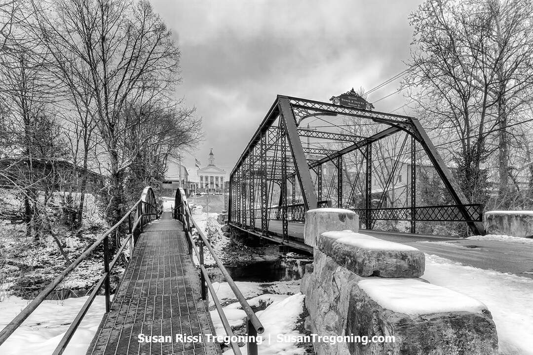
The historic Gospel Street Bridge in Paoli, Indiana, leading toward the courthouse on a snowy winter day.
Wilstem Wildlife Park
4229 US Highway 150, Paoli
Set on 1,100 gently rolling acres, Wilstem Ranch offers a lineup of adventures: face-to-face Elephant Encounters (March through October), chances to meet giraffes and kangaroos, a 4,000-foot canopy zipline experience, guided ATV outings, horseback rides, and convenient on-site lodging with a range of cabin layouts suited to couples, families, and large reunions. A standout highlight is the drive-thru safari, where visitors can view more than 50 species from their own vehicle. The park operates year-round and regularly debuts new activities.
Beyond the wildlife, Wilstem’s picturesque setting invites peaceful walks and photo-worthy vistas. Whether you come with family, friends, or a significant other, the park delivers an enriching, memorable visit that brings the natural world thrillingly within reach.
Paoli Peaks
2798 West County Road, Rt 25 South, Paoli
Paoli Peaks welcomes skiers, snowboarders, snowbladers, and snow tubers. The resort sits on a natural hill at an elevation of about 900 feet, with a vertical drop of roughly 300 feet. It offers 17 trails served by multiple chairlifts and surface tows. While the climate isn't especially frigid, the mountain relies on extensive snowmaking to maintain consistent conditions.
At the summit is a 45,000-square-foot day lodge. Inside, you'll find a cafeteria-style restaurant and pizzeria, a bar separate from the main dining area, rental and pro shops, a ski patrol first aid station, ticketing, a ski/ride school, and a group sales office. Paoli Peaks operates as a day-use area with no on-mountain lodging. However, numerous hotels and resorts are located nearby.
Pioneer Mothers Memorial Forest
1 South Triangle Road, Paoli
Pioneer Mother's Memorial Forest, once known as Cox Woods, is an 88-acre expanse of old-growth woodland just south of Paoli. It ranks among Indiana's few remaining sizeable tracts of ancient forest. It has been largely untouched since before Joseph Cox acquired it in 1816. A mile-long trail connects the parking area on State Road 37 with U.S. Highway 150; parking is accessed from SR 37.
Check out the Indiana Uplands for more Orange County travel information.
Floyd County
New Albany
On the north bank of the Ohio River, directly opposite Louisville, Kentucky, sits New Albany, Indiana. Laid out just downstream from the Falls of the Ohio, it drew early 19th-century farm settlers who saw its promise as a transportation crossroads and shipbuilding center. Many of those settlers came from New York and named the community after their state capital, calling it New Albany. Before locks were constructed on the Louisville side of the river, the city's strategic location on the river helped it grow into one of the Midwest's largest communities, with riverboat construction and glassmaking as key industries.
In 1858, Indiana's governor, Ashbel P. Willard, himself a New Albany resident, dedicated the Floyd County Fairgrounds, and the Indiana State Fair was held there the following year. When the Civil War broke out, the fairgrounds were turned into Camp Noble for mustering local regiments. During the conflict, New Albany became a vital Union supply and training hub for campaigns in the South, a receiving point for wounded soldiers sent north for treatment, and a station on the Underground Railroad aiding enslaved people fleeing the South.
Scribner House
106 East Main Street, New Albany
The historic Scribner House was the home of Joel Scribner, one of three brothers who established the town of New Albany. Built in 1813-1814 in the New England Federal style, using wood felled during the site's clearing, it is the city's oldest surviving structure. Joel and his brothers, Nathaniel and Abner, came from New York and chose the name "New Albany" in honor of their state's capital.
The property remained in the Scribner family until its last owner, Harriet Scribner. It is now owned by the Daughters of the American Revolution and has been preserved just as Harriet left it when she died. It was added to the National Register of Historic Places in 1977.
Public open houses are offered twice annually: on the third Saturday in May and the first Sunday in December, with the December event featuring a Victorian tea. Additional tours are available by appointment.
Town Clock Church
300 East Main Street, New Albany
A view of New Albany’s Town Clock Church, its tall spire and clock face standing prominently against the sky.
The Town Clock Church, is officially known as the historic Second Baptist Church. It was erected in 1852 on the banks near the Ohio River, when New Albany was the largest city in Indiana. The structure began life as the Second Presbyterian Church. Situated just across the river from Louisville, Kentucky, it functioned as a stop on the Underground Railroad, aiding enslaved people seeking freedom.
Second Presbyterian formed after a split from the First Presbyterian Church; the two congregations, only a block apart, opposed slavery and welcomed Black worshipers. In 1889, the Black Baptist congregation, composed largely of formerly enslaved people, purchased the building, which thereafter became known as Second Baptist Church of New Albany.
Well into the early 1900s, the soaring clock tower served as the community's official timekeeper, and riverboat pilots on the Ohio River used it as a navigation landmark. Before the Civil War, it was a highly visible beacon to the freedom seekers crossing the river from Kentucky.
For a time, the tower was shortened, but in 2013 the steeple was replaced, restoring the clock tower to its original 160-foot height. Today, the bells chime every hour and a half.
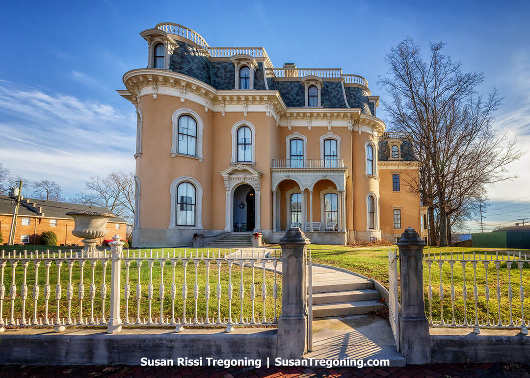
The ornate Victorian architecture of the Culbertson Mansion rises behind its wrought‑iron fence in New Albany, Indiana.
Culbertson Mansion State Historic Site
914 East Main Street, New Albany
The historic Culbertson Mansion was the home of William Culbertson, considered Indiana's wealthiest resident in his day.
Completed in 1869, this three-story, Second Empire mansion cost $120,000 to build. About 20,000 square feet with twenty-five rooms, its interiors boast an array of lavish details: frescoes and hand-painted ceilings and walls, a staircase carved and finished to resemble rosewood, marble fireplaces, wall-to-wall carpeting, crystal chandeliers, and fabric-like wallpaper. The original tin roofing was brought in from Scotland. Exhibits inside highlight the Culbertson family and the building's restoration, and guided visits take guests through the formal parlors, dining rooms, bedrooms, kitchen, and laundry room.
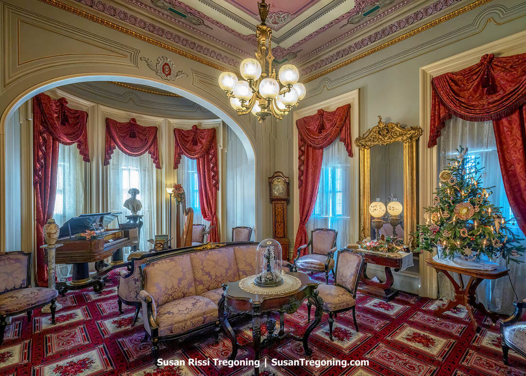
A beautifully preserved Victorian parlor inside New Albany’s Culbertson Mansion, highlighted by its ornate architectural features.
William S. Culbertson was a noted benefactor who funneled a large share of his fortune back into New Albany: he engaged in public life, financed the Culbertson Widows Home, served as a trustee at the First Presbyterian Church, and established the Cornelia Memorial Orphans Home in honor of his second of three wives.
Culbertson left New Market, Pennsylvania, at 21 to make his way in Indiana. He settled in New Albany, where he first worked as a clerk in a dry goods store. Driven and shrewd in business, he launched a utility company in 1854 and rose to become a successful, self-reliant entrepreneur. He stepped away from the dry goods trade in 1868 to invest in new ventures in and around New Albany. Twice a widower, he married a third time at 70. He died in 1892 at age 78, leaving an estate valued at $3.5 million, roughly $61 million in today's dollars.
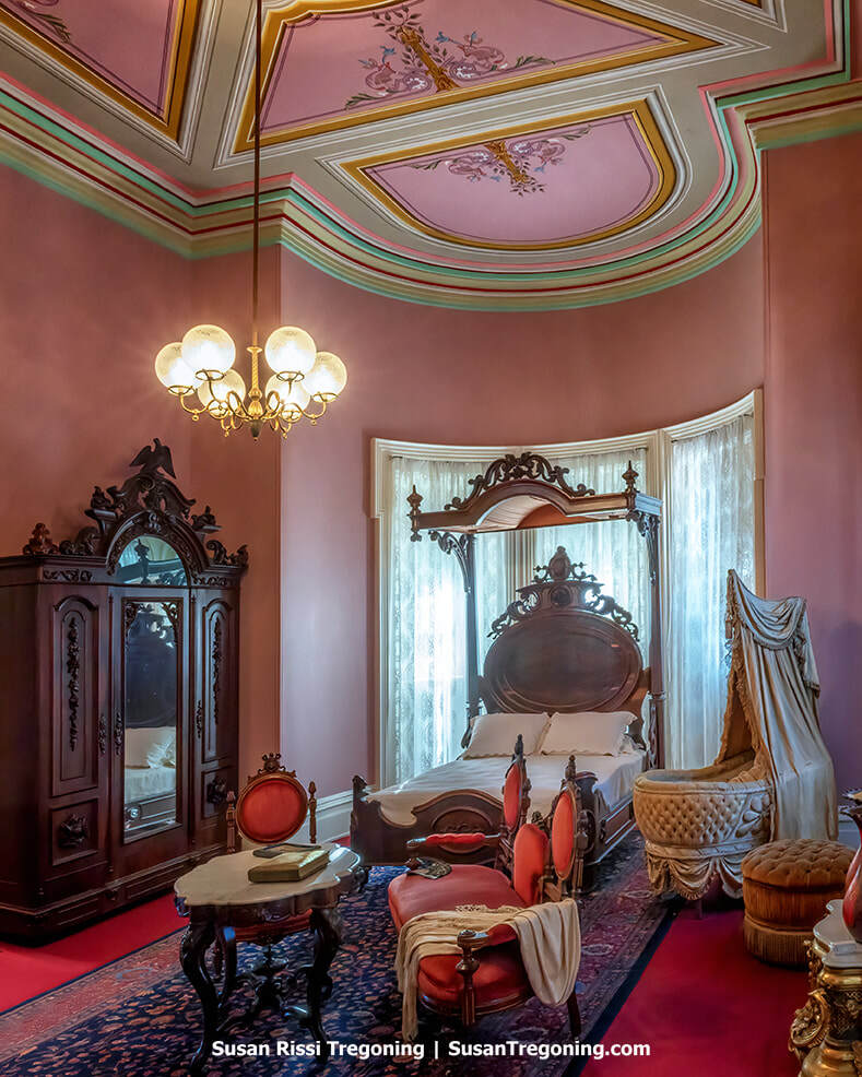
The Culbertson Mansion’s ornate Victorian bedroom, showcasing its elaborate woodwork, wallpaper, and period furniture.
Mansion Row Historic District
Main & Market Streets, New Albany
Mansion Row showcases many of the city's grand residences from the era when New Albany, around the time of the Civil War, was Indiana's largest city. Its principal stretch runs along Main Street from State Street, where the Scribner House stands, to 15th Street, with a shorter portion on Market Street between East 7th and East 11th. The architecture is dominated by Federal and Italianate designs, supplemented by Greek Revival, Gothic Revival, and Victorian examples. The oldest houses are largely Federal in style, erected before Upper High Street was renamed East Main Street.

Rows of white headstones at New Albany National Cemetery, each honored with a Christmas wreath.
New Albany National Cemetery
1943 Ekin Avenue, New Albany
Founded in 1862, New Albany National Cemetery served as a burial ground for troops stationed at the nearby training facility and as a place to reinter Union soldiers who died in local hospitals and had originally been laid to rest in surrounding cemeteries and soldiers' plots. The majority of these reburials came from West Virginia, Virginia, Kentucky, and Indiana. The cemetery's initial tract, 5.5 acres, was acquired from Dr. Charles Bowman in early 1862. By November 1870, the cemetery contained the remains of more than 2,000 identified soldiers and 698 unidentified individuals. An inspection from the 1870s further noted that African American servicemen of the U.S. Colored Troops were interred in segregated sections, separate from other soldiers.
It's the smallest National Cemetery I've ever visited. Which sure isn't a bad thing!
Visit the Greater Louisville Partnership for more Floyd County travel information.
Clark County
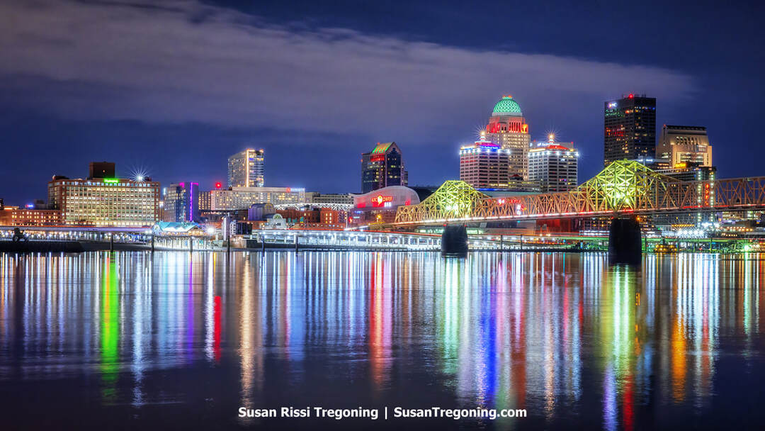
The Louisville skyline at night, with the George Rogers Clark Memorial Bridge stretching across the Ohio River.
Clarksville
Clarksville, Indiana, was founded in 1783 by Revolutionary War hero General George Rogers Clark. After the war, Rogers received a land grant for the area, and by 1803, he had retired there, built a cabin, and was operating a gristmill.
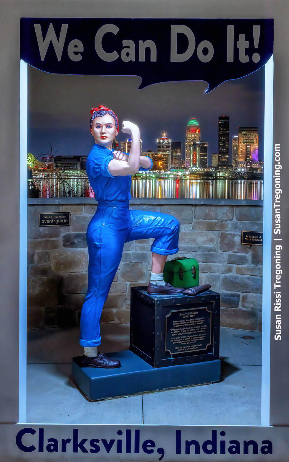
Clarksville’s painted Rosie the Riveter statue, depicting the famous “We Can Do It!” pose in three‑dimensional form.
Set along the Ohio River at the Falls of the Ohio, the town’s riverfront became the launch site of the Lewis and Clark Expedition in 1803. Near General Clark’s home by the Falls, Meriwether Lewis and William Clark met and formally began their journey. The shoreline is also famed for its 390-million-year-old Devonian fossil beds.
Early growth included the Franklin House hotel, established in the 1840s, which served as an important lodging spot for river travelers, helping Clarksville expand into one of the Falls Cities alongside New Albany and Jeffersonville, a hub of the Ohio River’s bustling steamboat trade.
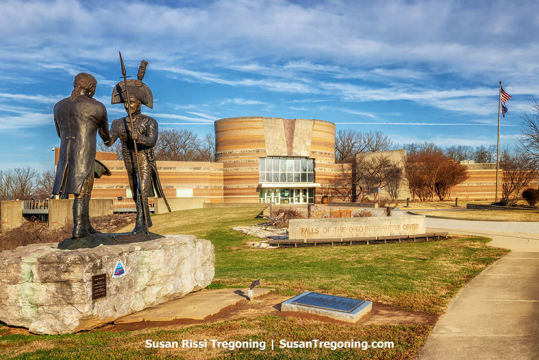
Overlooking the spot where Lewis and Clark joined forces at George Rogers Clark’s cabin, the Falls of the Ohio Interpretive Center preserves the story of their 1803 departure.
Falls of the Ohio State Park and Interpretive Center
201 West Riverside Drive, Clarksville
A National Natural Landmark, the Falls of the Ohio became a state park in 1990. The star attraction here is the world's largest expanse of Devonian-age fossil beds. Historically, it is part of the Buffalo Trace; the shallows at the falls served as a preferred crossing for bison migrating to wintering grounds in Kentucky. It is the location where Meriwether Lewis and William Clark met, at George Rogers Clark's cabin, before launching their expedition.
An on-site interpretive center presents exhibits on the area's rich fossil heritage and the human story of the Louisville region, from Indigenous presence and early settlement through the 20th century. While the large theater focuses on the fossil beds, a smaller theater tells the story of Lewis & Clark's time here, so be sure not to miss that.
The "falls" are actually a stretch of rapids created as the Ohio River cut across hard, 386-million-year-old Devonian limestone ledges. For generations, this was the river's sole major navigational barrier. The challenge of negotiating a 26-foot descent over about two miles fostered local river expertise in the late 1700s and through the 1800s. The obstacle helped spur the rise of Louisville, Kentucky, as well as Jeffersonville, Clarksville, and New Albany in Indiana. Unlike a single dramatic drop such as Niagara, the hazard here extended along the channel, yet it remained a formidable, defining impediment to inland navigation.
To ensure year-round passage, the Louisville and Portland Canal, featuring the river's first locks, opened in 1830. Later, the U.S. Army Corps of Engineers built the McAlpine Locks and Dam, which largely submerged the original rapids. Slower currents now deposit fine sediments over portions of the fossil beds. While this accumulation can hinder viewing, it also shields covered sections from weathering. Even so, substantial fossil-bearing limestone remains exposed and can be visited, with the clearest access typically during the Ohio River's low-water period from August to October. Collecting fossils is not allowed.
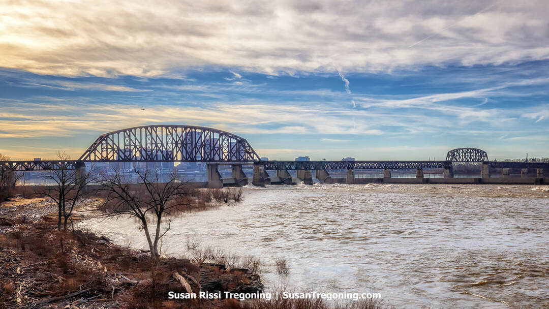
High river levels transform the Falls of the Ohio, submerging the fossil beds beneath the Conrail Railroad Bridge.
George Rogers Clark Cabin Homesite
1021 Harrison Avenue, Clarksville
Located within the Falls of the Ohio State Park, this seven-acre parcel of land was owned by George Rogers Clark. It is where he built his retirement home in 1803, and he lived until 1809, when he suffered a serious burn that resulted in the amputation of his leg. After the injury, he moved to live with his sister on her farm near Louisville, Kentucky.
While his younger brother, William Clark, became famous for the Lewis and Clark Expedition, George earned his own renown during the American Revolutionary War. A trained surveyor, he used his expertise to seize the forts at Kaskaskia, Prairie du Rocher, and Cahokia in Illinois, as well as take Fort Sackville at Vincennes. Clark is also the founder of Clarksville.
Clark's home was a key waypoint for travelers on the Ohio River. On October 15, 1803, Meriwether Lewis met William Clark here. It was at this location that they selected the nine men who would become the Corps of Discovery, which departed from here on October 26, 1803.
There was once a replica log cabin here, but it was destroyed by fire in 2021. The Grounds remain open to visitors.
The George Rogers Clark Homesite is one of the High-Potential Historic Sites on the Lewis & Clark National Historic Trail.
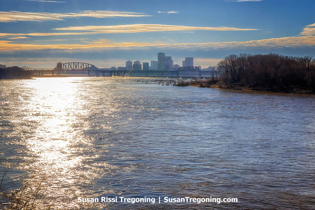
A quiet river scene from the George Rogers Clark homestead, the Conrail Railroad Bridge and Louisville, Kentucky can be seen in the distance. ,
Jeffersonville
Locals often shorten Jeffersonville, Indiana, to “Jeff.” This historic community sits on the Ohio River directly opposite Louisville, Kentucky. Founded in 1802 and named for President Thomas Jefferson, the town followed a distinctive checkerboard plan he proposed.
Settlement in the area began in 1786 around Fort Finney, later renamed Fort Steuben, placed to control traffic on the Ohio. In 1802, Jefferson’s plan guided the town’s layout, incorporating alternating open squares intended to improve health and air circulation; the city shifted to a conventional grid in 1817. From 1813 to 1814, Jeffersonville functioned as the Indiana Territory’s practical capital because Governor Thomas Posey chose to reside there to remain close to his doctor.
For nearly 200 years, the river drove the local economy. James Howard established Howard Shipyards in 1834, and it grew into one of the nation’s leading steamboat builders. The yard later operated as Jeffboat, which became the country’s largest inland shipbuilder and, during World War II, employed more than 13,000 workers constructing LST landing vessels. Shipbuilding in Jeffersonville ended when Jeffboat shut down in 2018.
Its combination of rail links and river access made Jeffersonville a key Union logistics center in the Civil War. The Jefferson General Hospital, opened in 1864, ranked as the nation’s third-largest during the war and featured a wagon-wheel layout to expedite care. The Quartermaster Depot, completed in 1874, was an enormous complex that supplied American forces across five wars; in World War 1, it earned the nickname “the world’s largest shirt factory,” turning out 700,000 shirts each month.
By 1830, Jeffersonville had strong Underground Railroad connections and served as a major crossing for enslaved people seeking freedom from Kentucky. Catastrophic flooding in 1937 covered about 90% of the city and spurred construction of a 10-mile concrete floodwall that still safeguards Jeffersonville. In the 1930s and 1940s, it gained a “Little Las Vegas” reputation as a gambling hotspot that drew figures such as Al Capone and John Dillinger, until reformers closed the casinos. The city integrated its public schools in 1952, two years ahead of the Brown v. Board of Education decision.
Today, visitors can explore the Howard Steamboat Museum and Schimpff’s Confectionery, and stroll or bike the Big Four Bridge, once a railroad bridge, reopened in 2014 to link Jeffersonville with Louisville.
Schimpff's Confectionery
347 Spring Street, Jeffersonville
Among the nation's longest-running, continuously operating, family-owned candy shops, Schimpff's Confectionery has drawn attention from outlets such as The Food Network, The History Channel's "Modern Marvels," and Paula Deen, and was named by Louisville Business First as one of the region's top 20 for‑profit attractions.
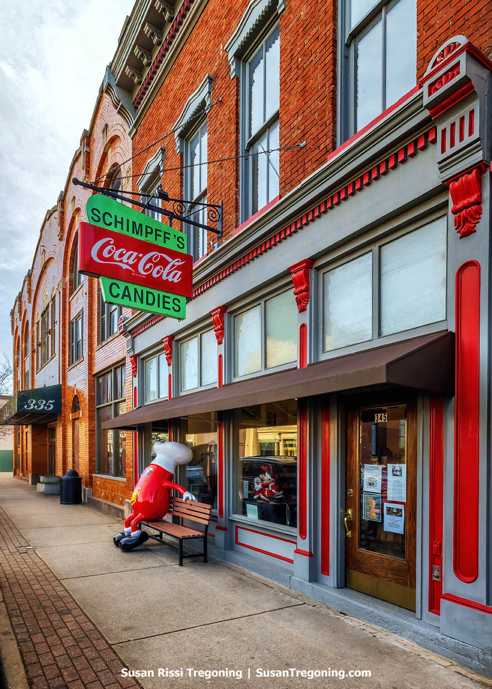
Schimpff’s Confectionery in Jeffersonville, featuring its old-fashioned candy-shop window displays.
The business began making sweets in Louisville in the 1850s, expanded across the river to Jeffersonville by 1871, and has operated at its present site since 1891, when Gustav Schimpff Sr. and Jr. opened the doors there.
Set in Jeffersonville's downtown historic district, this distinctive confectionery and lunchroom preserves vintage charm: an original tin ceiling, a classic 1950s soda fountain, and rows of old-time candy jars and cases alongside turn-of-the-century equipment that evoke the era of handmade treats and true fountain drinks.
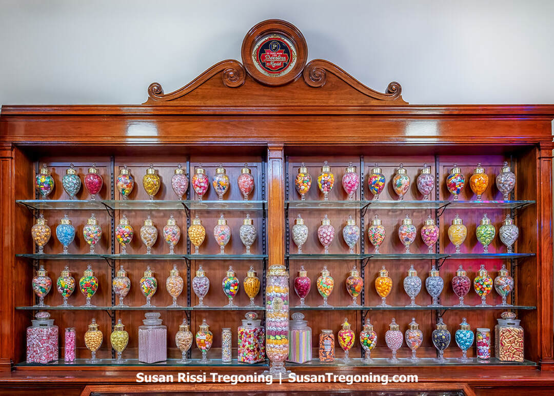
The Peerless Candy exhibit at Schimpff’s Candy Museum showcases early confectionery displays.
Visitors can explore a Candy Museum and a Candy Demonstration Area that spotlight the history of candy making, packaging, and advertising, with frequent live demonstrations.
Signature specialties include cinnamon Red Hots, hard candy fish, and Modjeskas. At the same time, a newer crowd-pleaser is a turtle-shaped combination of chocolate, caramel, and pecans.
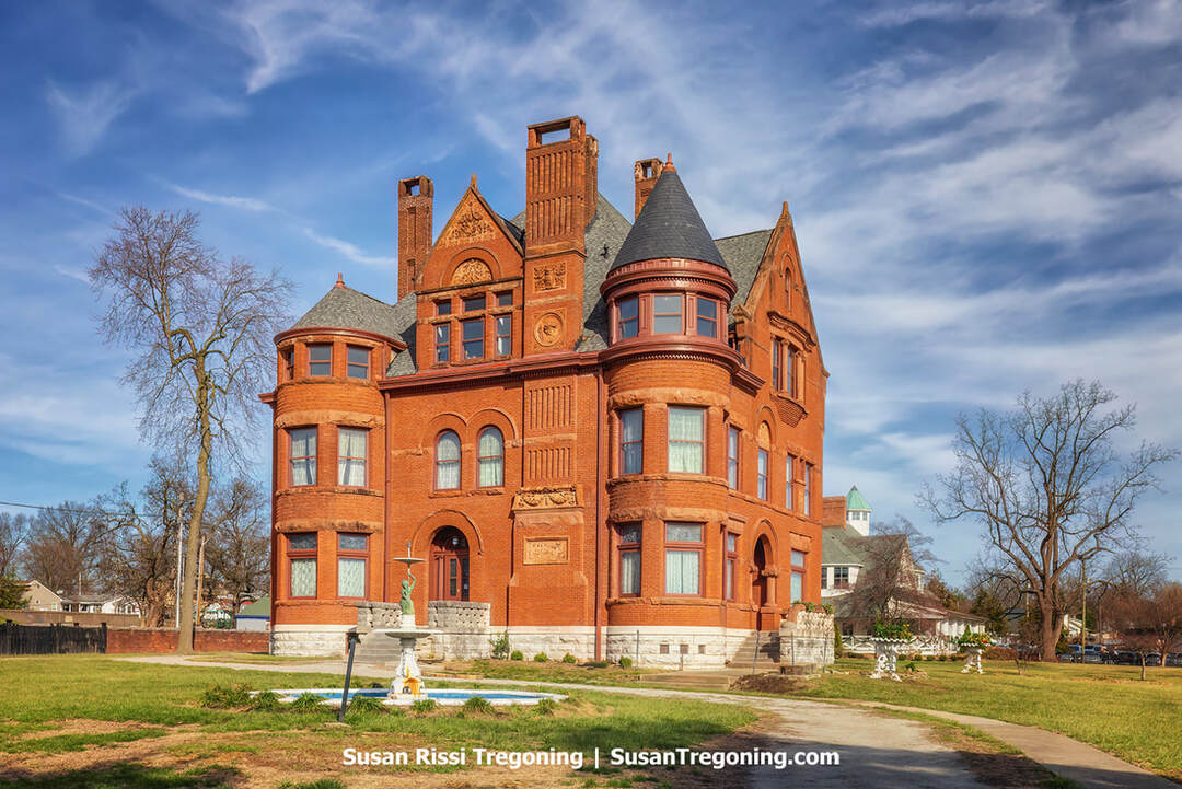
The ornate Victorian home of the Howard Steamboat Museum, preserving the legacy of one of America’s most storied shipyards.
Howard Steamboat Museum
1101 East Market Street, Jeffersonville
The Howard Steamboat Museum is housed in the Howard family's historic home. A family renowned for its steamboat-building history, the collections on the upper floors center on steamboat heritage, with special emphasis on the Howard Shipyards in Jeffersonville, while the first floor looks much as it did when the Howard Family still lived there.
In 1890, Edmonds J. Howard, the son of James Howard, who founded the Howard Ship Yards when the area was known as Port Fulton, commissioned a residence costing $100,000. Rising three stories and spanning roughly 15,000 square feet, the 22-room red-brick mansion is a showcase of late-Victorian Richardsonian Romanesque architecture.
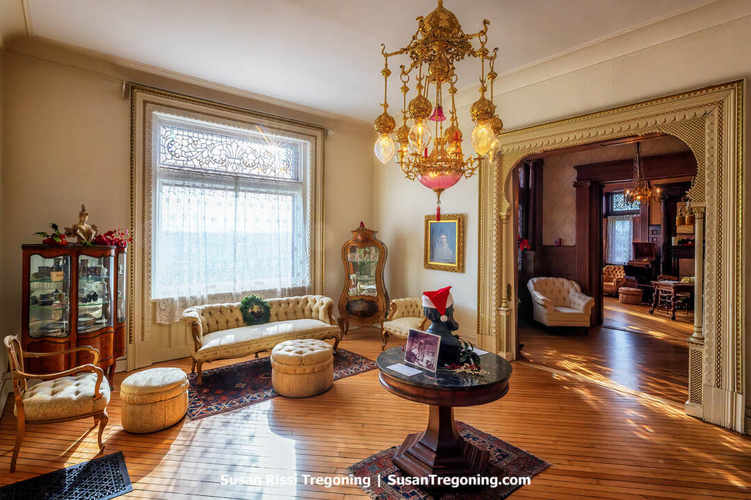
An opulent view of the Howard Steamboat Museum’s Moorish Parlor, filled with carved trim, arches, and period furnishings.
The interiors feature 15 types of wood and include distinctive themed rooms, such as a Moorish-inspired music parlor and a library. Remarkably, about ninety percent of the formal rooms still contain the family's original pieces, preserving exceptional period authenticity, and include gleaming dual-fuel brass gasoliers, stained glass, abundant woodcarving, and a sweeping black walnut staircase that is a replica of the one on their famed J. M. White steamboat. Many of the furnishings came from the 1893 World's Columbian Exposition in Chicago. The effect is an immersive glimpse of another era.
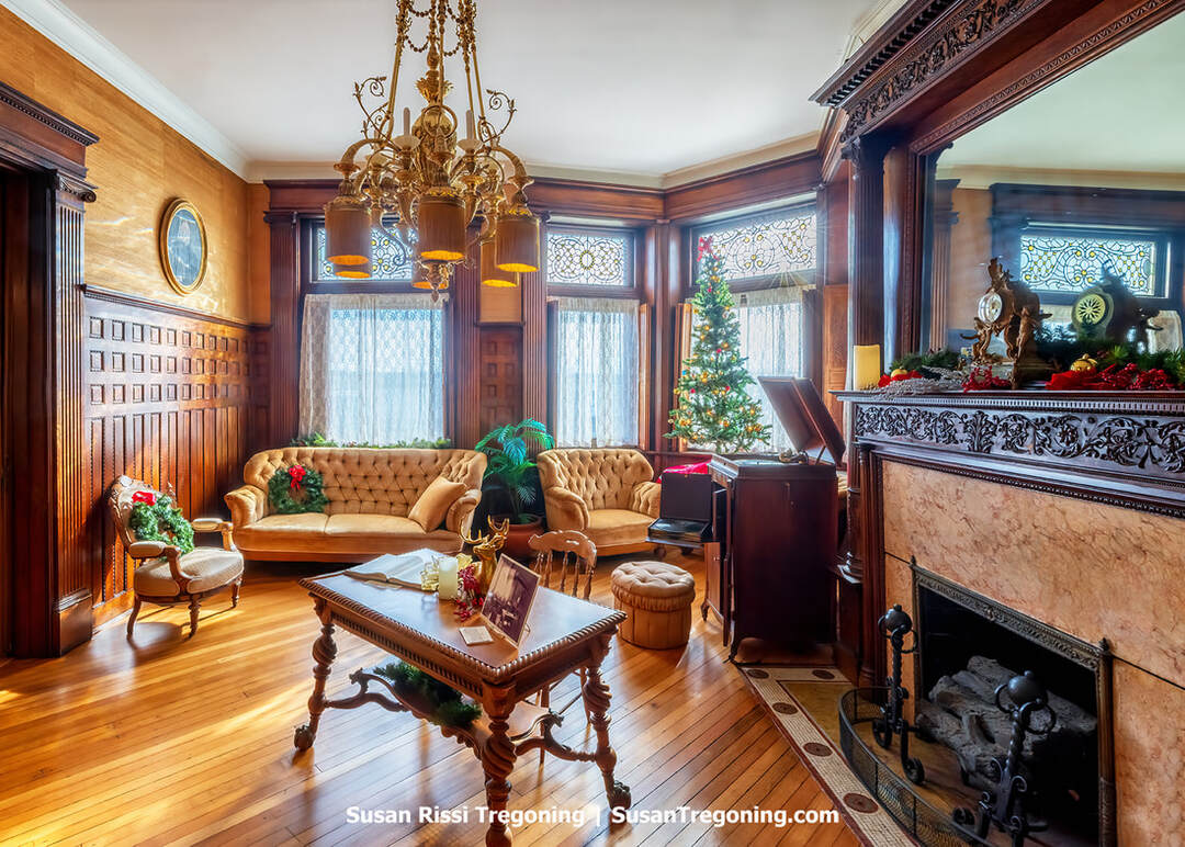
The library inside the Howard Steamboat Museum features dark wood bookcases, carved trim, and period Victorian furnishings.
Much of the ornamentation was produced by master artisans from the Howards' own shipyard. The family's fleet included the lavish J. M. White, the speed-record-setting City of Louisville, and the beloved Indiana. Today, the museum presents a rich treasure trove of river and shipbuilding history, including scale models, photographs, paintings, half-hull forms, tools, and numerous rare artifacts.
In business for over 107 years, the Howard Shipyards produced more than 1,100 river vessels. In 1941, the yard was sold to the U.S. Navy for World War II shipbuilding. In 1947, after the war, Jeffersonville Boat and Machine Company, already a wartime contractor, acquired the operation and adopted the name Jeffboat in 1964. Jeffboat continued until late May 2018 and, before closing, was regarded as the largest and oldest inland waterway boat-building and repair yard.
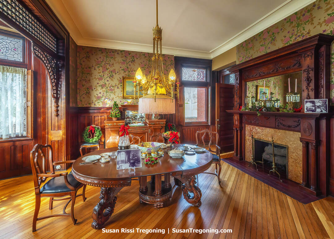
The Victorian dining room at the Howard Steamboat Museum is preserved with its ornate woodwork and period furnishings.
Visit Go So IN for more Clark County trip ideas.
For more travel information about Indiana's Historic Pathways National Scenic Byway see:
For more Indiana destination ideas, check out my post:
Not every image makes it into my blog. If you enjoyed the photos in this article, please check out my Indiana Collection for more pictures from the this amazing state, or visit my Image Gallery with over 4000 images of locations around the United States.

This black‑and‑white photograph shows the Lincoln Memorial Bridge in Vincennes, Indiana, with its full span reflected in calm water. Architectural details such as the arches, railings, and structural lines are clearly defined, creating a symmetrical composition. Presented as fine art photography, the image highlights form, structure, and contrast, making it suitable for collectors of Midwestern landmarks, architectural subjects, or monochrome work.
Fine Art Prints are available for order as print only, framed art, canvas art, metal art, acrylic art, and wood art prints in various sizes. Home Decor and Gift Ideas include shower curtains, throw pillows, towels, totes, phone cases, t-shirts, puzzles, blankets and more. Worldwide Shipping with a 30-day money-back guarantee.
More of the USA
- A Travelers Musings (1)
- Alabama (1)
- Hawaii (3)
- Illinois (6)
- Indiana (3)
- Iowa (3)
- Louisiana (1)
- Maryland (1)
- Michigan (2)
- Minnesota (4)
- Mississippi (6)
- Missouri (2)
- Montana (1)
- Nebraska (5)
- New Mexico (1)
- North Carolina (1)
- Pennsylvania (2)
- Route 66 (5)
- South Dakota (1)
- Tennessee (1)
- Texas (1)
- Virginia (2)
- Washington DC (1)
- West Virginia (3)
- Wildlife (6)
- Wisconsin (2)
- Wyoming (4)
