Nebraska: Sandhills Journey National Scenic Byway
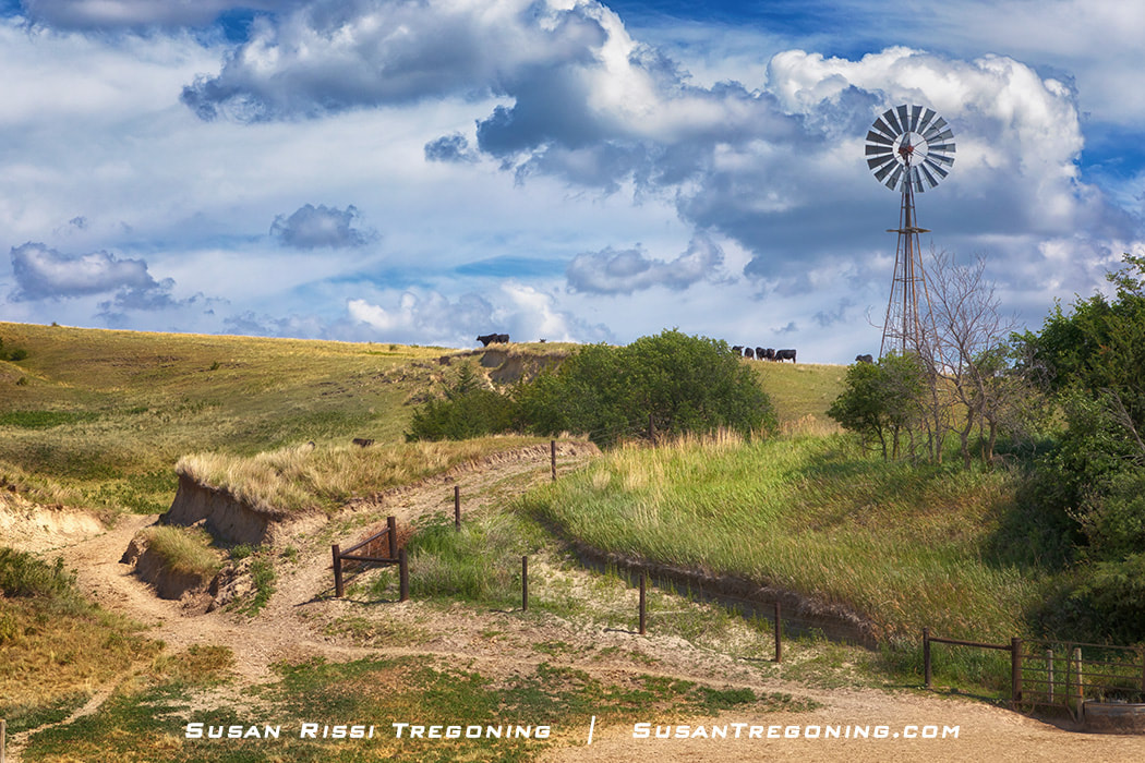
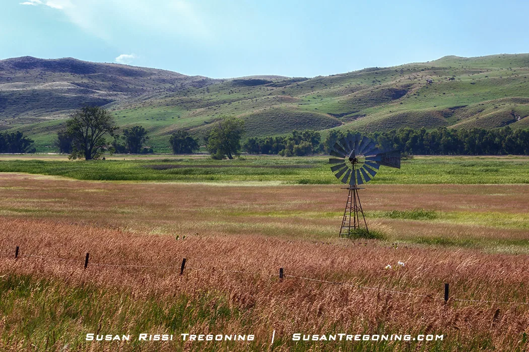
Cattle graze quietly beside a traditional windmill in the Nebraska Sandhills, surrounded by rolling, grass‑covered dunes shaped by centuries of prairie winds.
Very few places left in America are so pristine that they have been virtually untouched by man. Nebraska Highway 2, AKA Sandhills Journey National Scenic Byway, is one such place. Located in the north-central section of Nebraska, the Sandhills cover a little more than a quarter of the state. This 272-mile-long National Byway starts in Grand Island and ends in Alliance, passing through the middle of an area of world-class natural wonders. It’s home to the completely hand-planted Nebraska National Forest, the Loup River, abundant wetlands created by the Ogallala Aquifer, and brilliant night skies. Being in the Central Flyway for migratory birds, it’s teeming with wildlife, and you can’t forget the Spring Migration of the Sandhill Cranes.
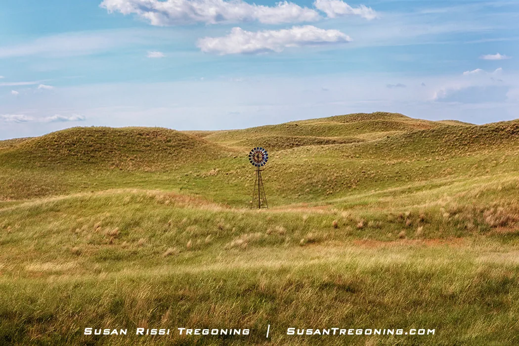
The Nebraska Sandhills are a place of wide-open spaces where undulating windswept dunes are stabilized by a sea of prairie grass that only has a fragile hold on the land. Cowboy hats and boots are a way of life, not just a fashion statement.
Areas where the land is bare, are called blowouts. Blowouts in various sizes occur throughout the Sandhills. They can be anywhere from a few feet in circumference to a few hundred feet. These spots are where the plants and their stabilizing roots have become depleted. The wind eventually exposes the sandy soil.
Having spent a lot of time in the Sandhills, I was thrilled to learn that Sandhills Journey Scenic Byway received the National Byway designation in 2021 for its natural beauty and unique geography. So, finally, it seems that one of my greatest secrets is out, and people unfamiliar with the state will no longer sit in disbelief as I wax lyrical about the beauty of the Sandhills. But, of course, most still think I am talking about the Sandhill Crane, not the land for which they were named.
I can't stress this enough...
You have most likely never been somewhere this rural. Once you leave Broken Bow, not every town has a gas station or restaurant, let alone a motel, and if you need a tow truck, you have a very long wait. Also, if you are out past dark, it's very dark, as it is one of the largest dark sky spots in the continental United States.
I never go into the Sandhills without a full tank of gas or let my tank get below half full, and I always take a small cooler with food and drinks with me.
The Sandhills Journey National Scenic Byway spans 272 miles across central and western Nebraska.
Starting in Grand Island and heading west on Highway 2:
- Grand Island → Ravenna: 33 miles
- Ravenna → Broken Bow: 49 miles
- Broken Bow → Dunning: 41 miles
- Dunning → Halsey: 11 miles
- Halsey → Thedford: 17 miles
- Thedford → Mullen: 25 miles
- Mullen → Hyannis: 39 miles
- Hyannis → Alliance: 59 miles
Total: 272 miles
Driving time, straight through driving with no stops, is approximately five hours. You could easily spend one to five days on the Byway and still not see everything.
How the Sandhills Were Created
Created during the last Ice Age, as the glaciers retreated, winds blew the loose sand, depositing it into dune-shaped formations as high as four hundred feet tall. These dunes stretch over a quarter of the state in length. At 13 million acres, it's the most significant dune formation in the Western Hemisphere!
Surrounded by the stark beauty of the Nebraska Sandhills, this lone ranch stands as one of the few signs of human life along the Sandhills Journey National Scenic Byway, tucked into miles of rolling grass‑covered dunes.
Then, the grasses took root and stabilized the dunes. After the early settlers discovered that the Sandhills were unsuitable for growing crops, they began raising livestock. Due to the lack of crop production, these grasslands are 85% intact natural habitat. There are over 720 native plants here and only 7% exotic grasses, less than half of the exotics that other prairies in the Great Plains have. As a result, the Sandhills are a unique ecoregion. With native grasses covering 19,600 square miles, the Sandhills region is the most extensive contiguous and least disturbed prairies in the United States.
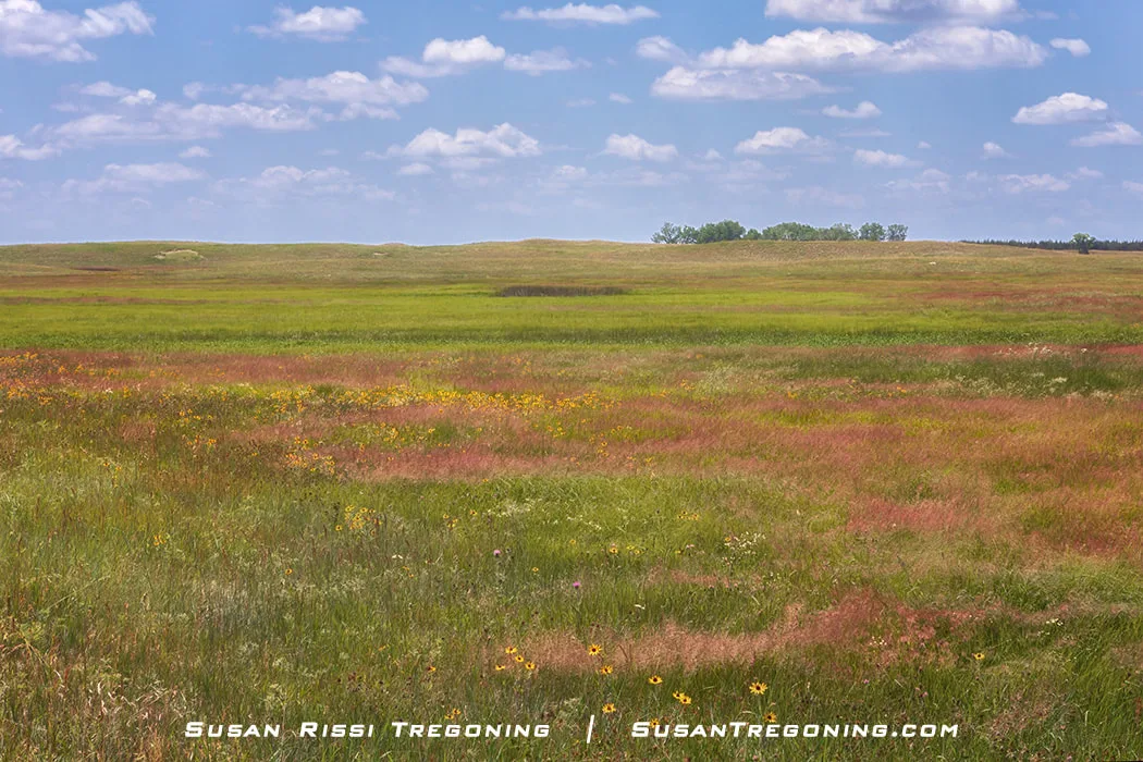
The many shades of green across the prairie areas of the Sandhills always amaze me, shifting subtly with the light and revealing just how diverse this grassland ecosystem truly is.
The Sandhills is home to some of the largest cattle ranches in the country. In the early 2000s, the Sandhills region had around 530,000 cattle grazing the prairie, and Cherry County, with nearly 166,000 cows, was the top cow county in the nation!
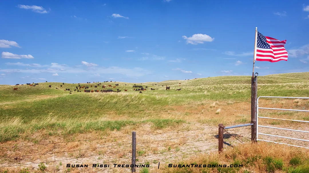
An American flag waves from the ranch fenceline, framing a classic Sandhills scene where cattle graze on the sweeping, grass‑draped hills beyond.
The Climate
The Sandhills fall into two climate classifications. The eastern section is sub-humid, with an average rainfall of 23 inches. The climate becomes semi-arid once you cross the 100th meridian, with an average of less than 17 inches of rain annually.
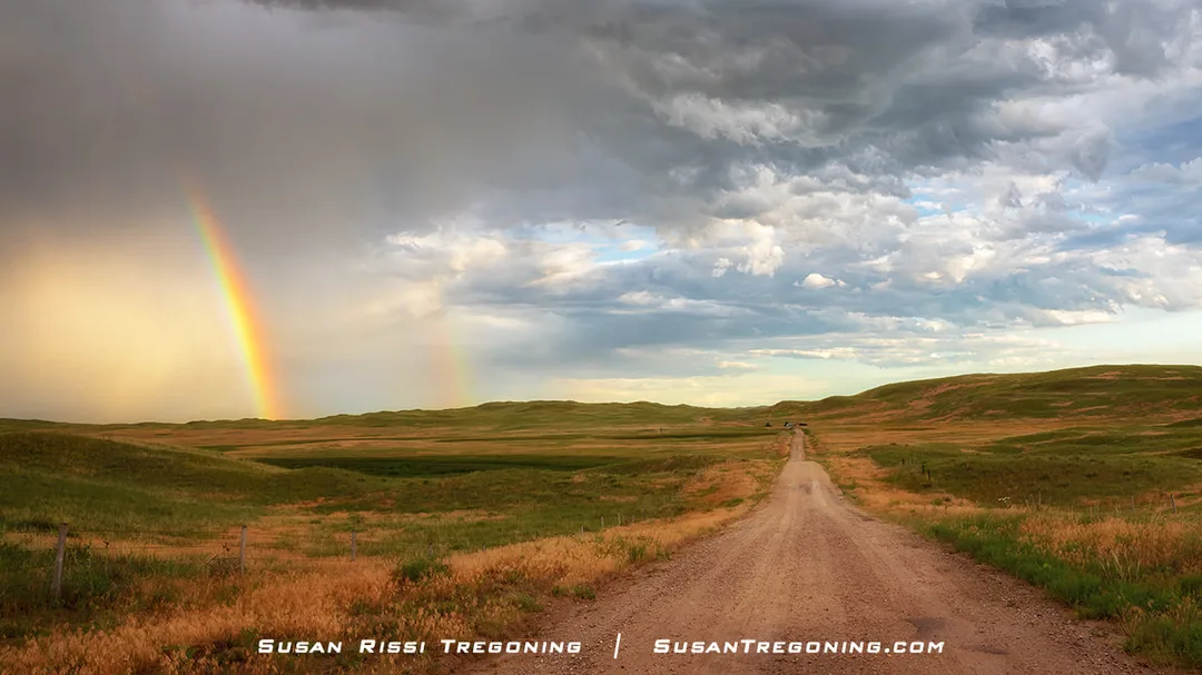
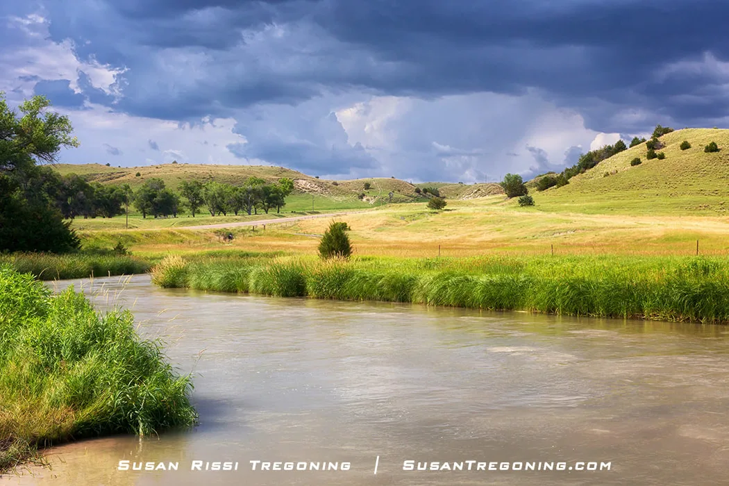
Despite the forecast calling for less than a 20% chance of rain, a sudden severe thunderstorm with small hail swept across the Sandhills, leaving us with no shelter and sending us to Alliance ahead of schedule. Once the storm moved on, we returned for sunset, trailing its retreat across the hills. When the clouds opened and the light shifted, a brilliant double rainbow stretched across the landscape.
The western half of the Sandhills experiences the heaviest precipitation from May through August, but the weather can be unpredictable on the High Plains.
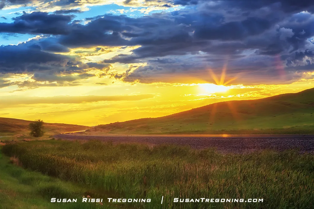
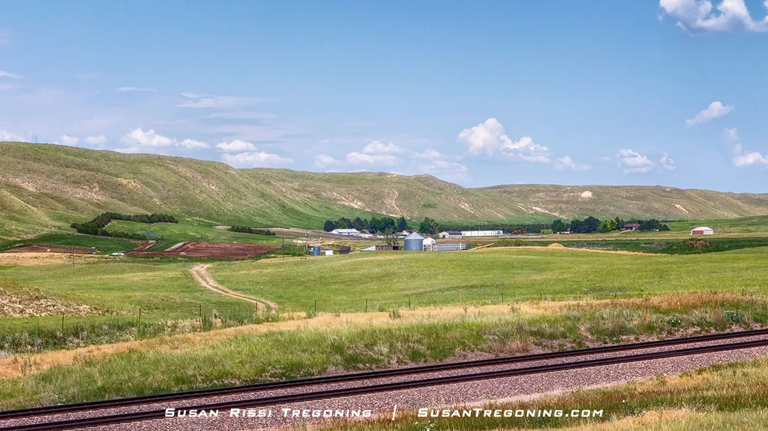
Golden light glints off the railroad tracks at sunset, tracing the path that parallels Highway 2 for almost all 272 miles of the Sandhills Journey National Scenic Byway.
Ogallala Aquifer
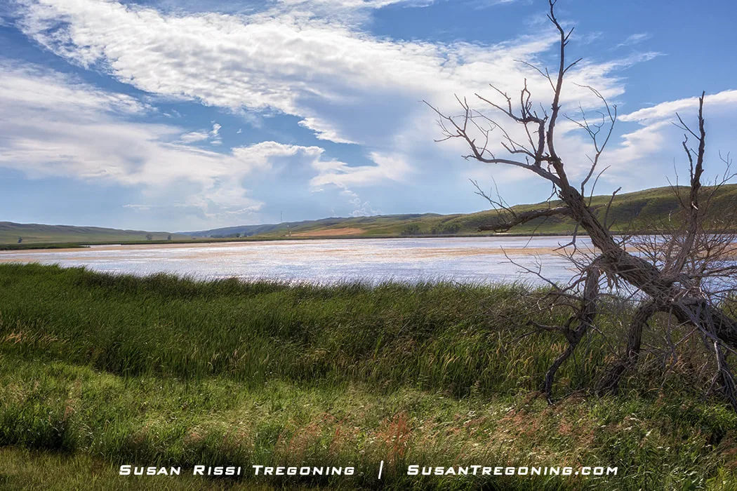
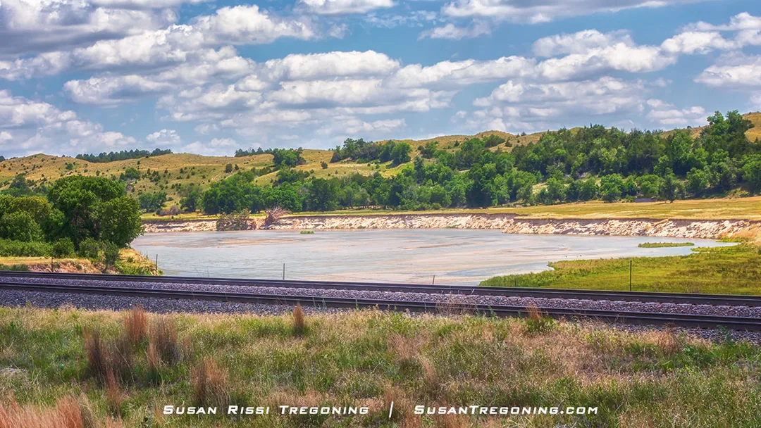
Just west of the tiny unincorporated town of Whitman, Doc Lake reflects the wide‑open beauty of Grant County’s Sandhills landscape.
The Loup River, along with its three branches, the North Loup, Middle Loup, and South Loup, and the Dismal River, have been documented as the most constantly flowing rivers in the world. All their water comes from the Ogallala Aquifer, which boils up in many different places beneath these rivers.
The Ogallala Aquifer is part of a more extensive groundwater reservoir called the High Plains Aquifer. It is the largest underground freshwater source in the world! While the High Plains Aquifer sits underneath eight states, it is under 83% of Nebraska, with the Ogallala Aquifer making up 76% of all groundwater in it.
The Sandhills is right on top of the most significant and accessible amount of this water. Around 1600 natural lakes and ponds are scattered throughout the Sandhills, providing approximately 80,000 surface acres of water. These lakes are usually shallow, most no more than six feet deep.
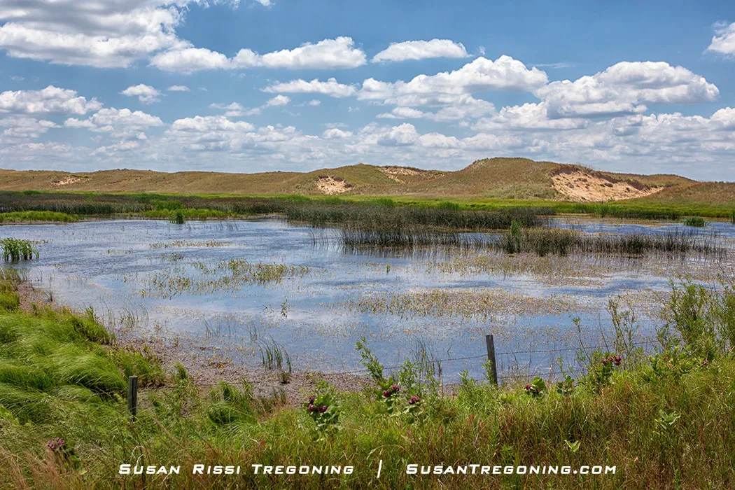
Sandhills wetlands reward patience—every one of them holds life. In this small marsh, baby coots were hidden safely in the thick grass at the water’s center.
While the Aquifer is usually found from 50 to 300 feet below the land surface, here in the Sandhills, the depth of the water table ranges from surface water to over 500 feet. The saturation thickness varies greatly, with an average thickness of around 200 feet, but in some areas under west-central Nebraska, it exceeds 1000 feet. So there is always water here, even during a drought.
You will not see much runoff during heavy rain since Sandhill's soil is primarily coarse sand, silt, clay, and gravel, making it highly porous. As a result, the ground acts like a giant sponge absorbing the precipitation. Then gravity pulls it down to help recharge the Aquifer.
You are going to see A LOT of trains...
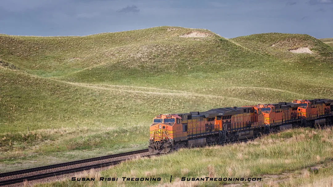
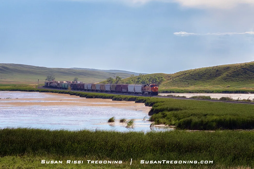
A line of locomotives curves through the grassy hills of the Sandhills, adding a burst of color and motion to the quiet prairie landscape.
Up to 100 trains pass through the Nebraska Sandhills daily on tracks parallel to Nebraska Highway 2. Sometimes a mile long, the trains carry coal from Wyoming's Powder River Basin coal fields, the largest coal-producing region in the United States, to power plants nationwide.
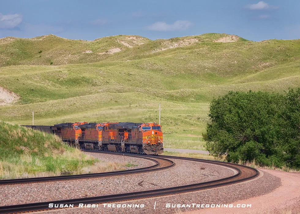
A line of locomotives rounds the bend in the Nebraska Sandhills, tracing the long rail corridor that cuts through this remote prairie country.
...and windmills!
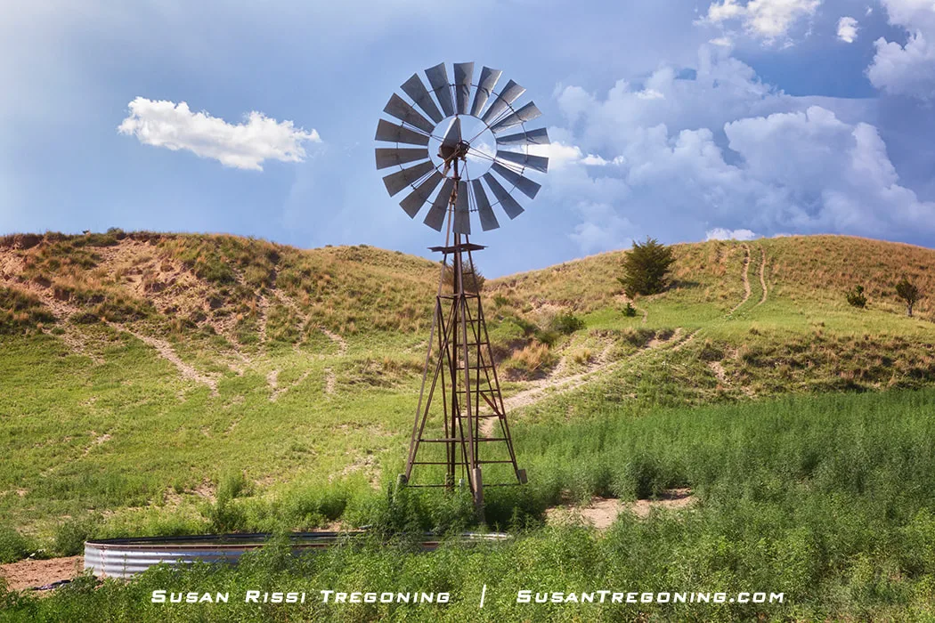
An Aermotor windmill anchors the Sandhills landscape, representing a company that sold its first windmill in 1888, grew rapidly, and—after being placed in a trust benefiting 48 colleges—endures as the last surviving windmill manufacturer in the United States.
The traditional agricultural multi-bladed four-brace tower windmill is one of the most straightforward, elegant representations of the best of Nebraska. But, while they can be seen dotting the landscape all over the state, most are decorative these days. That’s not the case in the Sandhills, where hundreds, probably thousands, are still at work out here. Farms and ranches use windmills and wind energy to draw their water out of the ground, pumping it into low circular metal tanks to water the animals. If it hadn’t been for the invention of the American windmill, the Sandhill would never have been settled.
Windmills are everywhere along the Sandhills Journey National Scenic Byway, anchoring the ranching landscape. But this patriotic red, white, and blue windmill was a first for me, a colorful twist on a classic Sandhills icon.
Traveling the Byway
Grand Island
Grand Island is not in the Sandhills region, although you can begin to see the Sandhills in the distance as you leave town on Highway 2.
Grand Island is included in the Scenic Byway because the Sandhill Cranes are named for the Sandhills region of Nebraska. Every year, for about six weeks in early Spring, they make their home along the Platte River nearby.
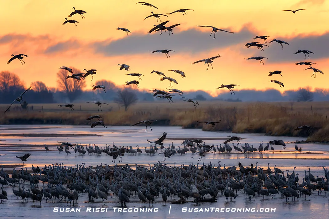
Returning to the roost and the rest of the flock, these Sandhill Cranes with wings spread and legs extended float in for a landing on the Platte River after a short sunrise flight.
I shot this on the last sunrise of the 2021 Sandhill Crane season. Many of the birds had already traveled on, and the few that are seen here left this same day.
At the high point of the season, around the middle of March, 80% of the world's population of Sandhill Cranes will be hanging out in the cornfields eating corn during the day and sleeping on the sandbars in the Platte River at night. This year's (2021) high count was almost 600,000 Sandhill Cranes!
They are doing two things, fattening themselves up to continue their journey onto their breeding ground, and the single cranes are looking for mates. It's quite an experience to watch the Sandhill Cranes performing their elaborate courtship dances. At times, it feels like the Cranes are throwing a giant party. I like to think of it as Spring Break for the Sandhill Cranes! LOL
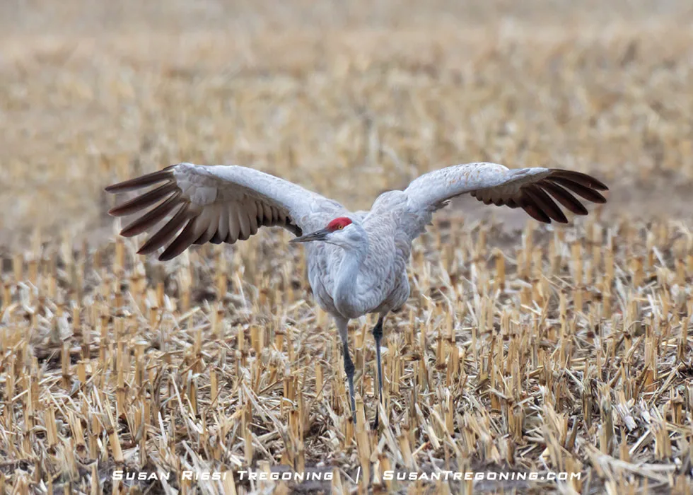
A Sandhill Crane squats low with her neck coiled back and wings close to her body with her primary feathers spread. This move is one of the most beautiful displays in the Sandhill Crane dance. The female typically does the curtsey in the dancing pair. It is a response to a Jump or Gape by her partner.
If you are a birdwatcher, this is a MUST SEE, and even if you aren't, the Sandhill Cranes are guaranteed to steal your heart. This Makes It the perfect time to plan a trip to visit the Sandhills—both the hills and the birds. As a photographer, the Sandhill Cranes are what keep me returning to Nebraska again and again.
Check out my blog post about The Spring Migration of the Sandhill Cranes for more information about timing your trip and where to see these amazing birds!
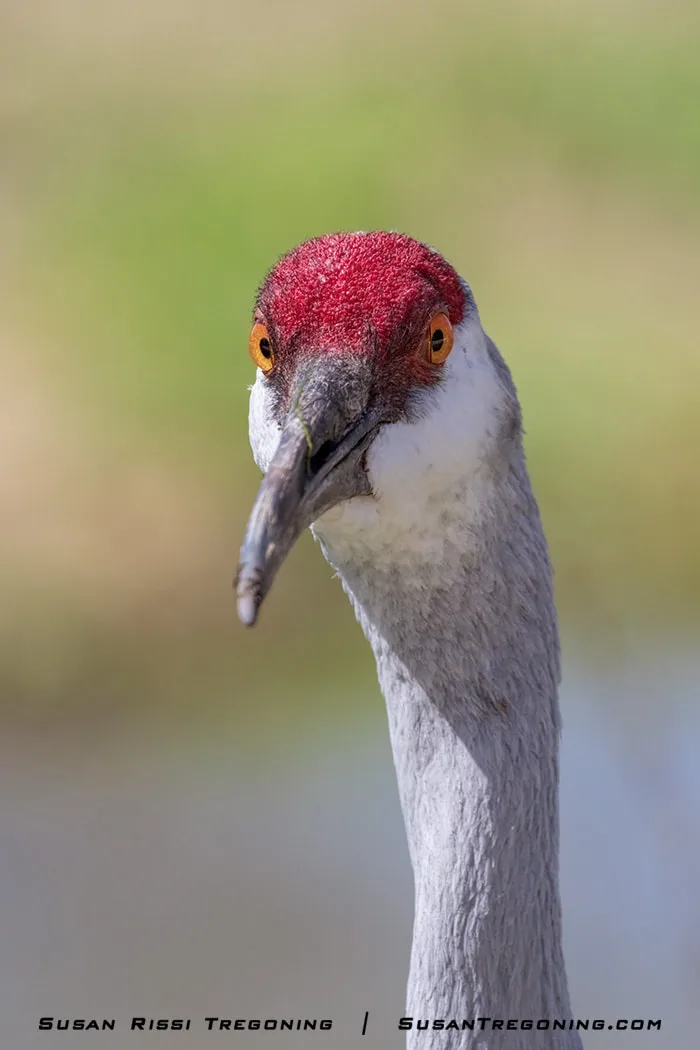
A Sandhill Crane stares directly into the camera, offering an up‑close look at its striking red crown, sharp beak, and intense golden eye.
Stuhr Museum of the Prairie Pioneer
3133 US-34, Grand Island
Another Grand Island MUST SEE is the Stuhr Museum of the Prairie Pioneer. This 200-acre complex is on the south edge of Grand Island. While they have a fabulous museum, my favorite part is the 1890s Railroad Town. They have recreated some buildings and relocated and restored many old buildings and homes from the area. They also have Henry Fonda's birth home.
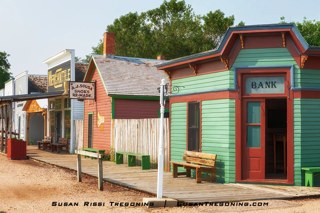
The Bank sits on the corner of downtown Railroad Town, part of a living history community representing an 1891 prairie town. More than sixty buildings and homes fill this four‑block area, recreating the look and feel of a late‑19th‑century settlement.

A vintage baseball uniform and bat sit cast off in the corner of a little boy’s bedroom, adding a nostalgic touch to the simple, early‑20th‑century space.
What makes a good living history museum is how well the interiors have been furnished and accessorized. These homes and businesses feel like the owners just walked out over a hundred years ago and left them this way. It's a true gem!
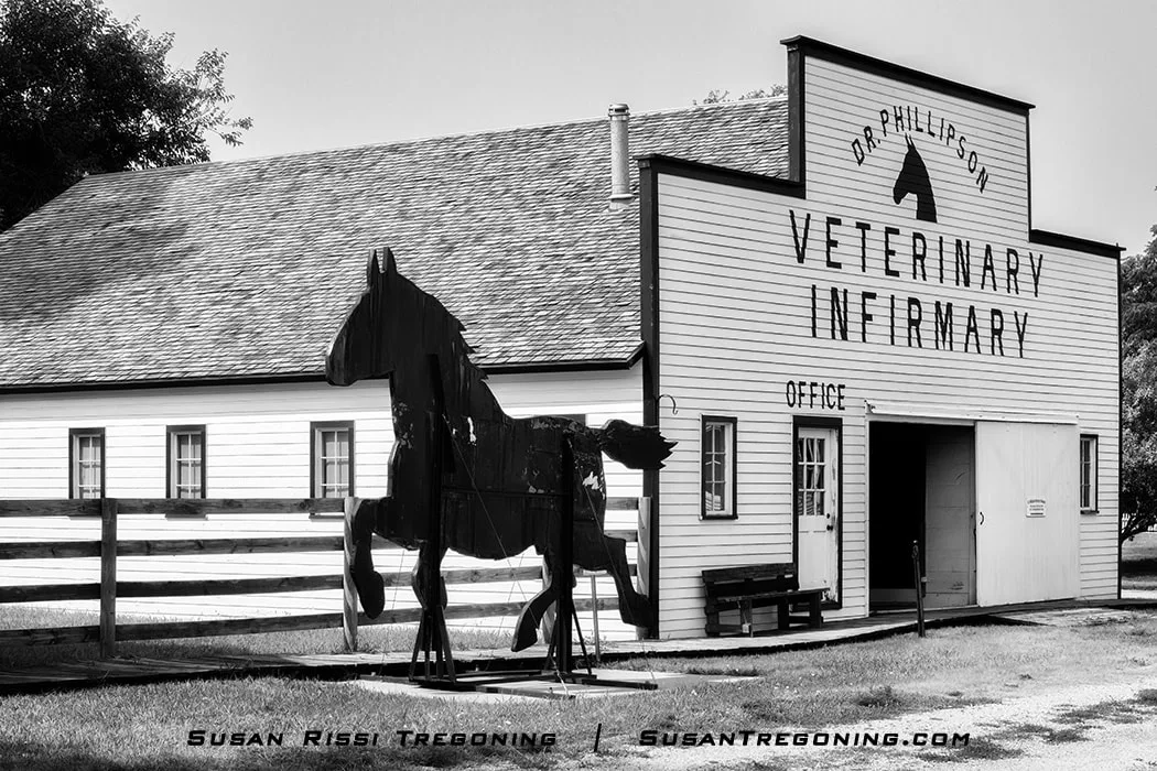
Grand Island’s iconic Black Tin Stallion stands beside the recreated veterinary hospital of Dr. Pete Phillipson in Stuhr Museum’s 1890s Railroad Town. Originally built as an advertising symbol for the North, Robinson, and Dean Sales Barn—back when Grand Island was the second‑largest horse and mule market in the world—the wood‑and‑tin stallion watched over the livestock yards for decades. After the company closed in 2004, the stallion was donated to the Stuhr Museum, where it has been part of Railroad Town since 2007.
Litchfield
Just a random piece of trivia...
Litchfield, Nebraska, is the very center of the nation. It's 1733 miles to each coast from here.
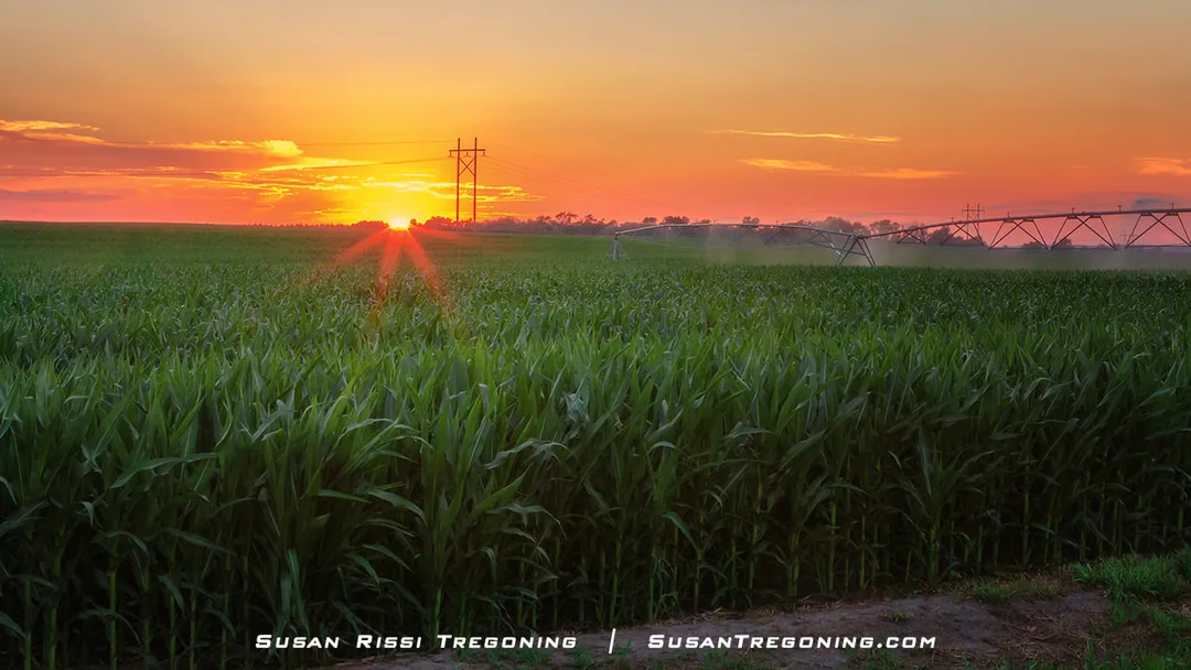
A Nebraska cornfield at sunset, with rows of tall corn stretching toward the horizon and glowing in the warm evening light.
Broken Bow
This is where you really start to get into the Sandhills.
Sandhill Journey National Scenic Byway Visitor Center
44106 NE-2, Broken Bow
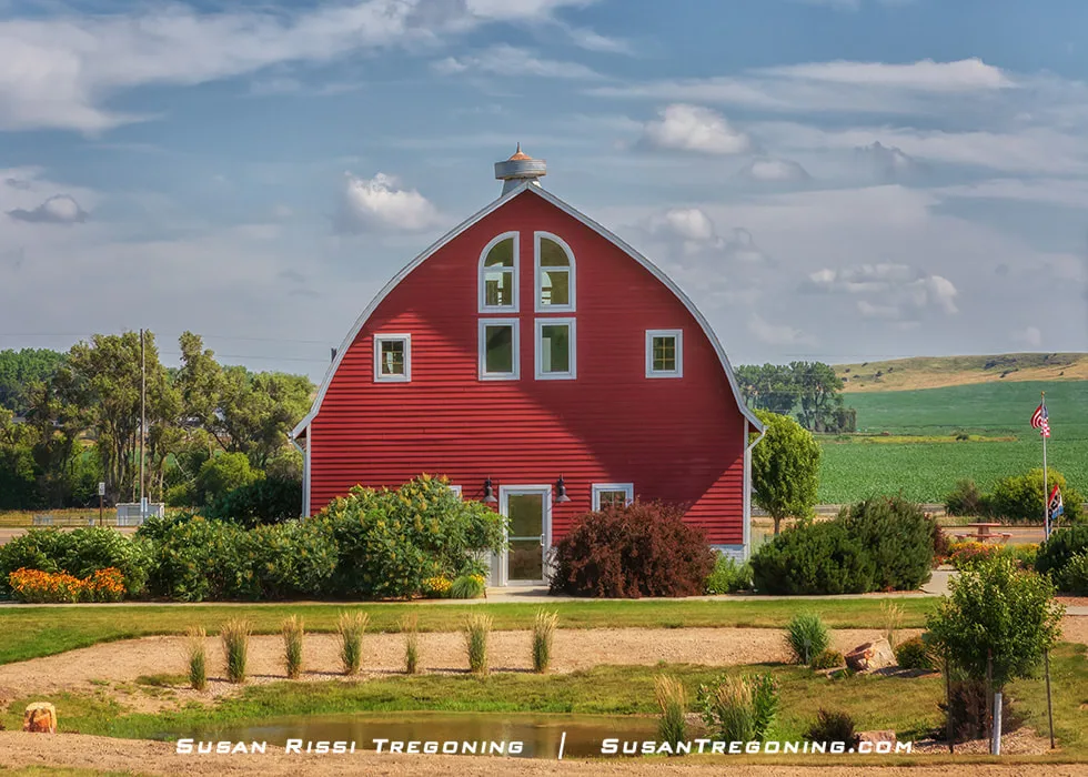
The Red Barn serves as the Sandhills Journey National Scenic Byway Visitor Center in Broken Bow, a bright landmark welcoming travelers exploring the heart of the Nebraska Sandhills.
Broken Bow is one of the last towns of any size to have a wide selection of restaurants and hotels at the eastern end of the Sandhills.
When Jesse Gandy platted Broken Bow, Nebraska, in 1882, he donated the lots to people to build homes and establish businesses, but he reserved the center of the town square for a park landscaped with trees, walkways, and a bandstand.
The town square was the town's first park. They broke ground for the park in 1885 and planted the trees on Arbor Day in 1886.
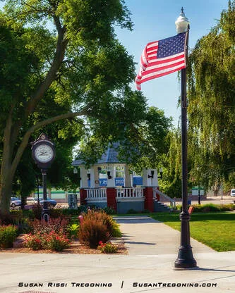
The town square in Broken Bow is beautifully decorated with American flags on each corner for the Fourth of July. At the center of the park stands the century‑old Tom Butler Bandstand, a long‑time gathering place for community celebrations.
The town added the bandstand in 1916. Band concerts were held weekly and are still held on most Thursday nights during the summer.
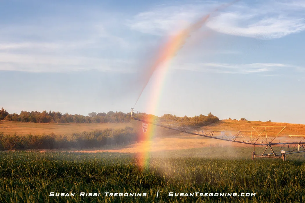
As the sun nears sunset, its low angle creates a rainbow in the water spray of a crop irrigation system sweeping across the field.
Broken Bow is still mostly cornfields, but the farmers use every square inch of land they can right up to the edge of the Sandhills.
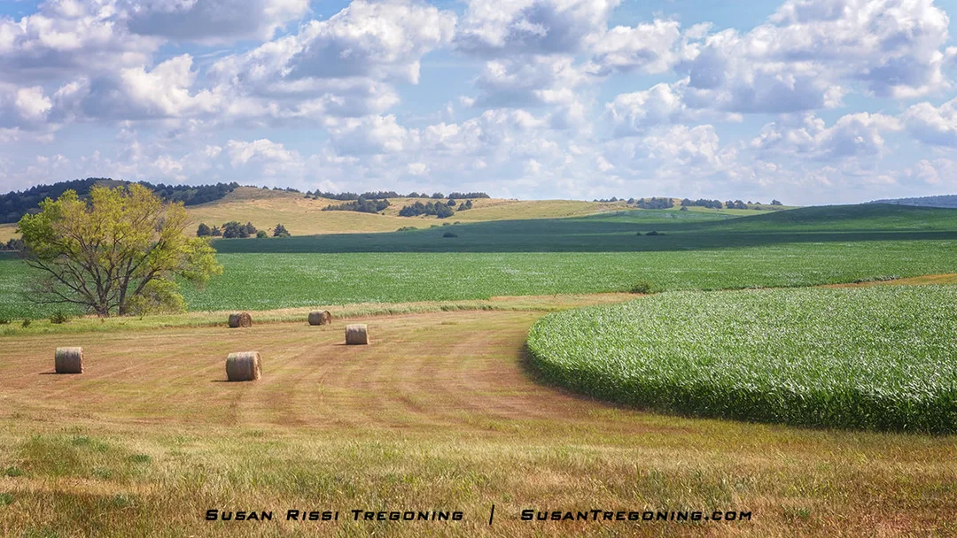
This gracefully curved cornfield, bordered by freshly cut and baled hay, immediately caught my eye. The precision of the cut around the cornstalks adds to the scene’s beauty, with the Nebraska Sandhills rising softly in the background.
While the Red Barn in Broken Bow is the Byway Visitor's Center, I recommend preplanning some of your trip using the Sandhill's Journey website.
Merna
Merna may be little more than a gas station, but an impressive collection of historic windmills stands right beside it, turning an unexpected roadside stop into something memorable.
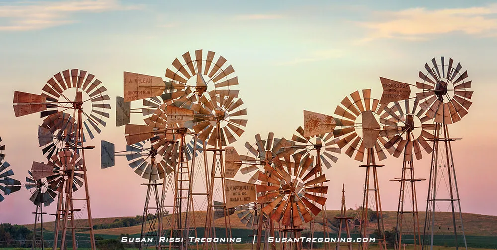
Downey Well Drilling’s collection of historic windmills stands in the village of Merna, creating a striking display against the open Sandhills landscape.
Victoria Springs SRA is located 6 miles north of the Byway in between Merna and Anselmo. It was established in 1925 and is the third oldest recreational area in the Nebraska park system.
We decided to take Victoria Springs Road east of Merna, and then we returned to the Scenic Byway on NE-21A Spur so we could see as much of the area as possible.
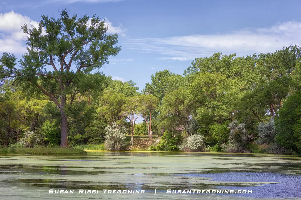
The scenic six‑acre lake at Victoria Springs State Recreation Area, surrounded by lush trees and quiet shoreline reflections.
Called the "Oasis of the Sandhills," Victoria Springs SRA is a 60-acre park at the base of the Sandhills. It is primarily a camping area, but there is a lake stocked with fish and paddleboat rentals. There is also a nice picnic area and a few historic buildings.
In 1874, intrigued by news of a mineral spring in the area, Oscar Smith and Custer County judge Charles Matthews came from Loup City to check it out. When they arrived, the valley was teeming with bison and elk.
Judge Matthews immediately staked a claim and built two log cabins on the land. One was his storehouse, and the other was his home and the first Custer County post office.
Back then, "taking the waters" and mineral spas were all the rage. Victoria Springs water became renowned for its therapeutic properties. The water was bottled and sold throughout the United States. They even tried to turn the area into a resort town, but that never happened.
Victoria Springs is the only known mineral spring in the state. It gushes out of the creek on the east side of the park.
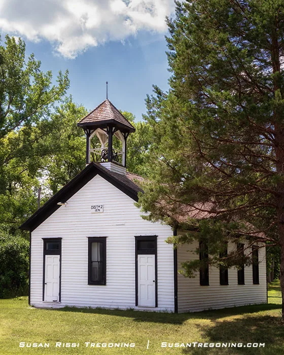
The New Helena one‑room schoolhouse, built in 1888–89, served local students until 1964, when the Anselmo–Merna Consolidated district was formed. New Helena was the area’s earliest town and organized its school district in 1876, becoming Custer County District #2 after a protest delayed its filing and cost it the distinction of being the county’s first district.
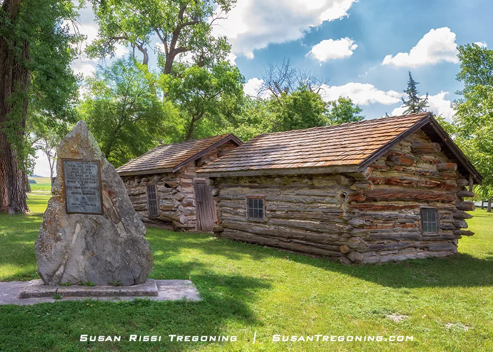
Judge Charles Matthews’ log storehouse served as his home and the first post office in Custer County, Nebraska.
Anselmo
Just off the south side of Highway 2, St. Anselm’s Catholic Church rises unexpectedly from the prairie, its tall brick façade earning it the nickname Cathedral of the Sandhills. Built in 1928–29, this is the parish’s second church, replacing the original 1905 building that now serves as the parish hall. Together with the rectory, the three structures form a cohesive parish complex that reflects both Late Gothic Revival and Bungalow/Craftsman design influences. In 2008, the entire complex was listed on the National Register of Historic Places, recognized not only for its architecture but also for its long‑standing role in the spiritual and cultural life of the community.
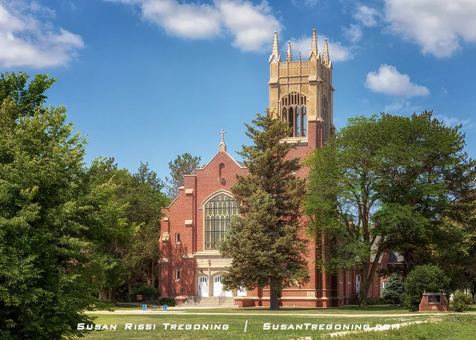
St. Anselm’s Catholic Church, the Cathedral of the Sandhills, stands prominently above the prairie just off Highway 2.
NE‑21A Spur—better known as Smith Avenue—forms the heart of Anselmo, a short main street where the town’s early history is still visible in everyday view. Along this stretch you’ll find an authentic sod house, a rare surviving example of the region’s earliest homesteading architecture, and a small historic jail built entirely without nails. Both structures sit right on the main street, making Anselmo one of those Sandhills towns where the past isn’t tucked away in a museum but woven directly into the rhythm of daily life.
Agriculture is the number one industry in Nebraska, with cattle and calf production being the number one segment in the industry.
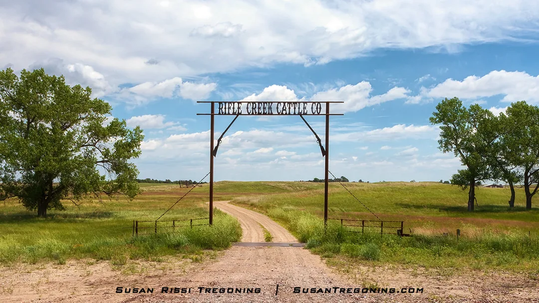
One of my favorite ranch gates along the Sandhills Journey National Scenic Byway, marking the entrance to Rifle Creek Cattle Co.
In the Sandhills, houses may be miles from the gate and almost always not visible from the road. The ranch gate is the entrance marker directing visitors up to the ranch. The gates usually display the ranch's name, and they will sometimes advertise the type of cattle they breed or the date the ranch was established. But, like in the Old West, the gates are still mostly wide open and welcoming here.
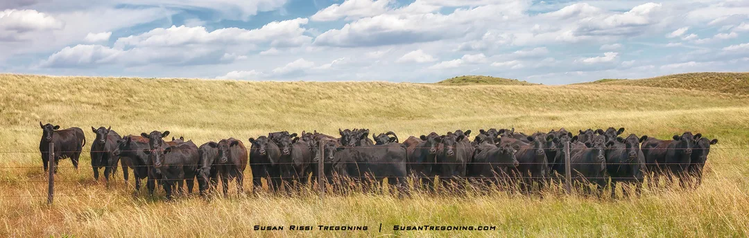
The moment I stopped to photograph a distant herd in the rolling Sandhills, every cow lifted its head, decided I was a friend, and came thundering to the fence—ruining my shot and snorting their indignation as I left.
Dunning
Dunning is a tiny burg of about 100 people situated at the confluence of the Dismal River and the Middle Loup River. You will cross the Dismal on the south side of town and the Middle Loup on the north. You will not see the Dismal River again from the Byway.
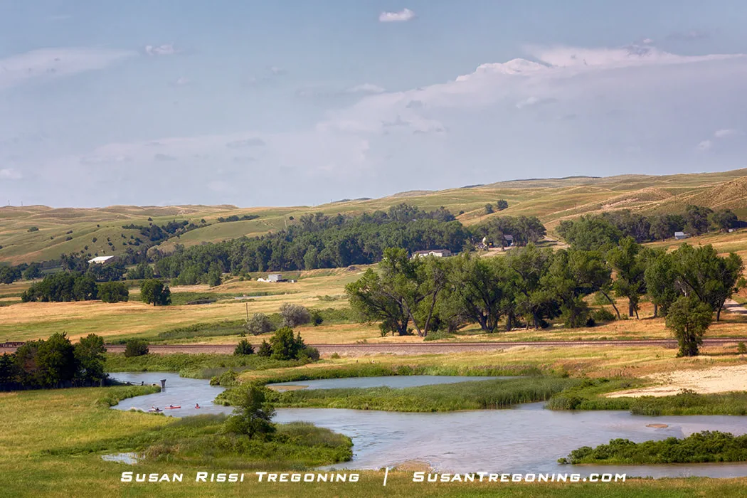
Kayaks on the Middle Loup River, winding through the lush green valleys of the Nebraska Sandhills.
For the next fifty miles from Denning, the Middle Loup River parallels Highway 2 until you get to Seneca.
Middle Loup River views are better when driving east than west, so remember to check behind you occasionally if you are heading toward Alliance.
Halsey - Nebraska National Forest
The Middle Loup River winds past the rolling hills of the Nebraska National Forest along the Sandhills Journey National Scenic Byway.
The Nebraska National Forest and Grasslands has two districts. The district along Sandhill's Journey is the Bessey Ranger District.
It began as an experiment by University of Nebraska horticulture professor Dr. Charles E. Bessey. Concerned with a possible national timber shortage due to large fires, unregulated harvests, and the country's growing need for wood products, Dr. Bessey wanted to plant trees in the Sandhills to help offset these shortages. Bessey and Gifford Pinchot, the first Forest Service Chief, convinced President Theodore Roosevelt to set aside two treeless tracts of the Nebraska Sandhills as a forest reserve.
The Charles E. Bessey Nursery, near Halsey, Nebraska, was established in 1902 to produce tree seedlings for replanting in the Sandhills. Today, the Nursery grows 2.5 to 3 million tree seedlings per year for distribution to national forests and state and tribal agencies in the Great Plains and West. It is one of only six USDA Forest Service-managed nurseries left in operation, and this Nursery is the oldest.
Although the Sandhills forest never became the timber-producing forest that Bessey envisioned, at one point, it was the world's largest completely hand-planted forest, encompassing 92,000 acres of rolling hills planted with 22,000 acres of trees! Nebraska State Forest is now said to be the largest in the Western Hemisphere, while Qinghai Tibet Plateau in China now has the title of the world's largest hand-planted forest.
I have never photographed the most heavily forested area. It is used for camping and has a very nice picnic area. It's a great place to stop and enjoy a picnic lunch in the shade.
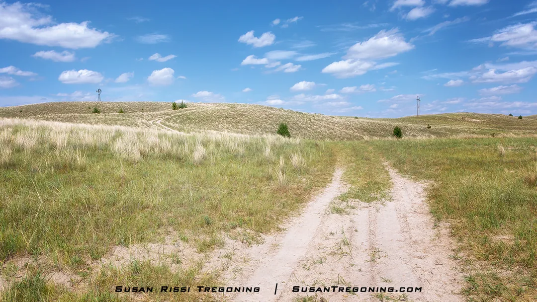
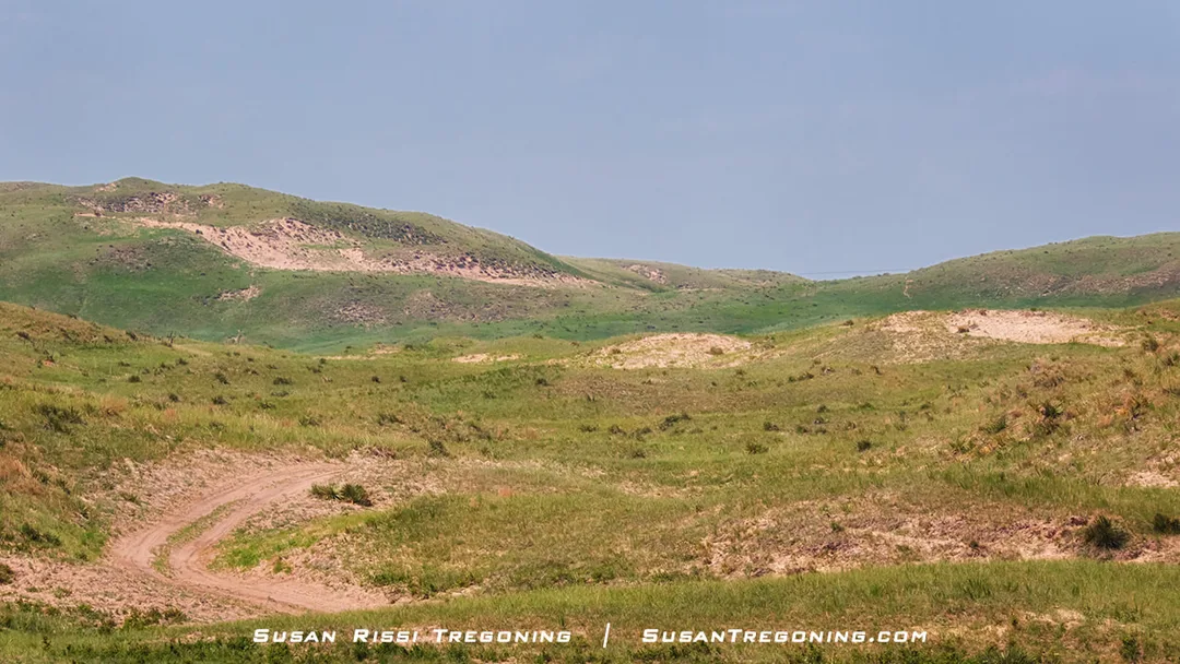
This sandy trail winding toward a distant windmill looked far better than the rough road we were actually driving, but I wasn’t sure if leaving the main route would take me onto private land.
I have always dreamed of exploring the Sandhills from the inside instead of just watching them rise and fall along Highway 2. But with most of the region privately owned, getting off the main road without trespassing is rarely an option. That’s why I was thrilled when we discovered a public 4WD‑only road at the far western edge of the Nebraska National Forest. For a moment, it felt like the adventure I’d always hoped for—finally a chance to slip deeper into the hills. Unfortunately, the excitement didn’t last long. Not far in, the road narrowed to a washed‑out stretch that would have been far more abuse than I was willing to put my Armada through. With a sigh and a reluctant glance back at the hills, we turned around.
Thedford
Thedford is a small village of fewer than 200 people. It has a grocery store, Dollar General, a couple of restaurants, and a gas station, so it's a good place to top off the tank and grab food.
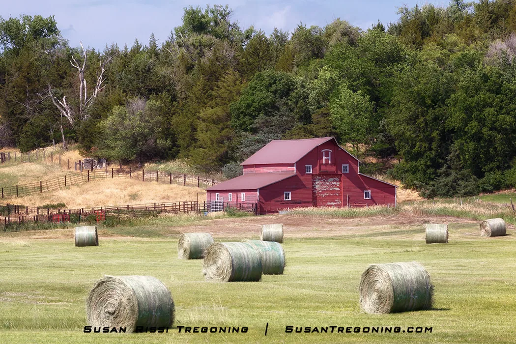
Scenes like this are common throughout the Sandhills, where meadows between the rolling hills fill with hay bales each season. It takes an enormous amount of hay to feed cattle and other ranch animals, with baling running from May through late summer and into early fall.
From the Thedford intersection of Nebraska Highway 2 and US Highway 83/Blue Star Memorial Highway, it is 41 miles north to visit Valentine National Wildlife Refuge, and 38 miles farther past Valentine NWR is Fort Niobrara National Wildlife Refuge.
We decided not to travel that far off the Byway on this trip, but if you like to visit National Wildlife Refuges, they are both well worth the drive. We have always seen many birds, prairie dogs, elk, and deer.
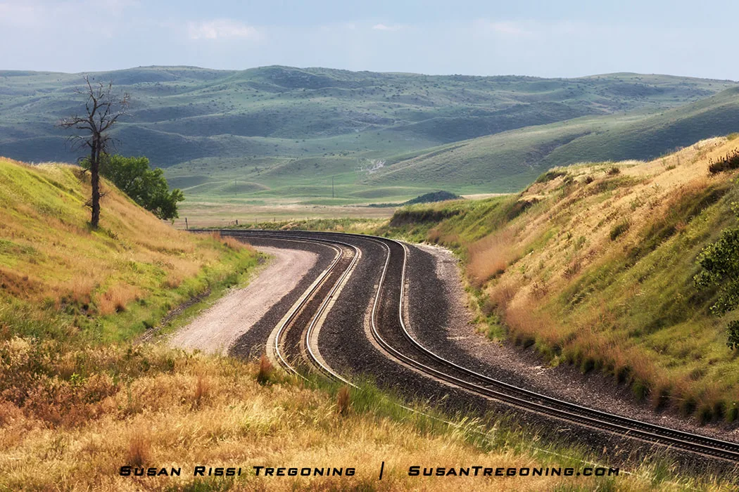
Railroad tracks zig‑zag through the rolling Nebraska Sandhills, curving with the natural rise and fall of the hills.
Seneca
On a previous trip through the Sandhills, we drove through Seneca, a population of 33 according to the 2010 census, until we crossed the Middle Loup River on the north side of town and discovered elk wading in the river.
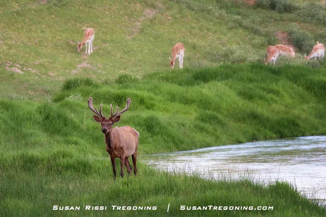
A bull elk walks along the edge of the Middle Loup River at Flip Licking’s Stable Productions Exotic Animal Ranch.
On this trip, we took a gamble, wondering if we could catch them in the river again, and a couple of elk were there!
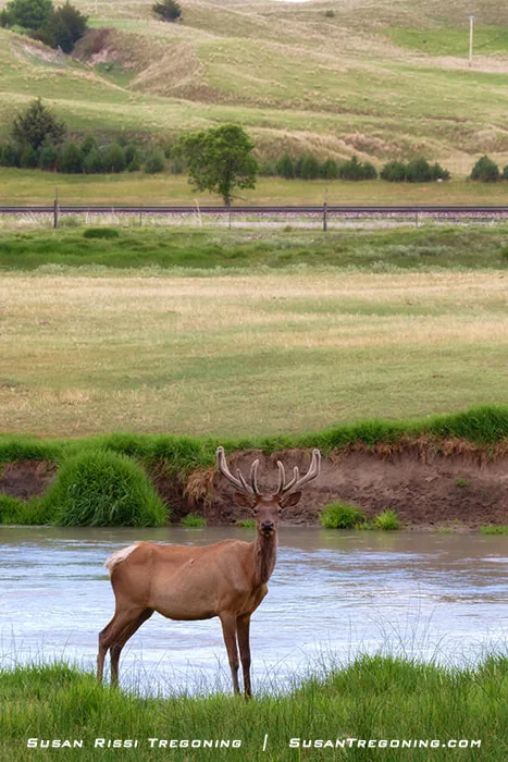
A bull elk poses beside the Middle Loup River, standing in the shallow water against the rolling green hills of the Sandhills
After a little research, I discovered this was the home of Flip Licking’s Stable Productions Exotic Animal Ranch. Unfortunately, we arrived after hours, so visiting wasn’t an option this time. Their reviews are consistently five stars, and their mission statement aligns with something that is near and dear to my heart. They offer ranch tours, a petting zoo, and even a four‑room B&B inside the barn. It’s definitely a place I want to return to when I can explore it properly.
Mullen
Just a short distance north out of Mullen on Nebraska Highway 92 will take you across the Middle Loup River. The area around the Middle Loup through here is especially scenic.
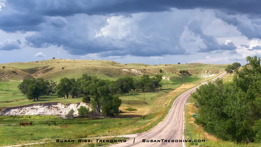
One of my favorite spots along Nebraska Highway 97 just north of Mullen. The clouds darkened dramatically as they rolled in, and for a moment it looked like we were in for quite a storm—then it passed without a single drop.
Shortly after leaving town, you will top a large hill. Look right for a beautiful view of the Middle Loup River. At the bottom of this hill is a driveway on the same side of the road. This is a tanking location, and it’s one of the few spots where you can walk down to the river without trespassing on private property.
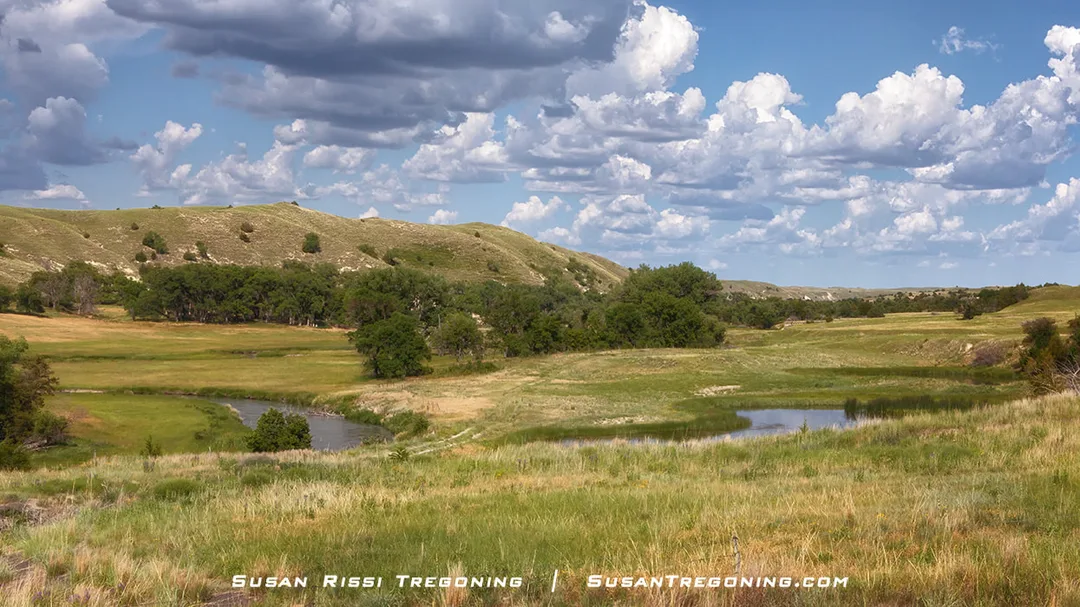
Just a peek at the Middle Loup River as it lazily winds its way through the Nebraska Sandhills just north of Mullen, Nebraska.
The Middle Loup River is a shallow, slow-moving river with a sandy bottom. It is bordered on both sides by private ranchland, so it is necessary to go through an Outfitter for river access. However, this lazy winding river is perfect for floating.
Down by the Middle Loup River, storm clouds roll over the Nebraska Sandhills, casting dramatic shadows across the hills as the light holds steady on the landscape below.
While you can rent a kayak, canoe, or even an inner tube at many outfitters, consider floating down the Middle Loup River in a livestock water tank for a unique Nebraska experience. These 7-9 foot in diameter tanks are practically unsinkable, making them perfect for people who prefer to stay dry while enjoying a float through the Sandhills.
While several different outfitters are in different areas of the Sandhills, the one along the Sandhills Journey National Scenic Byway is Gidden Canoe Rental at the Sandhills Motel in Mullen.
A windmill pumps water into a metal stock tank to keep livestock watered in the Nebraska Sandhills.
South of Mullen, you will find two world-renowned golf courses along the Dismal River: Sand Hills Golf Club and Dismal River Club.
Whitman
Once you get past Whitman, you will start noticing all the lakes and wetlands that are part of the aquifer system.
A BNSF Railway train crosses Doc Lake near Whitman, Nebraska, threading its way through the wide‑open Sandhills landscape.
Hyannis
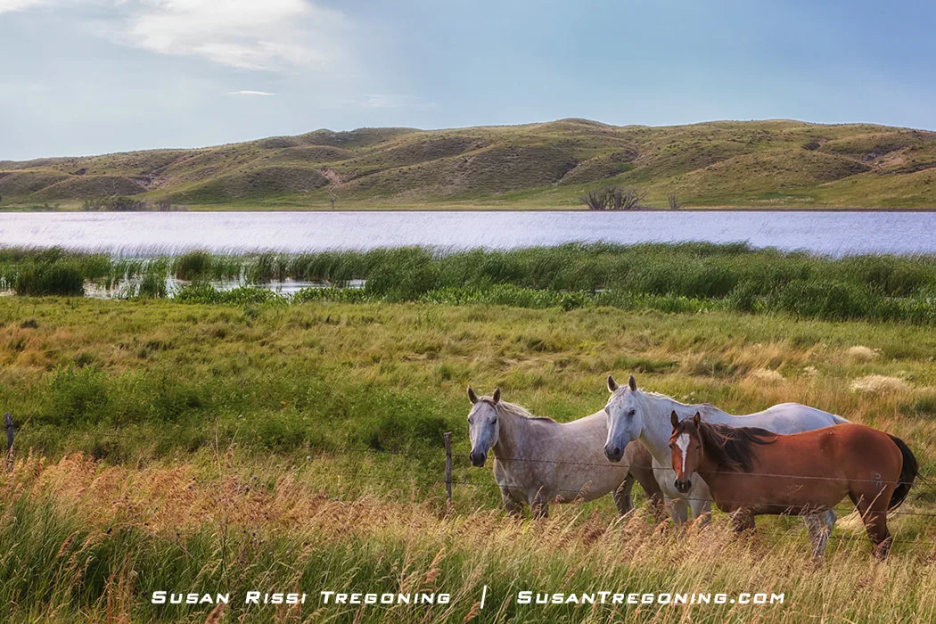
Three horses congregate near a barbed‑wire fence with Beem Lake and the rolling Sandhills behind them. Beem Lake, near Hyannis, is a swampy wetland close to the Avocet State Wildlife Management Area.
Grant County Museum
105 E. Harrison,Hyannis
Located in the Grant County Courthouse, the museum has memorabilia donated by the family of Charles Burt Hayward. Most notably, it has John Wayne's saddle from the movie True Grit.
Hayward grew up on his parent's cattle ranch near Hyannis and later became an actor, stuntman, and body double in Westerns dating from the 1950s through the 1980s. Hayward doubled for most famous stars that acted in Westerns during that time. After becoming good friends with John Wayne, he doubled Wayne in nearly two dozen of his later films. He received gifts from many stars he was a "stand-in" for, including John Wayne. Hayward's career spanned 50 years, and he was one of the most respected and admired stuntmen and stunt coordinators in the business. Hayward is in the Stuntman Hall of Fame.
Ellsworth
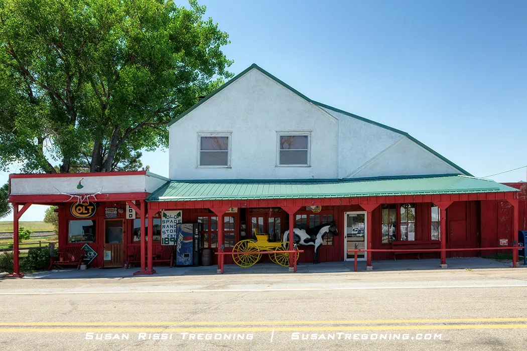
Morgan’s Store in Ellsworth, a historic Sandhills landmark once known as the Old Spade Ranch Store, still stands as a reminder of the region’s early ranching era.
Today, it is known as Morgan’s Store, but when it first opened in 1898, it was the company store for the legendary Spade Ranch. A historical marker on the north end of the building tells about the Spade Ranch.
After 1927, the store changed hands several times. It sat empty from 1967-1971, until Veldon Morgan, a former Spade Ranch Cowboy, purchased it. He and his son Wade built two warehouse additions to the original store. Through the 1970s and 1980s, they manufactured western tack and saddles and employed over 100 people. Morgan’s Western equipment is sold nationwide. However, Morgan began to downsize in the 1990s, and by 2000, factory operations had ceased.
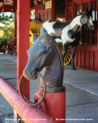
A cast‑iron horse‑head hitching post at Morgan’s Store in Ellsworth, a small reminder of the region’s ranching past.
Morgan’s is a ranch supply and general store that is now an eclectic store that carries clothing, boots, leather goods, guns, ammo, tack, and just about everything else a cowboy could need.
The store was placed on the National Register of Historic Places in 2010.
Lakeside
While it is common to see American White Pelicans migrating through Nebraska during the Spring and Fall, I have always been able to find Pelicans around the lake and marshes in the Sandhills, even in the summertime. Experts believe these are immature and nonbreeding Pelicans spending their Summer away from the nearby breeding colony at LaCreek National Wildlife Refuge in South Dakota.
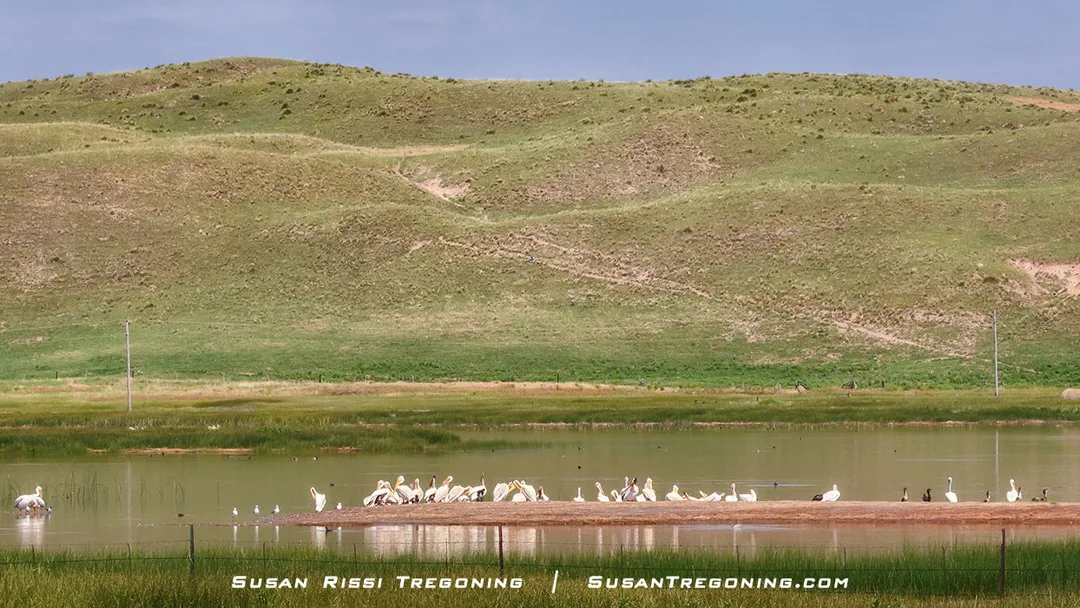
American White Pelicans gather on the sandbar at Hancock Lake in Lakeside, resting in the calm water before continuing their journey across the Sandhills.
When passing through Lakeside, I have never failed to find American White Pelicans, along with some Double-Crested Cormorants, hanging out at Hancock Lake on the north side of the Byway.
Nebraska Highway 250
Highway 250 intersects the Byway at Lakeside. If you head north on 250, you will drive through some of the most iconic prairie ranchland in the Sandhills as it winds around several small shallow lakes.
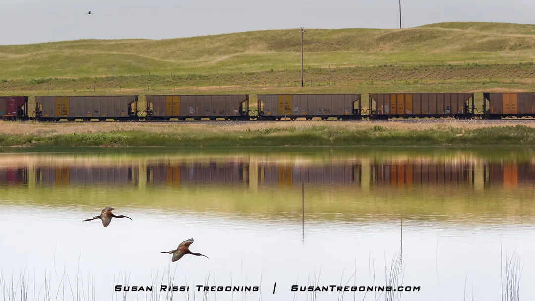
A pair of Ibis flies low across the wetlands while a passing train is reflected in the still water.
It’s a pretty drive, and while you won’t see many cars, it is the major highway through the area. Someone will eventually come along if you need help, so it’s a good choice if you want to venture off the Byway.
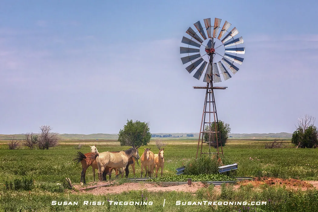
The horses spend a lazy day gathered beside the windmill and water tub on a Nebraska Sandhills ranch. Here in the heart of cow country, they’re most likely working horses. Some of the largest ranches in the United States are found in the Sandhills—thousands of acres in size—where many ranchers still rely on horses when checking their cattle.
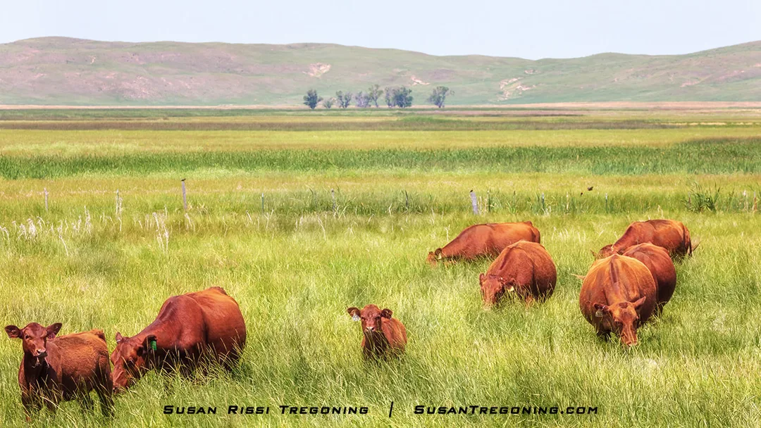
Red Angus cattle on a Nebraska Sandhills ranch mow the prairie one blade of grass at a time, doing the quiet daily work that keeps these vast grasslands healthy.
Smith Lake Wildlife Management Area
Smith Lake State Wildlife Management Area is 25 miles north of Lakeside on Highway 250.
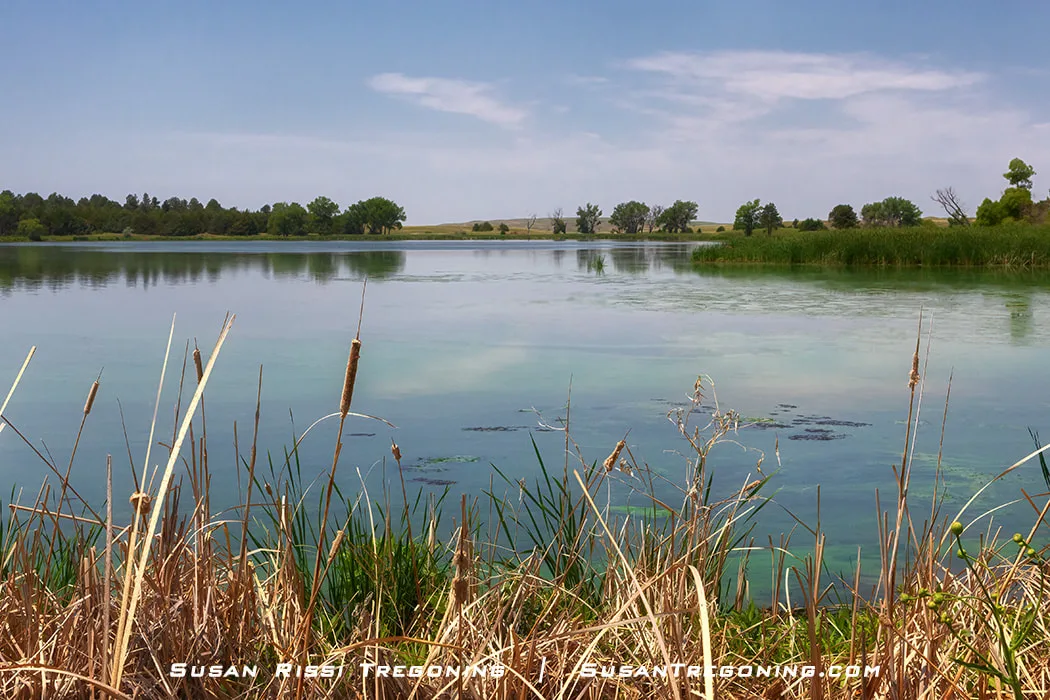
Scenic Smith Lake in the Nebraska Sandhills. Fed by a natural spring, it’s one of the few lakes in the Sandhills where fishing is allowed.
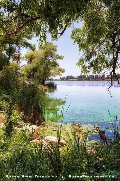
Another view of Smith Lake, its spring‑fed water reflecting the rolling Sandhills that surround one of the region’s few fishable lakes.
Crescent Lake National Wildlife Refuge
The most direct route to Crescent Lake National Wildlife Refuge is from Lakeside, approximately 28 miles south of Lakeside. Crescent Lake spans 71 square miles of grasslands dotted with wetlands, with a 19‑station self‑guided auto tour that winds through the refuge. It has been many years since I last made the trip, but I still remember that just getting there is an adventure. The drive from Lakeside is mostly dirt roads, and at one point I’m fairly certain an unimproved track through a farmer’s field was involved. I even found myself in a staring contest with a couple of bull calves—apparently practicing for the day they might grow up to be bulls.
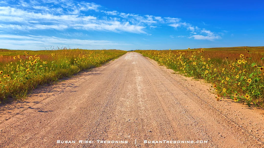
Plains Sunflowers lined both sides of the dirt road on my 2016 drive to Crescent Lake National Wildlife Refuge. I had never seen so many bright yellow blooms edging a road in my life, and aside from a few feisty calves I didn’t manage to photograph, this golden stretch of annual sunflowers is the part of the journey that has stayed with me.
It’s a fantastic refuge and fun off-byway adventure that will take you all day. Take your lunch along. I would not attempt this drive late in the day, if it has been raining recently or if you have a low-clearance car. The SUV that I was driving at the time made it just fine. I remember a few rough areas, but nothing so bad that you needed a 4WD. As always, with dirt roads, they can vary greatly from season to season and from one trip to the next.
Before heading out, check their website or call the refuge headquarters to make sure the refuge roads are open.
Antioch
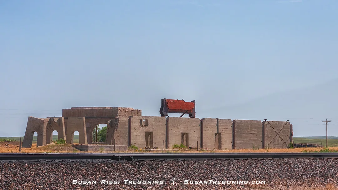
The ruins of a former potash plant in the ghost town of Antioch, Nebraska, a stark reminder of the short‑lived World War I–era industry that once brought this remote Sandhills community to life.
Potash was imported from Germany to produce fertilizer, Epsom Salts, soda, and other products. However, during World War I, potash became so scarce the price increased from around 8 to 10 dollars a ton to over $150 a ton!
In 1917, University of Nebraska scientists discovered a way to distill potash from the alkaline lakes in the Sandhills. Five potash reduction factories were built in Antioch. Virtually overnight, the town boomed, growing from a schoolhouse, one church, and a store to a population of 5000 people. Antioch became known as the "potash capital of Nebraska."
After the war ended in 1921, the US resumed trade with Germany and France. However, since importing potash was so much cheaper, the Nebraska potash trade was decimated. The factories closed and were mostly destroyed.
Today, Antioch is a ghost town with less than 25 residents, but the ruins of the potash plants are on the National Register of Historic Places. You can see what remains of two of the five plants along the Byway.
Birding Along the Byway
The Sandhills are at the heart of the Central Flyway, a critical habitat for millions of migratory birds.
Bird watching in the wetlands alongside the Byway between Lakeside and Alliance is fantastic, especially in the early morning and a couple of hours before sunset!
Here are a few of my images of commonly found birds in the Sandhills to watch for...
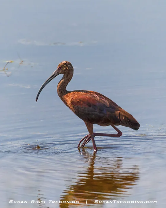
Water drips from this White‑faced Ibis’s bill, creating ripples across the surface as he forages for food.
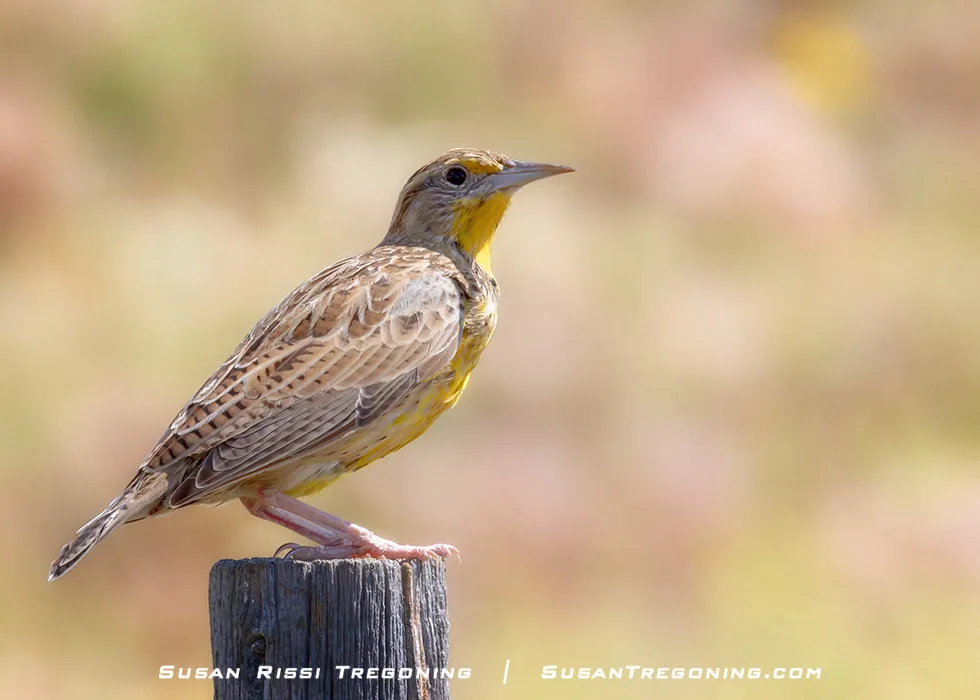
The Western Meadowlark, Nebraska’s State Bird, perches on a fence post, keeping watch over the open prairie.
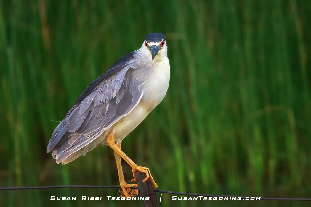
The Black‑crowned Night Herons were out in force after the storm, perched along the fence posts. I had forgotten just how abundant they are on the western end of the Sandhills.
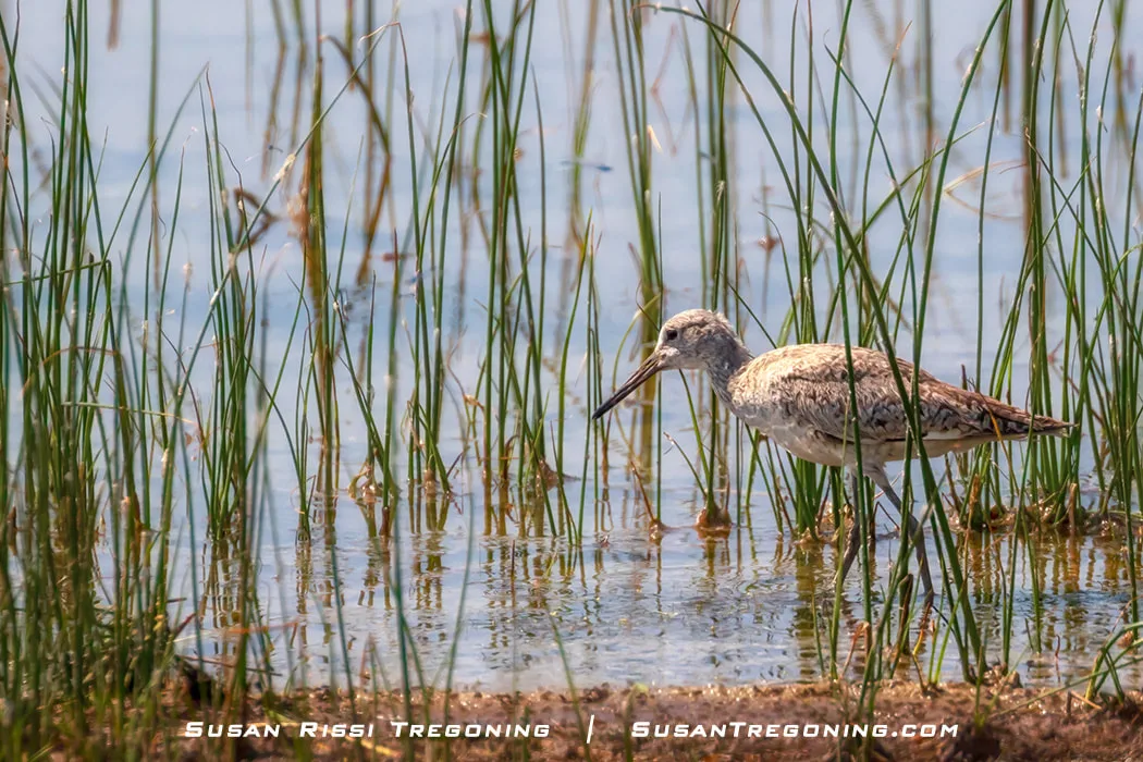
An Upland Sandpiper wades along the edge of the wetlands, searching for food.
Check out the Bird Watching in the Sandhills to learn more about birds commonly seen in the Sandhills.
Alliance
Shortly before you arrive in Alliance, you leave the Sandhills behind. Dubbed “An Oasis in the Sandhills,” the town sits along the region’s southern and eastern edge. With just under 8,500 people, Alliance is the largest community you’ll encounter since Grand Island. I grew up in a town with a similar population, but Alliance feels much larger because it supports much of the central population of the Nebraska Panhandle.
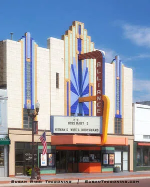
The Art Deco–styled Alliance Theater was built in 1937. The three‑story facade, marquee, box office area, and movie‑poster panels all retain their original colored glazed tile, even though the entrances have been modernized.
Alliance exists because of the railroad. When the Burlington and Missouri River Railroad reached the area in 1888, the town grew up around the right‑of‑way and quickly became a key point on the line. Today, the Burlington Northern Santa Fe (BNSF) Railway remains a major employer in Alliance, continuing the community’s long railroad legacy. If you have time, take a quick drive through the downtown business district—there are several interesting historic buildings that reflect the town’s early growth and its deep connection to the rails.
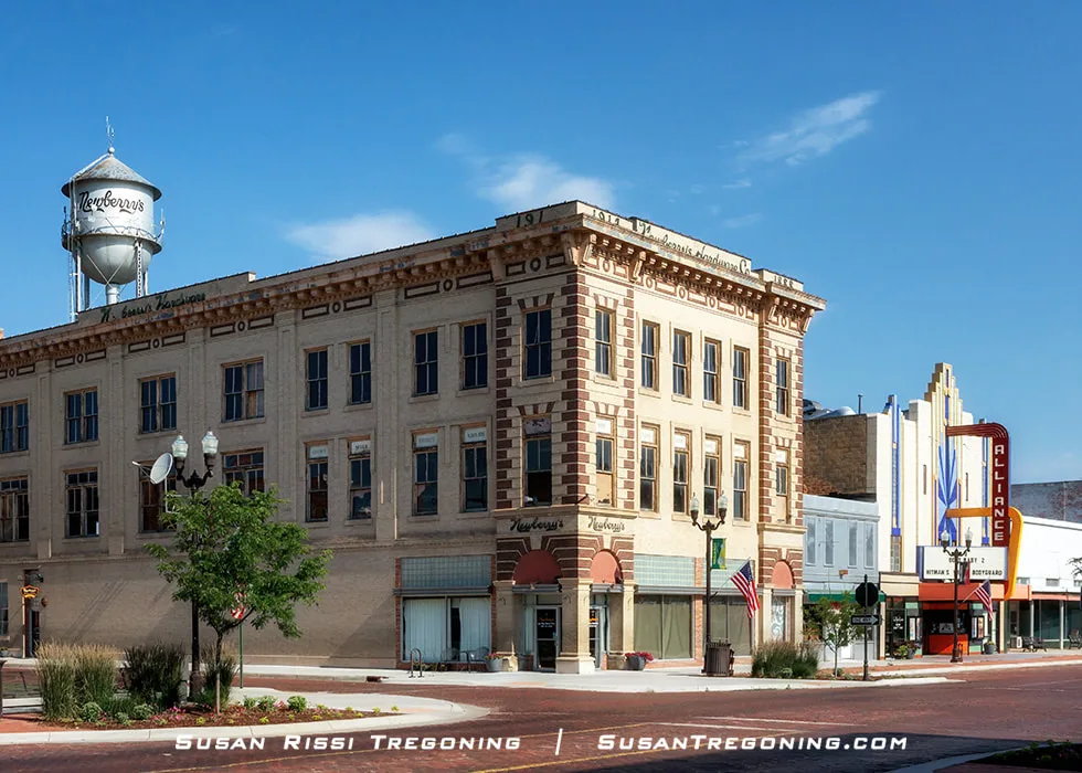
Newberry’s Hardware Company was established in 1888, the same year Alliance became a town. In 1914, the company built this three‑story Neoclassical Revival building, with hardware on the first floor, offices on the second, and a harness and saddle shop on the third.
Carhenge
Carhenge, located just north of town on Highway 87, is the most famous tourist site in Alliance. This quirky replica of Stonehenge was created using 39 vintage American automobiles painted with gray spray paint.
An idea sparked at Jim Reinder's father's funeral in 1982 came to fruition when Reinder and 35 of his family members gathered five years later at his father's farm for a family reunion. It was dedicated as a memorial to Reinder's dad during the summer solstice in June 1987 with champagne, poetry, song, and even a play written by the family.
Since that day, Carhenge has towered over the plains of Nebraska. A circle of cars, three standing trilithons inside the ring, the heel stone, slaughter stone, and two station stones are all placed to assume the same proportions as Stonehenge. The outside circle of cars measures approximately 96 feet in diameter. Some vehicles are held upright by burying their trunks in 5-foot-deep pits. The automobiles used to form the tops of the arches have been welded in place. A 1962 Caddy has the place of honor as the heel stone.
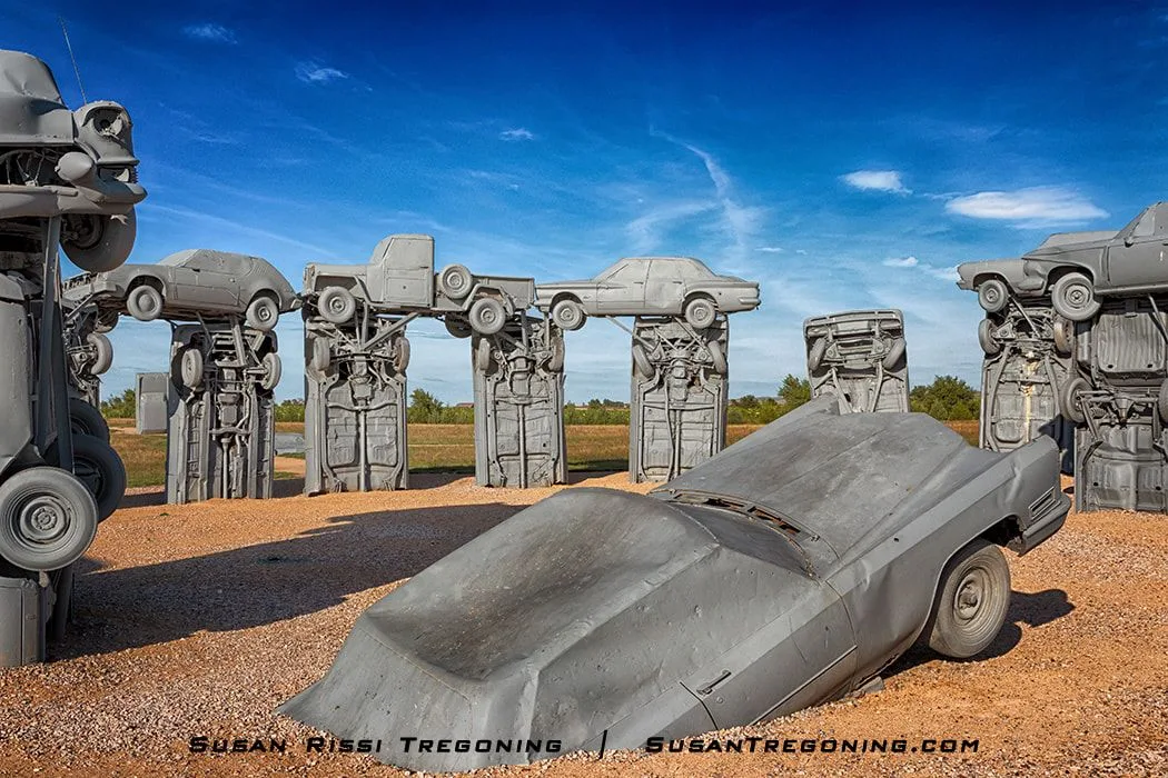
The heelstone at the center of Carhenge is a 1962 Cadillac, positioned to mirror the standing stone at England’s Stonehenge.
Other great places to check out while in Alliance...
Burlington Locomotive #719
8th Street & Box Butte Avenue intersection
This 86-ton steam engine, which dates from 1903, was donated to the city by the Chicago, Burlington, and Quincy Railroad. Initially built in the Havelock, Nebraska, shops, it was used for nearly 50 years.
Knight Museum and Sandhills Center
908 Yellowstone Avenue at the corner of Central Park.
This historical Museum provides the history of Alliance and the railroad, giving you a glimpse of what it was like to live in the Sandhills when it was first settled.
You can check out Central Park while you are at the Knight Museum. During the Great Depression, Alliance took full advantage of the New Deal to improve the city. As a result, Central Park received a fountain, swimming pool, and bathhouse at that time. The fountain in front of the bathhouse, refurbished in 2007, has a computerized fountain spray system with lights. Watching the fountain is a fun nighttime activity in the summer.
1101 Niobrara Avenue
320 E 25th Street
A turn-of-the-century frontier village created by Kenneth "Dobby" Lee, who relocated nineteen old Western Nebraska buildings to his property and restored them. Dobby's Frontier Town has won many awards and was featured on the TV show "Home and Gardens."
Other than my blog post about the Sandhill Cranes that I mentioned above, you may also be interested in reading:
Following the Path of the Pioneers Through Western Nebraska
That blog post covers the Western Trails Scenic and Historic Byway from Ogallala, Nebraska, to the Wyoming border.
Not every image makes it into my blog. If you enjoyed the photos in this article, check out the Nebraska Collection, Birds Collection, and Sandhill Crane Collection for more pictures of this beautiful state, or visit my Gallery with over 4000 images of locations around the United States.
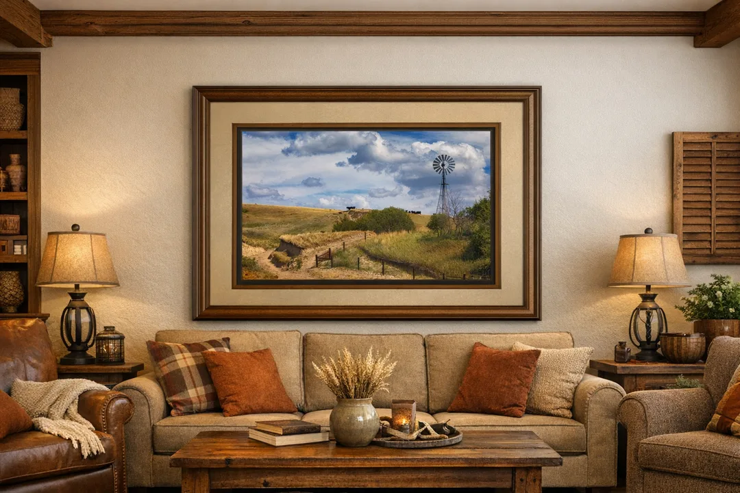
Add warmth and authenticity to your space with this Nebraska Sandhills landscape, where cattle and windmill meet rolling grass‑covered dunes.
Fine Art Prints are available for order as print only, framed art, canvas art, metal art, acrylic art, and wood art prints in various sizes. Home Decor and Gift Ideas include shower curtains, throw pillows, towels, totes, phone cases, t-shirts, puzzles, blankets and more—Worldwide Shipping with a 30-day money-back guarantee.
More of the USA
- Illinois (6)
- Wildlife (6)
- Mississippi (6)
- Nebraska (5)
- Route 66 (5)
- Wyoming (4)
- Minnesota (4)
- West Virginia (3)
- Hawaii (3)
- Indiana (3)
- Iowa (3)
- Pennsylvania (2)
- Missouri (2)
- Michigan (2)
- Virginia (2)
- Wisconsin (2)
- A Travelers Musings (1)
- South Dakota (1)
- Louisiana (1)
- Tennessee (1)
- Alabama (1)
- Maryland (1)
- North Carolina (1)
- Texas (1)
- New Mexico (1)
- Washington DC (1)
- Montana (1)

I'm so happy you enjoyed my post. Thank you for taking the time to leave me a note!
I'm so happy you enjoyed it. Thanks for leaving me a note!
What is the best time of year for photography if you only have one time to travel it?I usually try for fall because but that may not be the best time for the Sandhills.