Top of the Trace: The Natchez Trace Parkway - Tennessee and Alabama

The double‑arched Natchez Trace Parkway Bridge crosses Birdsong Hollow in a dramatic 1,648‑foot span, soaring 155 feet above the valley. Completed in 1994 and honored with the Presidential Award for design excellence, it’s a stunning autumn stop—especially just after sunset.
Travel back in time along the 444‑mile Natchez Trace Parkway, an All‑American Road stretching from Natchez, Mississippi, to Nashville, Tennessee, with a brief sweep through northwest Alabama. Officially opened in 2005 after 67 years of planning and construction, the Parkway preserves one of the most historic travel corridors in the Old Southwest. Today, seven segments of the Old Trace are listed on the National Register of Historic Places, and the drive offers more than 10,000 years of stories, landscapes, and landmarks to explore at a leisurely 50 mph.
Our journey down the Natchez Trace Parkway begins in Tennessee and slips into the quiet countryside of northwest Alabama, where waterfalls, river crossings, and early Old Trace history set the tone for the miles ahead.
A Brief History of the Natchez Trace
The Trace began as a series of random Indian trails connecting the Natchez, Mississippi, area to what would eventually become Nashville, Tennessee. Animals created the first corridor traveling from the Mississippi River to the salt licks in the Nashville area. When the Indians came along, they followed these same trails when hunting those animals for food.
By the early 1800s, these trails had evolved into America’s first National Road, linking what were now two bustling hubs of commerce. While it was easy to build makeshift flatboats to float goods down the Mississippi River, fighting the current coming back upstream was impossible. Keep in mind this was the era before steam power. The boatmen, AKA Kaintucks, solved this by scrapping their boats in Natchez, selling the lumber and everything else, and walking home along the Trace. In addition to the Kaintucks’ traffic, the road was used for troop movements, a postal service, and general travel between the two frontier towns.
By this point, these Indian paths were so highly traveled that deep gullies were worn into the ground. Some of this Sunken Trace is as much as 30 feet below the land around it. It was quite dangerous, fraught with bandits and angry Indians who preyed on the now‑wealthy boatmen flush from selling their goods. There were also mosquitoes, poison ivy, and poisonous snakes that thrived in the swampier areas. Those swamps made for deep mud that could be found along much of the trail. The Trace was by no means an easy road; it took travelers about six weeks on foot or four weeks by horse.
By the 1820s, the invention of the steamboat had come to the Mississippi River, and travel on the Natchez Trace had all but stopped. You would think that traffic would still be visible with this being a national road. However, newer and better roads were being built. By 1830, Jackson’s Military Road was completed between Columbia, Tennessee, and Madison, Louisiana. In 1840, Robinson Road, which ran between Columbus and Jackson, was in use. Eventually, the railroads came along, offering even better and faster alternatives than traveling the Natchez Trace. The Trace was all but forgotten.
This post begins in Nashville, TN, and follows the first 136 miles of the Natchez Trace Parkway through Tennessee and Alabama to the Mississippi state line. All milepost numbers correspond to the Parkway’s official system, with markers located on the east side of the road.
For planning your own trip, you can download Natchez Trace Maps and printed copies of the official map are widely available along the Parkway. Don’t travel the Trace without one — it’s the key to finding the overlooks, trails, historic sites, and hidden gems you’d otherwise miss.
Tennessee "Must See" Trace Sites
8400 Hwy 100, Nashville, TN
Located about 150 yards east of the northern terminus of the Natchez Trace Parkway, the Loveless Cafe has been serving classic Southern cooking for more than 65 years. They’re especially known for their fried chicken and their famous biscuits, which are still made from the original recipe.
While it’s absolutely worth a stop, be prepared for a wait. This place stays busy. We arrived at 2 p.m. on an off‑season Friday afternoon and still had a 30‑minute wait for seating.
Rating: 4.6

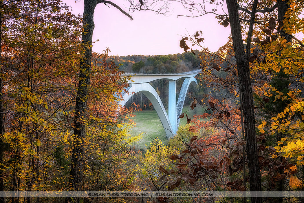
The Birdsong Hollow Double Arch Bridge in early spring, its graceful arches rising through muted light on an overcast day.
#438 - Double Arch Bridge
This double‑arched bridge spans Birdsong Hollow on the Natchez Trace Parkway. Completed in 1994, it received the Presidential Award for Design Excellence the following year for its innovative, graceful engineering. The bridge stretches 1,648 feet and rises 155 feet above the valley floor, making it one of the Parkway’s most iconic modern landmarks.
The bridge can be viewed from two different locations. If you’re heading south on the Trace, take the first road to the left after crossing the bridge to reach the overlook below. From there, you’ll have a sweeping view of both arches and the surrounding hills.
Leiper's Fork
Located just one mile east of the Natchez Trace Parkway, this beautiful little historic town is well worth a quick side trip. The Old Trace once ran straight through the center of the village, and its roots reach back to the late 1790s. Today, the entire community is listed as a National Historic District.
If you grew up in the late ’70s or early ’80s, you’ll get a kick out of the iconic car from The Dukes of Hazzard parked at the town limits — a nostalgic surprise that makes the stop even more memorable.
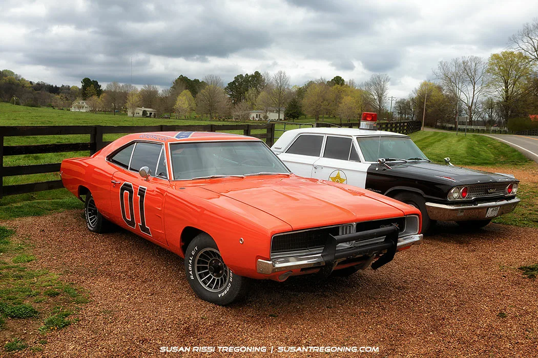
The General Lee: This iconic orange 1969 Dodge Charger is one of the surviving General Lees from the TV show The Dukes of Hazzard. It’s the real deal — we even checked the hood for the telltale scratches and dents from Luke’s famous “hood slide.”
Estimates vary widely on how many Chargers were used during the show’s six‑year run, ranging from 256 to 321. On average, at least two General Lees were totaled per episode, thanks to the show’s signature jumps and stunts.
Only 18 authentic General Lees are known to still exist today. Warner Brothers kept one and sold the remaining 17 to private owners, making each surviving car a rare piece of television history.
#411.8 - Water Valley Overlook
Late autumn settles over Water Valley, revealing a sweeping 180‑degree panorama from the overlook.
You can drive the short road up to the top of the ridge for this fantastic 180-degree view of Water Valley.
#407.7 - Gordon House Historic Site & Duck River Ferry Site
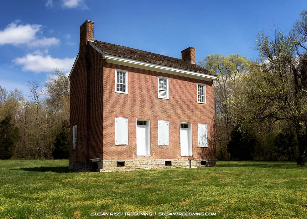
The 1817–1818 Gordon House, standing beside the Duck River as one of the Old Trace’s few surviving original buildings.
Built in 1817–1818, the Gordon House is one of only two original structures still standing on the Old Trace.
Located just inside Chickasaw Territory in the early 1800s, John Gordon entered into an agreement with Chickasaw Chief George Colbert to operate a trading post, rest stop, and ferry service across the Duck River at this site. Because Gordon spent much of this period away on military expeditions during the War of 1812, his wife, Dorothea, oversaw the construction of the house and managed the day‑to‑day operations.
Gordon died shortly after the home was completed, but Dorothea and their eleven children continued to live here and run the ferry. While the trading post and rest stop were short‑lived, the ferry remained in operation for nearly 100 years, until a bridge was built in 1896.
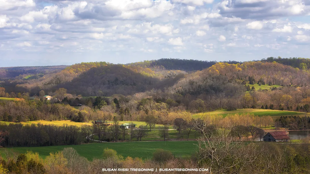
#405.1 - Baker Bluff Overlook
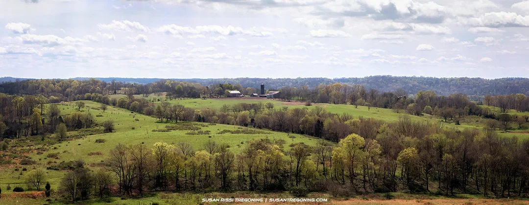
Rolling fields and wooded hills stretch out from Baker Bluff Overlook, offering one of the Trace’s most memorable Tennessee views.
Baker Bluff offers one of the best scenic views of the rural Tennessee countryside along the Natchez Trace Parkway. The overlook opens onto rolling farmland, wooded hills, and the quiet, open landscape that defines this stretch of the Trace.
A sign here notes that it’s only ⅓ mile to Jackson Falls, but that distance is only to the Falls trailhead, not the falls themselves. The short hike between Baker Bluff and the trailhead is hilly and wooded with no scenic views along the way.
Just drive it — you won’t miss anything by skipping the walk.
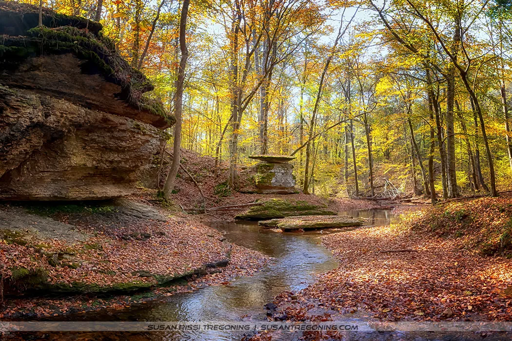
#404.7 - Jackson Falls
Not visible in this photo, Jackson Falls begins on the right as a long cascading slide before turning and flowing down a beautifully sculpted rock formation into a clear pool at its base. The trail to the falls is a paved but steep 900‑foot walk.
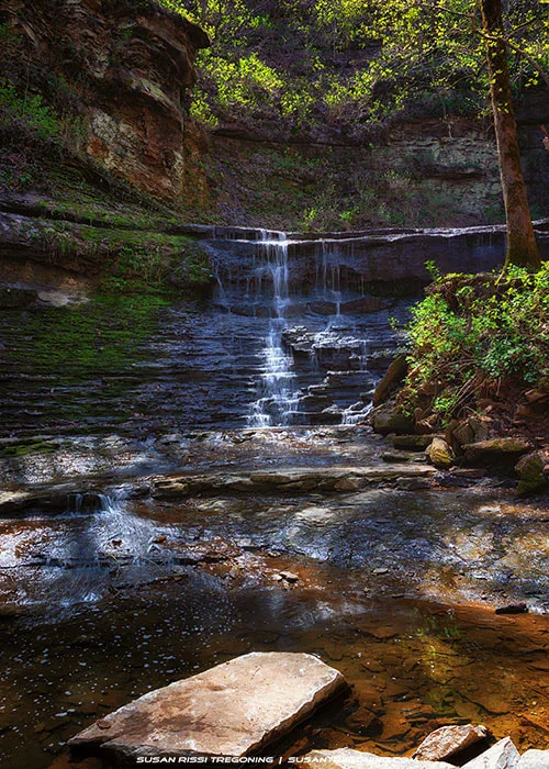
Water flows in a smooth cascade over sculpted rock at Jackson Falls, collecting in a clear pool framed by moss and deep green forest.
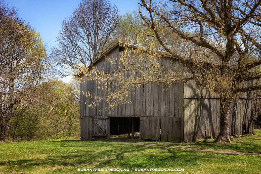
A rustic tobacco barn sits in a quiet spring clearing, its weathered boards echoing the region’s early farming history.
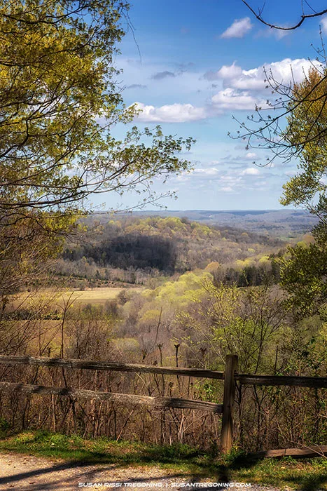
A narrow opening in the trees reveals a soft spring valley along Old Trace Drive, with a weathered fence in the foreground.
It may have just been too early in the season, but it doesn’t appear that the state of Tennessee is currently maintaining this site as an example of early 1900s tobacco farming. The small demonstration plot is now grass‑covered, and only a few dried tobacco leaves remain hanging in the back corner of the barn — they look like they’ve been there for years. Even so, the interior still carries a distinct tobacco scent, a quiet reminder of the farm’s original purpose.
The real highlight here is the two‑mile drivable section of the Old Trace. This narrow, one‑way road heads north, allowing you to enjoy the historic route without worrying about oncoming traffic. It’s a rare chance to experience the Trace much as travelers would have more than a century ago.
#391.9 - Fall Hollow
It’s just a short walk to a small deck where you can look down on the largest waterfall. From there, the trail drops steeply over rocky terrain to reach the base. Since it was raining and the path was muddy, we skipped the hike down.
#385.9 - Meriwether Lewis
While traveling the Natchez Trace to Washington, D.C., Meriwether Lewis died at Grinder’s Stand on October 11, 1809. He was only 35. There is long‑standing speculation as to whether he was murdered or committed suicide, though most historians believe it was suicide. Visit the 1848 monument marking the place where Lewis is buried; the column, broken intentionally, symbolizes a life cut short.
You can hike along the Old Trace to the ruins of the inn, located about 230 yards south of the monument. A small on‑site museum also shares the history of that night and Lewis’s final journey.
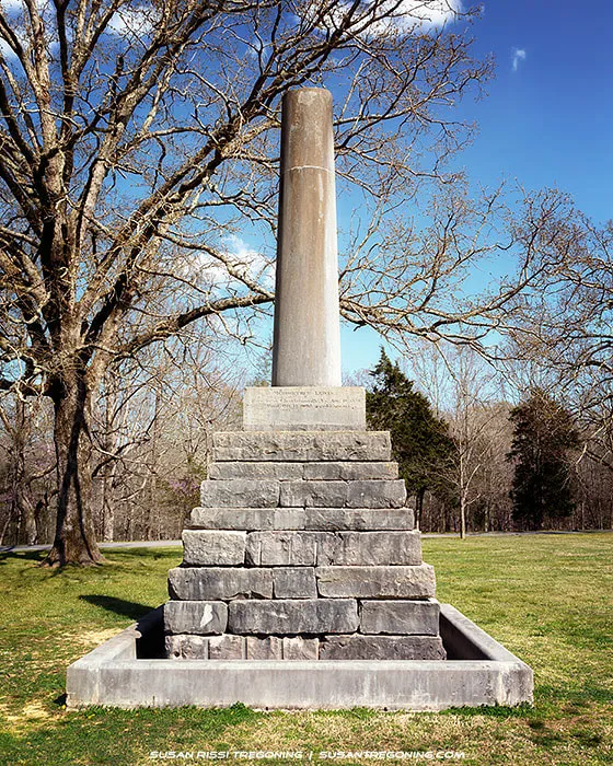
The 1848 Meriwether Lewis Memorial stands over his gravesite at Grinder’s Stand, its intentionally broken column symbolizing a life cut short.
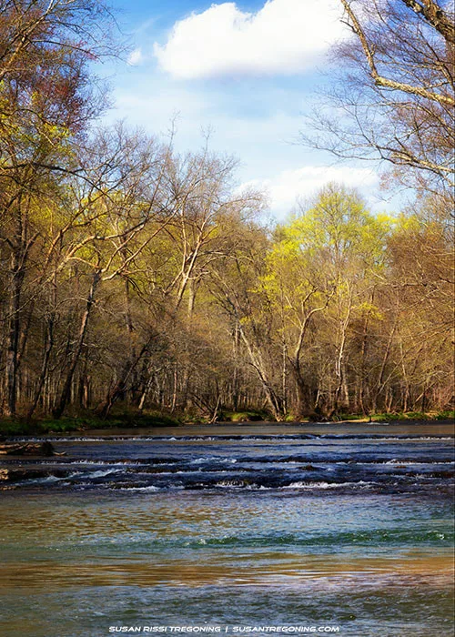
#382.8 - Metal Ford
A quiet autumn scene at Metal Ford on the Buffalo River, where stone steps descend toward the water beneath a canopy of fall color.
Metal Ford on the Buffalo River, with early spring trees lining the banks and water flowing over shallow ripples.
The Buffalo River served as an important river crossing for frontier travelers along the Old Natchez Trace. Except after heavy rains, it was almost always fordable, ranging from ankle‑ to chest‑deep. Travelers called it Metal Ford because the smooth stone river bottom reminded them of the stone‑surfaced, or “metaled,” roads of the day. A small section of the Old Trace still follows the water here.
Steel’s Iron Works operated at this site in the 1820s. A charcoal‑burning furnace once stood here to produce pig iron. Today, all that remains is the slag pile and a short section of the mill race that once carried water to power the air‑blasting machinery.
#375.8 - Old Trace Drive
A 2.5‑mile drivable section of the original Natchez Trace, this one‑way road heads north and preserves the feel of the early route.
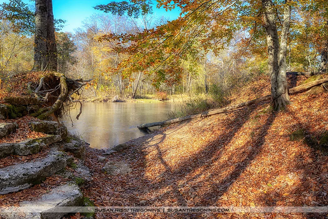
#364.5 - Glenrock Branch
Autumn at Glenrock Branch, with a quiet stream flowing beneath tall trees and limestone bluffs rising along the bank.
Glenrock Branch is listed on the Parkway map as a picnic area and restroom, but it’s far more scenic than the simple label suggests. It is gorgeous here, so don’t unknowingly miss this spot. It’s a short but steep walk down to the creek, where the limestone bluffs curve around the picnic area, creating a natural amphitheater of stone and water.
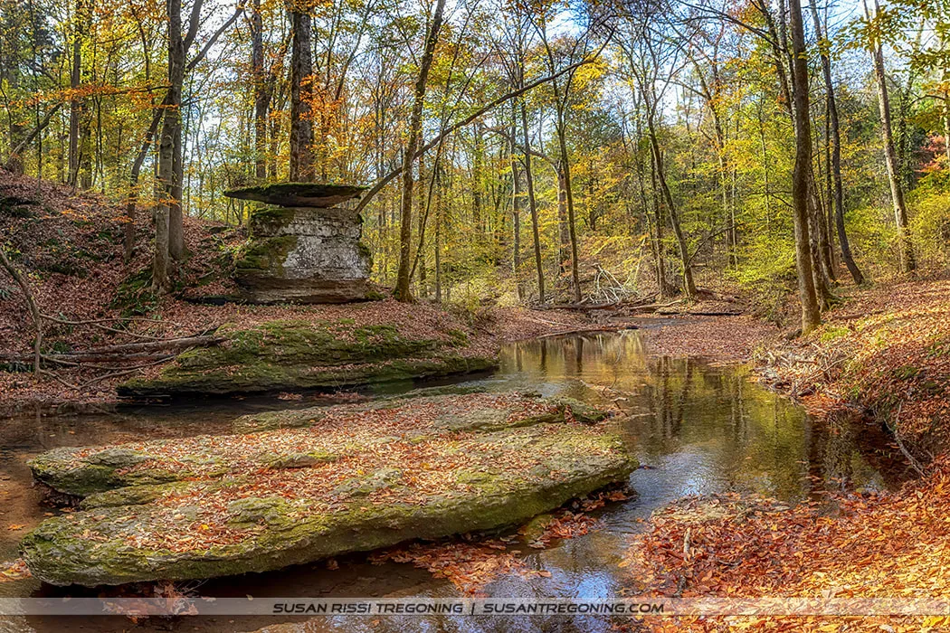
A balanced rock formation beside the creek at Glenrock Branch, surrounded by autumn trees and fallen leaves.
Alabama "Must See" Trace Sites
#330.2 - Rock Springs
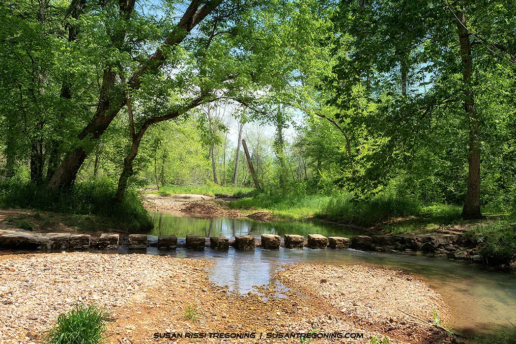
The stepping‑stone crossing at Rock Springs, where clear water and dense summer foliage create a quiet woodland scene.
I returned to Rock Springs after heavy rain on my first trip through. It’s a beautiful area. To reach the Rock Springs nature trail, you cross the stepping stones over Colbert Creek — an easy crossing as long as the water is low. The trail winds through a quiet woodland and leads down to the small natural spring bubbling up from the ground.
Beavers have dammed up the creek, creating a wonderful wetland. Turtles were sunning on logs everywhere, and butterflies drifted through the clearing, with plenty of good bird‑watching along the way. The hummingbirds had already passed through, so I didn’t see any on this visit. They say hummingbirds are abundant here in the spring, and they pass back through again in the fall.
It takes about 20 minutes to walk the loop — unless you’re like me and have to stop and check out every critter along the way.
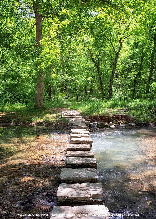
The stepping‑stone crossing at Rock Springs, where clear water, tall trees, and soft summer light create a peaceful woodland moment.
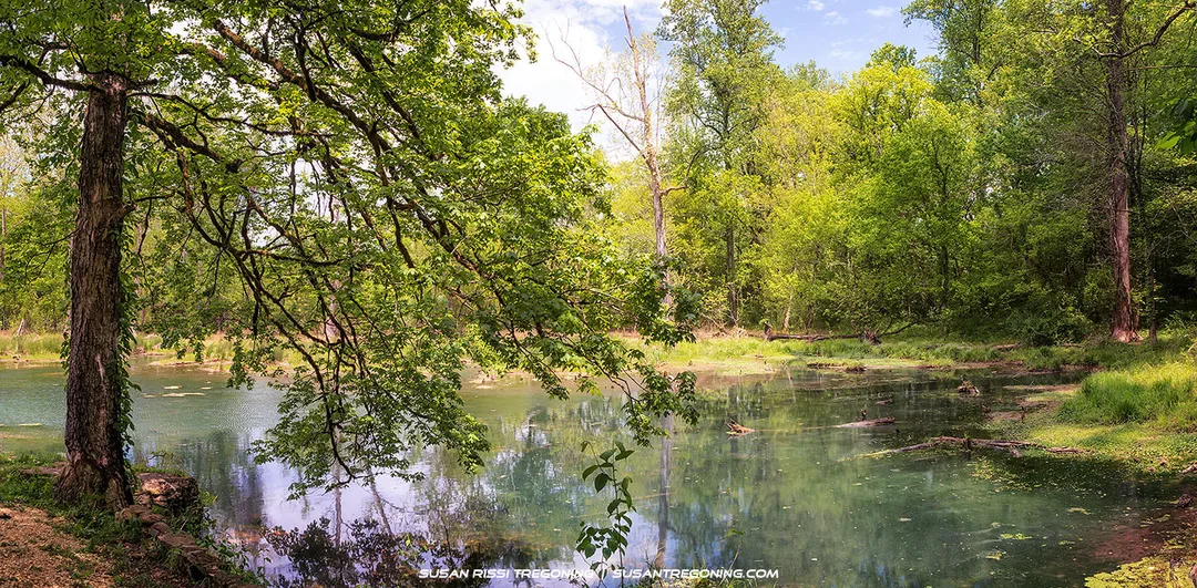
The quiet spring at Rock Springs, where clear water mirrors the surrounding forest and branches sweep low over the pool.
#328.7 – Lauderdale
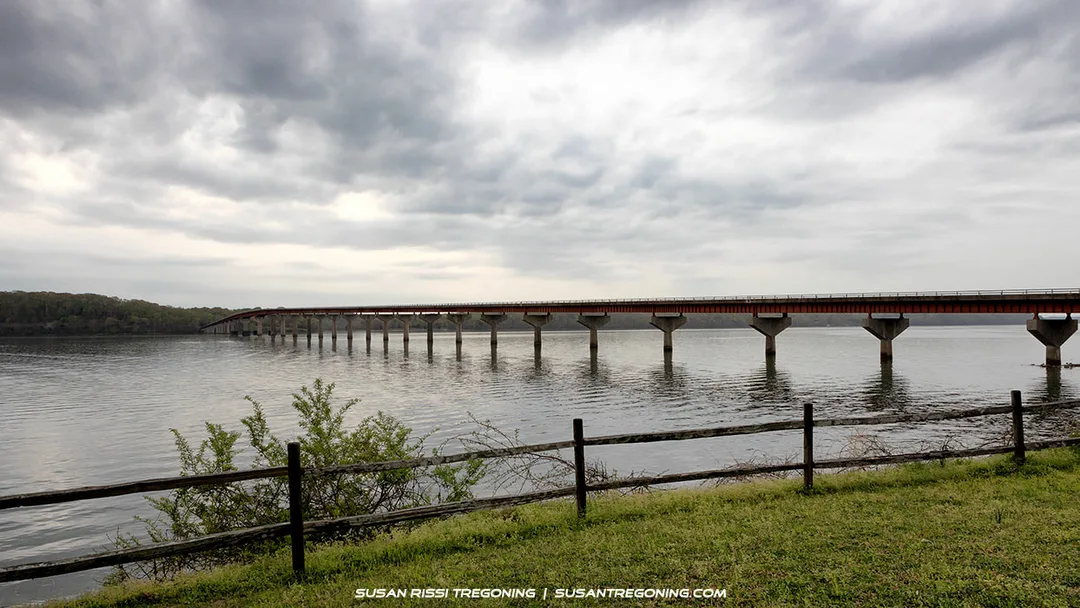
Crossing the Tennessee River into Alabama on the long span of the John Coffee Memorial Bridge under a moody, overcast sky.
The Lauderdale Picnic Area offers a fantastic view of the John Coffee Memorial Bridge, which spans the Tennessee River. Colbert Ferry sits across the river on the far side of the bridge.
The bridge is named for General John Coffee, who fought in the Creek War of 1813–14 and later served as one of Andrew Jackson’s generals at the Battle of New Orleans.
#327.8 - Colbert Ferry & Stand
There’s nothing left to see here today, but the land is beautiful and worth a quick drive around. In the early 1800s, this spot in the heart of Chickasaw Territory was the location of George Colbert’s ferry and inn, which operated from 1800 to 1819.
Colbert, who was half Chickasaw, had an agreement with the Chickasaw people to run his business here. He fought alongside American forces against the Shawnee and the Creeks and later served as a tribal emissary, working to protect Chickasaw rights. Known for his wealth and sharp negotiating skills, Colbert became one of the most influential figures along this stretch of the Old Trace.

A close look at a groundhog resting at the base of a tree, its textured fur and alert expression captured up close.
Don't forget to look for wildlife, it's everywhere along the Trace!
This is Part 1 of a 3 part series. You may also be interested in reading:
Part 2: Middle of the Trace - The Natchez Trace Parkway: Top Half of Mississippi
Part 3: Bottom of the Trace - The Natchez Trace Parkway: Bottom Half of Mississippi
Not every image makes it into my blog. If you enjoyed the photos in this article, please check out my Tennessee, Alabama & Mississippi Collections for more pictures of from the Natchez Trace, or visit my Image Gallery with over 4000 images of locations around the United States.

Transform your room with the rich colors and serene atmosphere of Glenrock Branch in fall. This artwork adds depth, warmth, and a touch of woodland charm to any home styled with natural textures and earthy tones.
Fine Art Prints are available for order as print only, framed art, canvas art, metal art, acrylic art, and wood art prints in various sizes. Home Decor and Gift Ideas include shower curtains, throw pillows, towels, totes, phone cases, t-shirts, puzzles, blankets and more—Worldwide Shipping with a 30-day money-back guarantee.
More of the USA
- A Travelers Musings (1)
- Alabama (1)
- Hawaii (3)
- Illinois (6)
- Indiana (3)
- Iowa (3)
- Louisiana (1)
- Maryland (1)
- Michigan (2)
- Minnesota (4)
- Mississippi (6)
- Missouri (2)
- Montana (1)
- Nebraska (5)
- New Mexico (1)
- North Carolina (1)
- Pennsylvania (2)
- Route 66 (5)
- South Dakota (1)
- Tennessee (1)
- Texas (1)
- Virginia (2)
- Washington DC (1)
- West Virginia (3)
- Wildlife (6)
- Wisconsin (2)
- Wyoming (4)
