Bottom of the Trace: The Natchez Trace Parkway - Bottom Half of Mississippi
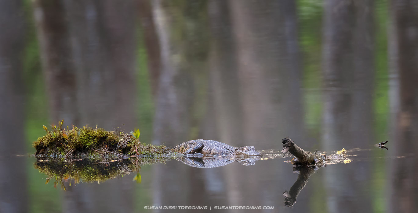

A young alligator naps on a small rise in the cypress swamp, its body still against the mirrored water and mossy reflections surrounding it.
Part Three takes us into the southern half of Mississippi, where the Natchez Trace Parkway winds through cypress swamps, historic stands, river country, and some of the most iconic and deeply worn segments of the Old Trace.
In this final stretch of the Natchez Trace, we follow the old road through Mississippi toward its southern terminus at Natchez.
If you missed the origin story of the Trace, you can read the full history in Part 1.
The Mississippi portion of the Natchez Trace Parkway is 308.8 miles long. I’ve divided Mississippi approximately in half, and this post covers the southern section of the Mississippi Trace from milepost 160 down to milepost 0 at Natchez.
The Natchez Trace Parkway’s milepost markers are located on the east side of the road. I am traveling the Trace backward in this series, counting down the mile markers.
For your own trip planning, you can download Natchez Trace Maps online. Copies of the Official Natchez Trace Map can easily be found along the Parkway. Please don’t travel the Trace without one — you will miss so much.
Part 3: Natchez Trace Parkway Highlights
#122.6 - River Bend
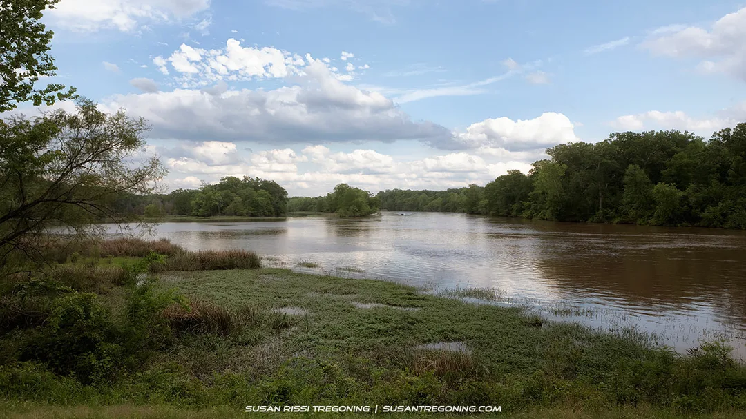
The view of the Pearl River from the River Bend Picnic Area makes this one of the prettiest picnic spots along the Natchez Trace Parkway, a quiet bend in the landscape where wide water, deep greens, and open sky come together in perfect balance.
With its views of the Pearl River, River Bend is one of the prettiest picnic spots along the Natchez Trace. It's well worth a quick drive-through.
The Pearl River was discovered in 1698 by the French Explorer Pierre LeMoyne Sieur d’Iberville. He sailed into the mouth of the river and found pearls, which he named the “River of Pearls.” The last 75 miles of the Pearl River have been the boundary between Mississippi and Louisiana since 1812.
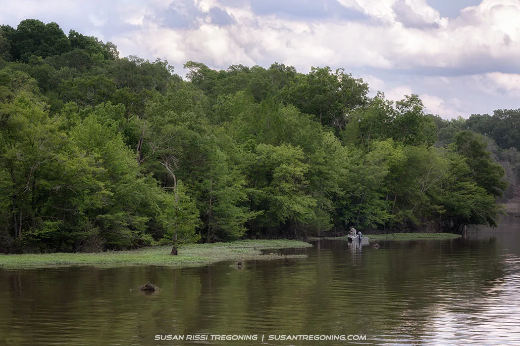
A fisherman works the quiet edge of the Pearl River near the River Bend Picnic Area along the Natchez Trace Parkway, casting into still water framed by deep green forest.
#122 - Cypress Swamp
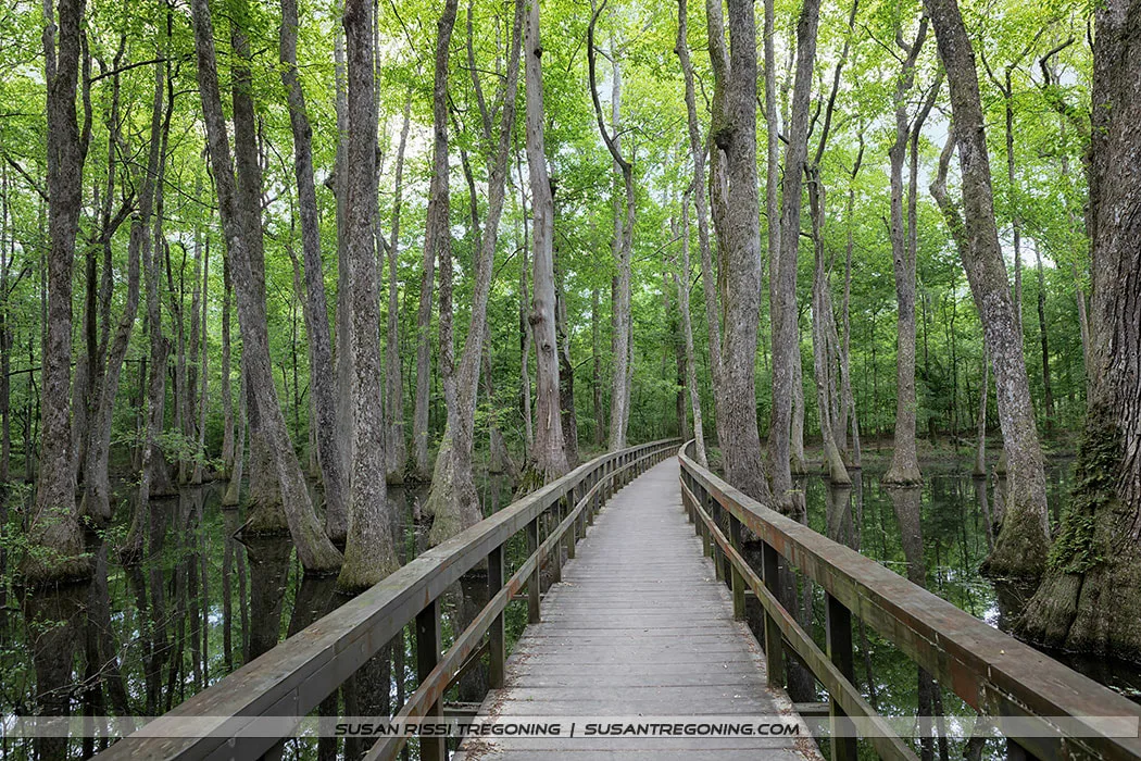
Aside from the mosquitos, the Cypress Swamp is one of my favorite natural areas along the Natchez Trace Parkway. The boardwalk carries you straight through the heart of the swamp, where towering tupelo and bald cypress rise from still water and their knees poke up like sentinels around the trunks. It’s one of the most beautiful, immersive stretches of wetland on the Trace.
Aside from the mosquitoes, the Cypress Swamp is one of my favorite natural areas along the Natchez Trace Parkway.
The boardwalk crosses through the prettiest part of the swamp with beautiful huge tupelo and bald cypress trees with their knees poking up through the water.
It is just a short 4/10th of a mile-long loop trail, but there is a lot to see here. Go slowly and be observant to find wildlife, such as frogs, snakes, and alligators. I haven’t spotted any snakes yet, I probably won’t like it as well here once I do, but I have spotted alligators on every visit. Usually, it’s just a couple, but I counted five on one rainy afternoon. They like to hang out in the center of the swamp. You won’t see them from the boardwalk.
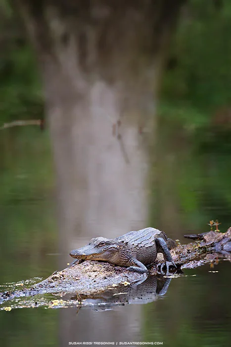
One of many alligators lazing in the Cypress Swamp, a top‑30 site along the Natchez Trace Parkway near Jackson, Mississippi. This young gator rests on a sun‑warmed log in the still water, surrounded by the deep greens and reflections that make this wetland such a memorable stop along the Trace.
Be sure to walk at least halfway down a side path, if you want a chance to find one without walking the entire loop.
There are a couple of swamp hikes along the trail, but this is the one to do if you are limited in time.
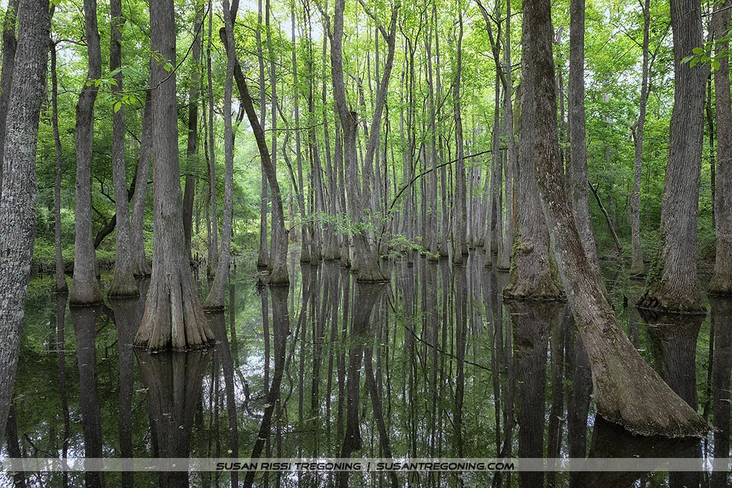
Another view of the Cypress Swamp just outside Jackson, Mississippi, along the Natchez Trace Parkway, where tall cypress and tupelo rise from still water and the reflections create one of the most peaceful wetland scenes on the Trace.
#106.9 Boyd Site
Six small burial mounds built during the Late Woodland and Early Mississippian periods (circa 800 to 1100 A.D.) are located here.
Mound 2 is near the parking lot. This elongated mound is 110 feet long x 60 feet wide and 4 feet high. An excavation in 1964 revealed that it is three mounds in one. The first two mounds were built side by side, with the third being built in the middle, creating a more oblong mound. These mounds were constructed in phases: phase one during the Late Woodland period and the second phase considerably later during the Mississippian period.
#54.8 - Rocky Springs
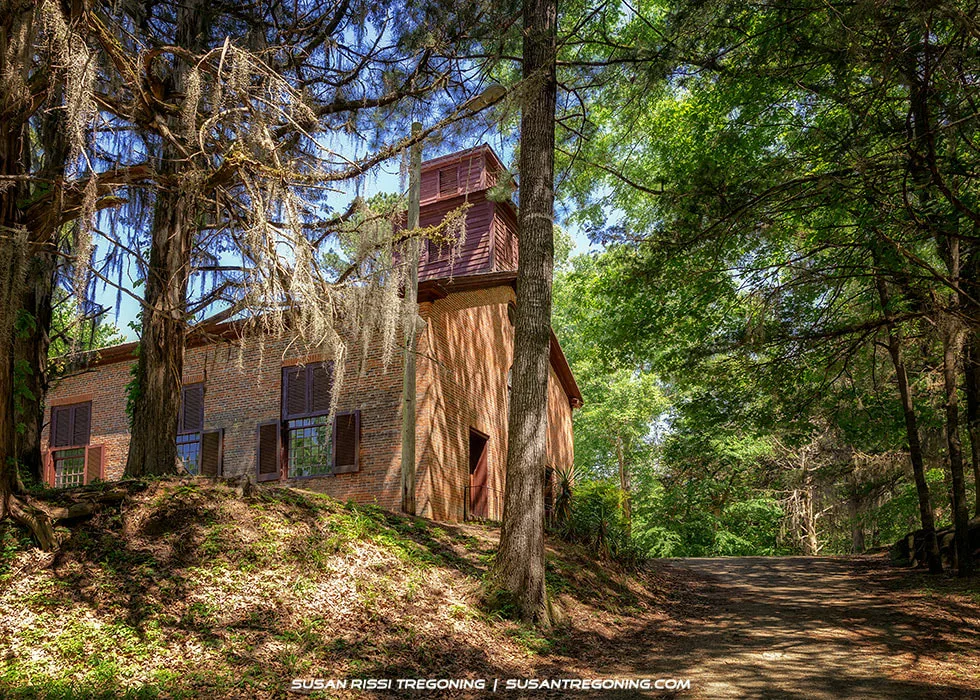
The 1837 Methodist church is all that remains of the historic town of Rocky Springs along the Natchez Trace Parkway.
The Methodist church, built in 1837, and a small graveyard are all that remains of Rocky Springs, Mississippi. In the late 1790s, this town grew up around Rocky Spring, a watering hole, along the Natchez Trace. By 1860, 2616 people lived here; the settlement included three merchants, four physicians, four teachers, three clergy, and 13 artisans, and it supported 54 cotton planters with 28 overseers and over 2000 slaves in an approximately 25 square mile area.
During the Civil War, the town started declining; a letter in 1863 states, “My slaves, horses, and mules are carried off. My fence is torn down and my crops destroyed.” In the summer and fall of 1878, yellow fever struck the area; there were 180 cases and 43 deaths. Although Rocky Springs attempted to recover from the yellow fever epidemic, the boll weevils migrated through in the early 1900s, devastating the cotton crops, and the natural spring started to dry up. After that, the population declined rapidly, ending this once-prosperous rural community. The last store closed its doors in 1930. The church still held services until 2010, when its congregation became too small.
Rocky Springs is now considered a ghost town.
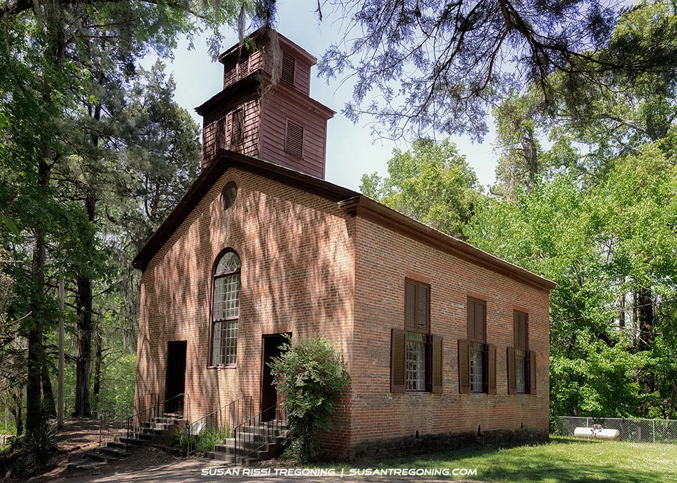
Rocky Springs Methodist Church, the 1837 brick church that stands as one of the last remaining structures from the historic town of Rocky Springs along the Natchez Trace Parkway.
#52.4 Owens Creek Waterfall
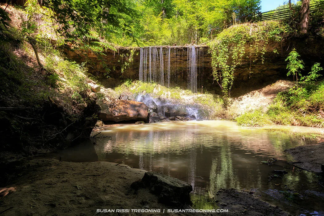
Owens Creek Waterfall, a small forest cascade along the Natchez Trace Parkway, where water slips over a rocky ledge into a quiet, shaded pool.
This is a pretty little waterfall that flows over a stone ledge. The natural spring that once fed Owens Creek has dried up, so it takes a good heavy rainfall for these falls to flow.
#41.5 Sunken Trace
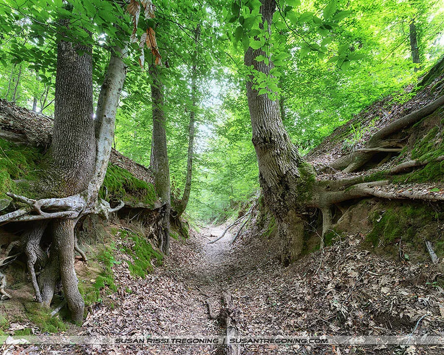
With exposed tree roots gripping the banks and the land rising sharply on both sides, this section of the Trace felt eerie. Located at mile marker 41.5 on Mississippi’s Natchez Trace, this deeply eroded stretch of the Sunken Trace is one of the true gems along the historic route.
With the exposed tree roots and surrounding land towering over me, this section of the Trace felt eerie. I don’t know if it was the informational board at the trailhead that triggered my thoughts, my overactive imagination, or a combination of both, but it was as if I could feel the spirits of the travelers passing me as I hiked through this narrow channel.
This deeply eroded section of the Sunken Trace is only about a hundred yards long. Your instinct will be to read the sign and then follow the path straight to a narrow, short, but steep trail down. If you walk this complete trace section, it gently curves back around and leads up to the parking lot.
A less able person might find it easier to walk backward or take the easier way in and out. If so, after reading the signage, turn left and walk to the end of the sidewalk off into the grass to the right.
Don’t pass this stop up; other than the drive-able sections of the trace in Tennessee, this is the most easily accessible section of the Old Trace that is most authentic to what the Kaintucks experienced.
#37 Exit Trace for Side Trip to Rodney Ghost Town
If you have time, visit Rodney, Mississippi. Here's my blog post about Rodney so you can decide: Rodney Ghost Town.
#15.5 Mount Locust Plantation & Inn
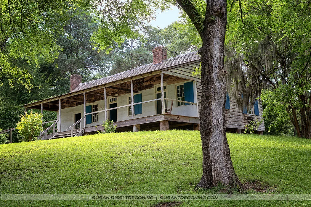
Built in 1780, Mount Locust is the only surviving stand along the historic Natchez Trace and one of the oldest homes in Mississippi.
Constructed in 1780, Mount Locust is the only surviving stand from the historic Natchez Trace and one of the oldest homes in Mississippi.
Originally built by John Blommart, he was jailed, losing his home and fortune after leading a failed rebellion against the Spanish. William Ferguson and his wife, Paulina, purchased the house in 1784. They operated the farm until William died in 1801. Shortly after William passed, Paulina married one of the farm’s overseers, James Chamberlain. They continued to farm the land.
By 1785, the Natchez Trace was in heavy use by the Kaintucks on their way home from Natchez, and Mount Locust just happened to be located a day’s walk from town. Such a perfect location right on the Trace. I imagine many men stopped here begging for food and lodging, knowing it would be their last chance before hitting the wilderness. The Fergusons decided to turn their home into a stand (inn).
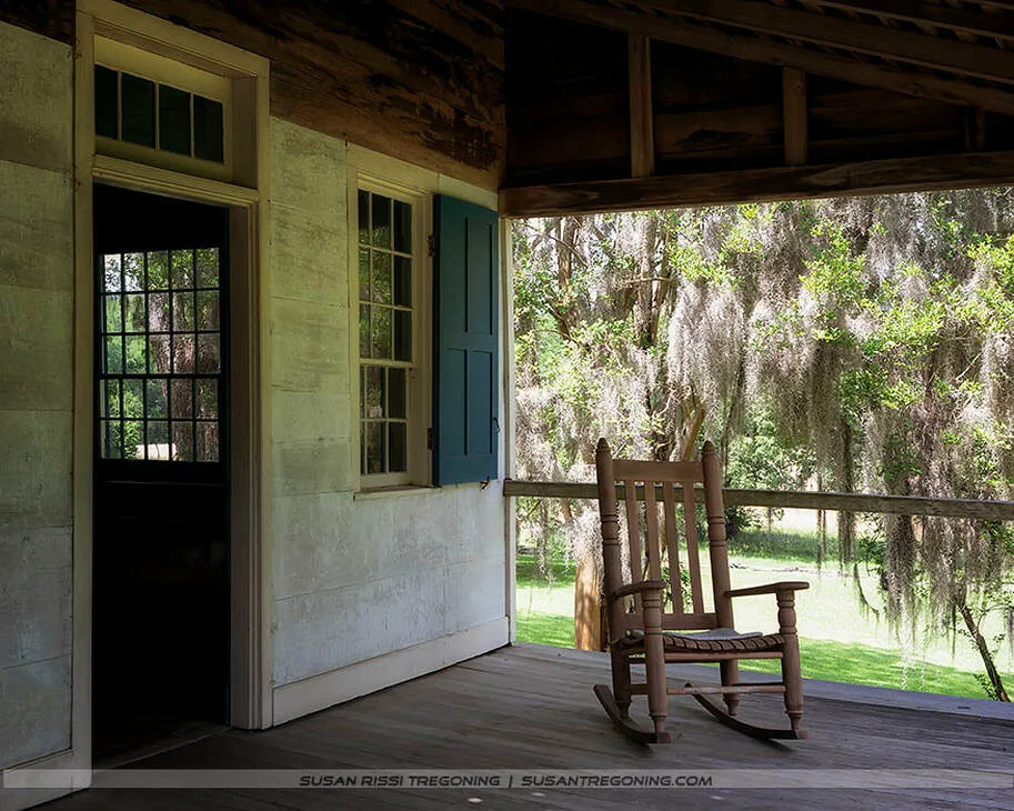
On the front porch at Mount Locust, an old wooden rocker sits in the shade, worn smooth by generations. It’s easy to imagine Grandma Polly—as Pauline Chamberlain’s descendants still lovingly call her—settling into this very chair in the late‑afternoon Mississippi heat, watching down the Natchez Trace for the arrival of her evening guest.
Corn was a plantation staple; the family offered a meal of corn mush and milk and allowed the men to sleep on the porches and grounds for .25 cents. While pretty crude offerings, this was considered a luxury to the Kaintucks.
Although James passed away sometime after 1810, Pauline and her 11 children continued to live comfortably and successfully ran the farm and stand.
By the mid-1820s, with the invention of the steamboat, traffic on the Trace was all but gone. Pauline’s stand became an inn, catering to the residents of Natchez who were looking for a little rural solitude.
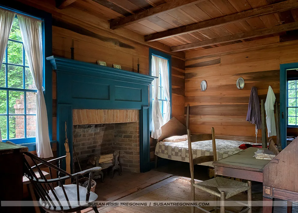
A quiet moment inside Mount Locust reveals the simplicity of early frontier life: hand‑hewn walls, a blue‑trimmed hearth, and a modest bed dressed in a patchwork quilt. Sunlight filters through tall windows, illuminating the desk, rocker, and everyday belongings that once shaped the rhythm of this 18th‑century inn along the Old Natchez Trace.
Pauline died in 1849, at the age of 80, twelve years before the Civil War. The children continued to live here, but with the end of the plantation, Mount Locust began a slow decline.
Five generations of Chamberlains lived at Mount Locust, with the last one leaving in 1944. In 1954, the park service restored Mount Locust to its 1820 appearance.
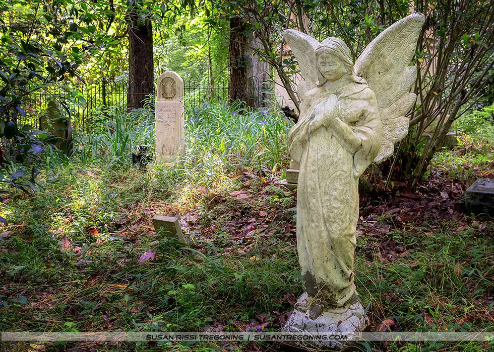
A weathered stone angel watches over the Chamberlains Family Cemetery, standing among old headstones softened by moss, leaves, and filtered light. Framed by trees and an iron fence, the scene captures the quiet endurance of this historic Mississippi resting place.
If you plan to visit, check with the Park Service for hours. When I wrote this, the hours were Thursday through Sunday from 9 to 4:30.
#10.3 Emerald Mound
Emerald Mound is a massive ceremonial mound and the second-largest in the United States, after Monk’s Mound in Cahokia, Illinois.
Named Emerald Mound in the 1850s because it sat on the property of the Emerald Plantation. This mound was built during the Mississippian Period between 1200 to 1730. It is 35 feet high and covers 8 acres, measuring 770 feet by 435 feet at its base. Two secondary mounds sit atop the central mound, bringing the overall height up to 60 feet tall.
#8.7 Old Trace
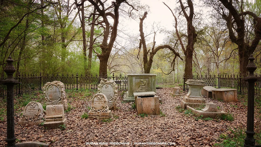
Leaf‑strewn ground, weathered stones, and bare trees frame this secluded family cemetery along the Natchez Trace Parkway. It isn’t marked on any map, but wander long enough and these forgotten plots reveal themselves—quiet, hauntingly beautiful reminders of the families who lived, worked, and endured along the Trace.
I love old cemeteries! This was my favorite family plot along the Trace. It’s not listed anywhere in the Parkway information, but if you hunt around, you can find small plots like this all along the Trace. I thought this cemetery was hauntingly beautiful.
There is not much else to see at this pull-off. The Old Trace here isn't too impressive, but if you are interested in visiting this little cemetery, it is straight up the mowed path behind the informational board.
This is Part 3 of a 3‑part series. You may also be interested in reading:
Part 1: Top of the Trace — The Natchez Trace Parkway: Tennessee & Alabama
Part 2: Middle of the Trace — The Natchez Trace Parkway: Top Half of Mississippi
Not every image makes it into my blog. If you enjoyed the photos in this article, please check out my Tennessee, Alabama & Mississippi Collections for more pictures of this beautiful state, or visit my Gallery with over 4000 images of locations around the United States.

In the stillness of the southern wetlands, an alligator drifts beneath mirrored reflections of moss and cypress—a quiet reminder of nature’s patience and power. This fine art photograph captures the mystery and serenity of the swamp, blending earthy tones and tranquil light into a piece that invites calm and contemplation. Perfect for rustic interiors, nature lovers, and collectors who appreciate the untamed beauty of the American South.
Fine Art Prints are available for order as print only, framed art, canvas art, metal art, acrylic art, and wood art prints in various sizes. Home Decor and Gift Ideas include shower curtains, throw pillows, towels, totes, phone cases, t-shirts, puzzles, blankets and more—Worldwide Shipping with a 30-day money-back guarantee.
More of the USA
- A Travelers Musings (1)
- Alabama (1)
- Hawaii (3)
- Illinois (6)
- Indiana (3)
- Iowa (3)
- Louisiana (1)
- Maryland (1)
- Michigan (2)
- Minnesota (4)
- Mississippi (6)
- Missouri (2)
- Montana (1)
- Nebraska (5)
- New Mexico (1)
- North Carolina (1)
- Pennsylvania (2)
- Route 66 (5)
- South Dakota (1)
- Tennessee (1)
- Texas (1)
- Virginia (2)
- Washington DC (1)
- West Virginia (3)
- Wildlife (6)
- Wisconsin (2)
- Wyoming (4)
