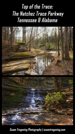
Travel back in time with a trip on the 444 mile long Natchez Trace Parkway. This All-American Road travels from Natchez, Mississippi to Nashville, Tennessee and clips the northwestern corner of Alabama along the way.
The Parkway was a long time coming; it officially opened in 2005 after being under construction and planning for 67 years! President Franklin D. Roosevelt signed the Natchez Trace Parkway into law on May 18, 1938, establishing it as a unit of the National Park System, and officially protecting this historically significant highway of the Old Southwest. There are seven segments of the Old Trace that are listed on the National Register of Historic Places. This scenic drive closely follows and commemorates the historic Old Natchez Trace and is jam-packed with over 10,000 years of history! Along the way, you can hike preserved sections of the Old Trace, read historical markers telling the stories of the people back in the day, see historical buildings, Indian ceremonial, and burial mounds, breathtaking scenic overlooks; there are rivers, lakes, swamps, picnic areas, hiking trails, and campgrounds. It’s not a road you can drive in a day or even a week if you wish to see it all. This is a pleasant, leisurely drive through beautiful country with a maximum speed limit of 50mph. Relax, take your time, and enjoy the drive. A Brief History of the Natchez Trace
The Trace began as a series of random Indian trails that connected the Natchez, Mississippi area to what would eventually become Nashville, Tennessee. Animals created the first corridor traveling from the Mississippi River to the salt licks in the Nashville area. When the Indians came along, they followed these same trails when hunting those animals for food.
By the early 1800s, these trails had evolved into America’s first National Road, linking what were now two bustling hubs of commerce. While it was easy enough to build makeshift flatboats to float goods down the Mississippi River, once there it was impossible to fight the current coming back upstream. Keep in mind this was the era before steam power. The boatmen's AKA Kaintucks solution was to scrap their boats in Natchez, sell the lumber along with everything else and walk home along the Trace. In addition to the Kaintucks traffic, the road was used for troop movements, a postal service, and general travel between the two frontier towns. By this point, these Indian paths were so highly traveled that there were deep gullies worn into the ground. Some of this Sunken Trace is as much as 30 foot below the land around it! It was quite dangerous, fraught with bandits and angry Indians that preyed on the now wealthy boatmen flush from selling their goods. There were also, mosquitoes, poison ivy, and poisonous snakes that thrived in the swampier areas. Those swamps made for deep mud that could be found along much of the trail, as well. The Trace was by no means an easy road; it took these travelers about six weeks to travel on foot or four weeks by horse. By the 1820s, the invention of the steamboat had come to the Mississippi River and travel on the Natchez Trace all but stopped. You would think that with this being a national road it would still see traffic. However, newer and better roads were being built. By 1830, Jackson’s Military Road between Columbia, Tennessee, and Madison, Louisiana was completed. In 1840, Robinson Road that ran between Columbus and Jackson was in use. Eventually, the railroads came along, offering even better and faster alternatives than traveling the Natchez Trace. The Trace was all, but forgotten.
This is Part 1 of a 3 part post, you may also be interested in reading:
Part 2: Middle of the Trace: The Natchez Trace Parkway - Top Half of Mississippi Part 3: Bottom of the Trace: The Natchez Trace Parkway - Bottom Half of Mississippi
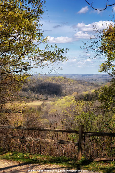
This post starts in Nashville, TN and covers the 136 miles through Tennessee and Alabama to the Mississippi State Line. The numbers that I have listed are from the Parkway's milepost numbering system. Mileposts will be found on the east side of the road.
For your own trip planning, you can download Natchez Trace Maps here. Copies of the Official Natchez Trace Map can easily be found along the Parkway, as well. Please don’t travel the Trace without one, you will miss so much. Tennessee "Must See" Trace Sites
#442.1 - Beginning of the Trace
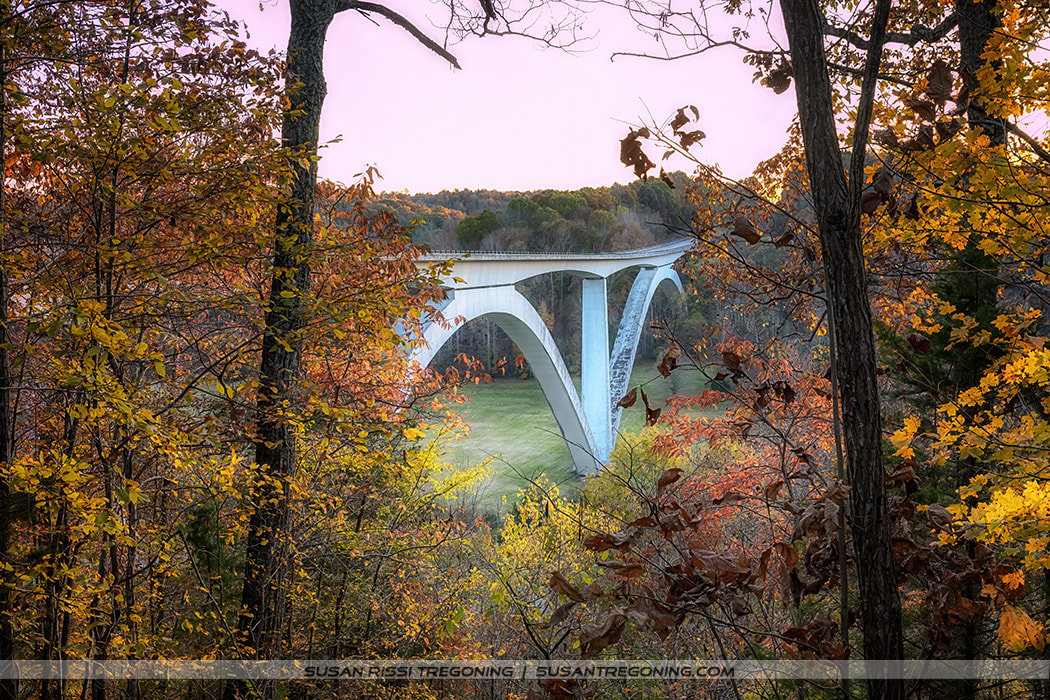
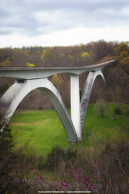
#438 - Double Arch Bridge
This double arched bridge spans Birdsong Hollow on the Natchez Trace Parkway. It was completed in 1994 and won the Presidential Award for Design Excellence for innovative design that next year. This beautiful bridge is 1648 feet long and rises 155 feet above the valley floor. The bridge can be viewed from two different locations. If heading south on the Trace, take the first road to the left after crossing the bridge to see it from below. 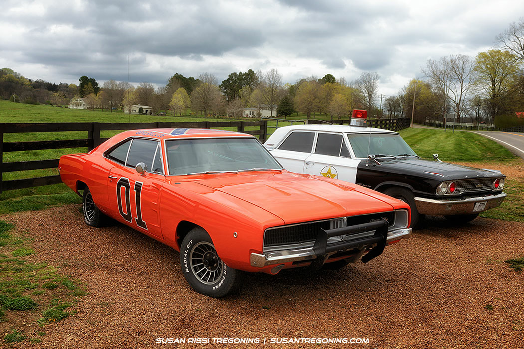
The General Lee - This iconic orange 1969 Dodge Charger is one of General Lees from the TV show The Dukes of Hazzard. It's authentic, we checked the hood for signs of scratches and dents from Luke's famous "hood slide." Estimates vary greatly as to how many Chargers were used during the six years of the series; it ranges somewhere between 256 to 321. On average, at least two General Lees were totaled per episode. There are only 18 still known in existence, Warner Brothers kept one and sold off 17 to private owners.
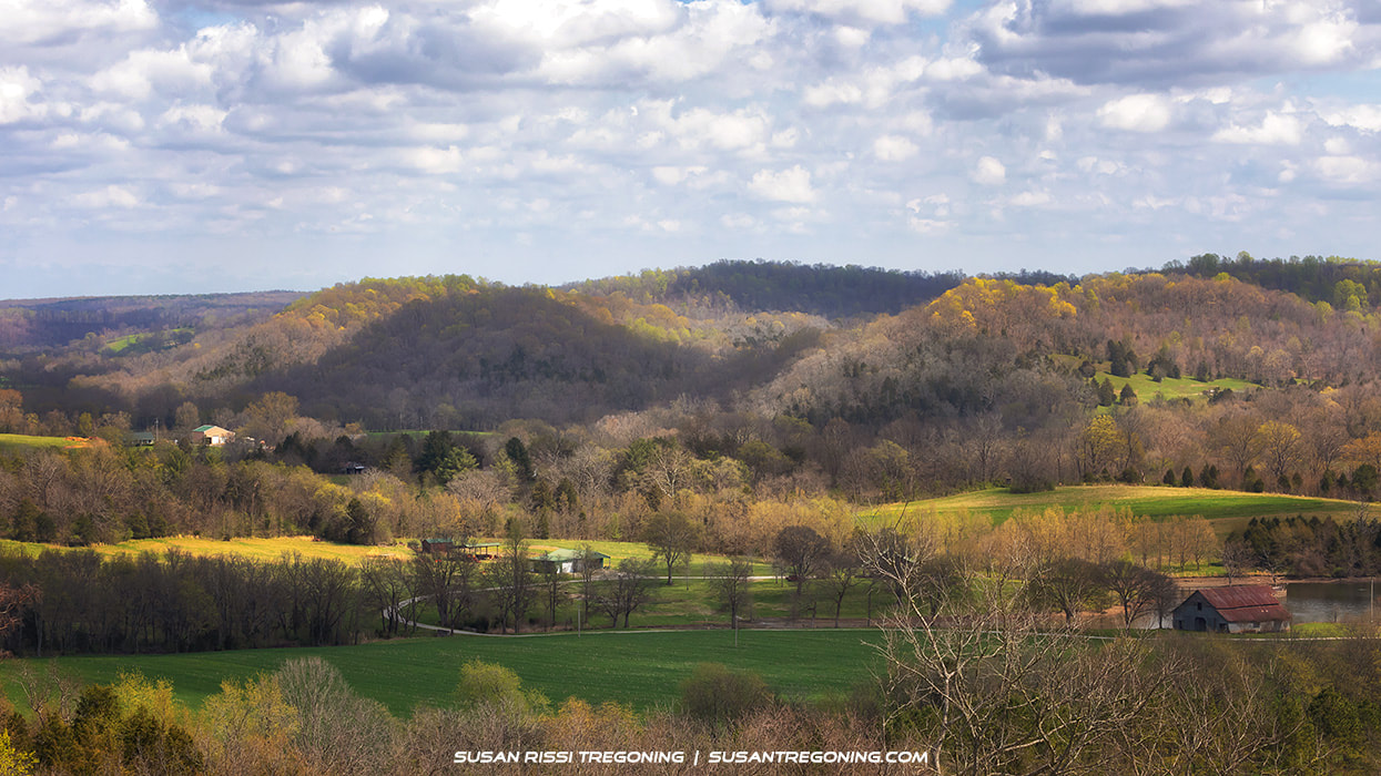
Water Valley Overlook
#411.8 - Water Valley Overlook
Drive the short road up to the top of the ridge for this fantastic 180-degree view of Water Valley. 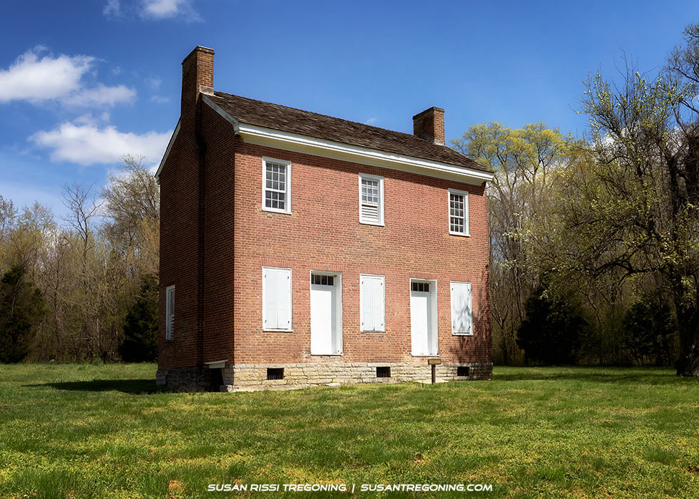
The Gordon House
#407.7 - Gordon House Historic Site & Duck River Ferry Site
The Gordon House, dating from 1817-18, is one of only two original buildings left from the Old Trace. Located just inside the Chickasaw Territory, John Gordon entered an agreement with Chickasaw Chief George Colbert to operate a trading post, rest, and ferry service across the Duck River at this location in the early 1800s. While the War of 1812 and military expeditions kept him away from home most of the time, his wife, Dorothea, oversaw the construction of this house and ran the business. Gorden died shortly after that, but Dorothea and their 11 children continued to live here and run the ferry. The trading post and rest were not in business for long, but the ferry ran for almost 100 years until a bridge was built in 1896. 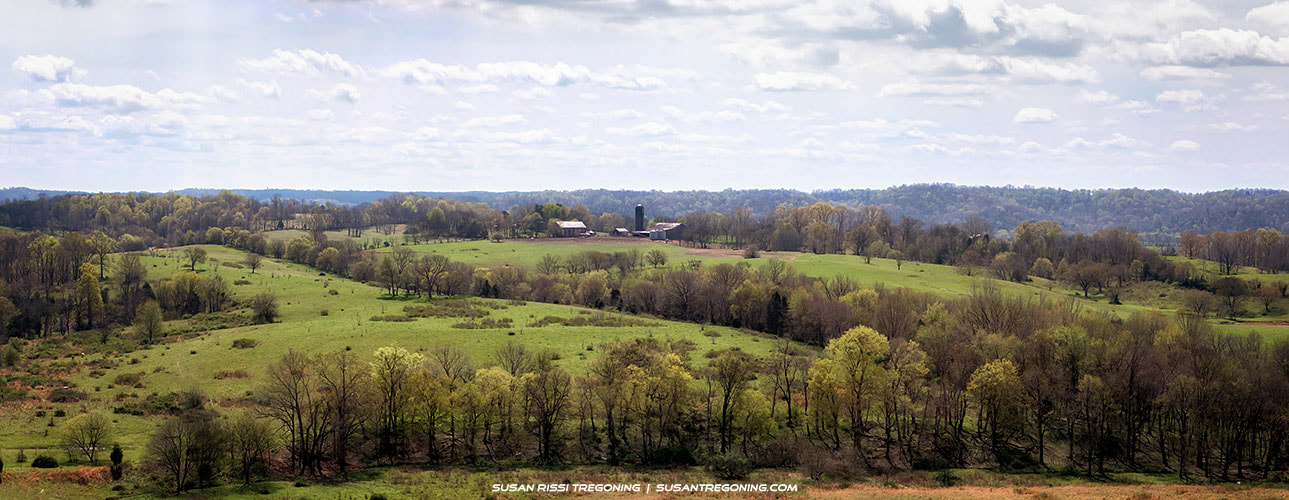
Baker Bluff Overlook Panorama
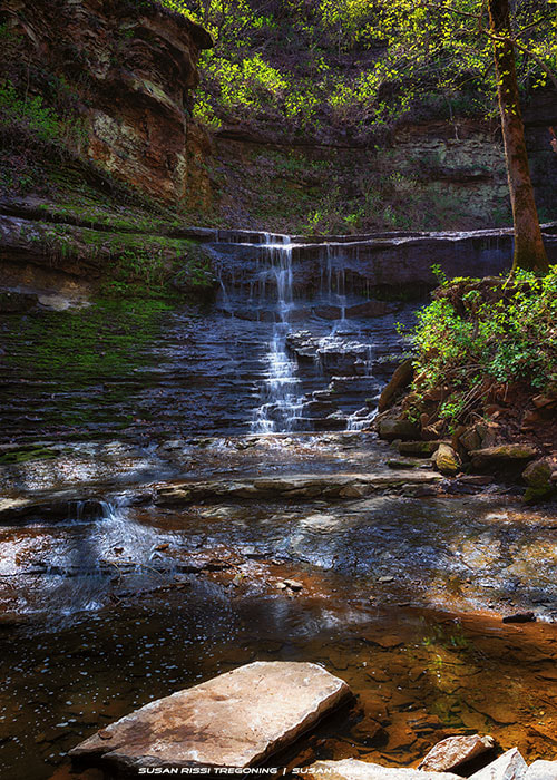
#404.7 - Jackson Falls
Jackson Falls is named after Andrew Jackson who supposedly visited this spot when traveling along the Natchez Trace in the early 1800s. Part of the Jackson Branch, this is an intermittent waterfall that empties into the Duck River. Not seen in the photo, Jackson Falls starts on the rights side of the image as a long cascading slide. It then turns to flow down this beautifully sculpted rock formation that ends in a clear pool at its base. This is a 900 foot long paved but steep trail. 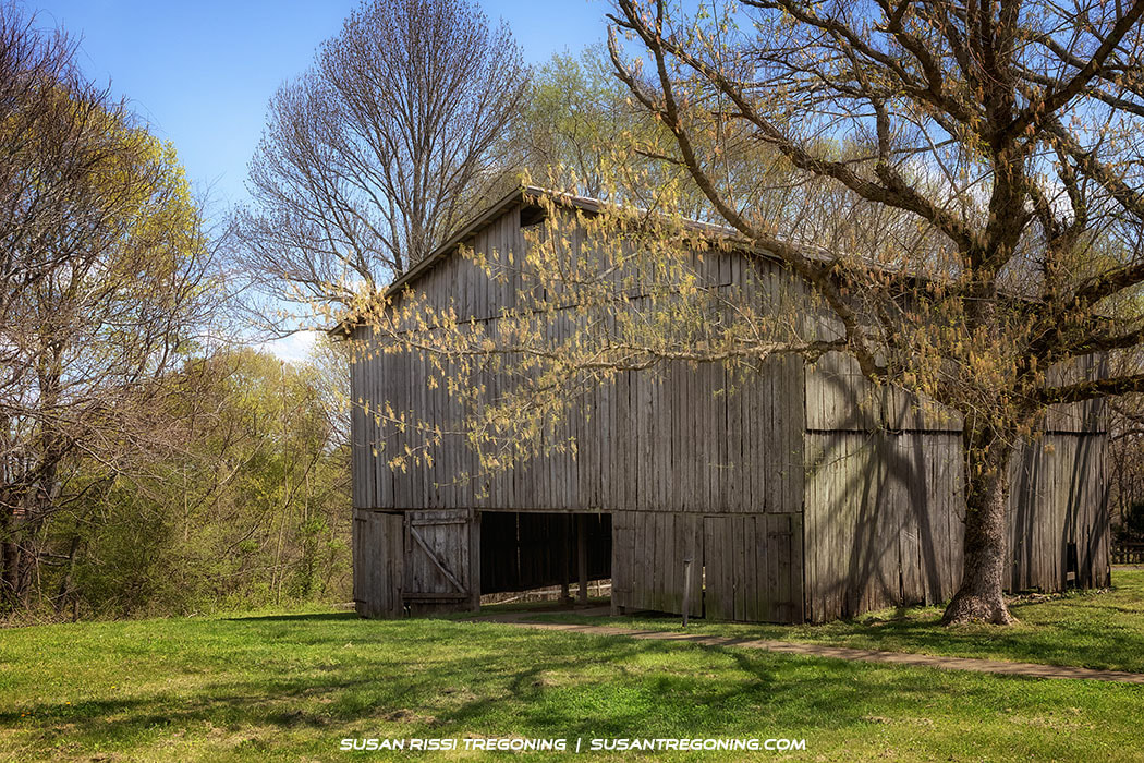
Old Tobacco Barn
#401.4 - Tobacco Farm & Old Trace
e real gem here is a two-mile driveable section of the old Trace. This is a one-way drive heading north so no worries about meeting another car on this narrow road.
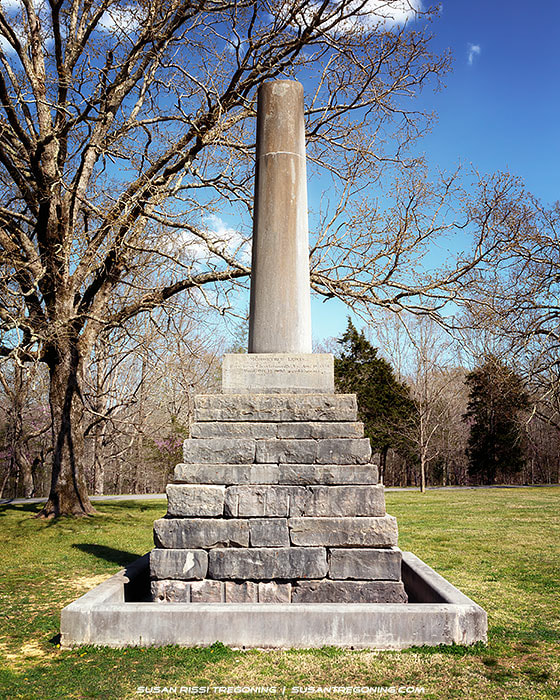
#391.9 - Fall Hollow It's just a short walk to a deck where you can look down on the largest waterfall here. From there it's a rocky and steep decent to the bottom. Since it had been raining and was very muddy, we didn't hike down. #385.9 - Meriwether Lewis
location of where Meriwether Lewis is buried. The column, broken intentionally symbolizes a life cut short.
You can hike along the Old Trace to the ruins of the inn. It’s about 230 yards south from the monument. There is also a small museum here giving the history of that night. 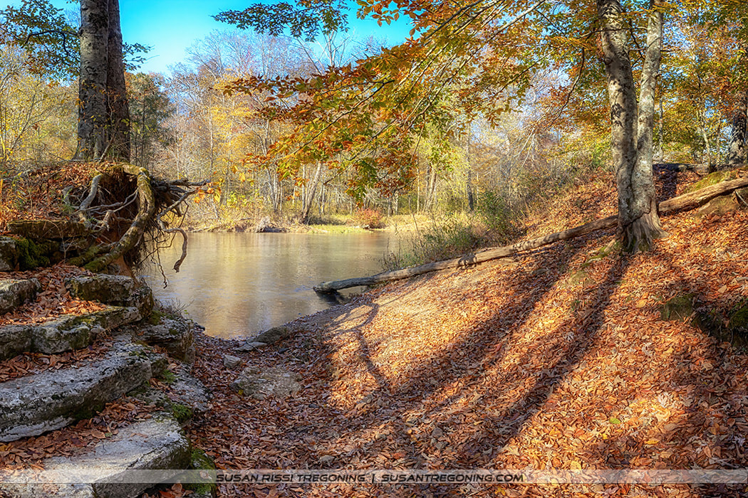
Buffalo River - Metal Ford
Also the location of Steel’s Iron Works in the 1820s, there once was a charcoal burning furnace located here to manufacture pig iron. All that remains is the slag pile and a bit of the mill race to pull water for operating the air blasting machinery.
#375.8 - Old Trace Drive A 2.5-mile driveable section of the original Natchez Trace, it is a one-way road headed north. 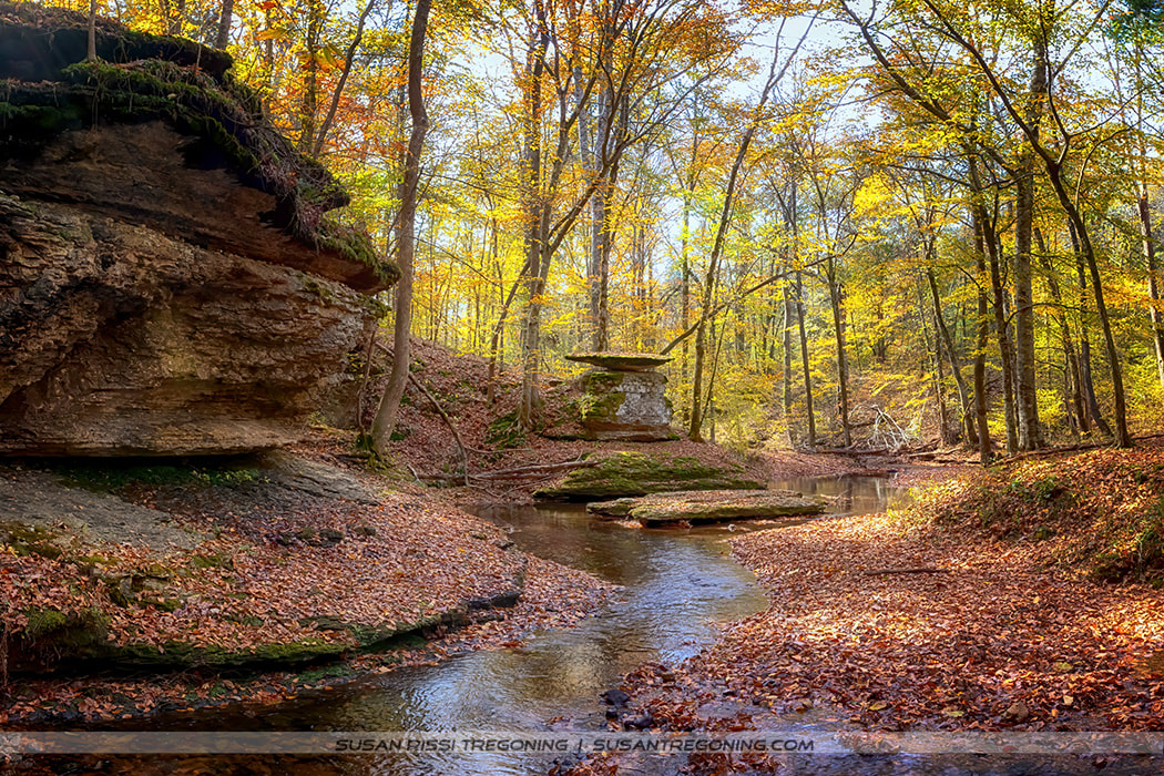
Glenrock Branch
#364.5 - Glenrock Branch
Glenrock Branch is listed on the Parkway map as a picnic area and restroom. It is gorgeous here! Don’t unknowingly miss this spot. It’s a short but steep walk down to the creek where the limestone bluffs bend around the picnic area creating a natural amphitheater. 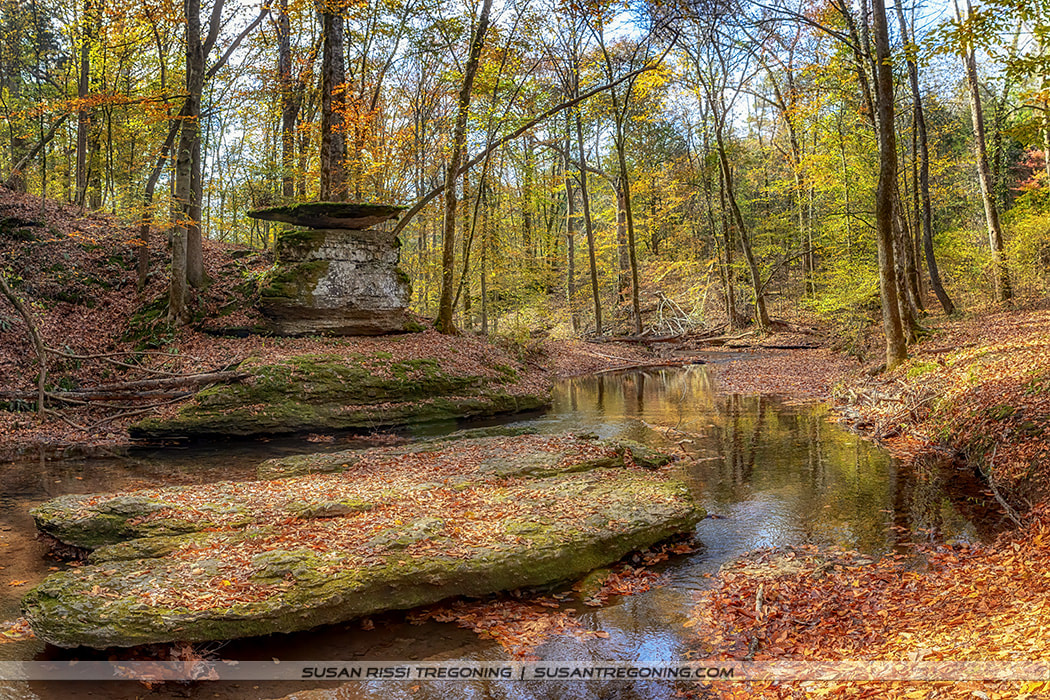
Glenrock Branch
Alabama "Must See" Trace Sites
#330.2 - Rock Springs
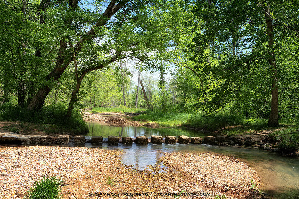
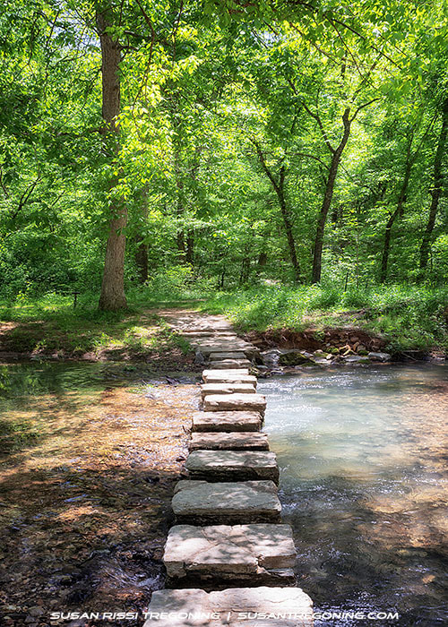
Colbert Creek Stepping Stones
Beavers have dammed up the creek creating a wonderful wetland. There were turtles sunning on logs everywhere, lots of butterflies, and some good bird watching. I think they had already passed through because, I didn’t see any hummingbirds. They say that there are "hummingbirds in abundance here in the spring." The hummingbirds pass back through again in the fall.
It will take you about 20 minutes to walk the loop unless you are like me and need to check out every critter you see. 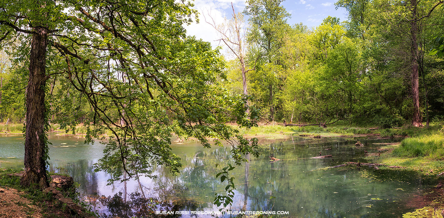
Rock Springs Panorama
#328.7 – Lauderdale
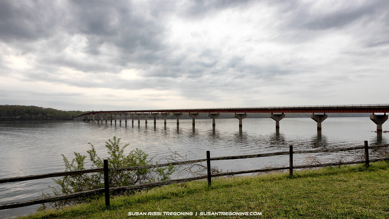
John Coffee Memorial Bridge
A fantastic view of the John Coffee Memorial Bridge as it spans the Tennessee River can be seen from the Lauderdale picnic area. Across the river and on the other side of the bridge is the location of Colbert Ferry.
The bridge is named for General John Coffee, who fought in the Creek War of 1813-14 and was one of Andrew Jackson’s Generals at the Battle of New Orleans. #327.8 - Colbert Ferry & Stand There’s nothing left to see here, but the land is beautiful and worth a quick drive around. Here in the middle of Chickasaw Territory was the location of George Colbert’s Ferry and Inn from 1800 to 1819. Being half Chickasaw himself, Colbert had an agreement with the Chickasaw people to run his business here. He fought with the Americas against the Shawnee and the Creeks and was a tribal emissary in charge of protecting the Chickasaw people’s rights. Colbert was quite wealthy and a shrewd negotiator. 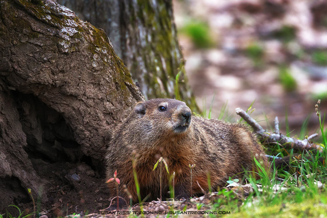
Groundhog
Don't forget to look for wildlife, it's everywhere along the Trace!
You will find more images from Susan's travels down the Natchez Trace Parkway in the Tennessee, Alabama & Mississippi Collections in her Gallery.
Susan's work is available for purchase here: The Gallery. All images in the her collection are available as wall art, fine art prints, on home decor, gift items and apparel. 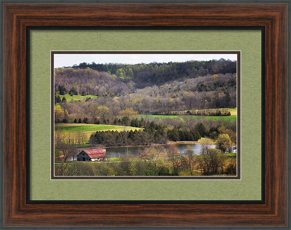
Water Valley Barn - Framed Art Print

0 Comments
Your comment will be posted after it is approved.
Leave a Reply. |
AuthorI am the 8th photographer in 4 generations of my family. Back in 2006, my husband accepted a job traveling, and I jumped at the chance to go with him. Categories
All
Archives
June 2024
|

 RSS Feed